“Blue Sky and Preliminary Cartography”
Mapping Disneyland has been a tradition since the earliest planning and developmental stages of Walt Disney’s magic kingdom. Some of the first illustrated “maps” were prepared by artists of WED Enterprises for Disneyland, Inc.
Harper Goff planned Adventureland. A team of many artists (like Stan Jolley) were assigned to work on True-Life Adventureland, and these ones “toiled over their drawing boards from dawn until sundown, creating thousands of sketches” in order to pitch their countless ideas to Walt.
Then there was the talented Herbert Ryman. Herb had joined the Disney Studio in 1938, after Walt saw a public show of his work in New York. (Herb's paintings were being exhibited with those of another up and coming artist, Andrew Wyeth.) Herb Ryman acted as art director for such films as Fantasia and Dumbo, but had left Walt Disney Studios in 1946 and (by 1953) was employed by 20th Century Fox. However, Walt reached out to Herb and during one weekend a historic drawing of the Park was produced. Some of these very concepts and influential thematic elements of other contributing artists can be seen in the first “Aerial View Over Disneyland” drawing (pictured above) produced by Herbert Ryman in 1954. The latter was published in a number of publications (like Popular Mechanics Magazine of December, 1954) and its brown lines were reproduced in T/O (brownline or translucent ozalid) form.
By September 16, 1954, Walt could excitedly wrote to his sister Ruth Beecher in Portland, Oregon, briefly describing Adventureland : “ADVENTURELAND will be a tropical setting -- fish, flowers, birds, water, and other things associated with the Tropics. An Explorer's Boat will take you on a journey to some of the remote corners of the world darkest Africa included… I an scheduled to be in New York at the end of the month.”
That last part of Walt’s letter referred to his trip back East in which he presented a portfolio (prepared for Dick Irvine and Nat Winecoff) full of colored sketches by Herb Ryman, Bruce Bushman, Harper Goff, with the intent to sell the Disneyland concept to prospective licensees. Yes, some of these maps were used to create expectation and sell the idea of Disneyland to potential investors.
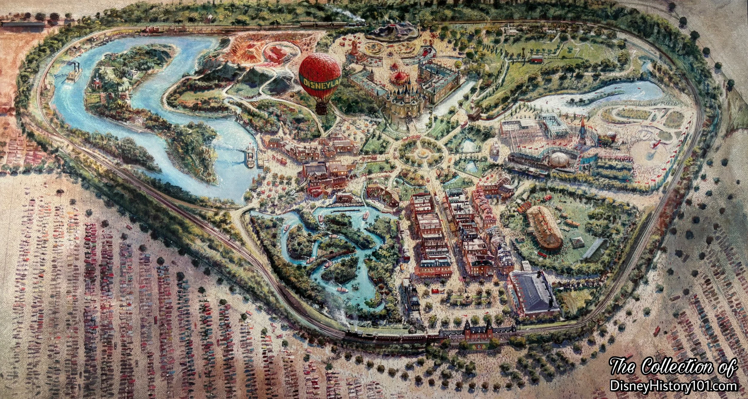
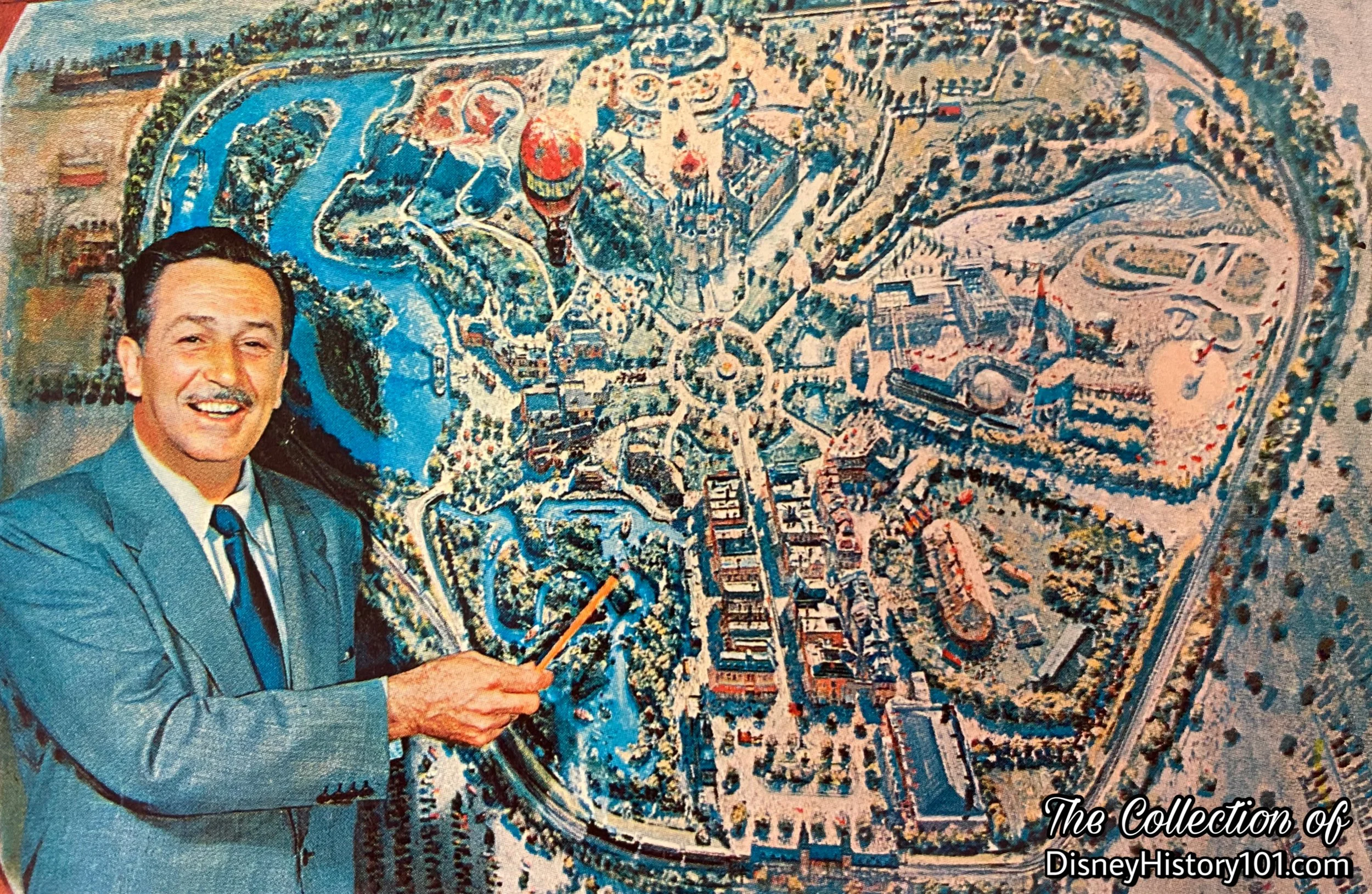
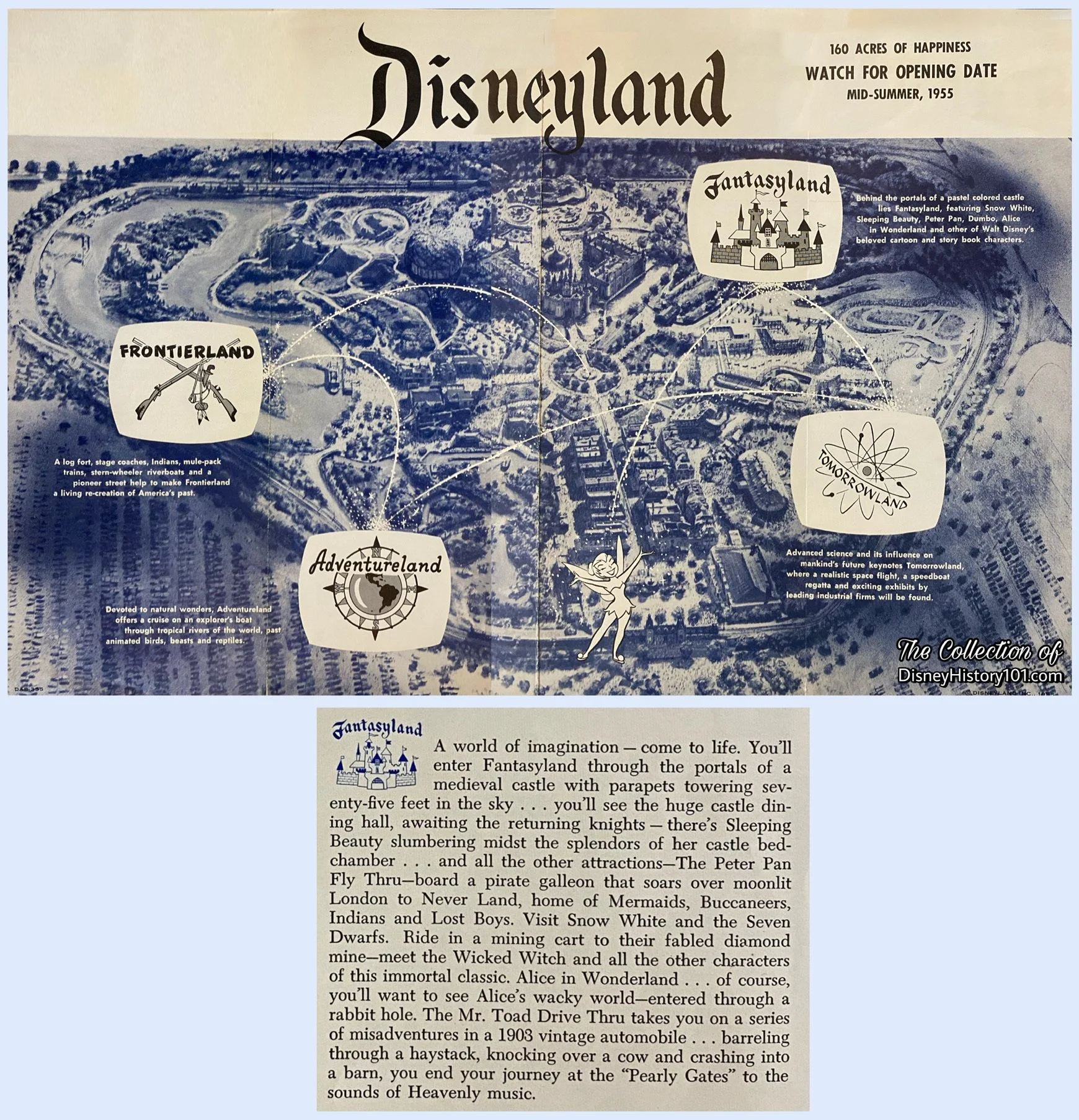
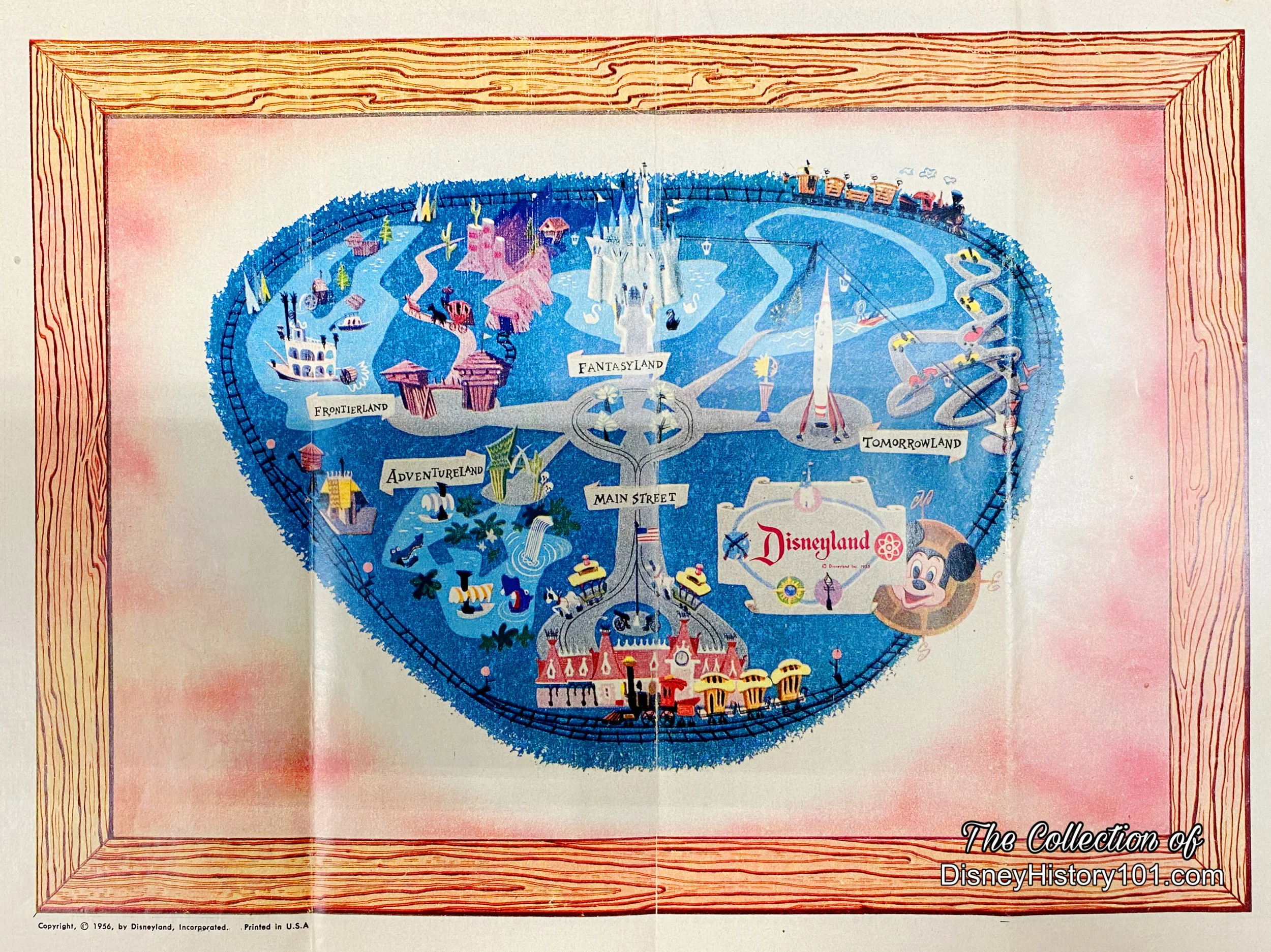
“Aerial Over Disneyland (Daytime)” by Peter Ellenshaw, 1954.

“Aerial Over Disneyland (Nighttime)” by Peter Ellenshaw, 1954.
In 1954, Peter Ellenshaw painted the two maps (pictured above) which introduced television audiences to Walt Disney’s Disneyland. Within these colorful representations were the originally intended cardinal lands and landmark attractions, along with the peripheral groves and parking areas. Soon Ellenshaw’s work appeared in newspaper excerpts, magazine articles. These images continued to be referenced for licensed merchandise (like post cards), which was manufactured even after Disneyland debuted and welcomed its first visitors.
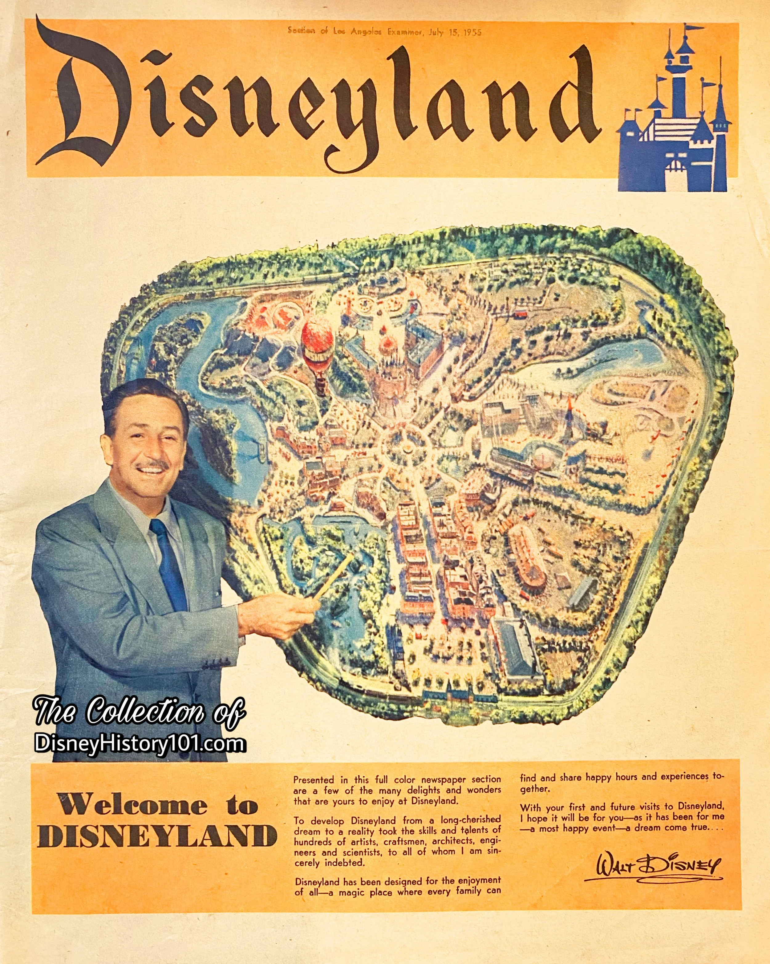
Peter Ellenshaw’s Aerial Over Disneyland was published in inserts that promoted Walt Disney Productions’ newest form of family entertainment.
Another pre-opening advertisement published Spring 1955 showcased Peter Ellenshaw’s black-light painted map of Disneyland Park, that was featured on Walt Disney’s Disneyland television anthology series. These were mailed to area residents of “the site”.
“Architectural Plans Help ‘Map’ Disneyland”
Members of WED Enterprises, Inc. and Walt Disney Productions performed the creative and design work in Disneyland. Plans were created, depicting the site and surrounding plots of land, but these were prepared by subcontracted architects like Marvin Aubrey Davis and architectural firms of William Pereira and Charles Luckman. These helped to plan and “map” Disneyland before ground was broken and were instrumental to the construction that would make Walt’s dream a reality. Marvin worked alongside individuals like J.E. Thomasson (e.g. who drew the Site Work Plot Plan for Fire Protection Utilities).

An early architectural Plot Plan of Disneyland.
“A Guide Map to Disneyland”
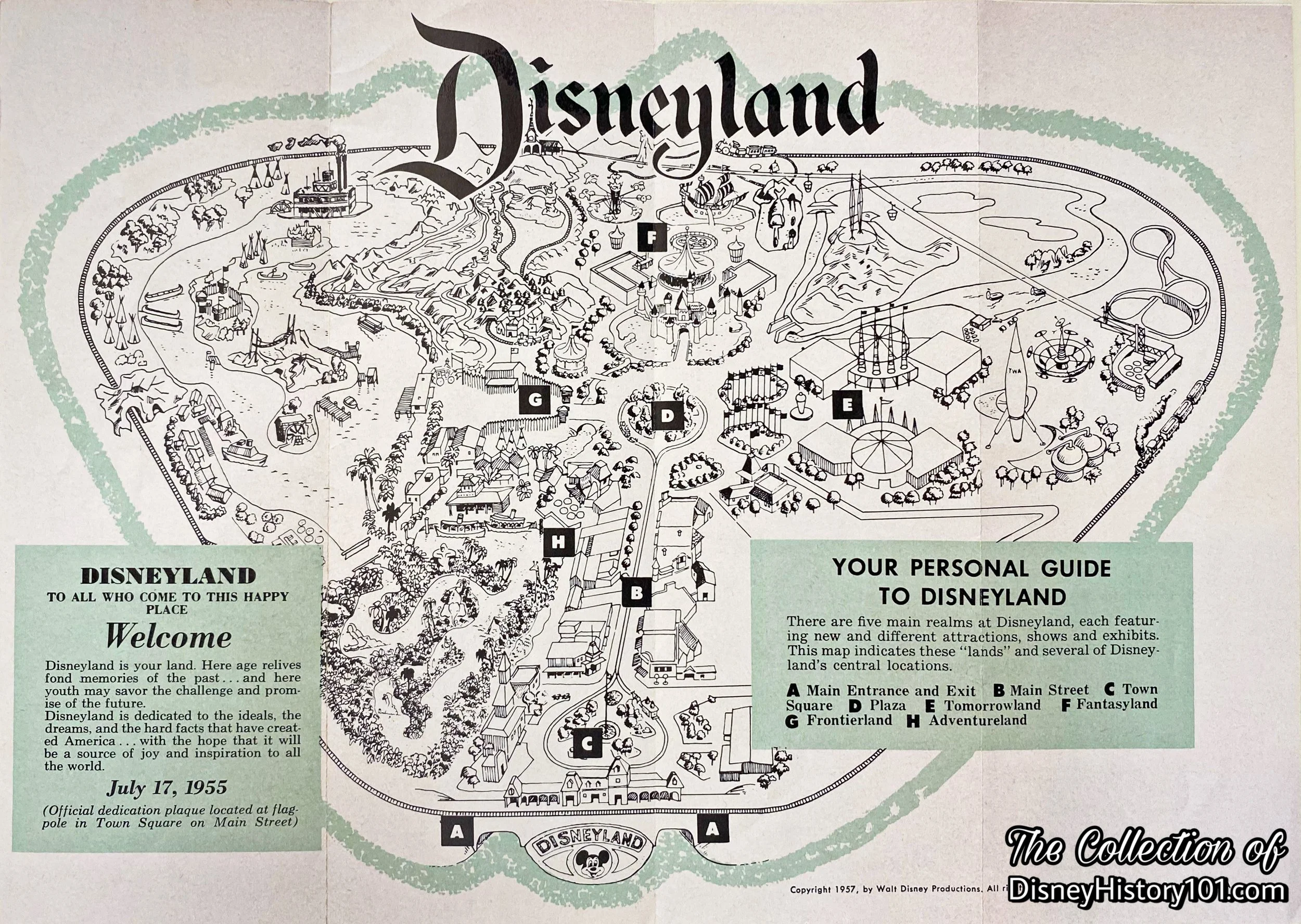
In July 1955, The Guide Map to Disneyland was introduced to guests as an indexed guide to all the attractions, exhibits and shows in Disneyland. These were originally “double-gatefold” or “accordion fold” and were administered at the Main Gate, as complimentary gifts to guests of Disneyland. Pictured below are some of those maps.
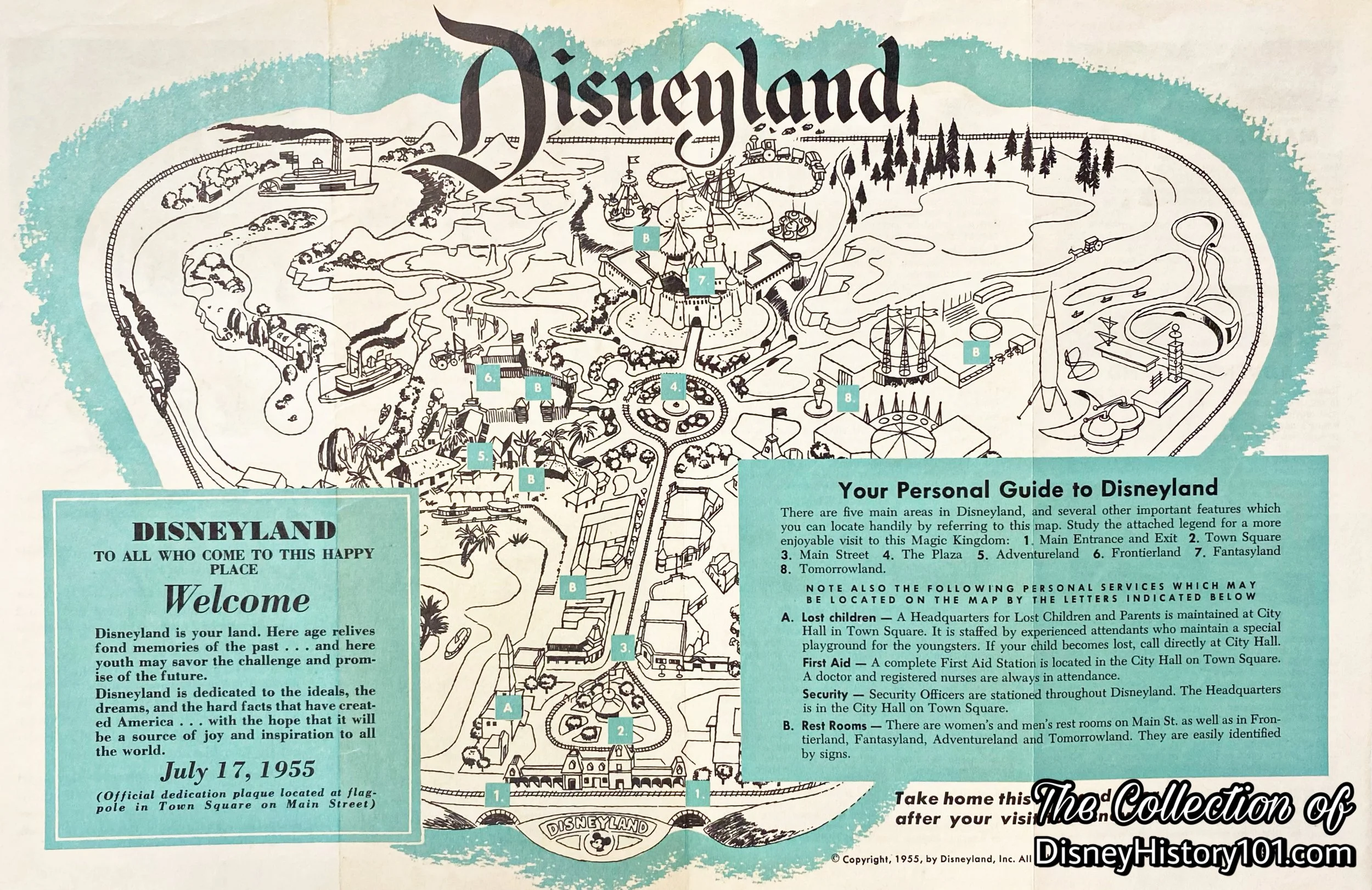
“Your Personal Guide to Disneyland” Map, published 1955.
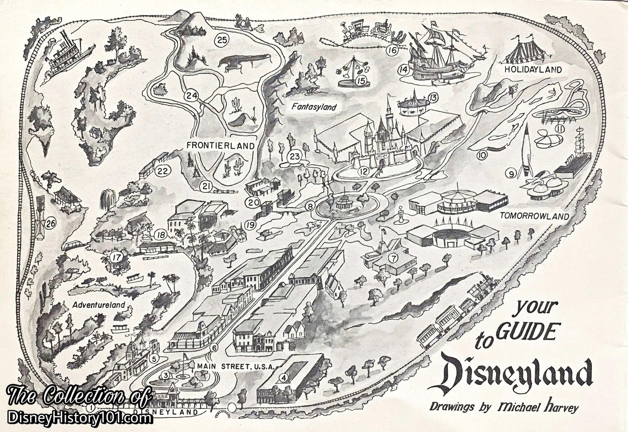
“Your Guide to Disneyland”, a map by artist Michael Harvey, published in the “Disneyland Souvenir Book in Natural Color”, 1955.
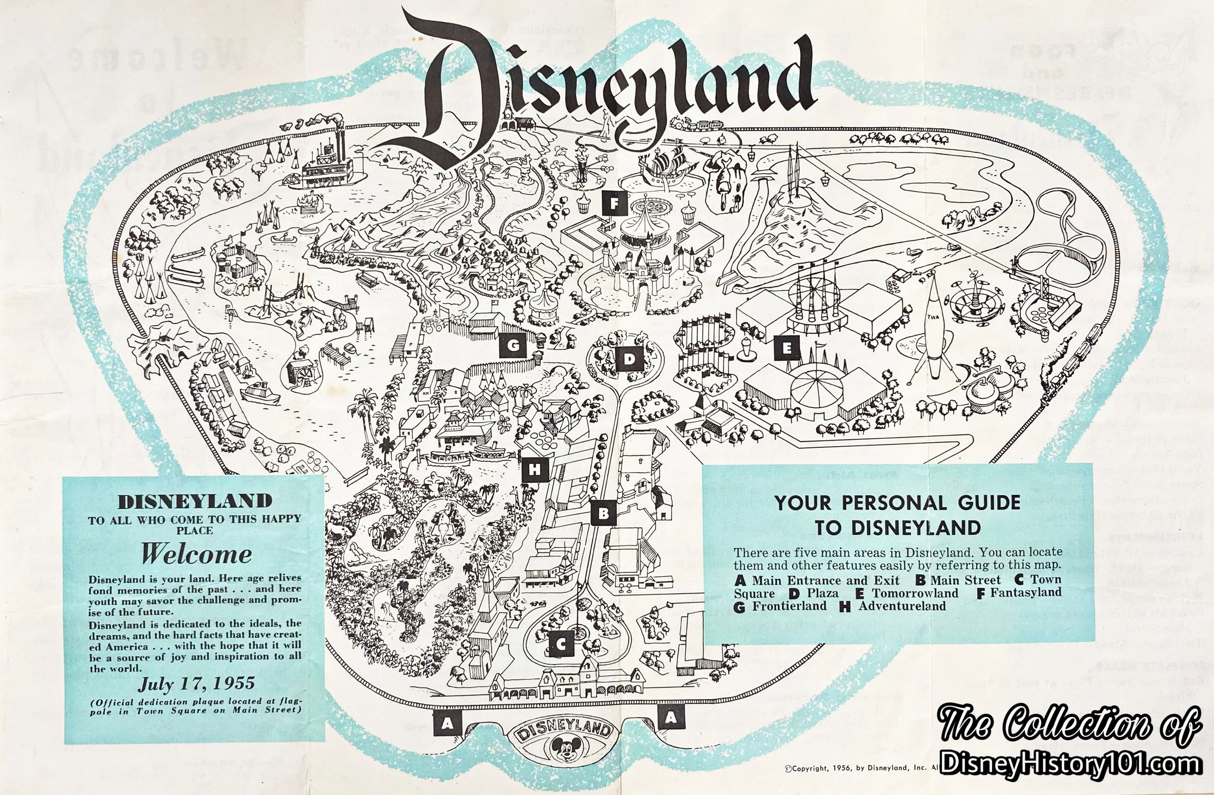
“Your Personal Guide to Disneyland” Map, published 1956.
“Your Guide to Disneyland” Map, published in “Your Personal Guide to Disneyland”, 1957.

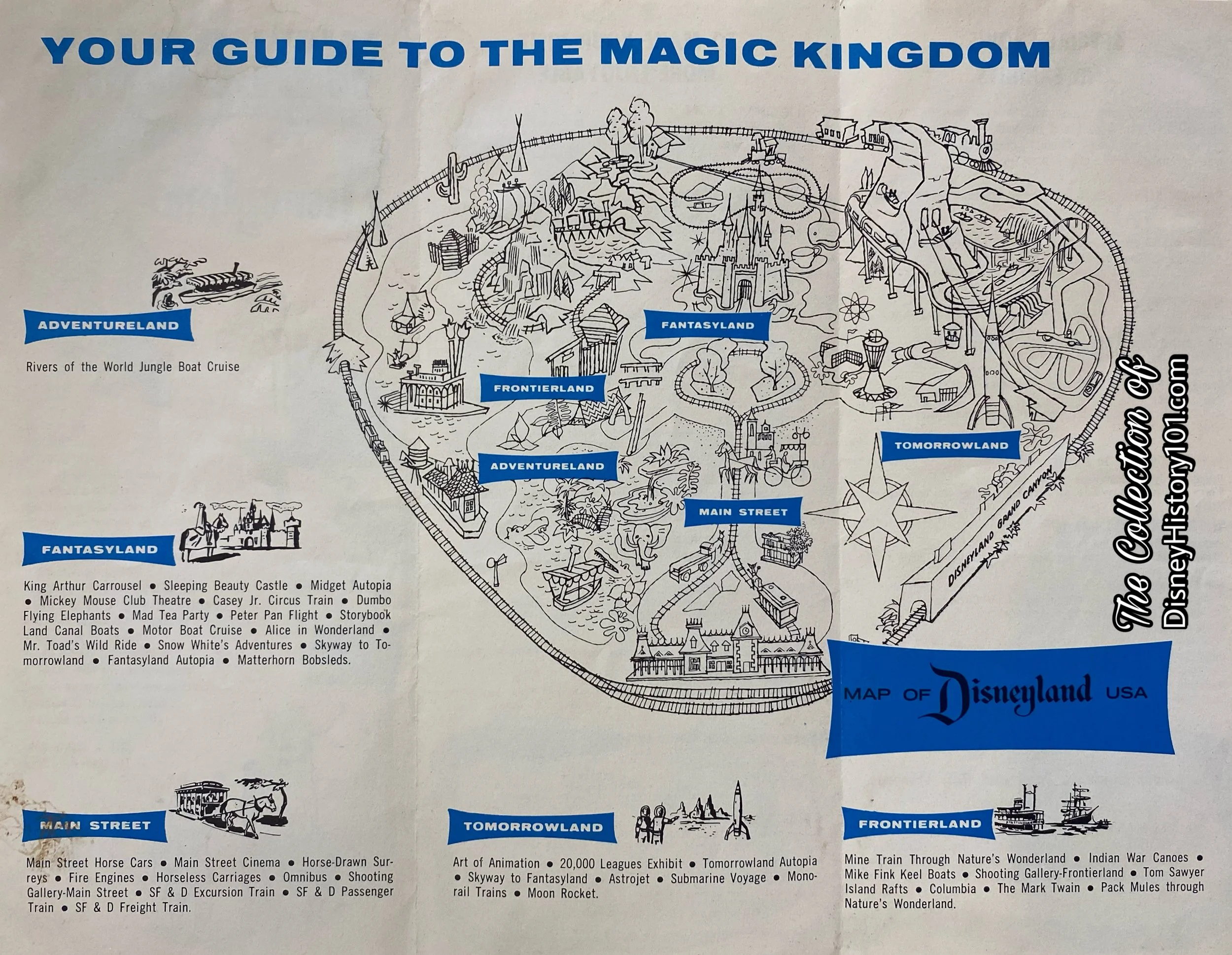
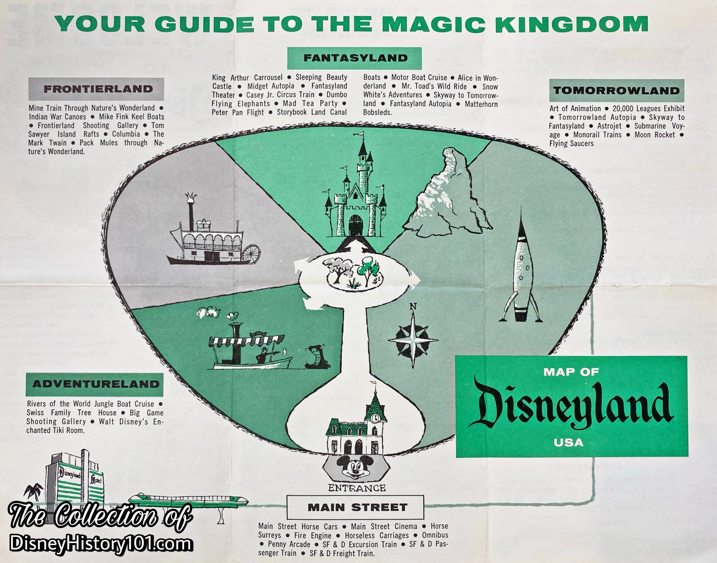
The “Disneyland’s Five Lands” Map published in “Your Guide to the Magic Kingdom”, 1958.
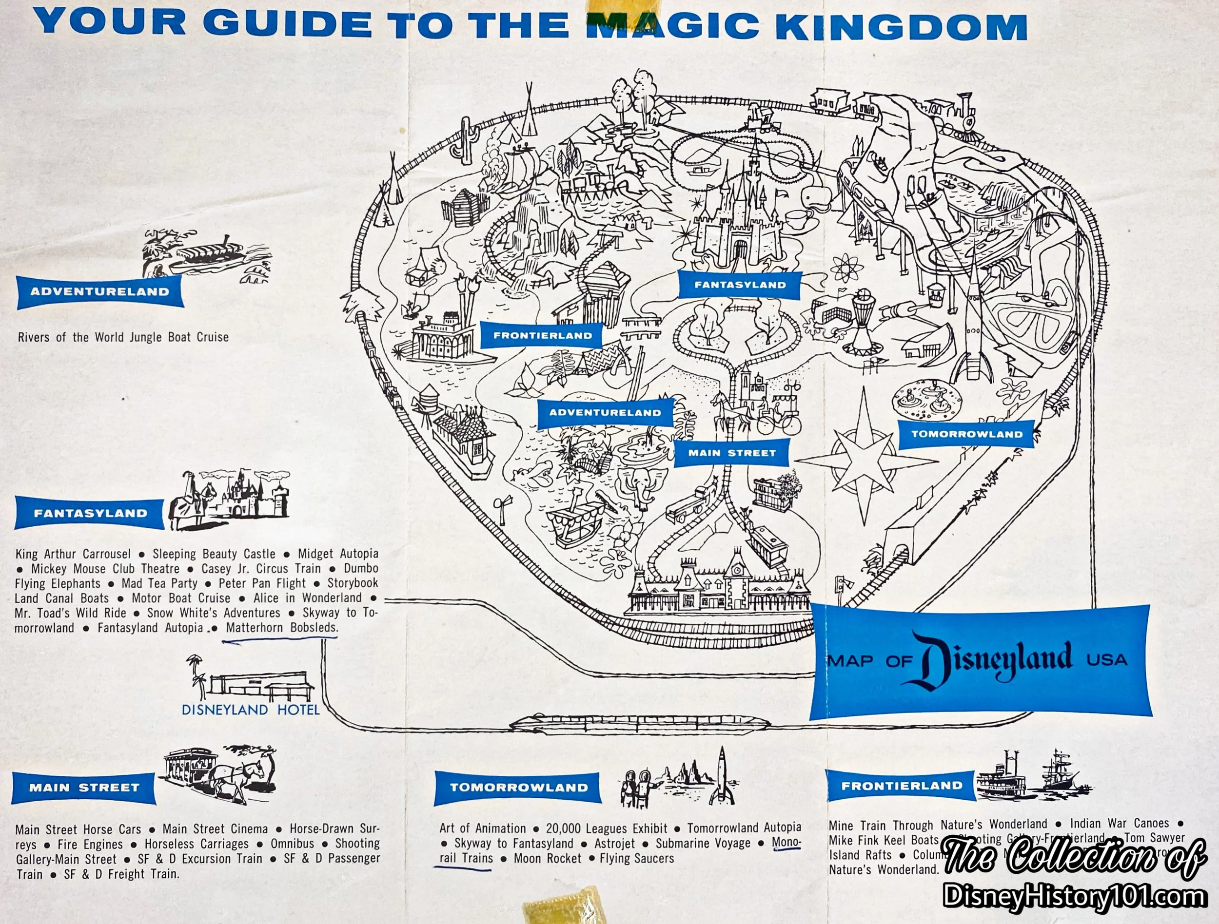
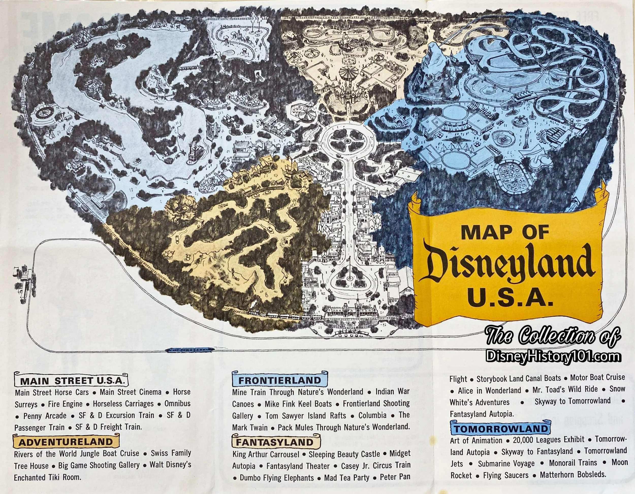
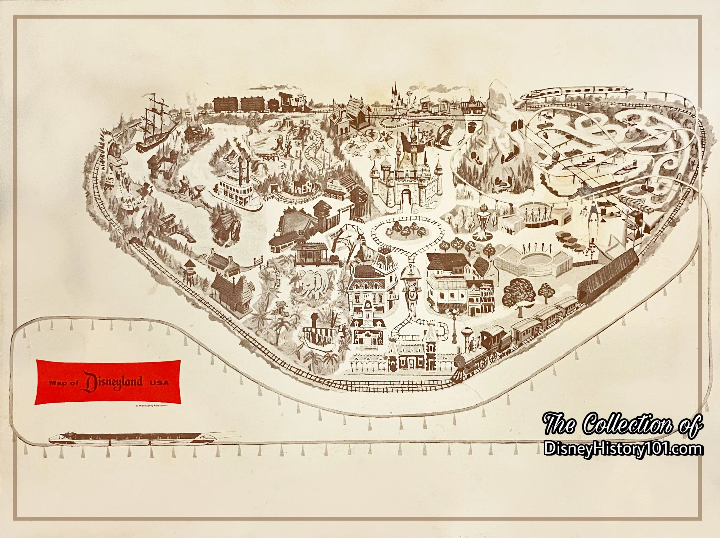
The “Map of Disneyland, U.S.A.” published in “Your Guide to the Magic Kingdom”, 1960.
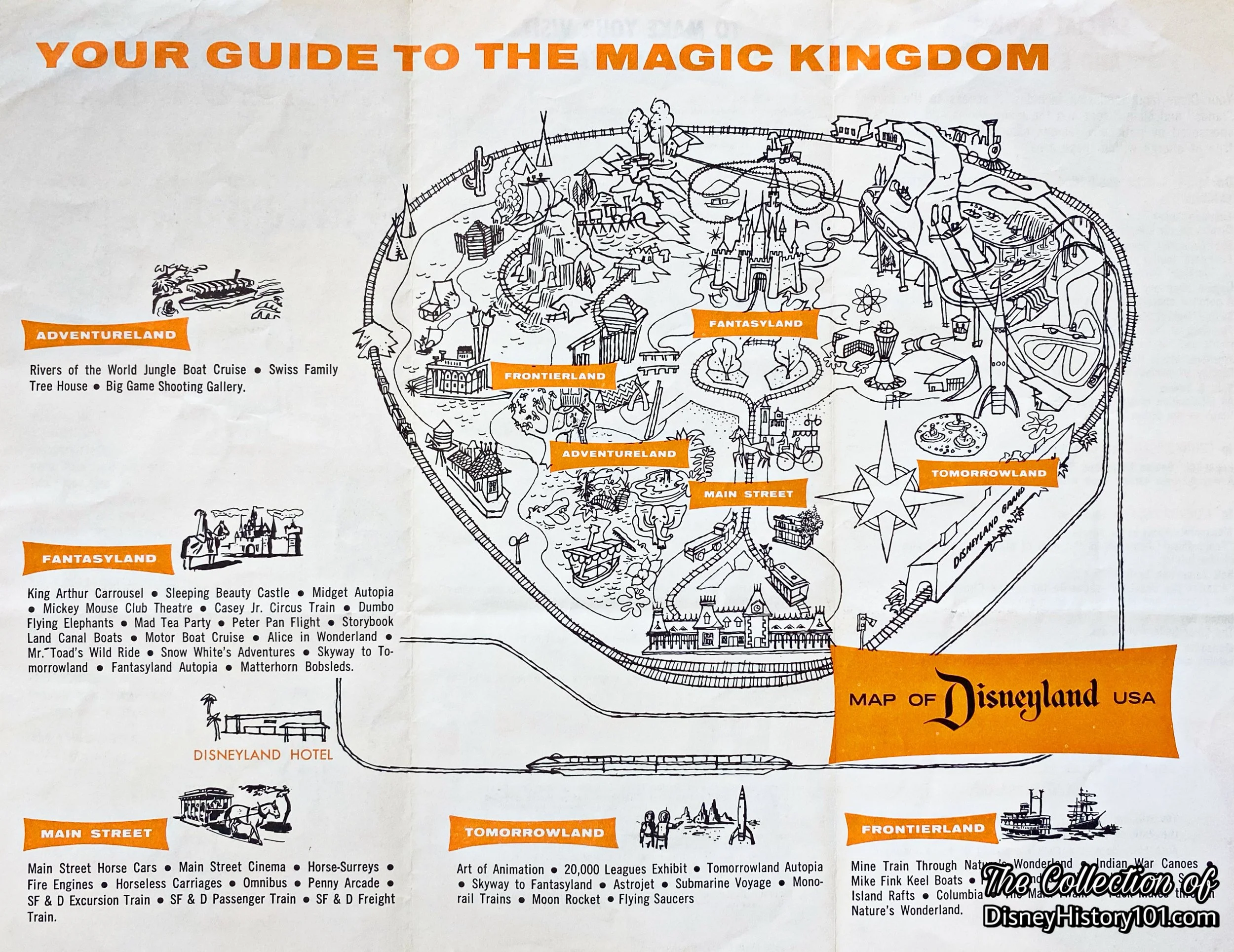
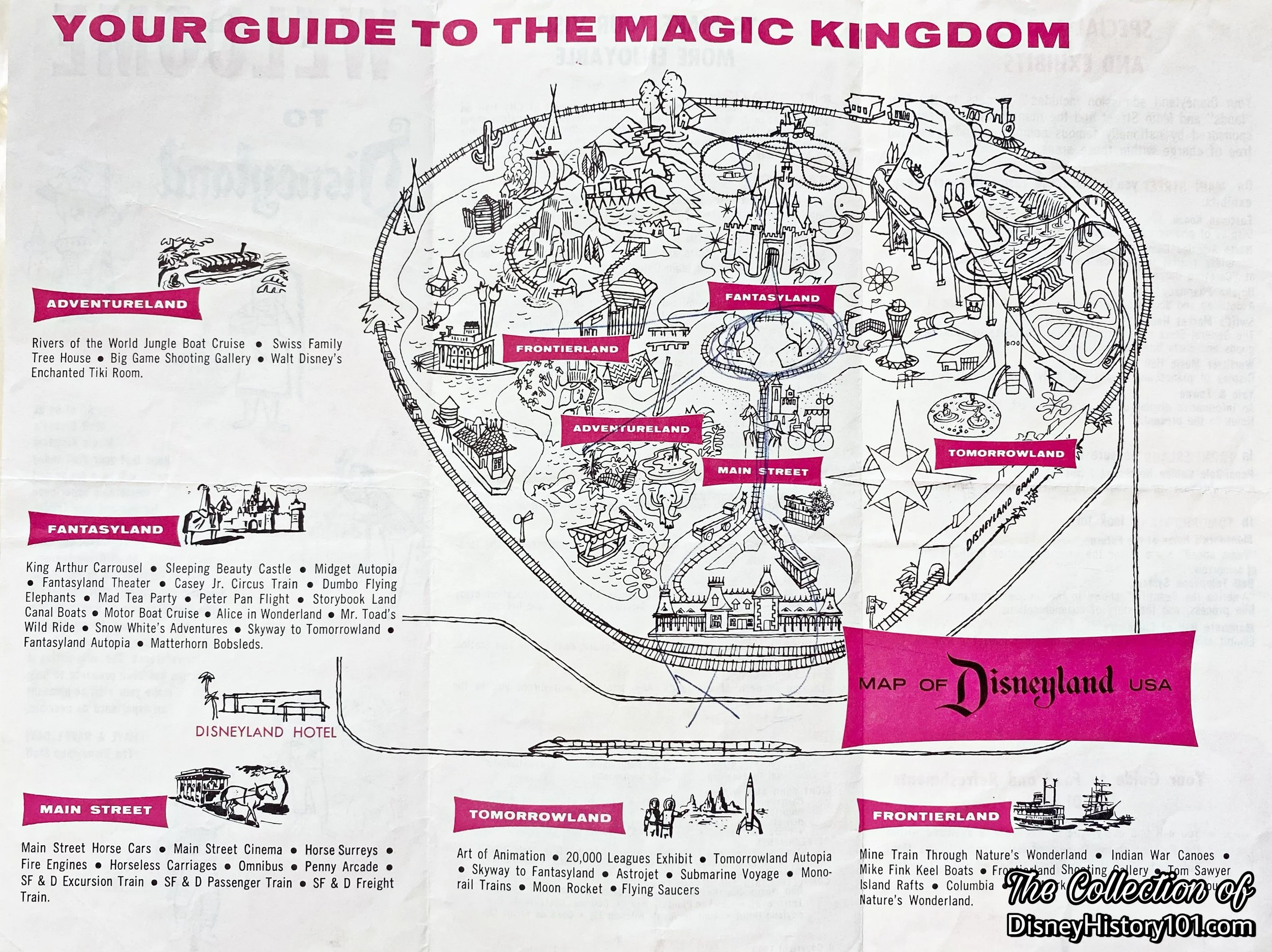
The “Map of Disneyland, U.S.A.” published in “Your Guide to the Magic Kingdom”, 1961.
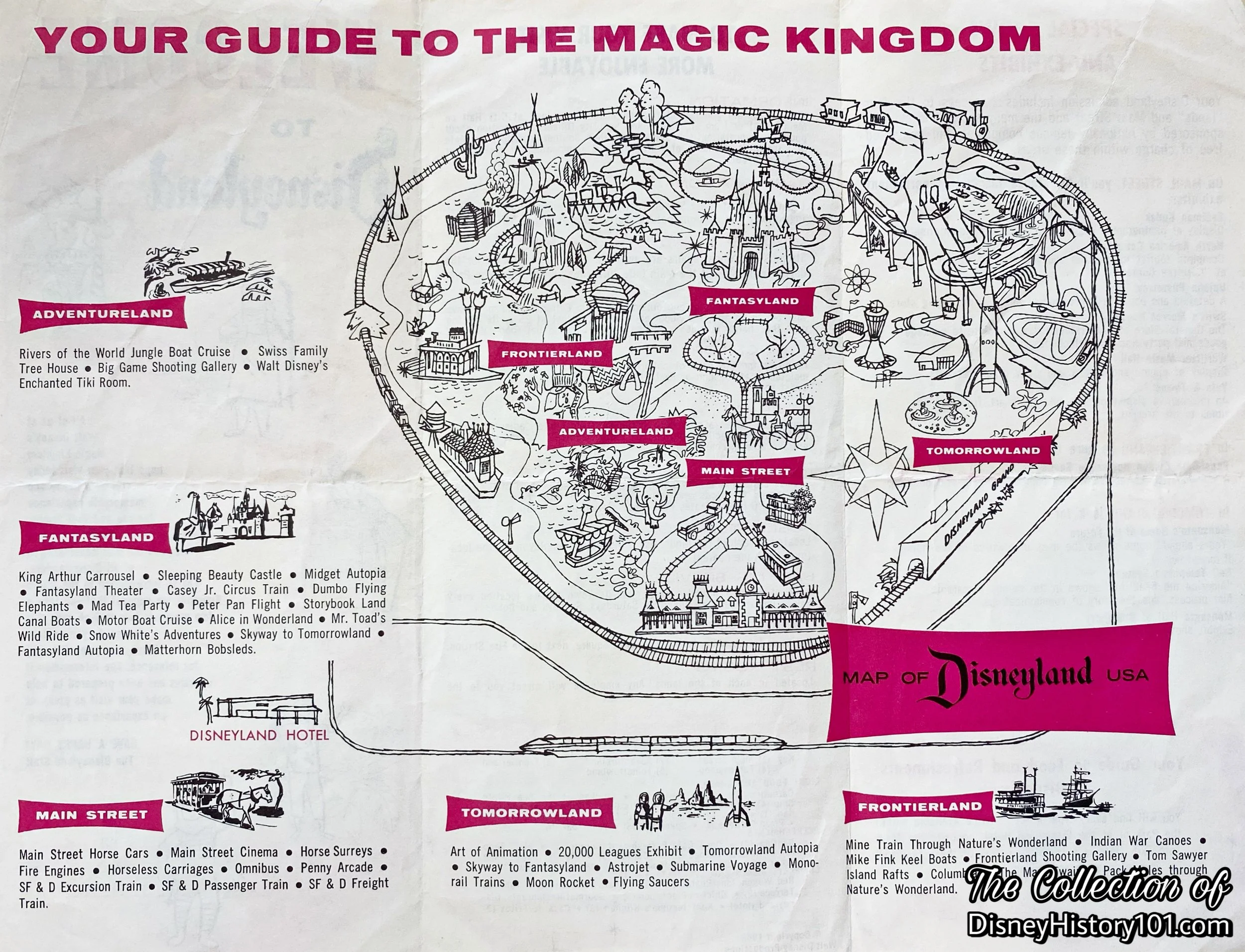
The “Map of Disneyland, U.S.A.” in “Your Guide to the Magic Kingdom”, published 1962.
The “Map of Disneyland, U.S.A.” in “Your Guide to the Magic Kingdom”, published 1963.
Another “Map of Disneyland, U.S.A.” in “Your Guide to the Magic Kingdom”, published 1963.
The “Map of Disneyland, U.S.A.” in “Your Guide to the Magic Kingdom”, published 1964.
The “Map of Disneyland, U.S.A.” in “Your Guide to the Magic Kingdom”, published 1965.
“Promotional Souvenir Maps of Disneyland”
Some maps were prepared as promotional souvenirs of exhibits which were presented by Disneyland Participant sponsors like Bank of America, Eastman Kodak and Hills Bros. Some of these maps were published as brochures while others were printed on placemats that guests dined upon at table service restaurants. Some promotional maps were published as newspaper inserts.
Above: Disneyland First Anniversary Souvenir Pictorial; newspaper supplement published 1956.
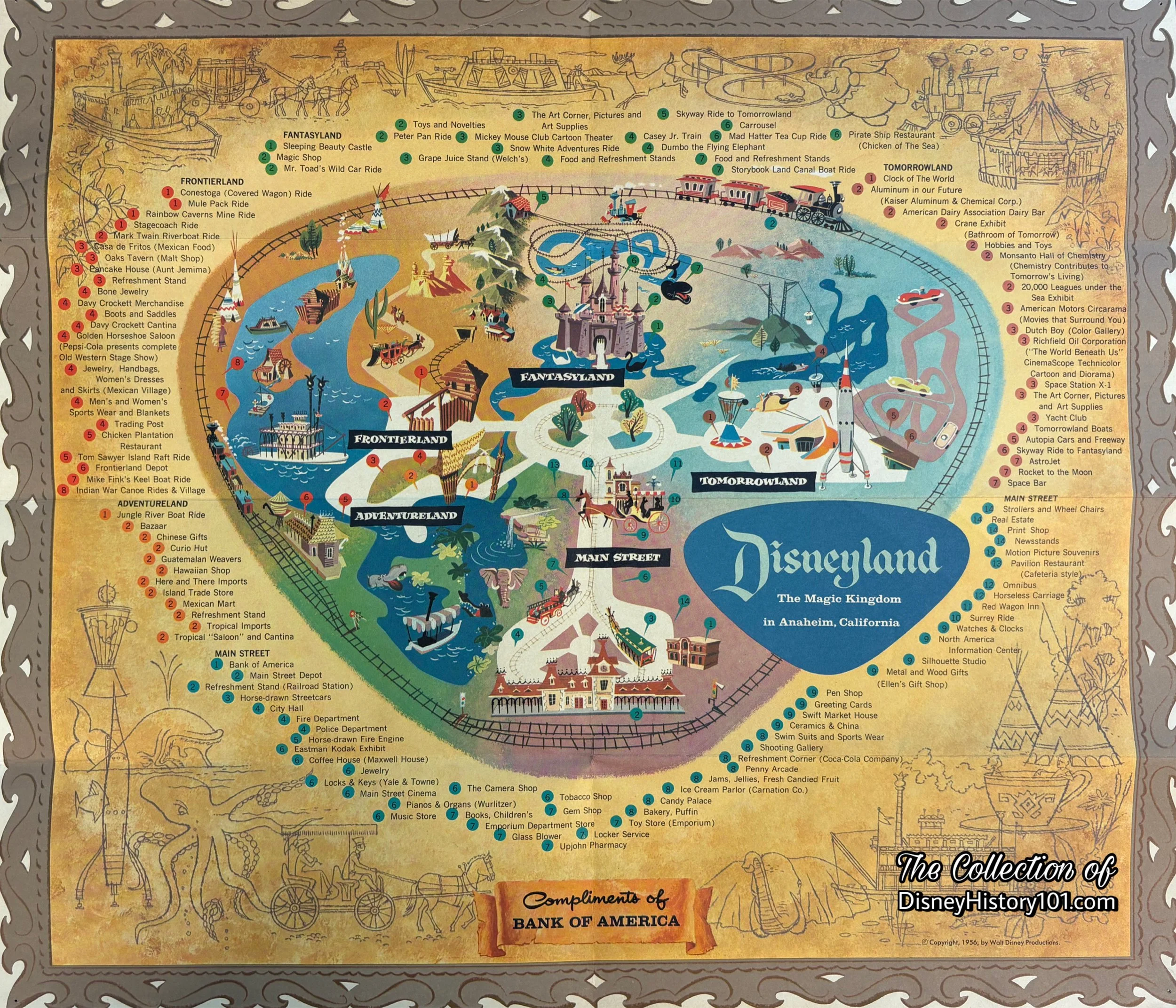
A Disneyland Map in a complimentary souvenir of Bank of America, 1956.
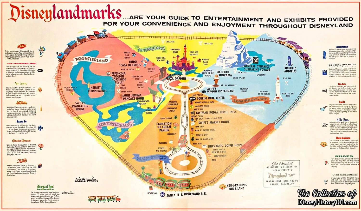
“Disneylandmarks” Newspaper Insert
A Hills Bros. Coffee House Menu featured the recent Monorail System extension of 1961.
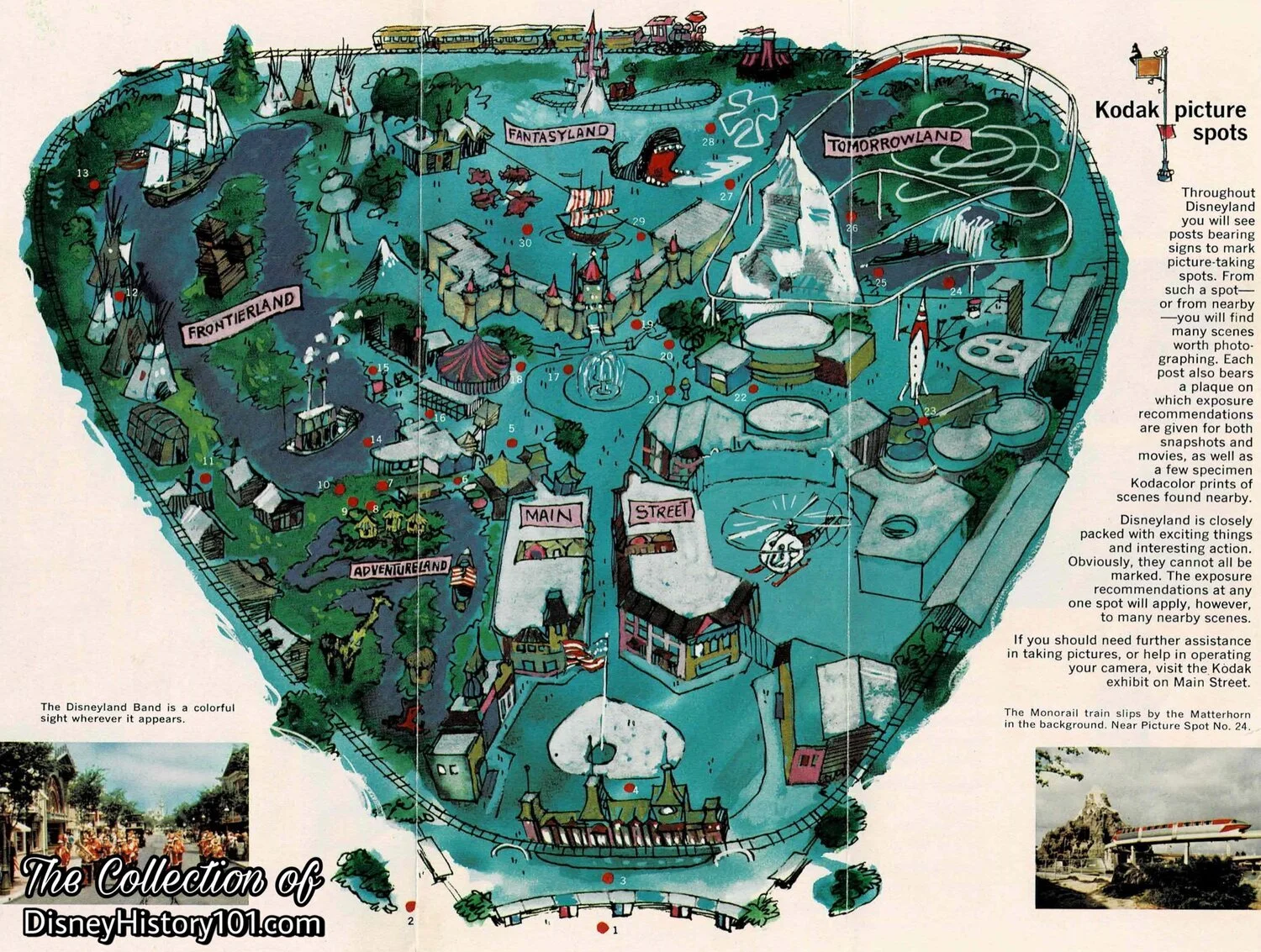
“A Kodak Camera Tour of Disneyland”, C-38; 1963
“Souvenir Fun Map”
The first Fun Map of Disneyland was included within the pages of a Guide to Disneyland. The Fun Map of Disneyland was not individually sold as souvenir until the second year of operation.

The “Fun Map of Disneyland” published in a souvenir book.
Herbert Ryman was first considered for the task of completing the first souvenir map of Disneyland, but Sam McKim (who began began working for Walt Disney's W.E.D. Enterprises in 1954), was assigned to complete the concept drawing. Finally by 1957, the first Disneyland Fun Map was available for individual purchase as a souvenir of Disneyland. Perhaps you recall mounting one of these to your wall at home.
By the 1958 season, the original map was available for purchase both in shops, and through mail order catalogs. The map measured approximately 30” x 45” and was originally sold rolled up and inside a tube, until Merchandising Department decided that it was better to sell the map folded and measuring approximately 8” x 15”.
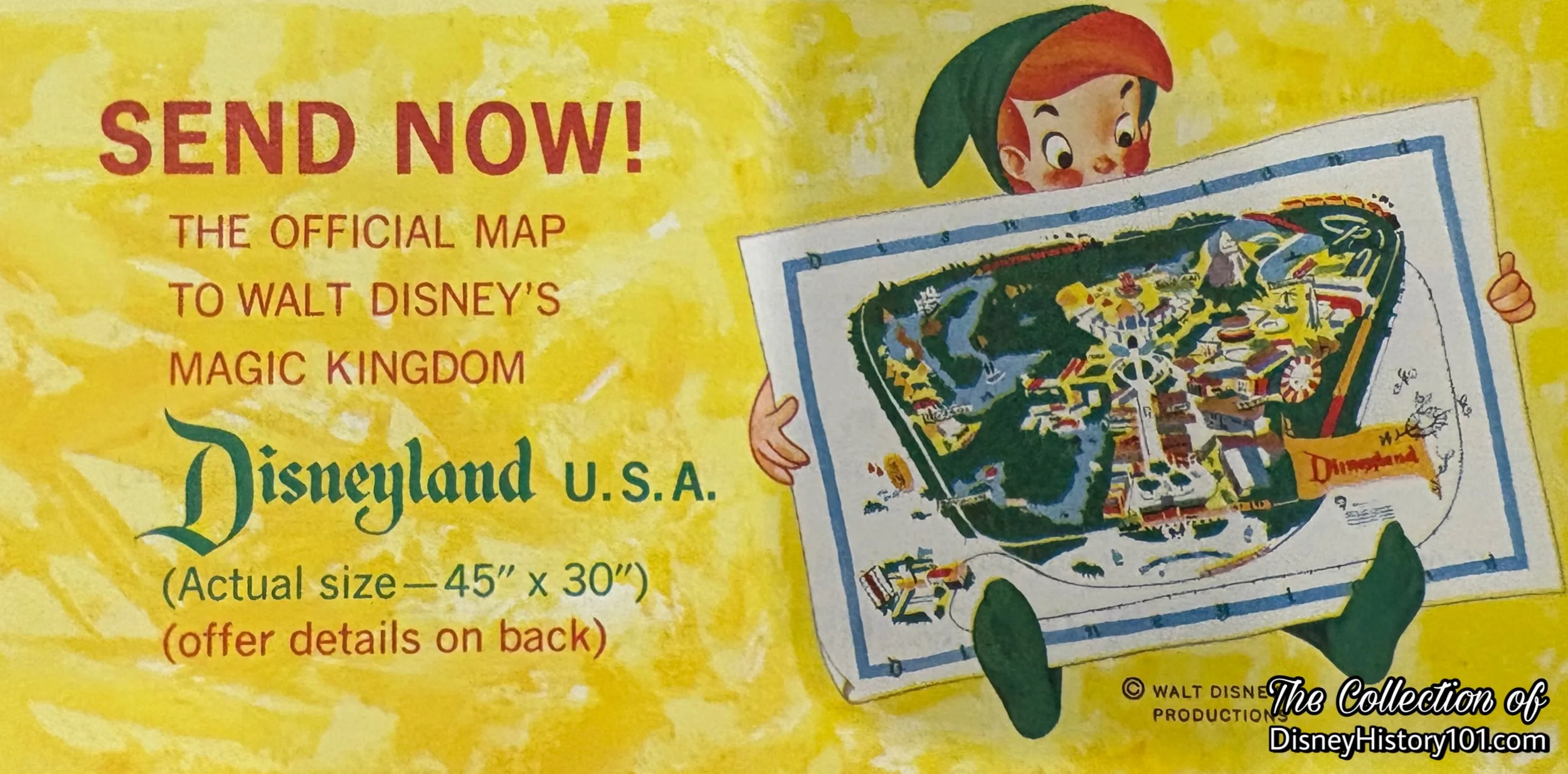
“The Official Map to Walt Disney’s Magic Kingdom, Disneyland, U.S.A.” was a promotional offering through Sunkist in 1960.
As Disneyland continued to grow and expand, Sam McKim kept pace, creating new editions of Disneyland Fun Maps, with each passing year. Sam created more maps from 1958 to 1964. However, in 1966, McKim was busy with other projects and Collin Campbell began creating the Disneyland Fun Maps.
1962 Disneyland Souvenir Fun Map.
1968 Disneyland Souvenir Fun Map.
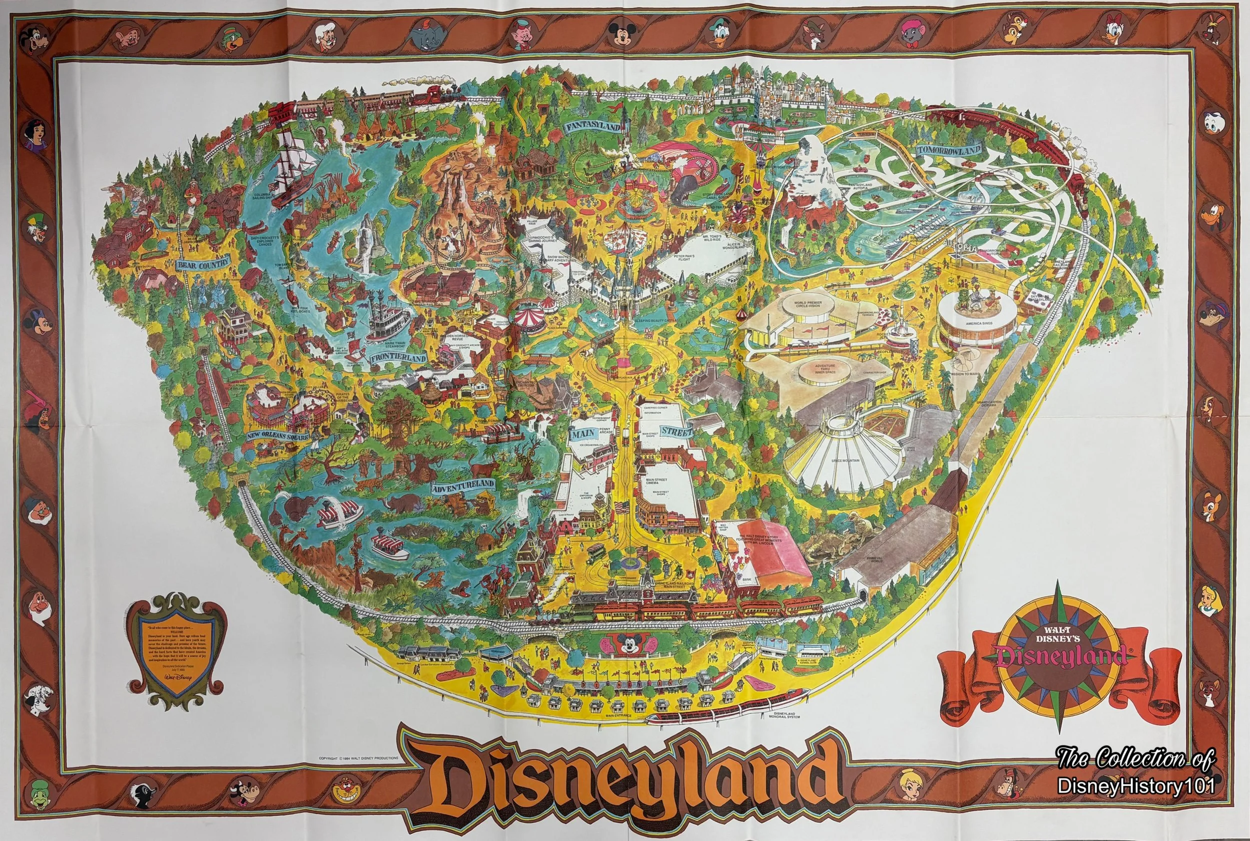
1982 Disneyland Souvenir Fun Map.
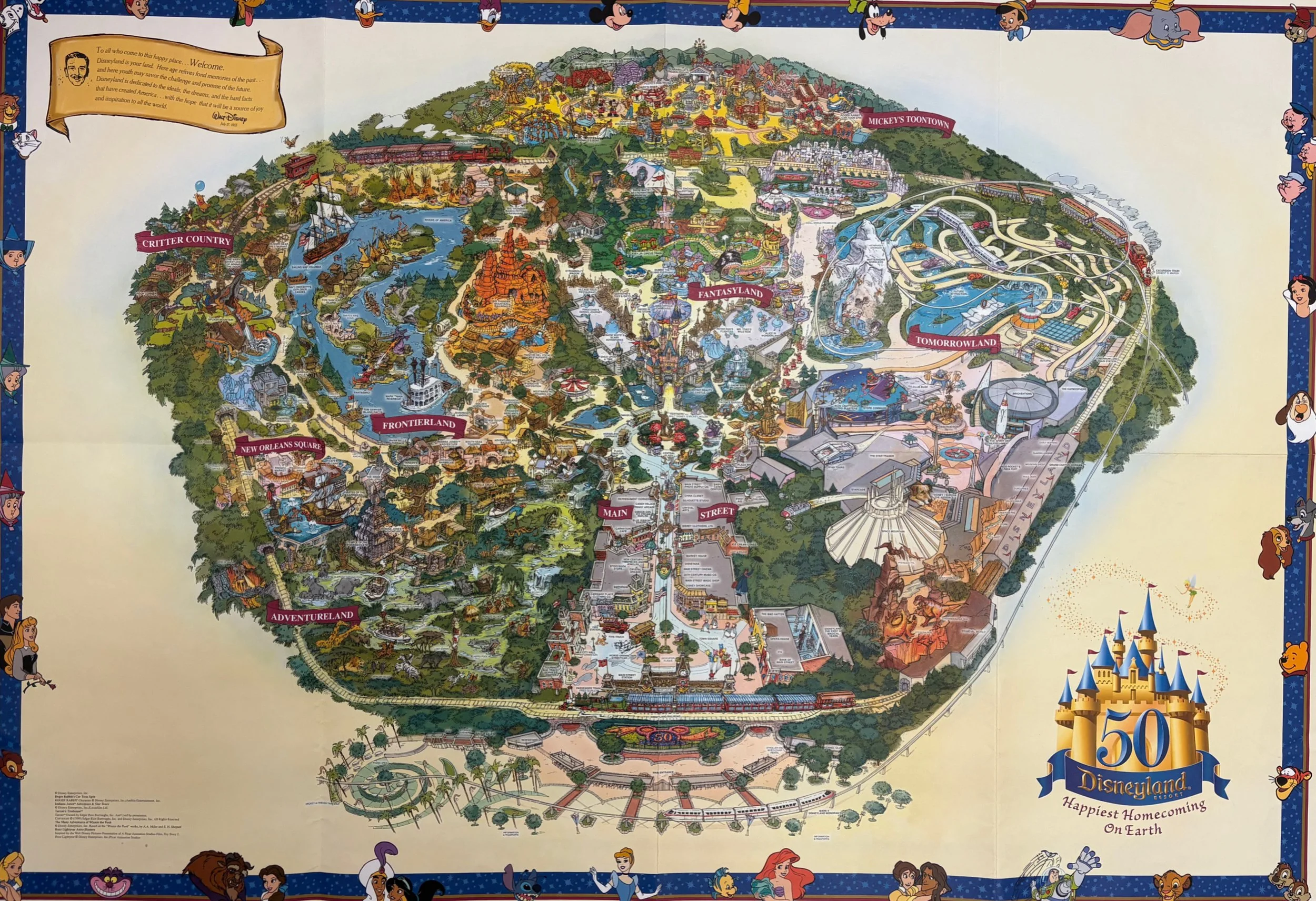
The Disneyland 50 - “Happiest Homecoming on Earth” Fun Map.