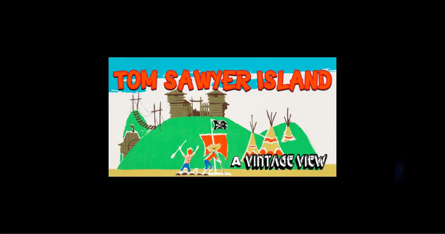
TOM SAWYER ISLAND
Explore caverns, rock formations, bridges, with the leader of the club Mickey Mouse! Yes, long before Tom Sawyer and Huckleberry Finn navigated Disneyland’s Rivers of America en route to exploration, an entirely different concept was envisioned for Tom Sawyer’s Island!
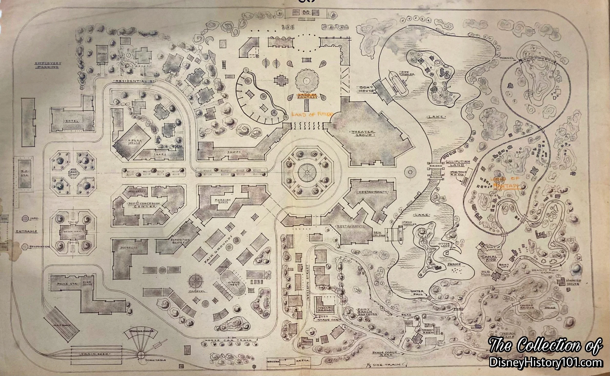
“Disneyland Preliminary Scheme #1”

WED Enterprises, Inc. "Disneyland Prospectus" Excerpt, 1953
“‘MICKEY MOUSE CLUB ISLAND’ & ‘BIRD ISLAND’”
The document (pictured above) was prepared in 1953, by Walt Disney Incorporated, in order to describe the concept of Disneyland (and its future attractions) to WED‘s board of shareholders. Mickey Mouse Club’s island-based Headquarters are further described on this document that was produced three years before Tom Sawyer Island would debut to Disneyland’s guests. This may have been one reason why a journalist for the Anaheim Bulletin (published Saturday, May 1, 1954) described Disneyland as a “fantasy-playground and television plant,” and again as a “park and television studios.” In fact this same reporter wrote : “The project… will be in production of television shows within one year [of May 1, 1954], it was revealed.” Soon, Popular Mechanics (December of 1954) even made mention of “Mickey Mouse Island” among the landmarks of the Disneyland project. Few things about Disneyland were finalized by this time, and over the next three years, many artists would submit conceptual renderings of this island, including Claude Coats, Herb Ryman, Marvin Davis, Sam McKim, and Vic Greene.
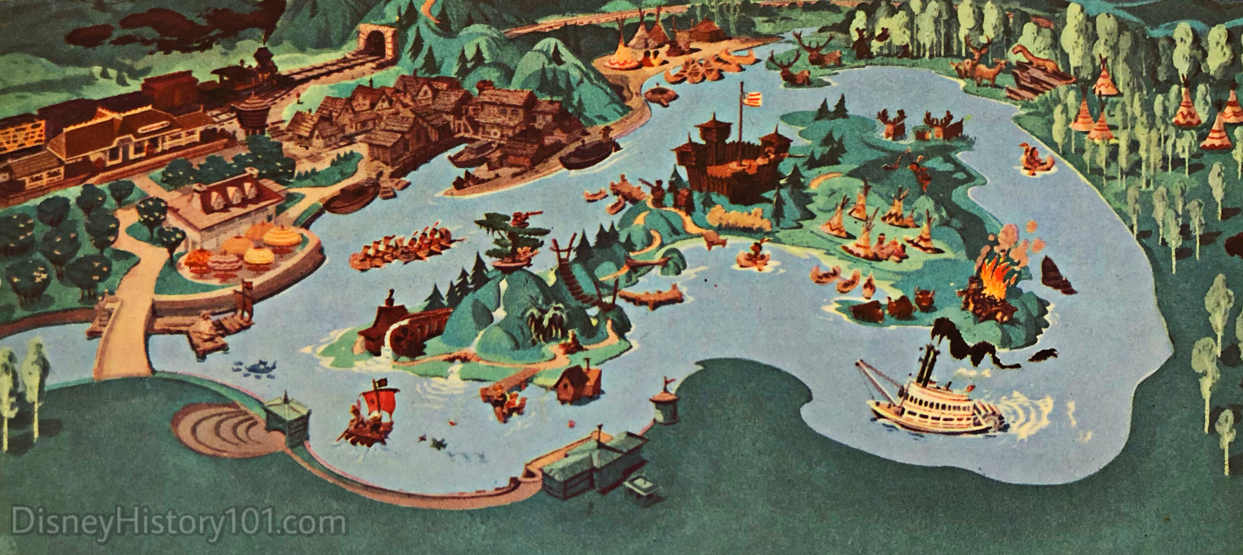
By 1954, some of the earliest drawings of Mickey Mouse Park were created for an area to be located between Riverside Drive and the Los Angeles Flood Channel in Griffith Park, Burbank, California. Many of these drawings depict a “Mississippi Steamboat” attraction circumnavigating the waters of a man-made river, and at least one drawing labels locations on the west side of the island with the words “Lagoon + Bird Sanctuary” and “Bird Island”. The east side of the island featured the labels “Skull Rock” and “Lighthouse”. Clearly artists were considering additions to the island, though it did not seem that they entertained the idea of guests being transported there.

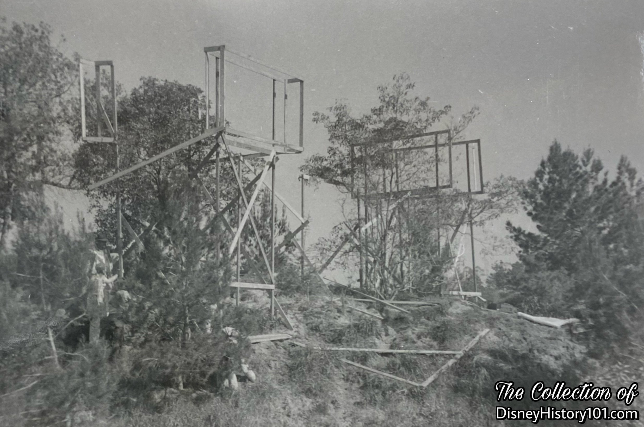
“Draw Concept” - "Aerial View Over Disneyland" by Herbert Ryman Excerpt, originally produced September 26 & 27, 1953.
Early thumbnail sketches and other concept artwork of Disneyland seemed to be unencumbered by restrictions of budget, schedule or the laws of nature and physics. Though guided by Walt, his artists appeared to engage in “free-thinking,” as if implementing the modern “Blue Sky” Imagineering process. Like some advanced “High Concept,” final designs were quickly generated and approved while others were voided.
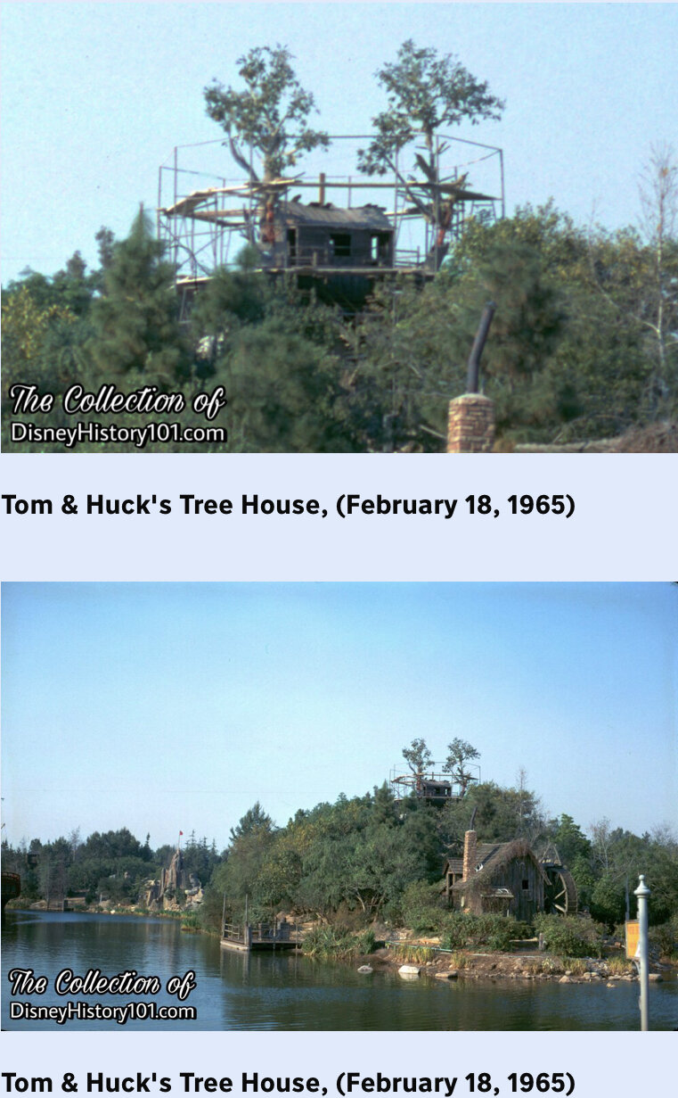
While many artists contributed, the talented Herbert Ryman is of note. Herb had joined the Disney Studio in 1938, after Walt saw a public show of his work in New York. (Herb's paintings were being exhibited with those of another up and coming artist, Andrew Wyeth.) Herb Ryman acted as art director for such films as Fantasia and Dumbo, but had left Walt Disney Studios in 1946 and (by 1953) was employed by 20th Century Fox. Walt reached out to Herb and during one weekend (September 26 & 27, 1953) the first “Schematic Aerial View” over Disneyland originally produced! Herbert Ryman’s work notably depicted a Mickey Mouse Club-themed island featuring a tree house, an entrance to a cave, and what looks like a raft in a cove.
Sam Mc Kim began working for Walt Disney's W.E.D. Enterprises (now Walt Disney Imagineering) in 1954, as an imagineer, doing the original sketches for Frontierland and a variety of sketches of Tom Sawyer Island. Other ideas were thematically centered around Treasure Island. Some of these viable project Concepts (as seen above), were supported by a well-developed business case and built expectation.

(July 17, 1955 - June 16, 1956)
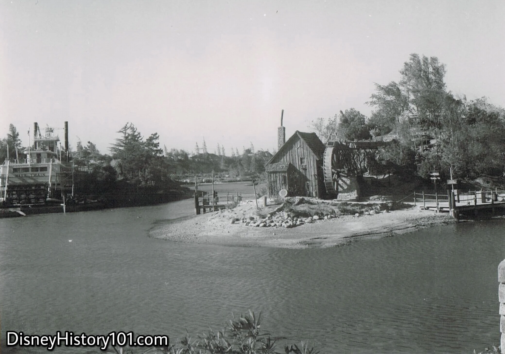
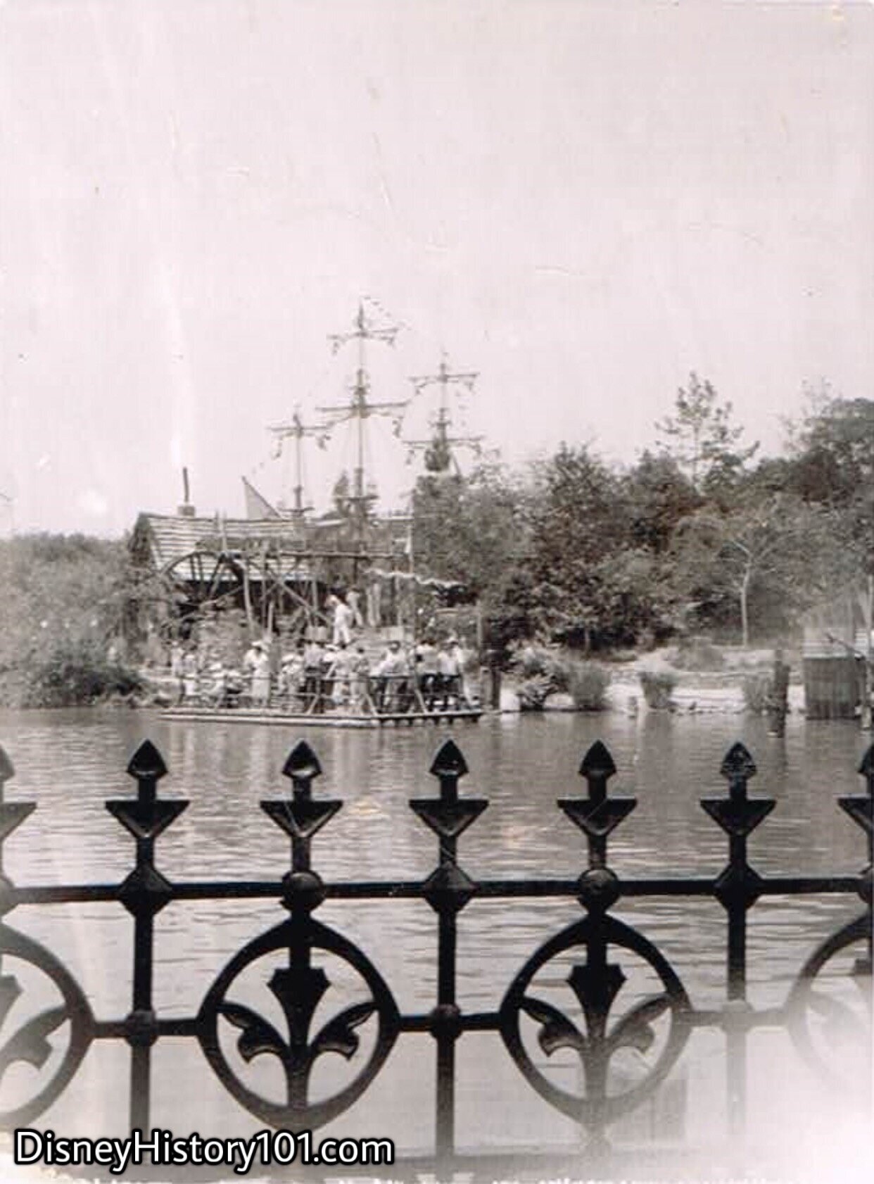
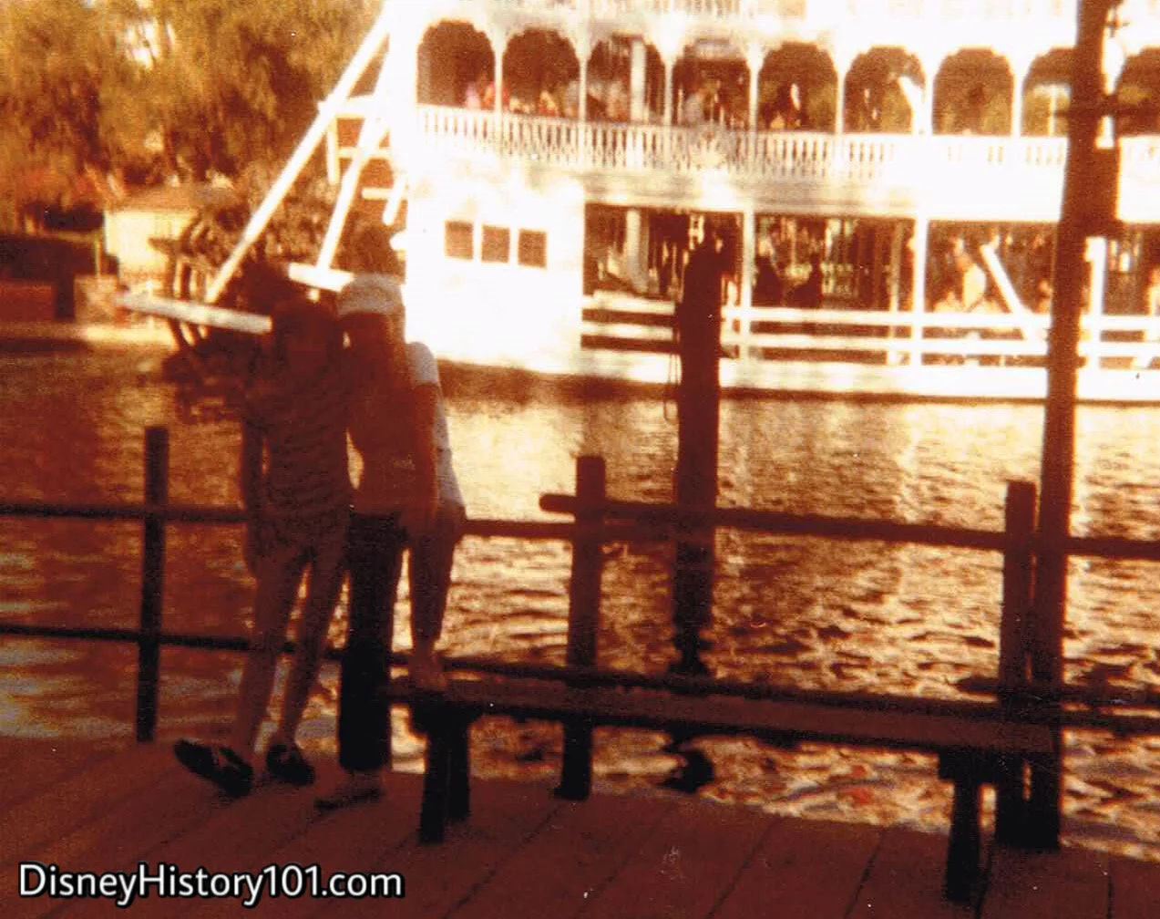
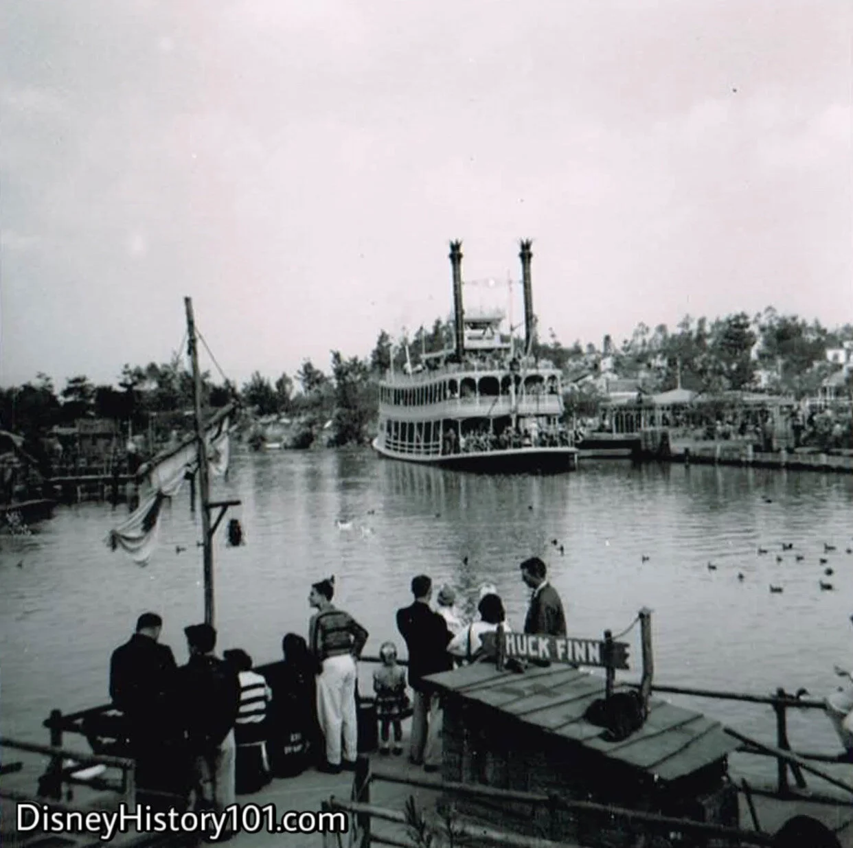
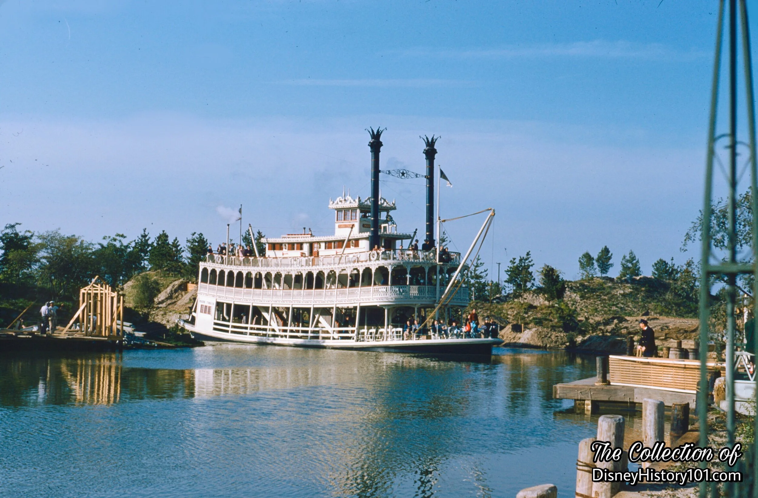
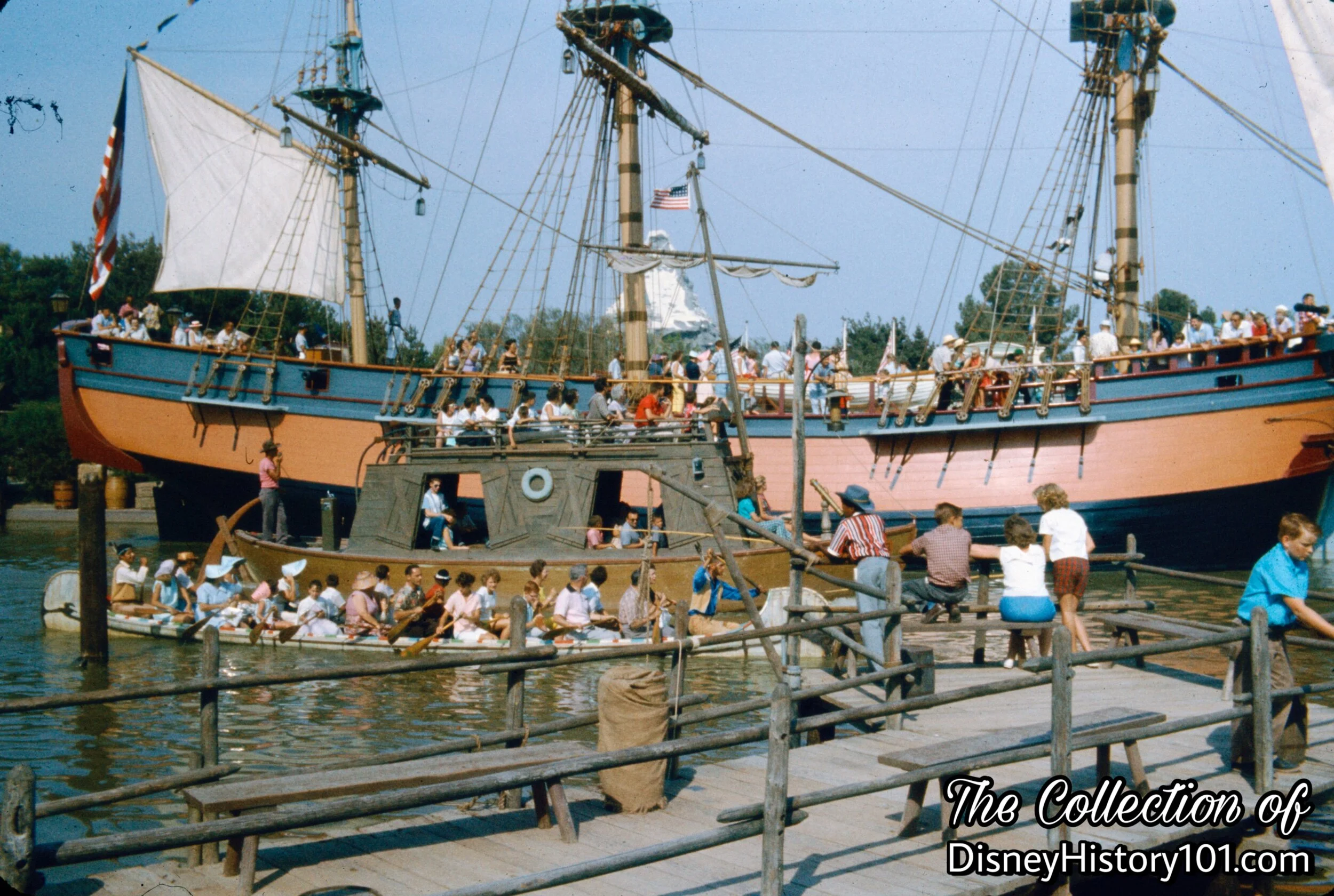
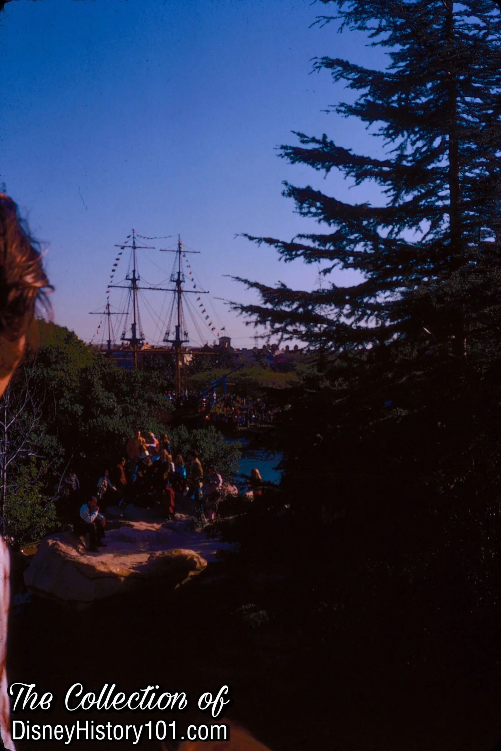
Though early drawings of Disneyland depicted a Mickey Mouse Club theme on the island, this was the scene upon Disneyland’s opening in 1955. “Like the pioneer country that it represents, Frontierland was partly undeveloped in 1955,” according to “Walt Disney Disneyland,” page 42, printed by Officine Grafiche Arnoldo Mondadori - Verona; first published 1964. When the Mark Twain embarked on excursions down the Rivers of America, in the center of the river was a wild, rugged, and “untamed” island, somewhat reminiscent of the shores of the Mississippi River.
The unnamed island wasn’t much to look at (compared to today), but the feel of the territory fit well with the natural setting of Frontierland! Disneyland was constructed under a meager budget, and so the island had a lot of bare earth and unfinished areas, sparsely decorated with immature trees, that would require some three years of growth. According to Tom Nabbe, “there was a ‘live’ spiel on the Mark Twain as it huffed and puffed its way around the Island. Only trouble was that there wasn’t anything to spiel about. Pardon me. There was one big tree hanging out over the big bend of the River, right beside the old Chicken Plantation House.”
Besides the big tree next to the Chicken Plantation House, there were few rather distinct “natural” features about its landscape. This was the state of the “uncharted” island, during Disneyland’s first year of operation.

The Island on a Disneyland Television Tray, 1955
I would like to direct your attention to the unique shape of the island. Some early (c. 1954) renderings of Disneyland featured three islands (where perhaps small scenes or vignettes would be placed), but later drafts consolidated these islands into one main island.
According to some accounts, Walt Disney may have been influential in this process (not satisfied with the renderings by Disneyland Inc. employees). According to those same accounts, he personally traced the design on drafting vellum while relaxing inside his Carolwood Drive train barn workshop. This shape was retained, and can be seen on this early licensed Disneyland merchandise.
Yes, this early Disneyland souvenir was only sold during 1955, and features a unique idea of what the island may eventually look like. In this rendering, the island looked to be settled with southern mansions amidst the forested area, similar in style to the Chicken Plantation across the river!

"Your Trip To Disneyland" on Records "Giant Full-Color Panorama" Excerpt, by Mattel, Inc., 1955
Similar artwork was produced for this “Disneyland Musical Map 4-Record set” by Mattel. The artwork is more detailed than the artwork produced for the television tray, and features of the island are more discernible. It is quite possible that these were elaborated upon through a description of the Frontierland sights along the banks of the “Rivers of America” in an early Tanner Gray Lines brochure which read: “At the river dock, you can step aboard a paddle-wheel steamboat for a fascinating cruise on the Rivers of America - you’ll steam by replicas of colorful river towns - New Orleans, Natchez, Mobile, and historic West Point and Mount Vernon.” Nash Airflyte Magazine (July 1955) published a similar description, stating that “a real sternwheeler” will make its way “past historical American landmarks.”

LOOK magazine presented a “first view” of Disneyland as illustrated by Peter Ellenshaw.

THE ISLAND, (August 4, 1955)
“Grand Opening”
“55er” Cal McMurtrey recalled: “I was workin' on Tom Sawyer Island, trying to bring up grass. I ran the sprinklers and I repaired them and, of course, I was the one that had to put them in. One day, before opening, I spent 16 hours on the island..they had forgotten me! Opening day seemed to be going pretty smooth. I was kept busy trying to keep out of sight of the guests, when I saw Fess Parker coming down the mule trail in a stage coach.”
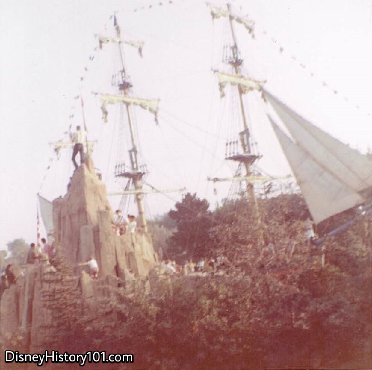
Those early structures off the port (or, left) side, are connected to “Joe’s Ditch”, named after the harbor recommended by Admiral Joe Fowler. These were never connected with Tom Sawyer’s Island, but were a few signs of new “civilization” that cropped up along the opposing banks of the Rivers of America before opening day. Look in the foreground (to the right) - an undeveloped portion of the Island! It would not continue this way for long. By this time, Herb Ryman continued to produce rough drawings detailing proposed Show additions the island and shores of the “River Ride.” One particular rough sketch produced in ink lists natural scenic elements - “Semi-Submerged Logs”, “Dead Trees With Moss”, a “Cave Up High On Bank”, “Animals” (like “Bear, Buffaloes, Deer, Wild Turkey, Grouse, etc., Goat, Bighorn”), “Rock Strata Ledges” and “Some Cypress Swamp Area.” Other proposed scenes (on the same drawing) Included a “Fowler’s Dock” and scenery - “Dummy Kids Sitting Fishing”, a “Rustic House With Lighted Windows at Night on A High Hill,” and even areas named after Walt’s intimate family members (“Lilly Bay,” “Point Diane,” and another partially illegible location named after Sharon).
THE ISLAND, (August 4, 1955)
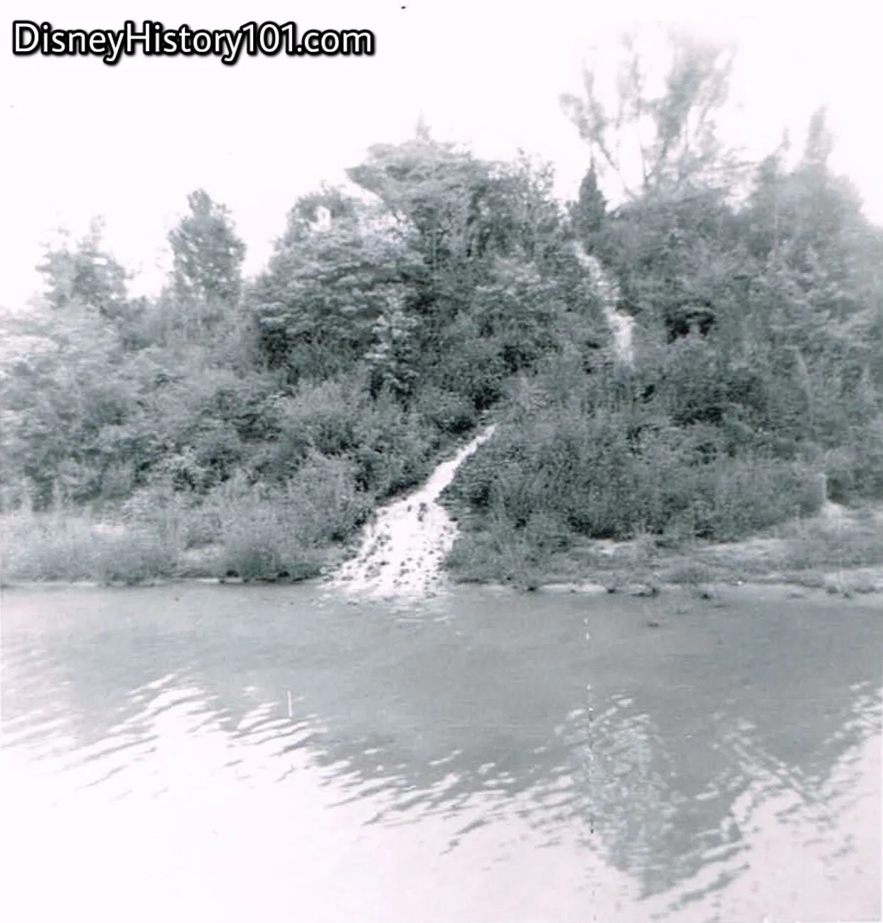
In the early days of Disneyland, this is what really happened when the moon climbed “high o’er the dead oak tree.” A legend would spring from this spot. Many moons ago, lightning struck a tree which grew here on Indian Hill. This lightning strike caused three waterfalls to spring from its roots… “and the Three Falls became the headwaters of the Rivers of America”! This tale was preserved in early material and publications (like “Frontierland”, published for True West magazine, June of 1958).
This simple lone water feature partially shrouded by trees, was one of the few things to see along the starboard direction of the Mark Twain. Say, this spot might make a mighty fine “look-out” point, from which an explorer may survey the rest of the island.
The Mark Twain's name also helped Imagineers pin down a theme for the island. Remember that Walt intended on housing The Mickey Mouse Club there, but when it was decided that Mickey would fit better in Fantasyland there was a dilemma as to what would become of the island. Walt was unhappy with blueprints for the island, so he took them home one night to draw them up. In the morning Walt introduced the design of the island, but he had named areas of the island after his family, which would never work with Guests who had no idea who Diane and Sharon were. Drawing upon the namesake of the riverboat, Imagineers made the island home of Tom Sawyer, Huck Finn and Injun Joe.
Fast forward a few months, to 1956! “Shortly after the first of the year, Walt Disney revealed his plans for the then distant summer season. In fulfillment of the promise made on opening day, that ‘Disneyland will never be completed’ Walt made public plans to add extensively to the Park’s facilities. Whole new areas were to be opened : Tom Sawyer Island.” [‘Disneyland - 1st Anniversary Souvenir Pictorial”]
At a meeting of the Disneyland Merchant's Association (held January 25, 1956), the momentous announcement was made:
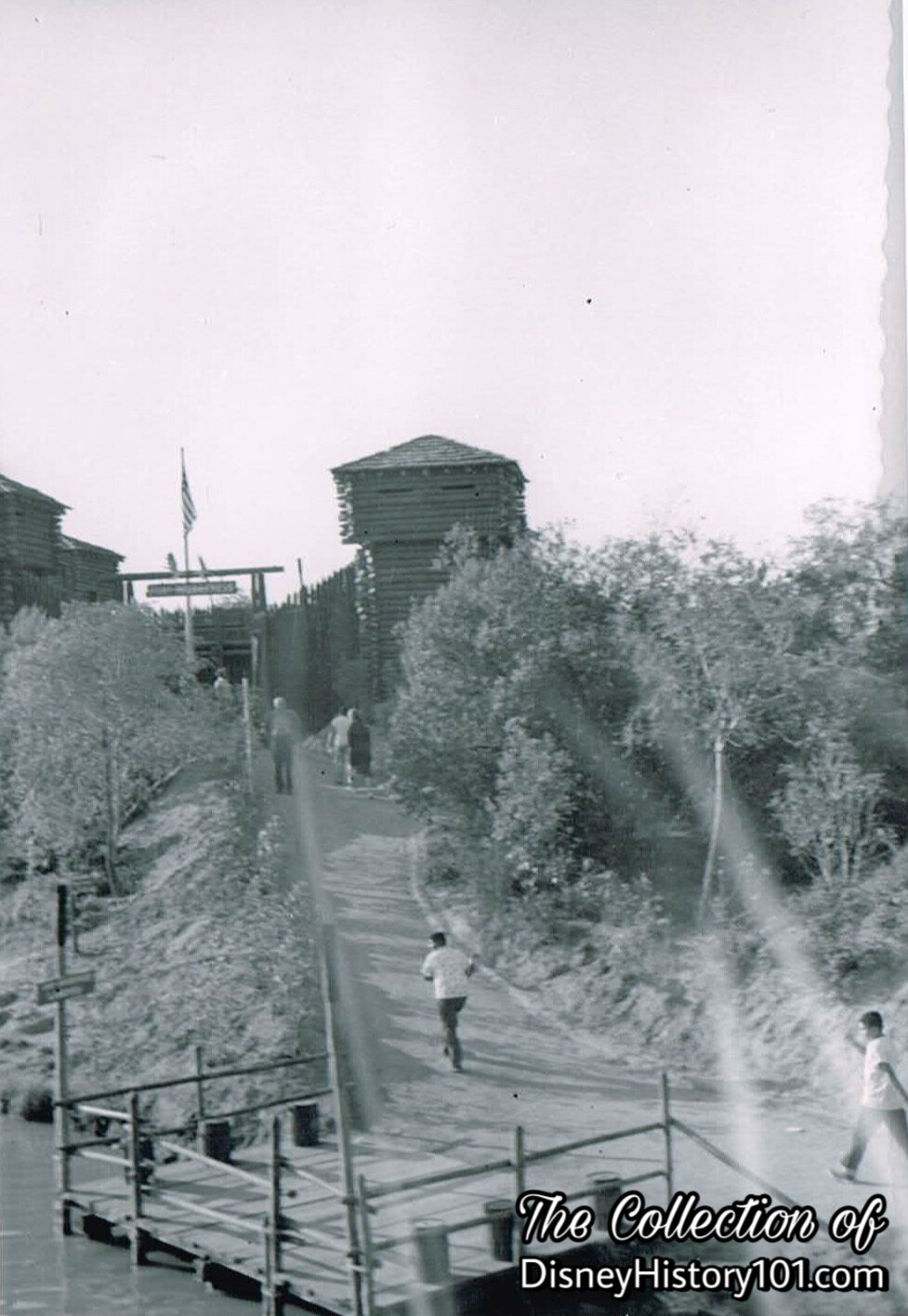
“Tom Sawyer Island: This Is an island located in the center of the river opposite the Mark Twain dock. This Island is being developed as a walk-through with many pictorial editions. Included will be an old fashioned water wheel, suspension bridge, Indian Joe's Cave which will have a lot of under ground ‘gimmicks’ somewhat similar to a Jungle Jim development; and an authentic reproduction of an old time western fort built at about 3/4 scale. This will be called Fort Wilderness and will have parapets where youngsters can fire old fashioned rifles. These will be all noise and no bullet. On the northern part of the island there will be many plastic animals with some animated. The Island will be reached by Tom Sawyer log rafts which will dock on both sides of the river and on both sides of the Island. The only charge will be for the trip on the raft. All of the attractions on the Island will be free.”

Lumber on the Frontierland Dock is Shipped Across the River, as a Fishing Pier Takes Form

THE ISLAND, (Winter/Spring, 1956)
“New Pages for the Disneyland Story”
We would like to direct your attention to the shores in the distance, where Indian War Canoe parties have discovered lumber and signs of development on the island just across the river.

THE ISLAND; Spring, 1956.
This was an adventurous time in the history of “the Island.” Hand-hewn logs were floated across the river and assembled into Fort Wilderness. Skiffs and rafts would transport construction equipment and foliage across the river, from “Joe’s Ditch.” Cal McMurtrey (of Landscaping) recalled, “We were taking off for the Island and the skiff was overloaded with plants. Somebody shifted his weight too much, and the boat started to nose down, and then it sank.” It was quite the adventurous time, in deed.
Bill Sullivan recalled: “I can also remember his moods. When we were building Tom Sawyer Island, he came out and personally gave a lot of directions. He came out in his old boon docks and his pin stripe pants and straw hat...and wandered through the area. Those were his working clothes.” John Yarber was “known as the Mayor of Tom Sawyer Island because he spends most of his working life there...repairing the docks and fences. working on the bridges. He also takes care of the Water Wheel and the Grist Mill.“

A press release photograph captures Vic Greene and Walt Disney with some of those hand-hewn logs, May of 1956; ©️Walt Disney Productions.
Mill Foreman Scotty Cribbes recalled meeting Walt on Tom Sawyer Island when he was checking out a mock-up of Fort Wilderness. The mock-up consisted simply of l’x4”’s and string.”
George Mills recalled: “We were bringing the prefabricated BURNING CABIN across to the Island on a landing barge. The cabin was made of steel and it was very heavy. We got half way across the River when the barge started to sink, and it soon went down, all hands!”
The photo above appeared on the front page of The Disneyland News, June of 1956.
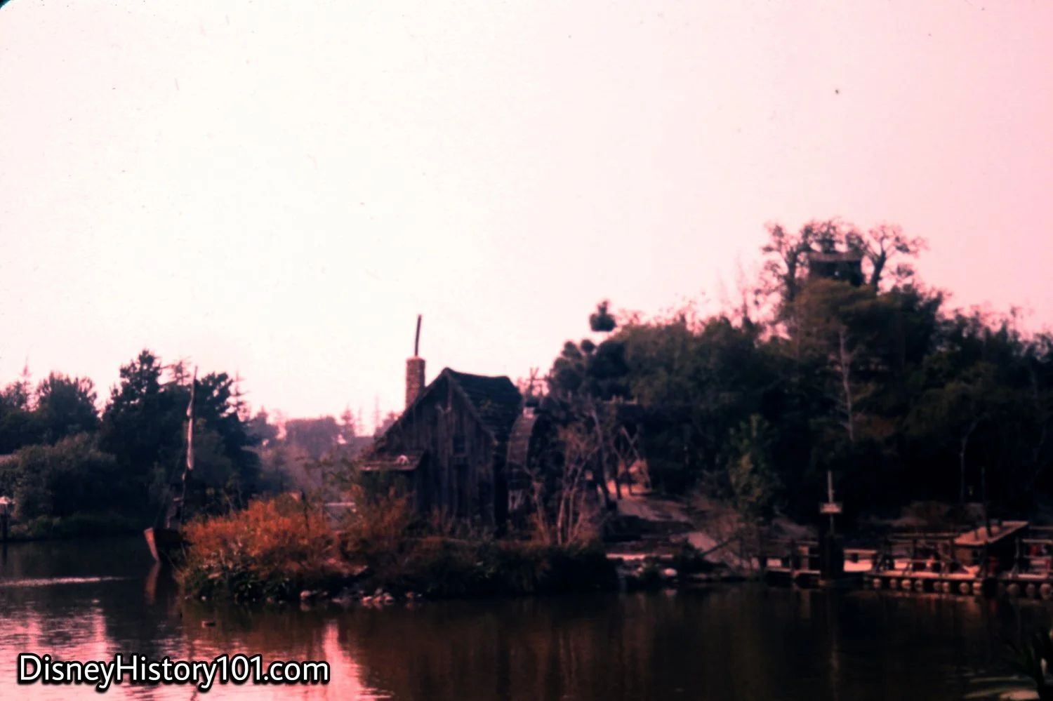
Tom Sawyer Island, (1957)
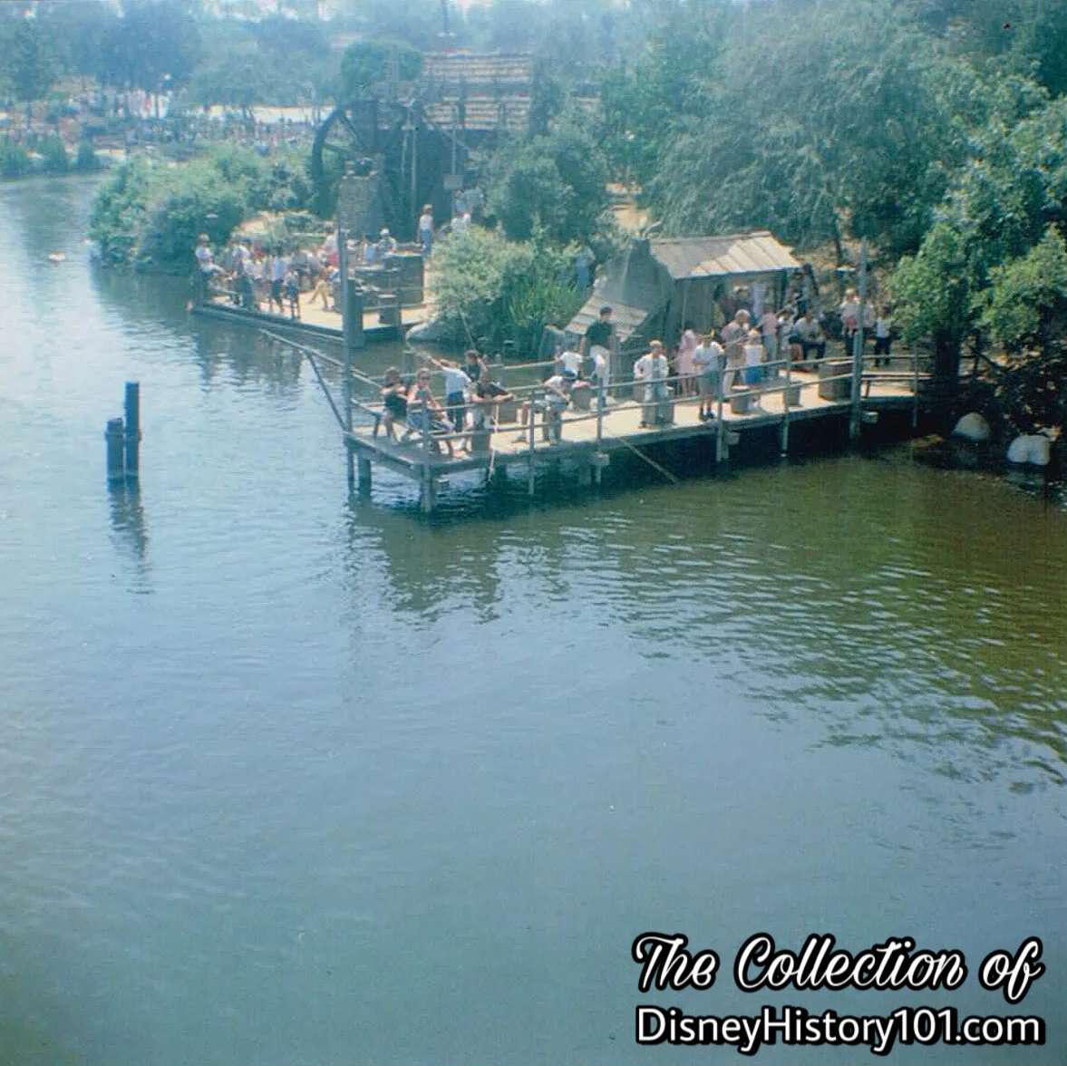
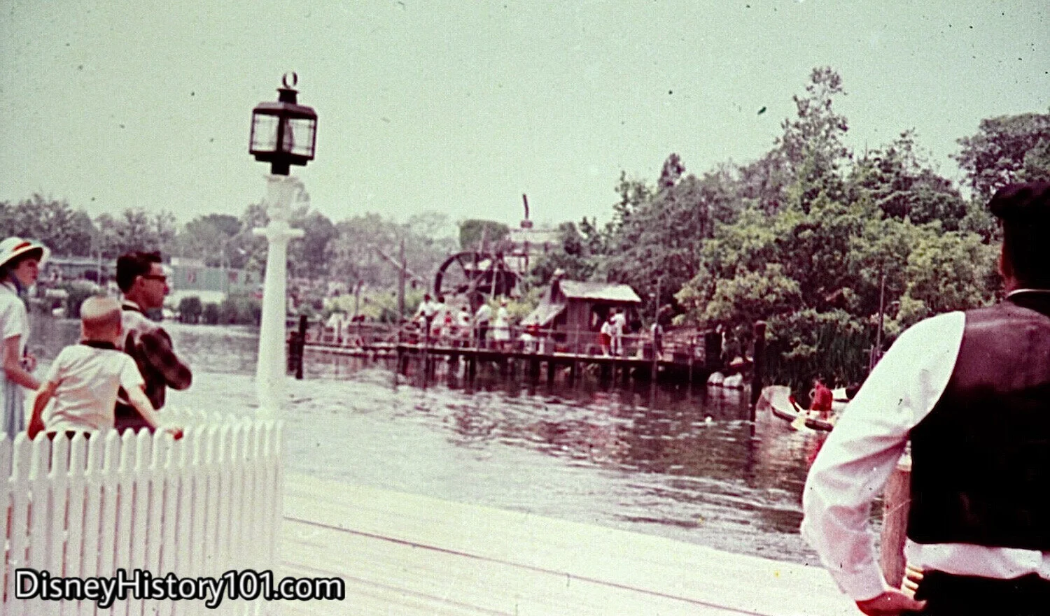
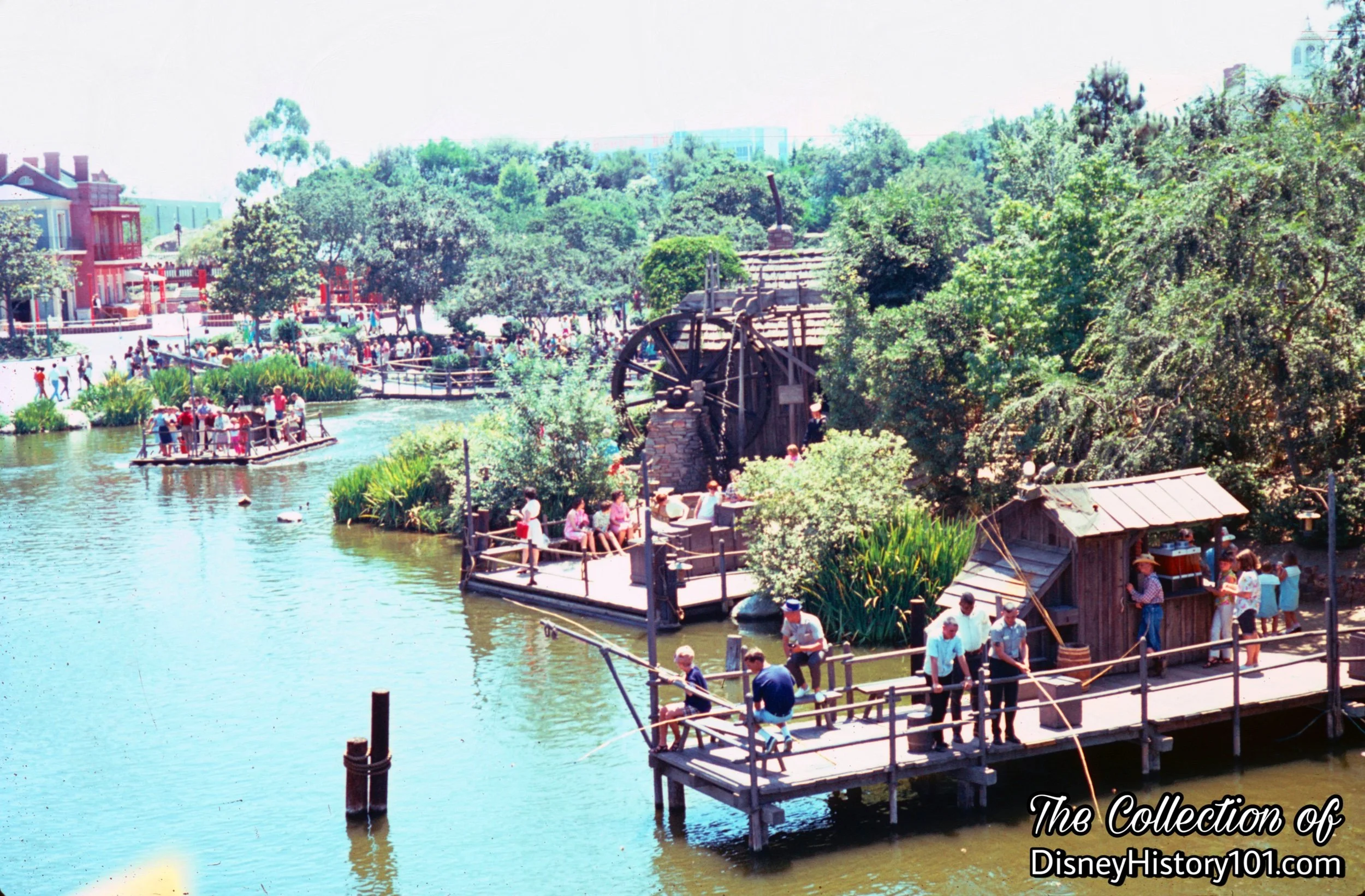
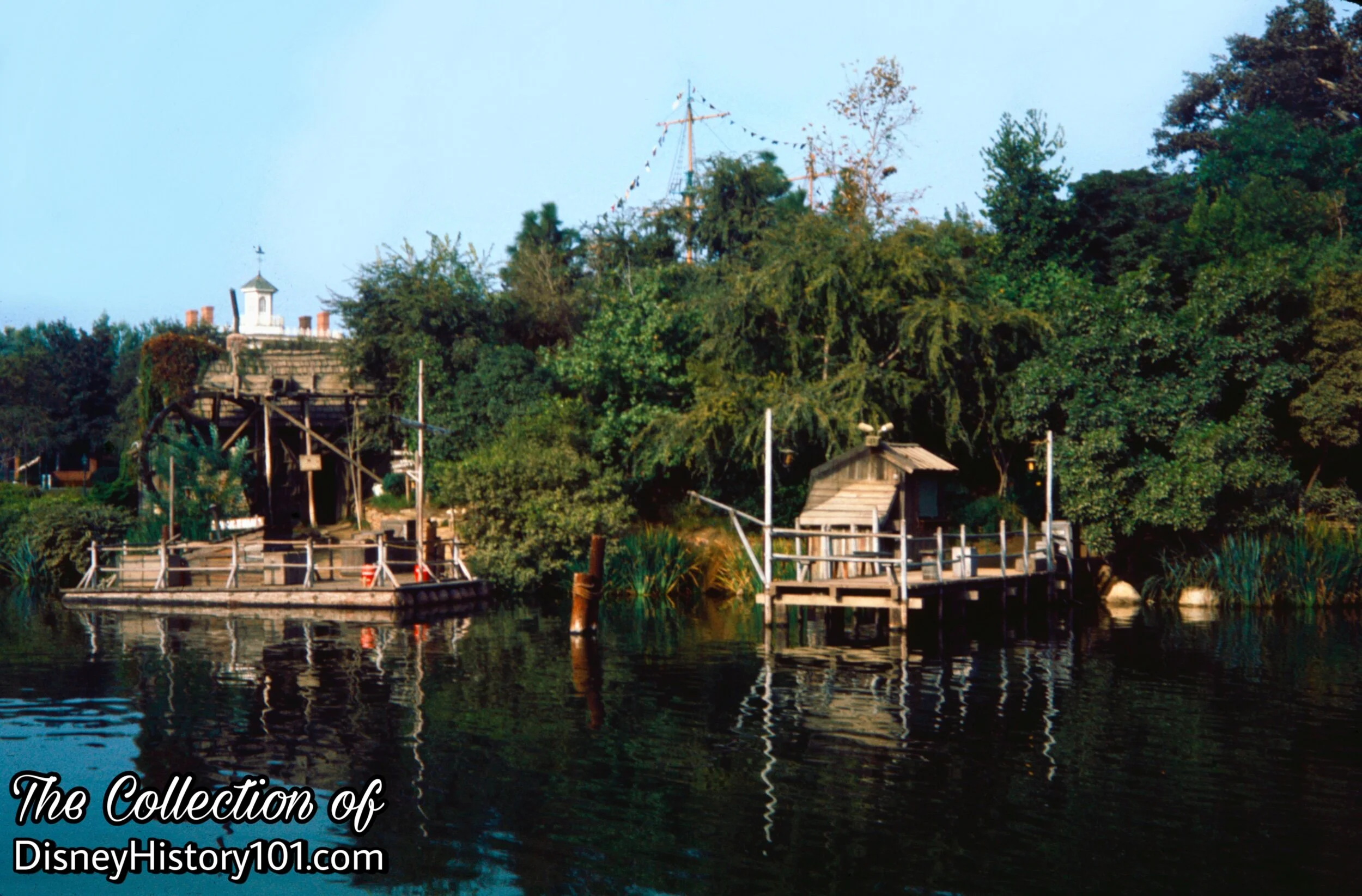
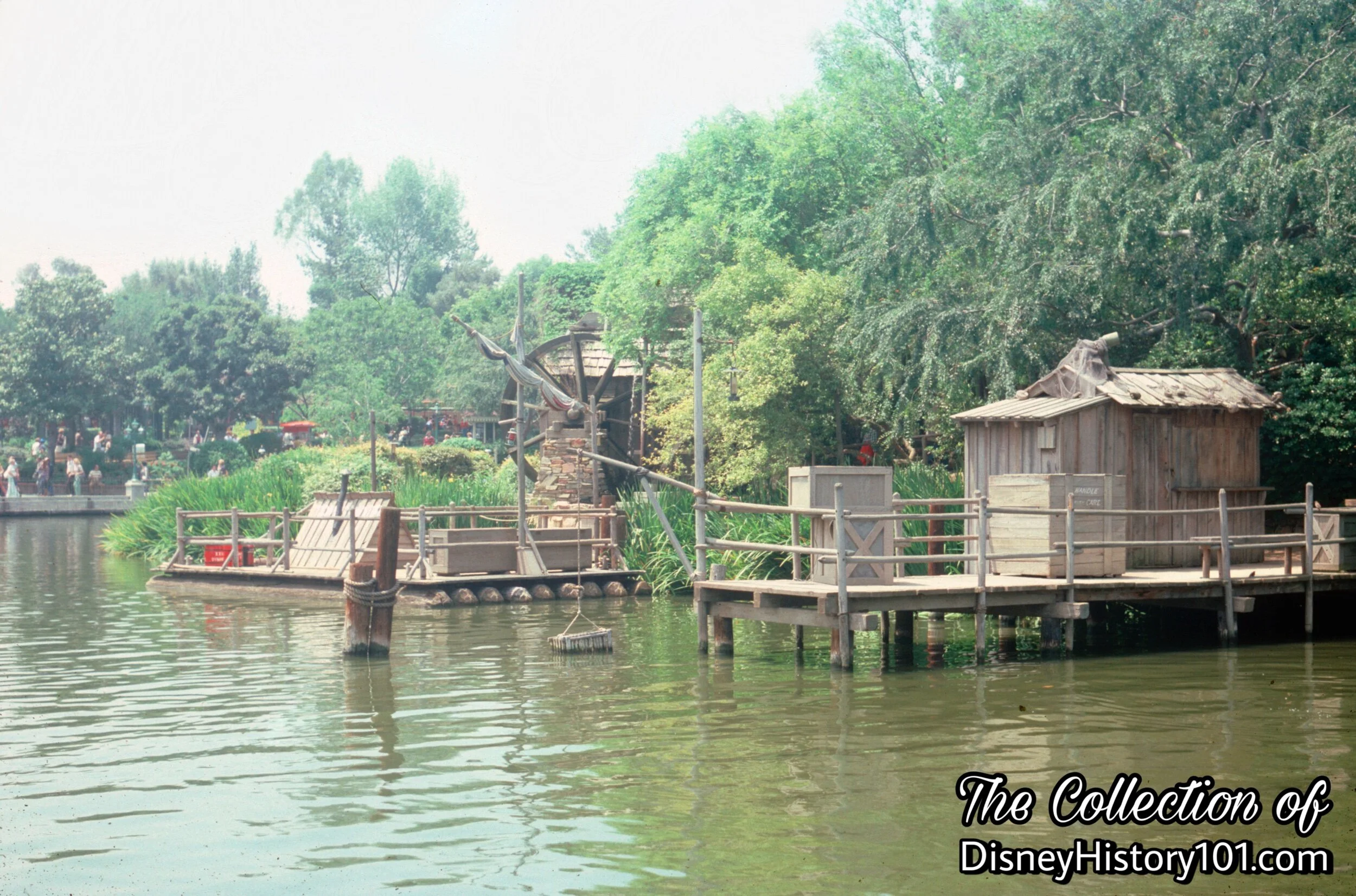
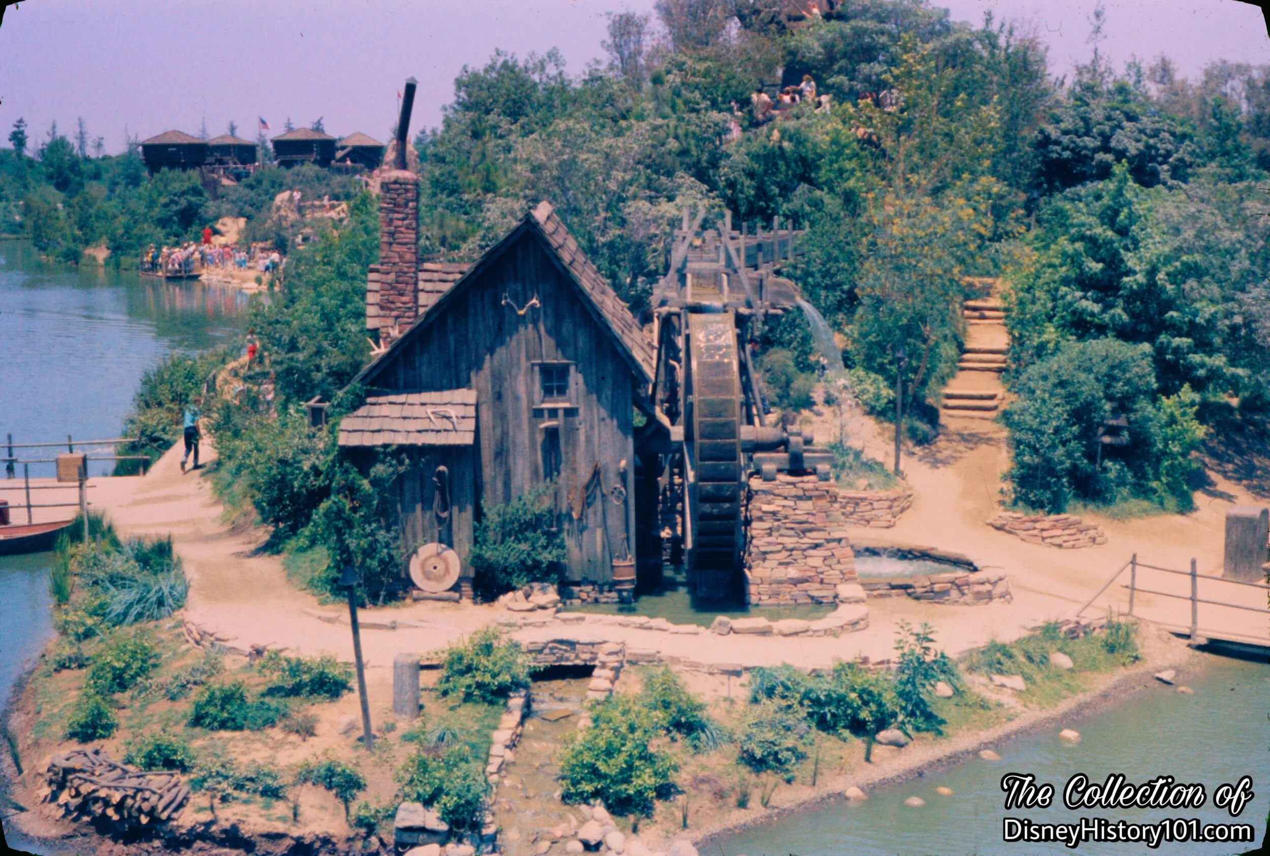
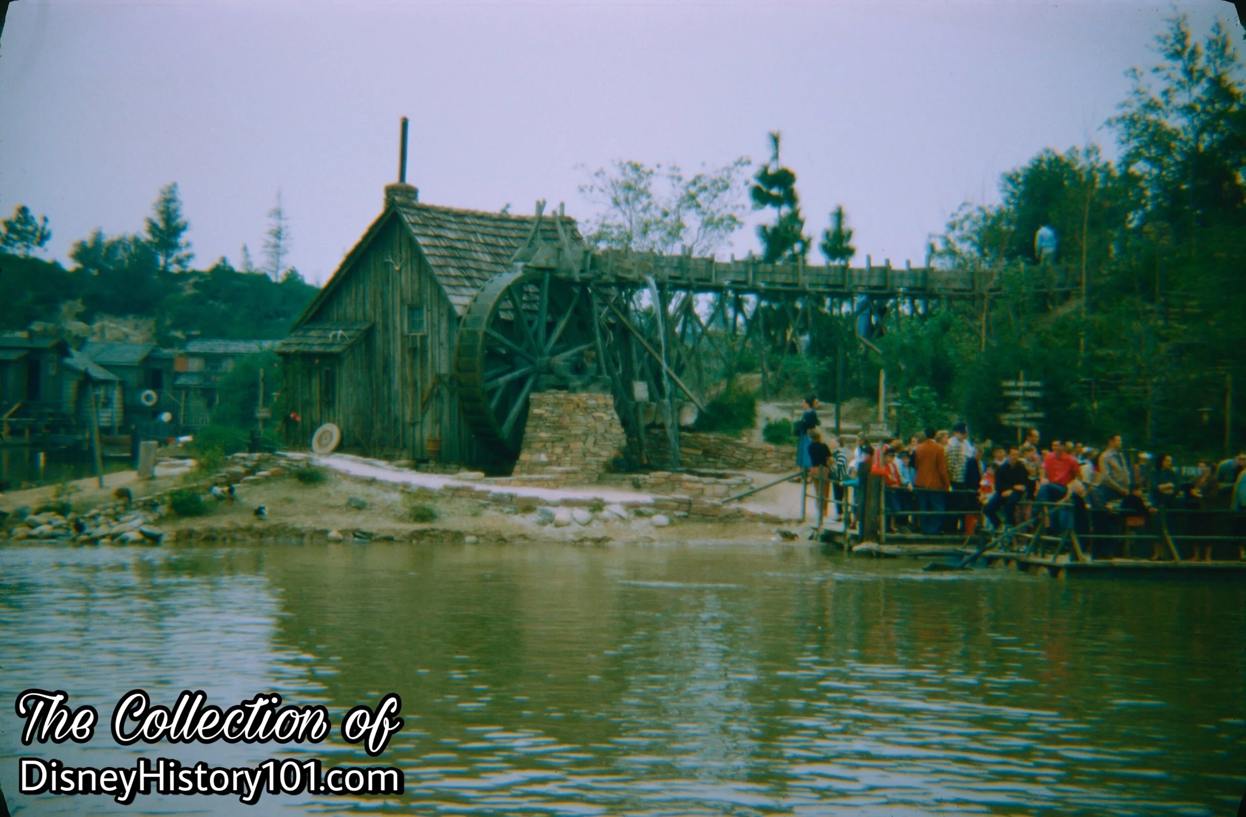
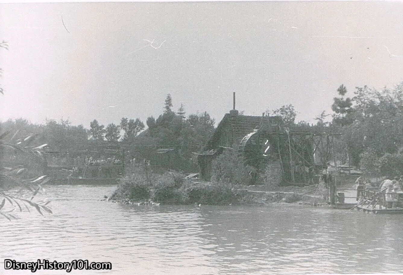
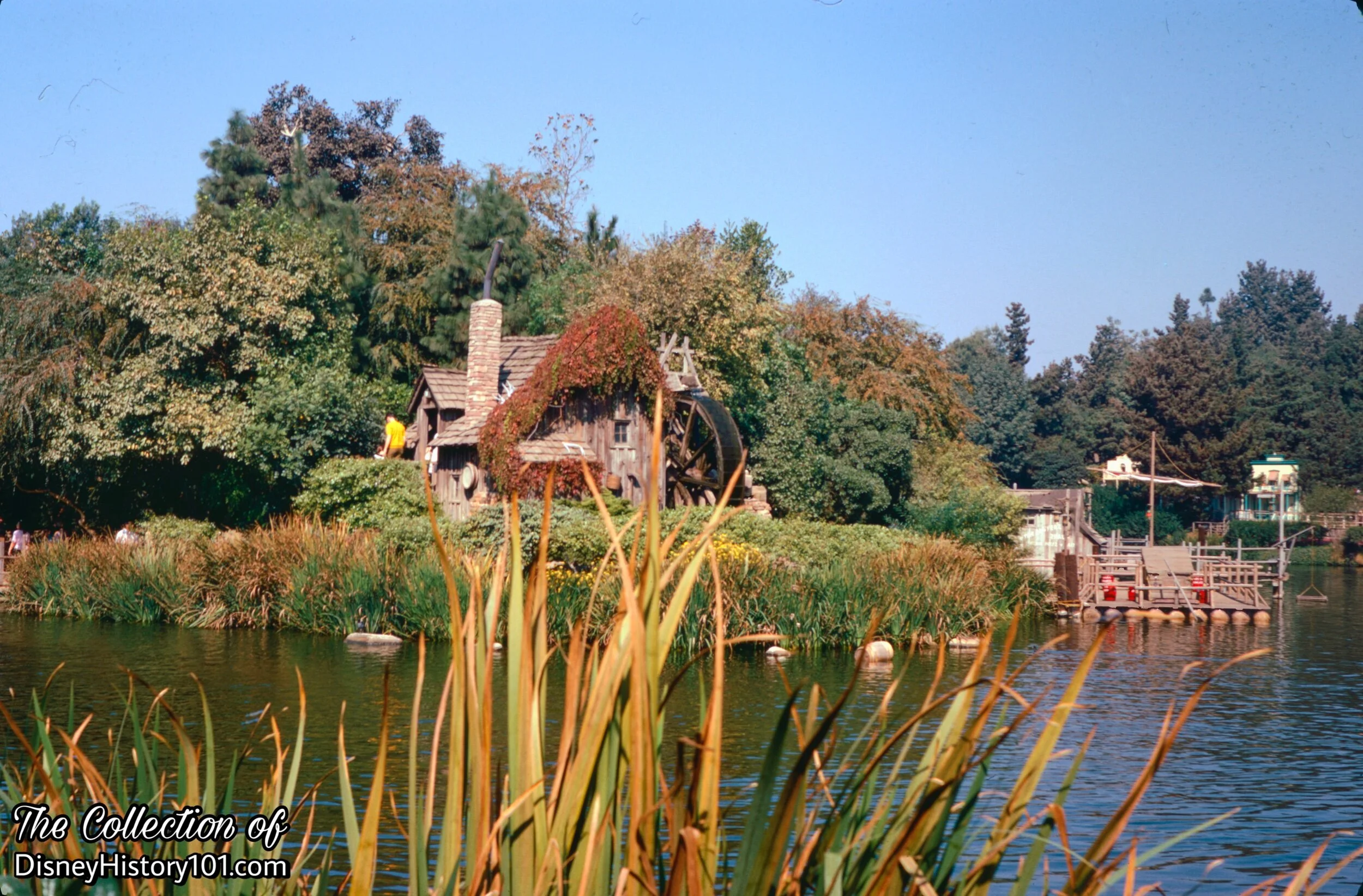
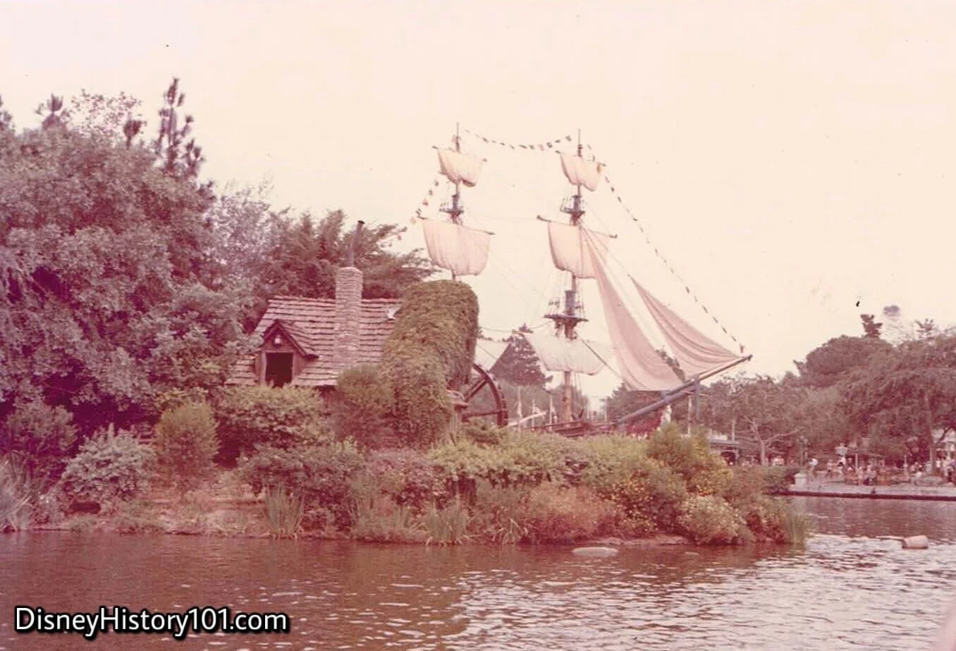
Soon, an Old Mill (looking as if its been in this spot for ages) mysteriously appears along the Southern shore of the uncharted island! A millstone leans against a wall while a flume pours water onto the paddles of a giant wooden water wheel. The Old Mill sits as what will become the introductory icon of the island. Across the river the Mark Twain is covered in scaffolding inside Fowlers Harbor, preparing to circumnavigate the island. Look, up on that Island lookout - it also looks like we might have company, because someone has built a structure in that tree!
Little details were added. Disneylander and “55er” Stan Gomez recalled spreading sea shells over the ground between the Grist Mill and the Fishin' Dock. “The shells were brought up from Newport Beach, Stan recalls and were spread all over to make that part of the Island look realistic.”

(Friday, June 15*, 1956 - present)
*Press Opening Saturday, June 16, 1956.
You may recall hearing how Walt Disney, on the eve of Disneyland’s first day of operation, promised innovation that “Disneyland will never be completed. It will continue to grow, to add new things, as long as there is imagination left in the world.” These words were spoken by Walt Disney, on July 17th, 1955. When the year 1956 began, new developments (under the direction of Art Director Vic Greene) were already brewing in this section of Frontierland territory, that quickly proved Walt Disney would keep his promise of an ever-expanding Disneyland! “Construction operations” were “in full swing” by February of 1956 (with a “full operation” deadline of June 1st). But guests would have to wait quite a few more months (until June 16, 1956) - eleven months after Disneyland’s premier. By then, some new Frontierland attractions appeared on page 5 of The Disneyland News (published June of 1956), including a near-complete Fort Wilderness.
“Anyone for Exploring?”
A total of $1.5 million of new attractions were to be added to Disneyland, bringing $250,000 of thematic elements and attractions scattered around the island for Frontierland guests to discover. According to “The Disneyland News” (No. 2), “The Island, until now inaccessible to Disneyland’s visitors, will provide a slice of living Americana.” Soon enough, travelers to “the Island” would find themselves in a setting reminiscent of Jackson’s Island in the 1875 novel, The Adventures of Tom Sawyer! Like Tom, Huck, and Joe - guests of all ages found themselves exploring caverns, rock formations, bridges, an old mill, and even Fort Wilderness - a true-life log fort! Of course, these locations and features were open to discovery by Tom Sawyer Island explorers willing to brave the currents of the mighty Rivers of America (all before dusk, of course)!
The Disneyland News Vol. 1 No. 12 (published June of 1956) gave an advance description of the opening day ceremonies this way : “Friday, June 15, will see two of the new attractions unveiled as Tom Sawyer Island and Storybook Land will both be opened to the public for the first time. On Saturday, official public ceremonies with press representatives and visiting dignitaries will be held on the Island. Guests of honor at the Island opening are two freckled youngsters from Mark Twain’s home town of Hannibal, Missouri. Twelve-year-old Chris Winkler and 13-year-old Perva Lou Smith were selected in a local Hannibal contest to choose a modern day Tom Sawyer and Becky Thatcher, Tom’s fictional girl friend. The youngsters are being flown to Disneyland via TWA, courtesy of Western Printing and Lithograph Co., which has a plant in Hannibal. Chris and Perva Lou will stay at the Disneyland Hotel while here and be honored guests of the Disneyland management while in California.” “Harold Crawford, plant manager , Hannibal Division of Western Printing and Lithographing Co.” handed Chris and Perva Lou plane tickets to Disneyland (and a photo of this was published in “The Disneyland News” (Vol. 1, No. 12). Their transportation to Disneyland was via Tanner Gray Line Limousine and accommodations at the Knickerbocker Hotel. During the dedication ceremony, youngsters read a proclamation by the governor of Missouri, whereby Tom Sawyer Island was temporarily annexed to the state of Missouri! Memories were captured in photographs by Mell Kilpatrick.
In another publicity stunt, “Phil Connely, the governor of Missouri, sent a tongue-in-cheek letter to Governor Goodwin Knight of California asking him ‘to take appropriate action which will cause the Tom Sawyer Island in Disneyland, California, to be deeded to the Sovereign State of Missouri, the only true and rightful possessor of any and all Tom Sawyer Islands in the World.’” [See Disney Facts Revealed by Dave Smith, 2016]
To accommodate the audiences visiting these new adventures, Disneyland returned to its summer schedule, open from 10 a.m. to 10 p.m. including Mondays (on which Disneyland was previously closed for maintenance). Further, the Disneyland Ticket Book plan was put in effect, offering a choice of eight rides from a list of 25 and admission to the Park for a single price.
While total investments for Disneyland had reached $18,500,000 (by 1956), Tom Sawyer Island and its rafts were among attractions that were projected to add a 30 - 40% ride capacity to the Park! Disneyland had grown from 27 original rides and amusements to 37, and from 11 free shows and exhibits to 17. Tom Sawyer Island - an island world of free attractions - caves, forts, foot bridges, and waterfalls - (and its rafts) were part of the exciting paid attractions debuting during 1956. These adventures faithfully increased ride capacity, and (owning to this) one day in August saw a peak total of “197,547 individual rides” enjoyed by Guests (according to a letter from Walt to Ward Kimball, dated January 23, 1957).

Tom Sawyer Island Child Ticket Stub, (35¢ Value)
In an era of Disneyland “lettered” coupon books, ticket stubs valid for admission to individual attractions were also available through ticket booths.

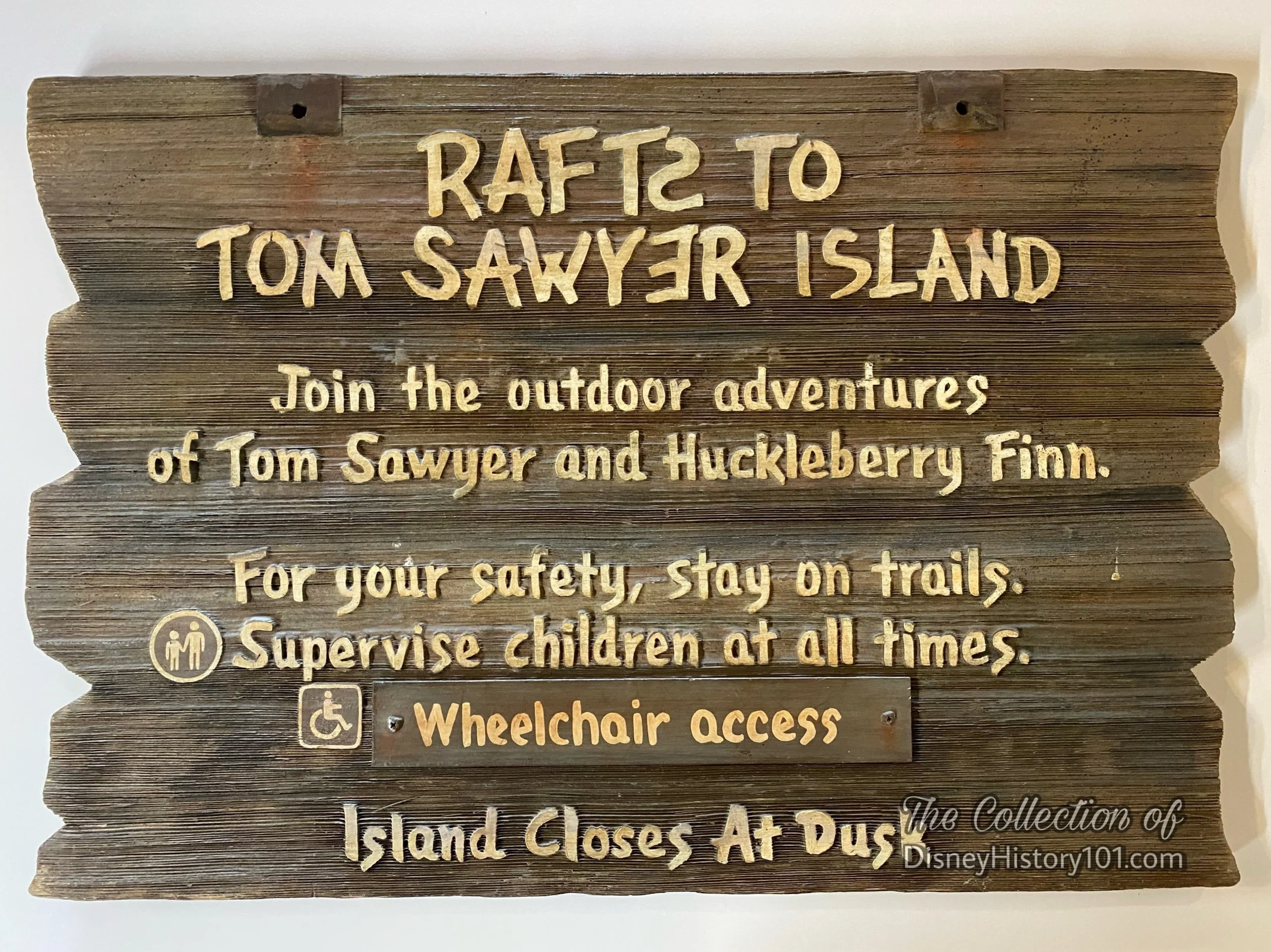
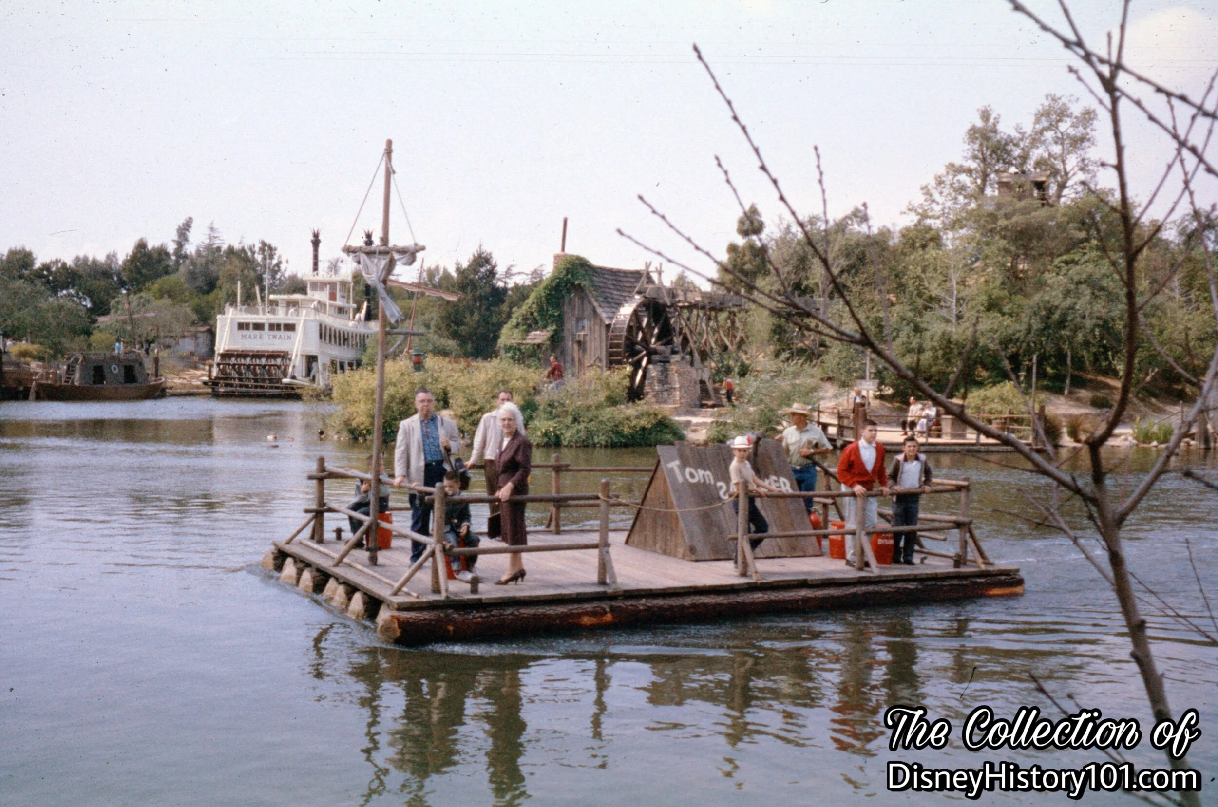
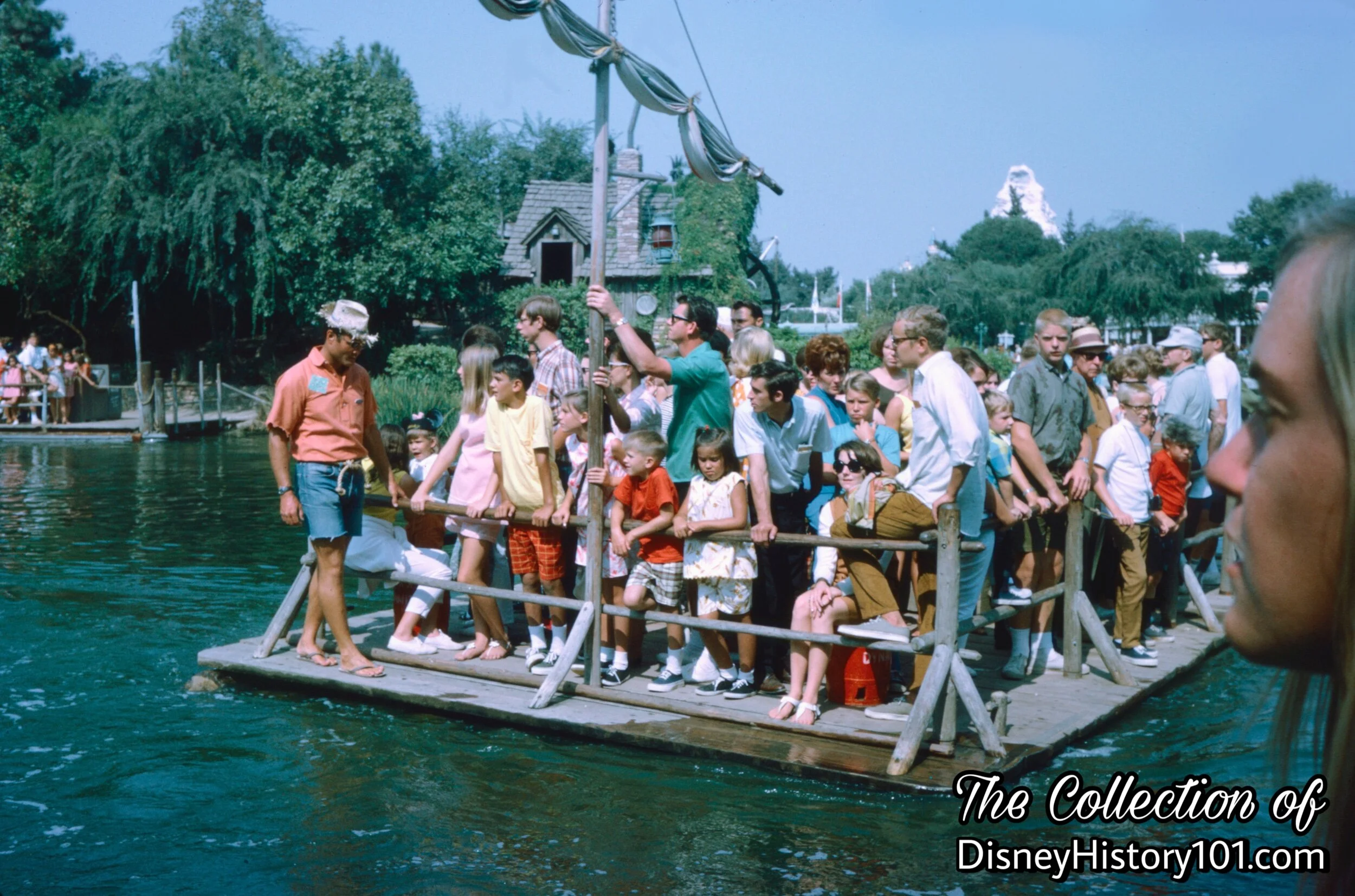
Rafts to Tom Sawyer Island, (July 7th, 1956)
A Raft Operator prepares to bring his raft to the hidden dock, tucked away in the bushes, near the old Chicken Plantation House. After these guests exit his raft, he’ll load new guests, and make another excursion to that unexplored island!
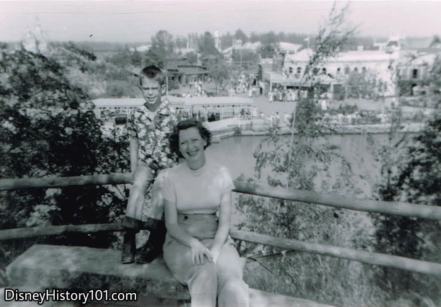
Tom Sawyer Island, (Summer, 1956)
“Tom and Huck were ready for their adventure” . . . are YOU? This adventurous mother and son sit at one of the highest points on Tom Sawyer Island, overlooking Frontierland’s dock on the other side of the river. Speaking of “high adventure”…
Note the maximum utilization of space in the Complete Guide to Disneyland, 1956, excerpt
“High adventure and fun await you on Frontierland’s Tom Sawyer Island”, in this excerpt from A Complete Guide to Disneyland, published 1956. Yes, those are bison on the south-eastern side of Tom Sawyer Island! You may also note the absence of the ever-popular Castle Rock, which was added a year after Tom Sawyer Island opened to Guests!

Excerpt from Disneyland Holiday, Winter, 1957-58.
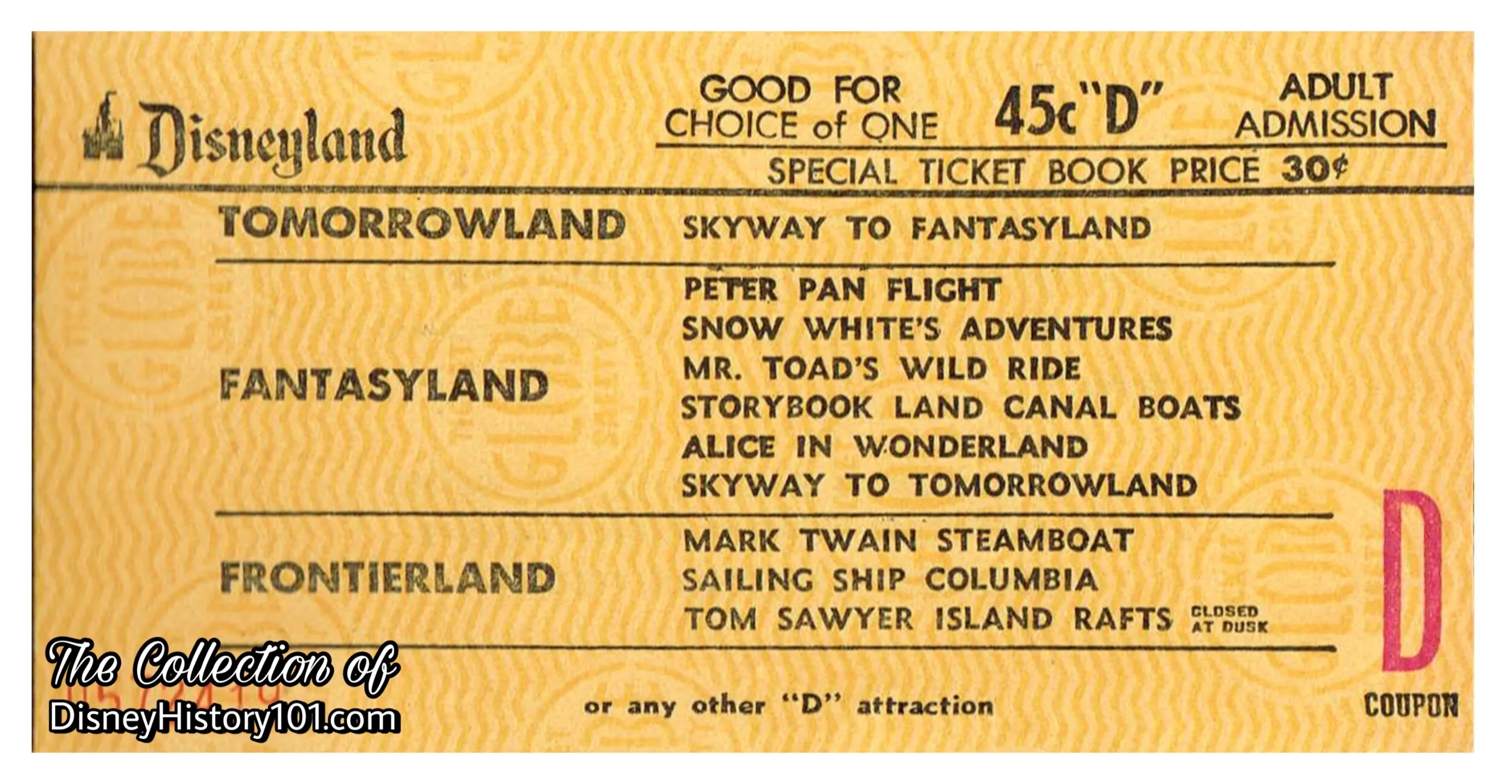
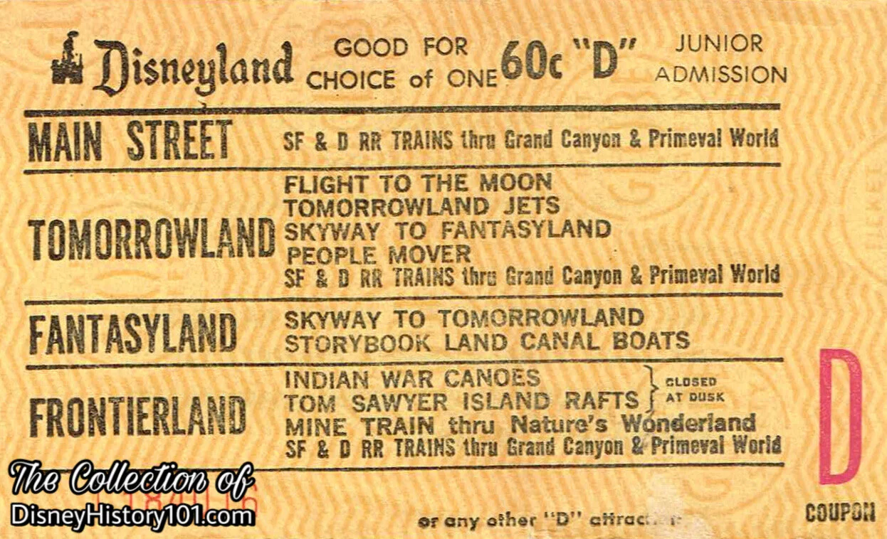
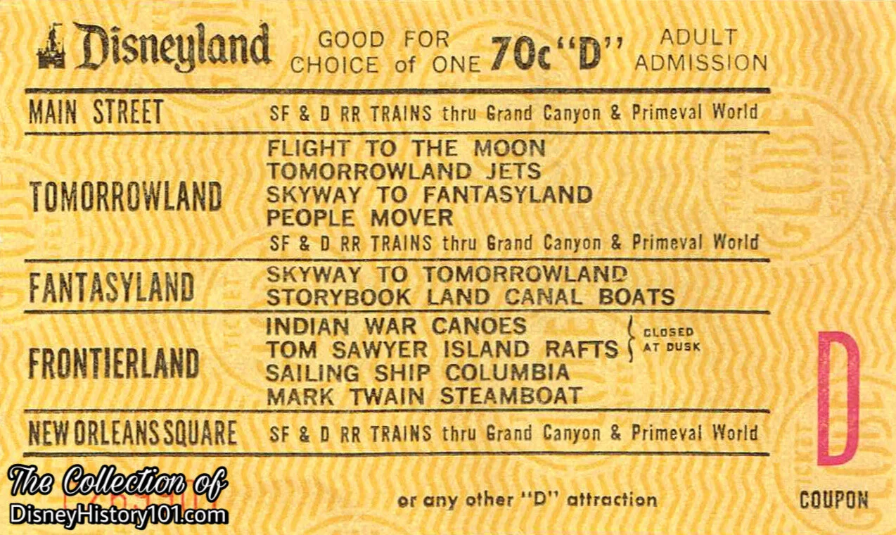
In addition to these attractions, Welcome to Disneyland brochures (published 1958) mention the Nesbitt Orange Drink Center located on Tom Sawyer Island, accounting it among Disneyland’s refreshment locations. Admission to Tom Sawyer Island during 1958 was one “jumbo” “D” coupon (the price of 35 cents, for one child), the same as the Jungle Cruise, Rainbow Caverns Mine Train, or TWA Rocket to the Moon.
Walt Disney’s vision and creativity would heavily influence the look of Tom Sawyer Island as well as the placement of many of its features. Jack Lindquist (former President of Disneyland) recollected (to Disneyland LINE magazine, Vol.25 ; No.28, published 1993) : “When we were building Tom Sawyer Island, we went over to the Island when the fort was about 75% complete, Walt looked at it and said, ‘That one wall of the stockade - its not where it should be. It needs to go about 12 feet west.’ We were all puzzled, but they moved it. Then in 1971, I was sitting talking with Roy Disney. For some reason, I told Roy said, ‘Walt knew it was wrong because when we were growing up in Marceline, there was a little sand spit about 20-30 feet offshore. Walt was about 10 years old, and we would build a little raft and go out there and we took old pieces of scrap wood and cardboard and we built a fort and Walt knew just where he wanted everything to go. So you see, Tom Sawyer Island was that sand spit.’ I believe that when Walt was 10, he saw what Tom Sawyer Island stodgy, and when we were building Tom Sawyer Island he saw what he remembered from when he was 10. That’s my favorite story [about Walt Disney] because it tells us so much about the vision and creativity of the man, and the ability to look at the world like a child looks at the world. Walt never lost that ability.”
Other individuals who had a hand in the artistic development and design of Walt’s creative ideas were Vic Greene (Art Director, Frontierland), Herbert Ryman (known for his “Aerial Over Disneyland”), Sam McKim (who was later renown for his Disneyland maps, and now instrumental in completing final designs of Fort Wilderness, the Old Mill, as well as Tom and Huck’s Treehouse), and Claude Coats. Bill Evans helped bring the rich forests and flora to life, while Emil Kuri (notable Hollywood set designer) helped add touches of wildlife.
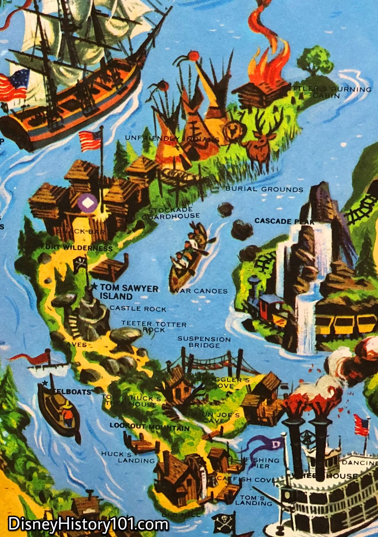
Upon the realization of Tom Sawyer Island’s caverns, rock formations, and structures, many a Disneyland cartographer has documented the “natural” and man-made features of Tom Sawyer Island. For those explorers that chose to navigate Tom Sawyer Island, not missing a landmark or attraction, there were plenty of souvenir maps available for free or a small fee. Now, I invite you to browse a collection of a few Tom Sawyer Island Explorer Maps and Disneyland Map excerpts (featuring Tom Sawyer Island). These maps (spanning decades) are but a few detailing different elements of Tom Sawyer Island!
Early Official Guide to Disneyland Frontierland Map excerpt
Log rafts travel from the launch, under Frontierland Bridge (at the bottom of the map), and across the Rivers of America, to Tom Sawyer Island (until dusk)! The main trails of the island can be seen on this simple map included in the souvenir Official Guide to Disneyland.

Early Tom Sawyer Island Map Artwork
During 1957, a “complete revision” of Tom Sawyer Island was unveiled to guests (and with it, a new map)! We recently had the pleasure of viewing this amazing artifact in person at one of Van Eaton Galleries’ auction exhibitions. As you browse the original artwork, you may notice a couple of locations that didn’t make it onto the final version - “Subterranean Passage” and “Mysterious Maze”! The island’s new attractions were among $2.8 million worth of additions, bringing the Park’s total investment beyond $21,300,000.
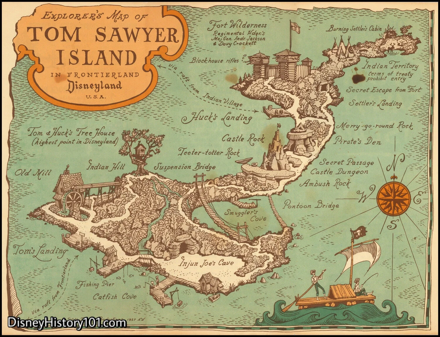
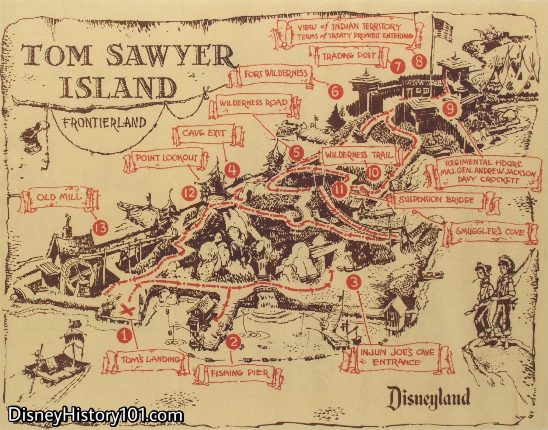
Explorer’s Map ofTom Sawyer Island, 1957
Just one year after rafts began transporting Frontierland guests to Tom Sawyer Island, Disneyland cartographer Claude Coats created the first edition of the Explorer’s Maps of Tom Sawyer Island in Frontierland, Disneyland U.S.A. Some of the main trails and cavern entrances can be seen in the drawing. These early maps included most of the geographic features not included on other maps (like Merry-Go-Round Rock, the Secret Passage, and Pirate’s Den). A new Raft route was added (from the new Indian Village), and these routes were also outlined, so that explorers could decide which launch to set out from.
Versions of this map would be produced for years to come. For instance, Vacationland (Summer, 1970) printed this map in a special insert!

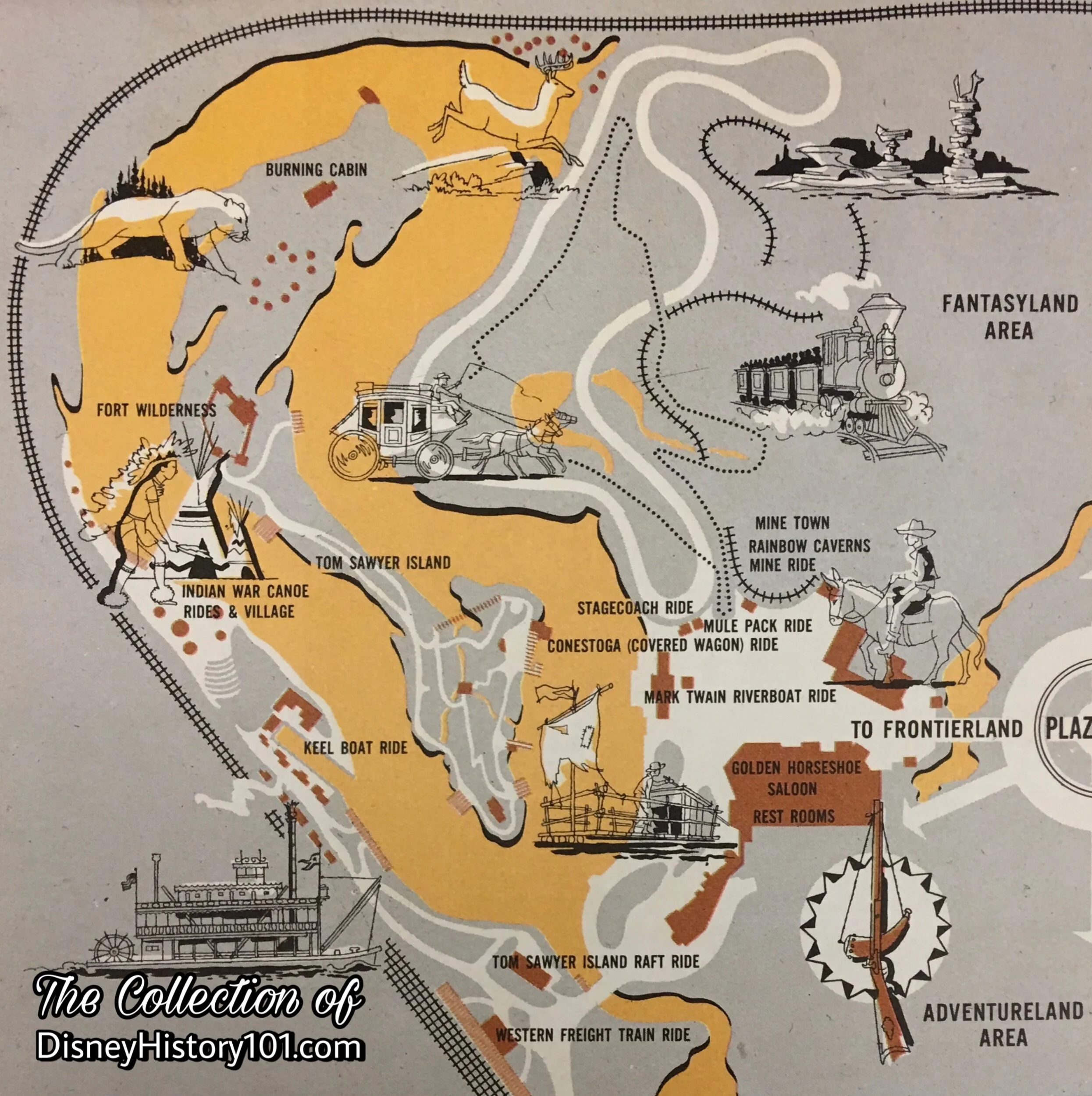
Disneyland Map by Sam McKim Excerpt, 1961
As a new wilderness mine train route enhanced guest’s exploration of Nature’s Wonderland to the East (across the river), the following geographic and man-made features enhanced the experience of exploring Tom Sawyer’s Island! This colorful map detailed the more notable stops along your Tom Sawyer Island trek.
Disneyland Map, 1976
By 1962, Tom Sawyer’s Island was a highlight of the Guided Tour Script : “Across the river you see Tom Sawyer’s Island. . .a mother’s paradise. Here children may spend hours exploring old Fort Wilderness, rock caves and formations, suspension bridges and even go fishing. This island may be reached by taking one of Tom’s rafts embarking from Fowler’s Harbor.”
An eagle eye will spot some additions to this Disneyland map. Weary travelers could now quench their thirst or satisfy their hunger at the Snack Bar inside Fort Wilderness. Also, the Unfriendly Indian Camp became the scene of a sacred Burial Ground. Along with the Burning Settler’s Cabin to the north, these vignettes impressed an important ideal to which Disneyland was originally dedicated. They depicting “some of the hard facts that created America”.
But many Indians are friendly. This fact was further impressed (perhaps), when guests would travel to the end of Wilderness Trail, where they would be welcomed by true-life tribal representatives of the Disneyland Indian Village!
Explorer’s Map of Tom Sawyer Island, c. 1990
You’ll note that circa 1990s maps still chart Wilderness Road (on the West side of the Island) and Wilderness Trail (as it winds throughout Tom Sawyer Island). But most notably, many geographic features (like Teeter-Totter Rock or Castle Rock) are not labeled. One notable disappearance is the vanishing of Tom & Huck’s Treehouse from Lookout Hill (which has been renamed Point Lookout)!

Wooden Tom Sawyer Island "Accessible Route" Map Sign, c. 1980s
We may have found a “new” route, but we’re walking in circles trying to find it! The remnants of this accessible “cave” still remain to be seen, near Lafitte’s Tavern (formerly Harper’s Mill).
For now, this old simple map (painted with “white-wash” on a river soaked piece of wood), directs us toward an accessible short-cut (and washroom facilities) on the other side of the island. This old relic has changed hands several times over the past few years. Why, most recently it was discovered with our friends at Van Eaton Galleries.
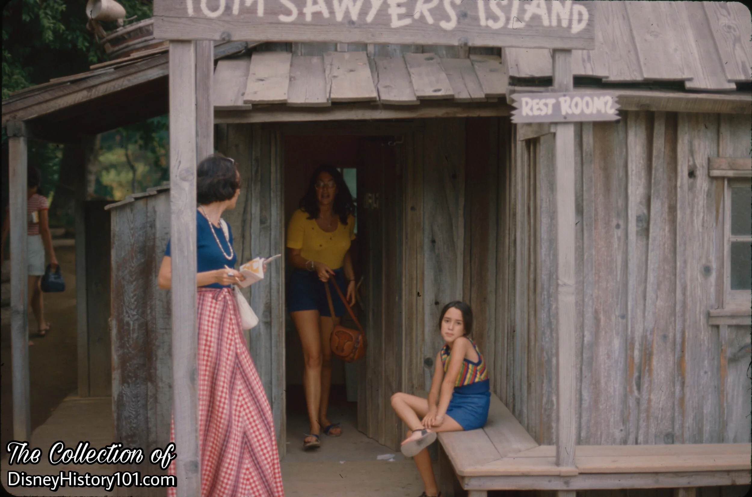
Tom Sawyer's Island Restrooms, (June 1973)
By 1965, Guest Services and Accommodations included restrooms at the Fishing Dock and at Fort Wilderness on Tom Sawyer's Island. Rest Rooms (or, wash facilities), were available to the weary traveler, on the South East side of Tom Sawyer Island.
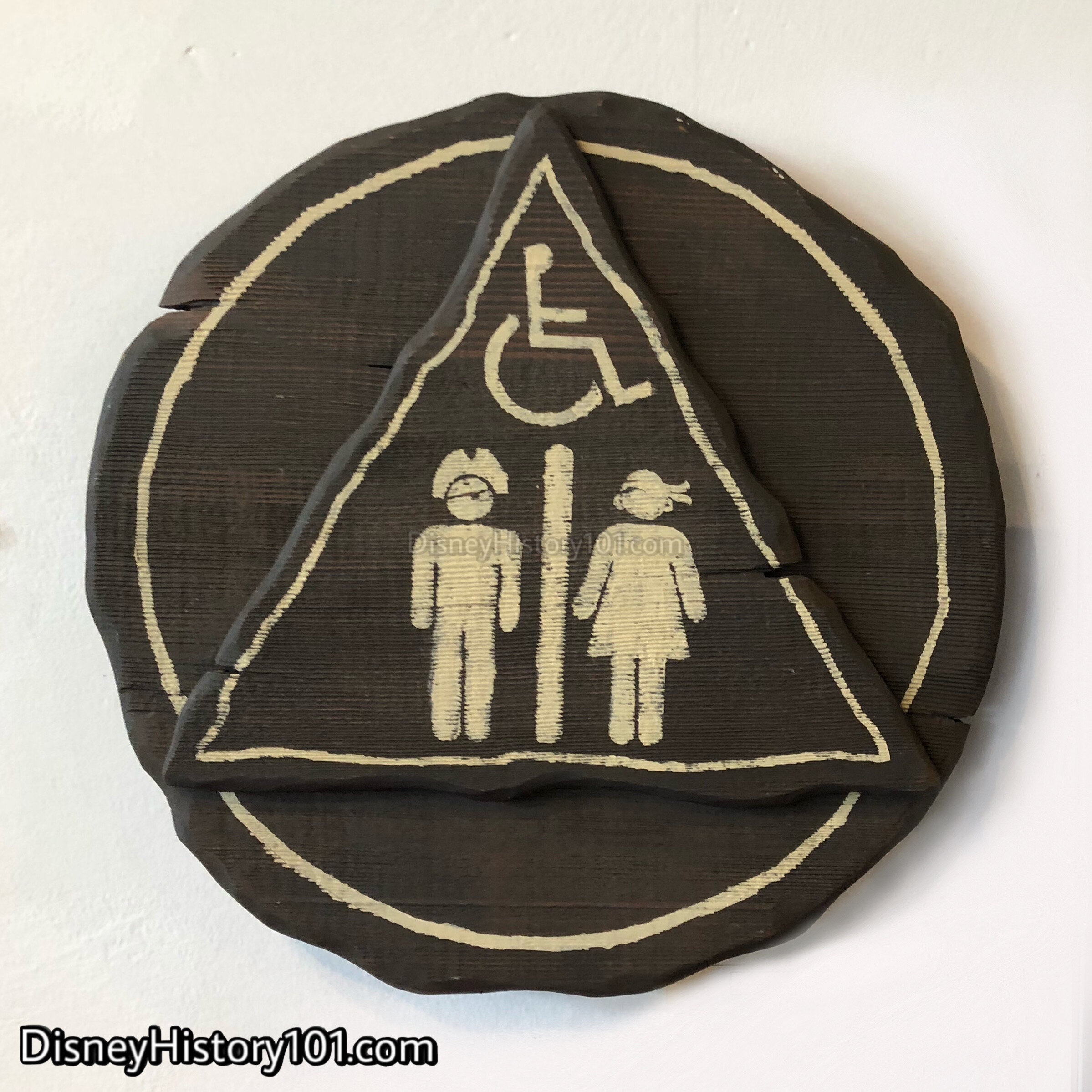
Tom Sawyer's Island Rest Room Sign, 2000s
There are still wash facilities currently on “Pirate’s Lair”, should the weary explorer need to discover them! Note how the sign is themed to support the story.
At Disneyland, signs are themed to support the stories with appropriate graphics, colors, fonts, terminology, overall design of the sign, materials (wood, metal, banners, etc.), and verbiage used on the signage. The character of these signs have been inspired by the portion of the story centering around “painting Aunt Polly’s fence.”

(June 16, 1956 - present*)
*Figure doesn’t account periods of closure for refurbishment.
The year 1956 brought several new attractions to Disneyland, proving the truth of Walt Disney’s promise of an ever-expanding Disneyland! One of those attractions offered guests the opportunity to board “romantic reproductions of the raft in the Tom Sawyer story.” [“Disneyland Dictionary,” October 1959] Until dusk, Guests boarded these log rafts, and embarked on excursions to and from Tom Sawyer Island!
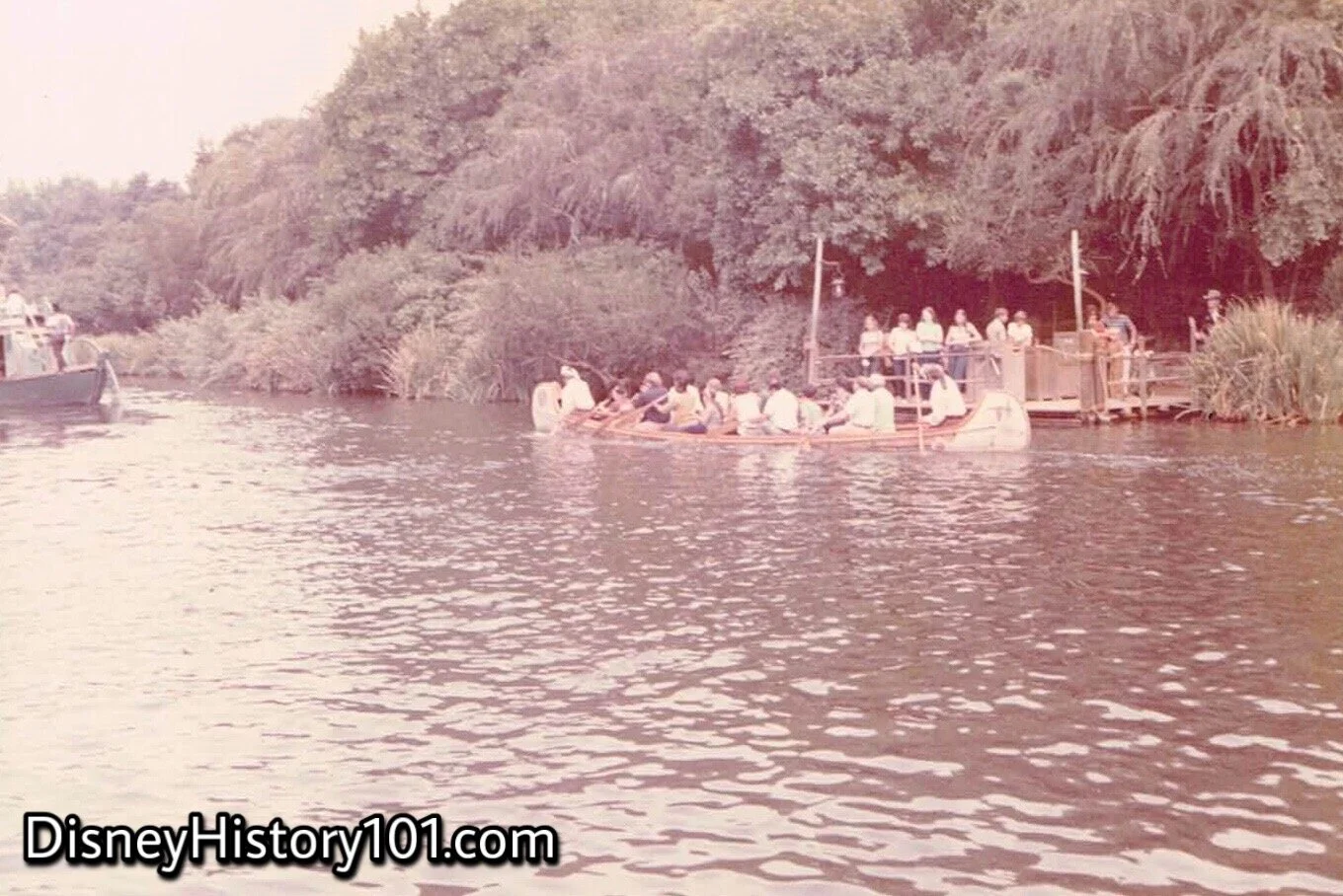
Originally, guests could only explore the river via the Mark Twain, or one of Mike Fink’s Keel Boats. Now, even more river craft -“Rafts, Canoes, and Keel Boats will carry fun seeking youths to Tom Sawyer Island in the center of the river,” [“The Disneyland News,” Vol.1, No. 12 ; June 1956]. But as things developed, it was decided that guests would begin their adventure aboard a raft patterned “after the log rafts of the Mississippi at the time of Mark Twain.” While the Rafts to Tom Sawyer Island only travelled between two points, they were one of few Disneyland attractions that did not operate on tracks, when they first opened to the public.
The construction of the original rafts was commissioned to Bob Dorris Boatworks of Costa Mesa, California. Bob Dorris and his crew had previously built the first fleet of Canal Boats for the Canal Boats of the World (an opening day Fantasyland attraction, that would later be re-themed and renamed Story Book Land Canal Boats). He also constructed a fleet of U-Drive Motor Boats, (that operated in a lagoon in Tomorrowland), and even developed an experimental “Airboat” that would be utilized decades later in Walt Disney’s Magic Kingdom, in Bay Lake, Florida. For now, Bob Dorris’ boat-building expertise would be called on again, for a different type of watercraft.
Several 45-passenger capacity rafts were constructed, measuring 23 ft, 6 inches × 14 ft. Each was powered by an internal-combustion Gray marine engine and was named after four popular characters of Mark Twain’s novels - the Tom Sawyer, the Huck Finn, Becky Thatcher, and Injun Joe. Originally, the Tom Sawyer often serviced Tom’s Landing, and the Huck Finn serviced Huck’s Landing. Beginning during the summer of 1956, the Injun Joe was seen making special trips from the Indian Village, when it wasn’t docked there.

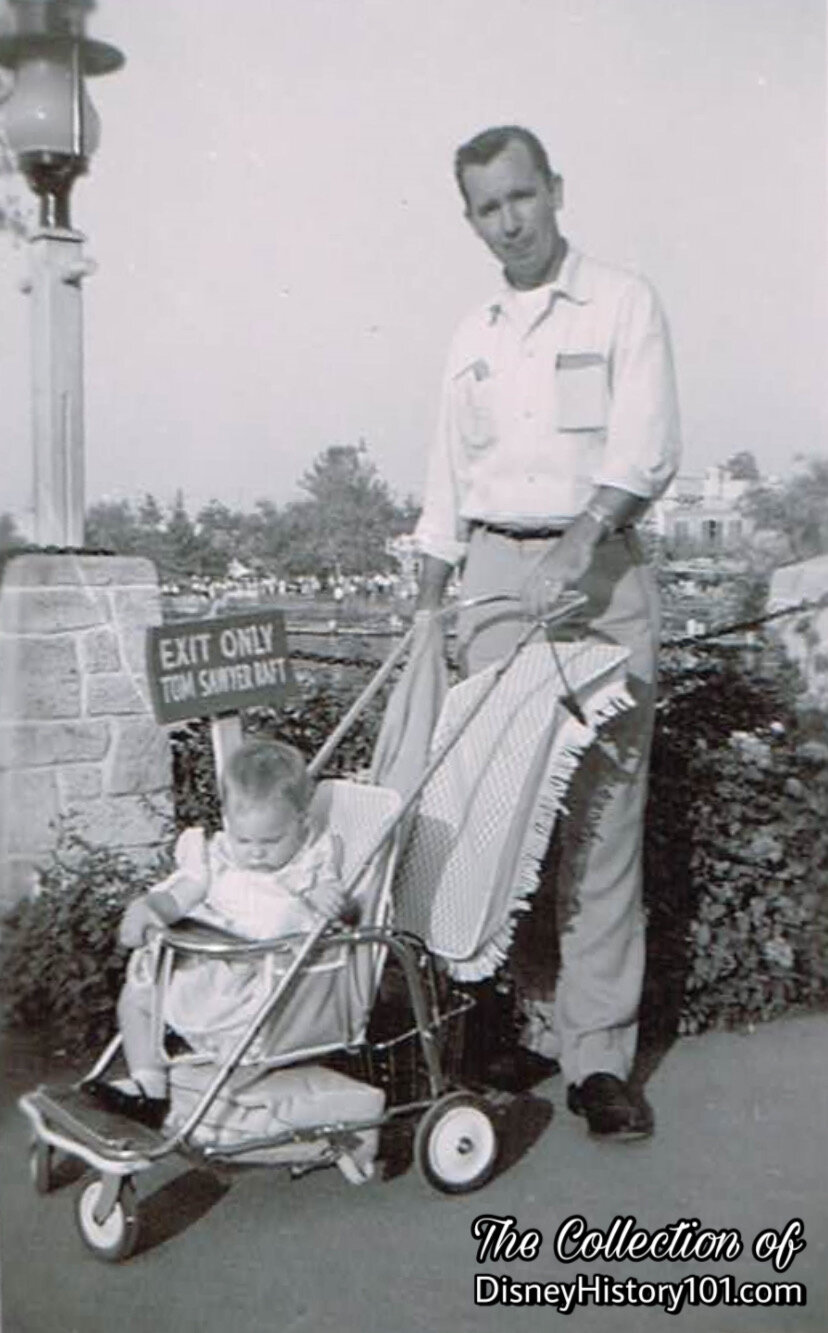
Rafts to Tom Sawyer Island
Tom Sawyer Island Rafts were operated from the dock at the Plantation House and from the Indian Village. After loading his raft, the operator headed toward Tom’s Landing!
Guests Near Tom Sawyer Island Raft Exit

Disneyland "D" Attraction Child Admission Coupon; 35¢ Value.

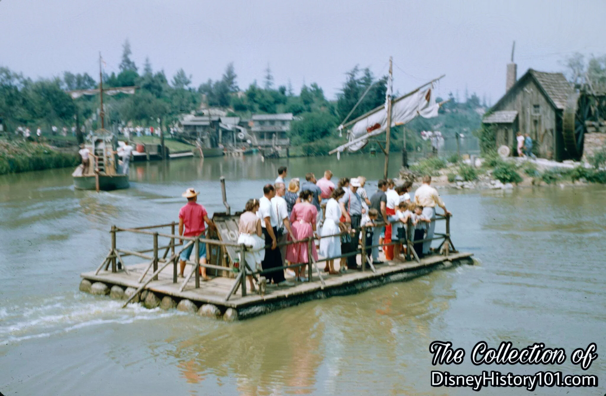
Rafts to Tom Sawyer Island
Tucked (near the Chicken Plantation), is the raft loading dock belonging to the Tom Sawyer Island Raft Ride. Two rafts (one labeled Tom Sawyer, one labeled Huck Finn) transported guests toward Tom’s Landing on Tom Sawyer Island’s southern shore!

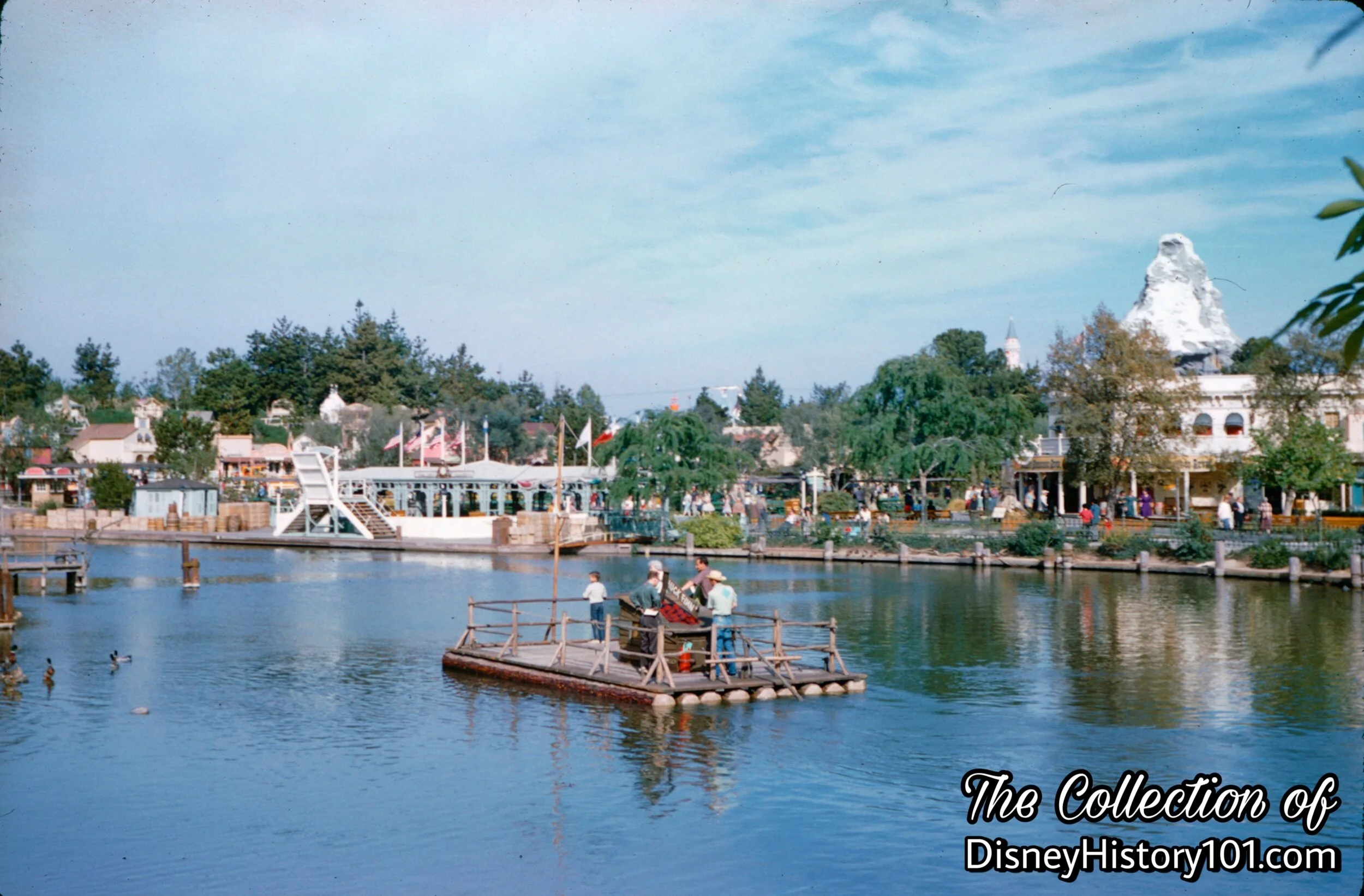
Rafts to Tom Sawyer Island

Rafts to Tom Sawyer Island
Raft to Tom Sawyer Island

Raft to Tom Sawyer Island

Raft to Tom Sawyer Island
Raft to Tom Sawyer Island
Raft to Tom Sawyer Island
At times, the groups of guests were much smaller.

Raft to Tom Sawyer Island, (c. October, 1960)

Raft to Tom Sawyer Island
But this was the typical scene - a raft headed for Tom’s Landing with a full load of passengers.

Rafts to Tom Sawyer Island Accessing the Frontierland Dock
It was always a challenge to make landings with the wind blowing.
Rafts to Tom Sawyer Island, (March, 1961)
Rafts to Tom Sawyer Island

Rafts to Tom Sawyer Island, (c. July, 1967)

Rafts to Tom Sawyer Island, (1981 - 1982)
Raft to Tom Sawyer Island, Attractions Host, and Guests
Some groups of guests were larger than others. Well, it looks like we’re off to Tom’s Landing! A contributor to Backstage Disneyland Magazine (published during 1966) wrote: “Ken Gordon on the Island Rafts holds the record for the greatest number of people on one raft. Ken tells me he’s had 96 on a raft at one time; can you believe 55? (Editor’s note: I’d believe 30 guests, 1 driver, 4 crates, and a cat trying to get at the ducks!)”
Disneyland "D" Coupon, (Summer, 1960)
During 1960, the traditional Dixieland at Disneyland event commenced. All rafts were utilized as floating stages for the various bands that would perform while floating down the river in Frontierland.
While listed in the Coupon Book as a “D,” Tom Sawyer Island was closed weekdays during the winter season of 1962, operating only on weekends.
Disneyland "D" Coupon
In 1965, the cast of admission for exploring Tom Sawyer Island after departing a river raft was exactly one “D” coupon, or 60¢.
Disneyland "D" Coupon, c. 1971 (?).
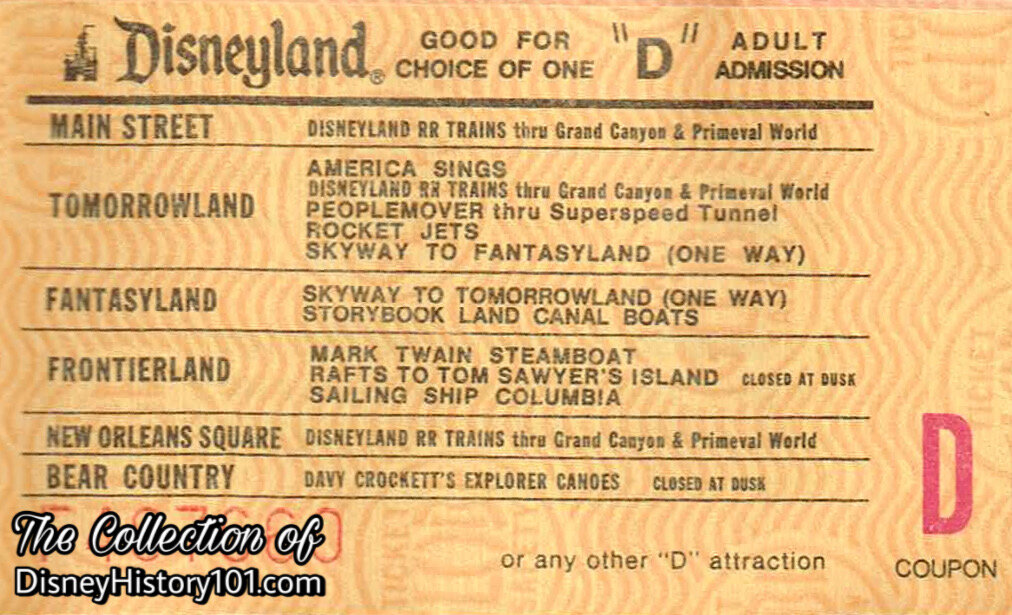
Disneyland "D" Coupon, c.1977.
“Live Entertainment”
The Rafts were utilized as stages. From May 28, 1972 through November 25, 1972, the Raft Group performed from 5:00 PM - 12:00 M.
“Routine Inspection”
During each day Park Operations M-44 Machinists would, at least once, circulate to each Adv/Front area attraction and discuss with each attraction lead any problems, defects, or other feedback regarding the attraction. They would then notify the Mechanical Dept. of anything regarding this department and notify the M-1 of anything regarding other crafts. The Park Operations Machinists would check all the fluid levels on all the Rafts, then start and run all the Rafts. Refurbishments of the adventure would continue through the following decades.
“Repairs & Rehabilitations”
During 1958, an appraisal of the ride structure valued it at $189,000 while the equipment was valued at $26,000. In an effort to increase the Show Quality of the adventure, Gray Marine engines were being used to propel the 45-guest capacity rafts by 1959. “55er” Dave Bartchard recalled: "I was very impressed when we transferred the vehicles to natural gas. They asked for my opinion about it and I said that I favored the change because I like clean air. The Omnibus was the first to go over to natural gas, then the Jungle boats, and the Motor Boats, Rafts and the Keel Boats followed along. We couldn't do it for the Submarines because there was no place to put the tanks.”
By 1975, John Yarber had “redesigned the rafts so that the girl drivers could tie up easier and also they could get on and off the raft without jumping over the rail. He even made a MAGNIFICENT model of the raft, using fine wood and beautiful craftsmanship.”
The “I Have an Idea” Program (est. 1978) would come to yield many ideas that would influence and shape the efficiency and safety of how things were run. For instance, Disneyland Cast Member William Burnett had the idea to “attach floating keychains to key sets of attractions near the water, to support keys accidentally dropped in the water.” [Disneyland Line, March 1st, 1979]
By 1984, Tom Sawyer Rafts had (4) rafts - Becky Thatcher, Injun Joe, Tom Sawyer, and Huck Finn (the latter was sent to Walt Disney World). With Guests, the Tom Sawyer weighed 16,100 lbs., the Huck Finn (sent to Walt Disney World) weighed 15,300, the Becky Thacher weighed 16,500 lbs., and Injun Joe weighed 15,550 lbs. Each raft had a length of 23’ 6”, a beam of 14’, a 40-50 Guest capacity, weighed about 2 tons, and was powered by a Model 69 Gray Marine engine, self-contained cooling system.
By 1996, the Rafts to Tom Sawyer Island still offered one-way trips to or from Tom Sawyer Island on a raft. Operational rafts included the Becky Thatcher, Injun Joe, and the Tom Sawyer. More than a half-century after inaugural voyages (and during February of 2007), rafts to Tom Sawyer’s Island would briefly discontinue as the island would close for renovations. Rafts would resume on May 25, 2007 when the Tom Sawyer’s Island would reopen as Pirate’s Lair, with a heavy connection to an adjacent attraction (and re-theming based on a certain popular Walt Disney Studio production)!
“Legacy”
The tradition was continued with the Rafts to Tarzan's Treehouse at Hong Kong Disneyland in 2017.

(June 16th, 1956 - present)
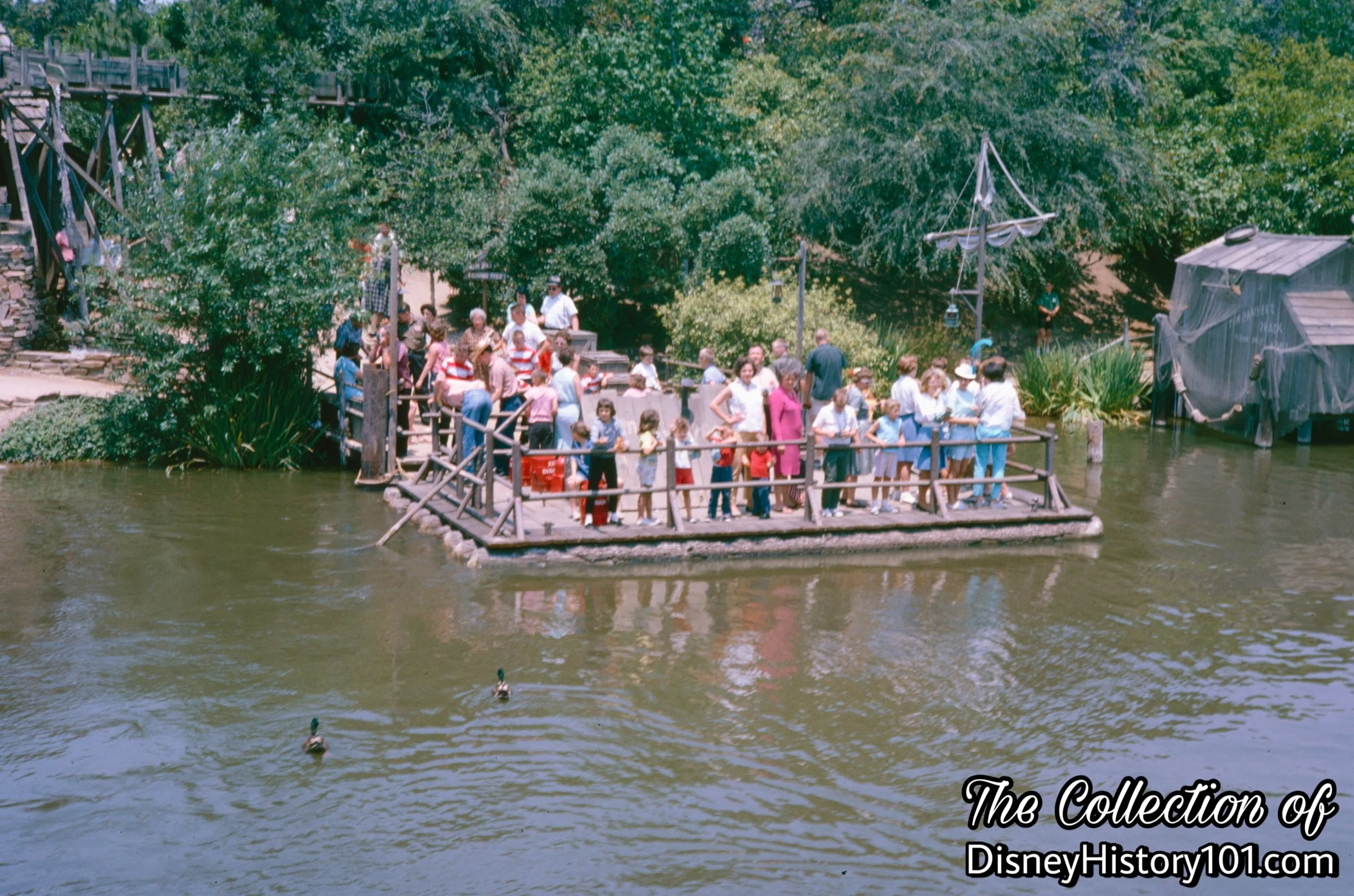
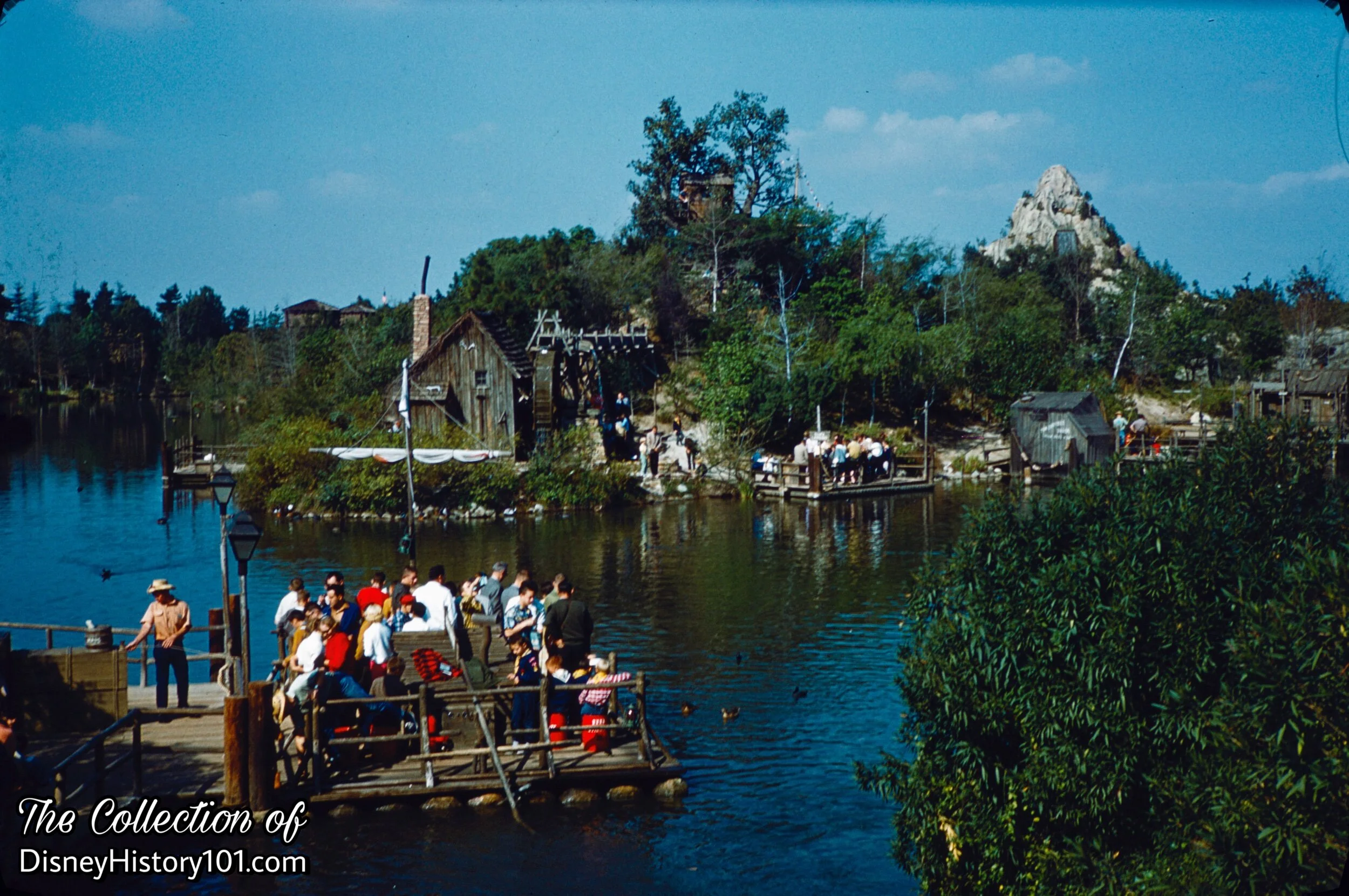
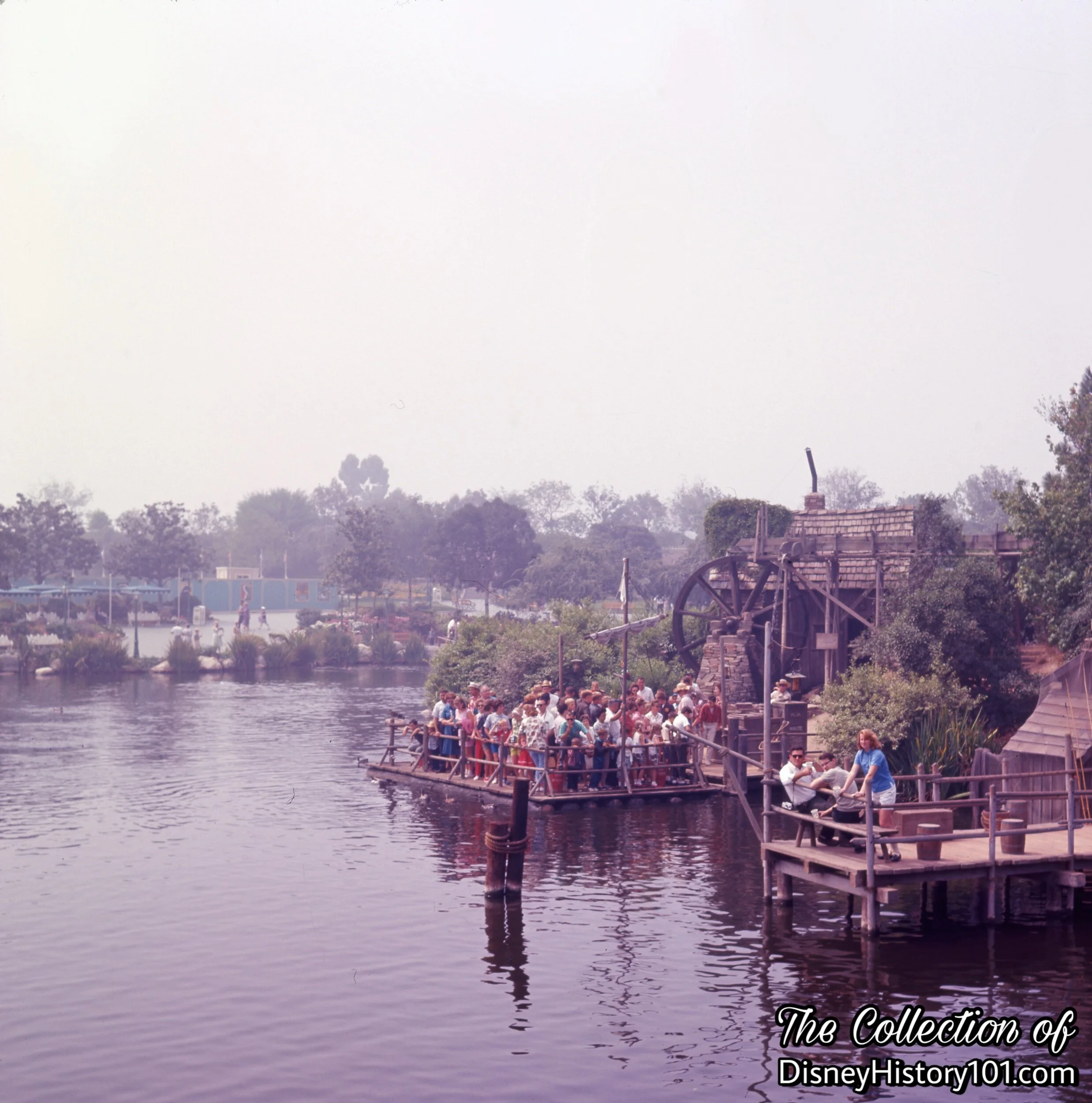
On June 16th, 1956, the first log rafts traveled to Tom’s Landing, a dock on the southern end of Tom Sawyer Island. On maps, an “X” marked this spot where you would step ashore for exploration and fun on the island.
Rafts would also depart from Tom’s Landing, and head back to the launch near the Frontierland Bridge (until at dusk, of course). That launch was tucked away in the foliage near the southern Chicken Plantation House. In the early days, there was just this one route and one launch from which rafts carried guests towns from Tom Sawyer Island.
In the present, Tom’s Landing is often referred to as the “Long Run Dock”, owing to its length from the mainland Raft Dock.
Tom Sawyer Island Raft at Tom's Landing
As we pier out through the wrought iron fence near Chicken Plantation, we gain a view of our destination - Tom’s Landing, just the other side of the Rivers of America!

Tom’s Landing was located between the Old Mill and Fishing Pier on the Southern portion of Tom Sawyer Island. Sometimes the rafts were not in use, sitting tethered to the dock near Tom’s Landing.


Tom Sawyer Island Raft at Tom's Landing, (1967)

Tom's Landing

Tom Sawyer Island Raft at Tom's Landing

Tom's Landing and Fishing Pier
Since the beginning, Tom’s Landing offered a great vantage to watch the passing river traffic along the Rivers of America.

Tom's Landing, (1972)
Tom’s Landing was also a clearly picturesque spot for father and son to enjoy fresh popcorn or hot peanuts while those vessels made their way down the Rivers of America.
Tom's Landing, (March, 1978)
It was also an unofficial Photo Spot for best pals!

Beginning in July of 1957 (and barely more than a year after the first log rafts traveled to Tom Sawyer Island on June 16th, 1956), the Indian Village Rafts started to offer exclusive transportation to and from Huck’s Landing on the north-western side of Tom Sawyer Island.
In the present, Huck’s Landing is often referred to as the “Island Raft Dock,” as it is often the main dock used by Rafts heading to the island.
Huck's Landing, (May, 1957)
Huck's Landing, (1957)
These rafts were exclusively labeled Huck Finn, to distinguish them from Tom Sawyer’s Rafts!
Huck's Landing, (September, 1972)
Rafts to Huck’s Landing departed near the location of Fowler’s Harbor (west, on the other side of the Rivers of America).

The Old Mill & Huck's Landing, (1967)
Huck’s Landing was the second dock added, and it is still currently located on the West side of Tom Sawyer Island, just West of the Old Mill!

Huck's Landing

Huck's Landing, (1960s)
Huck Finn once said, “You feel mighty free and easy comfortable on a raft.” Of course, Huck probably never had in mind a raft reaching full-guest capacity when he made that statement! In its “heyday”, Huck’s Landing was also a popular launch used to depart from Tom Sawyer Island!
Huck's Landing
Tom Sawyer Island explorers wait near Huck’s Landing, to board the next arriving raft.
Huck's Landing
When not in use, Keel Boats would occasionally winter at Huck’s Landing. At this time, Tom’s Landing would become the main dock for Rafts to Tom Sawyer Island.
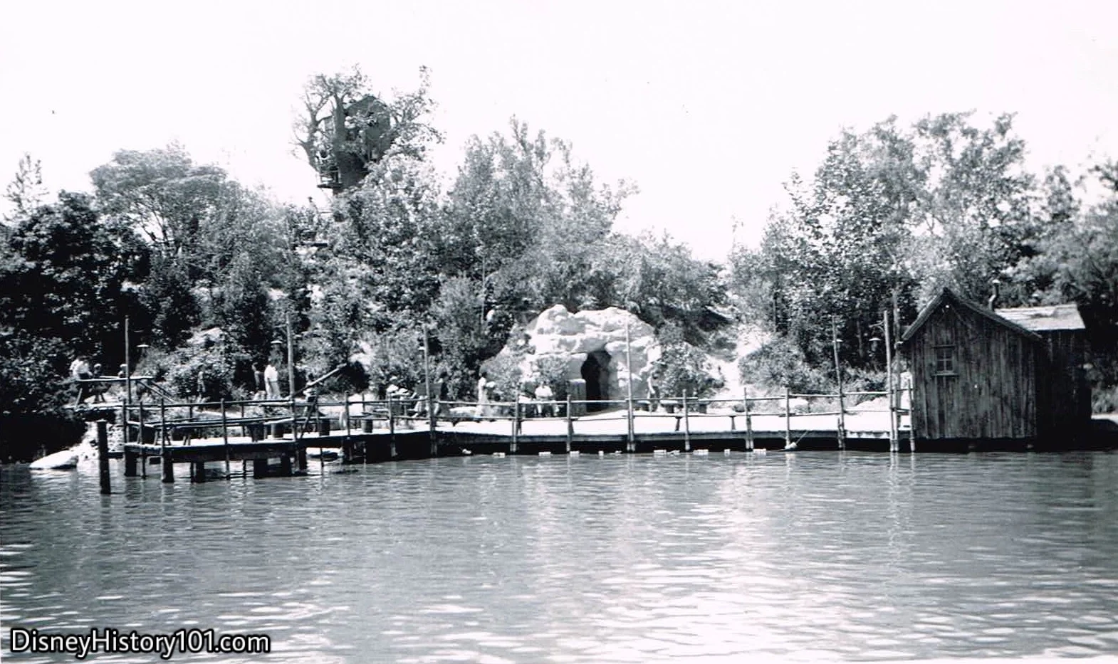
One of Herb Ryman’s earliest conceptual drawings of “River Ride” suggestions (and related Island Show Scenes) depicted “Dummy Kids Sitting Fishing” for “Catfish” in “Fowler’s Dock.” As early as November 3, 1955, Disneyland, Inc. was issued a Domesticated Fish Breeder’s License by the State of California. The license was good for a few months (from November 3rd through December 31st, 1955) but it allowed Disneyland, Inc. to begin to specifically propagate and raise domesticated Blue gills, thereafter holding them “in possession” within their “pond,” (near Harbor Boulevard and the Santa Ana Freeway) during the term of the license.
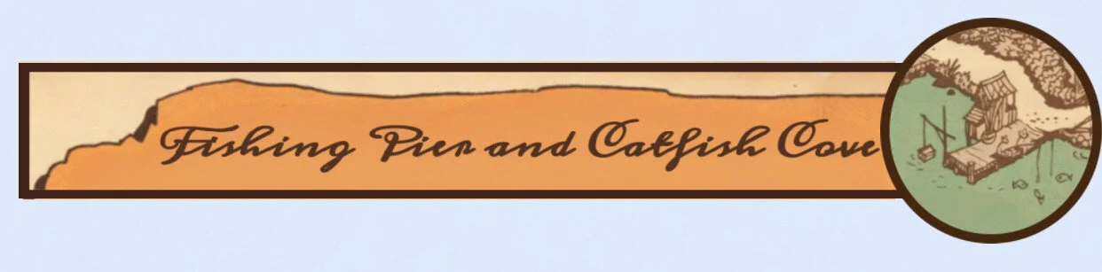
Tom Sawyer Island and Catfish Cove Construction
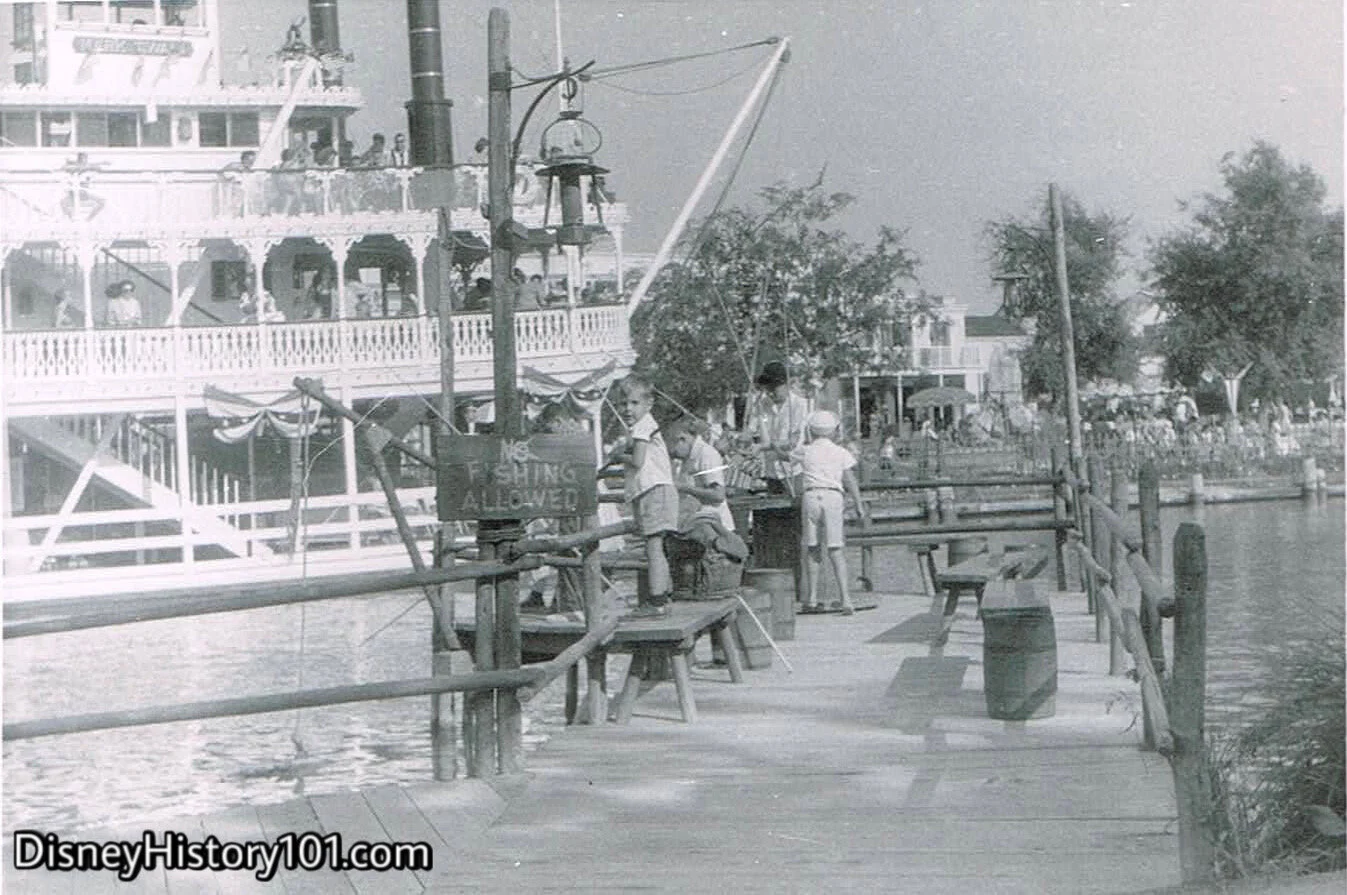
It would be six months before the two piers that jettisoned out of Catfish Cove were sectioned off by a net, and the area of water was stocked with several kinds of fish (originally 15,000 catfish, perch, and bluegill by opening day, according to “Disneyland Dictionary” printed October 1959). Guests of all ages enjoyed grabbing one of Huckleberry Finn’s favorite bamboo fishing poles and a can of worm bait, and relaxing on the old pier! Whereas many of the attractions cost the price of a ticket, there were several free attractions inside Disneyland. One of them came to be in a Catfish Cove where guests could experience fishing with reel and rod from an actual, factual, Fishing Pier! Yes, the fish were real, they would really bite, and you could keep all that you caught.
“Disneyland Dictionary” (published 1959) stated that “Many small fish are planted in the Rivers of America (Blue Gill, Perch, etc.) so that Disneyland's "small fry anglers may have the chance to really catch fish from the Island's dock.” According to a 1959 Disneylander information book : “Guests may fish FREE from the dock. Bait and poles are supplied. (Net fishing area is stocked with small fish such as Perch, Bluegill, and some Trout.)”
Tom Nabbe (a future WED Florida Distribution Services Warehouse “E” manager & Main Street Window honoree) had his humble beginning here, portraying the starring role of Tom Sawyer, baiting fishing poles on the fish dock, and cleaning the fish that were pulled out!
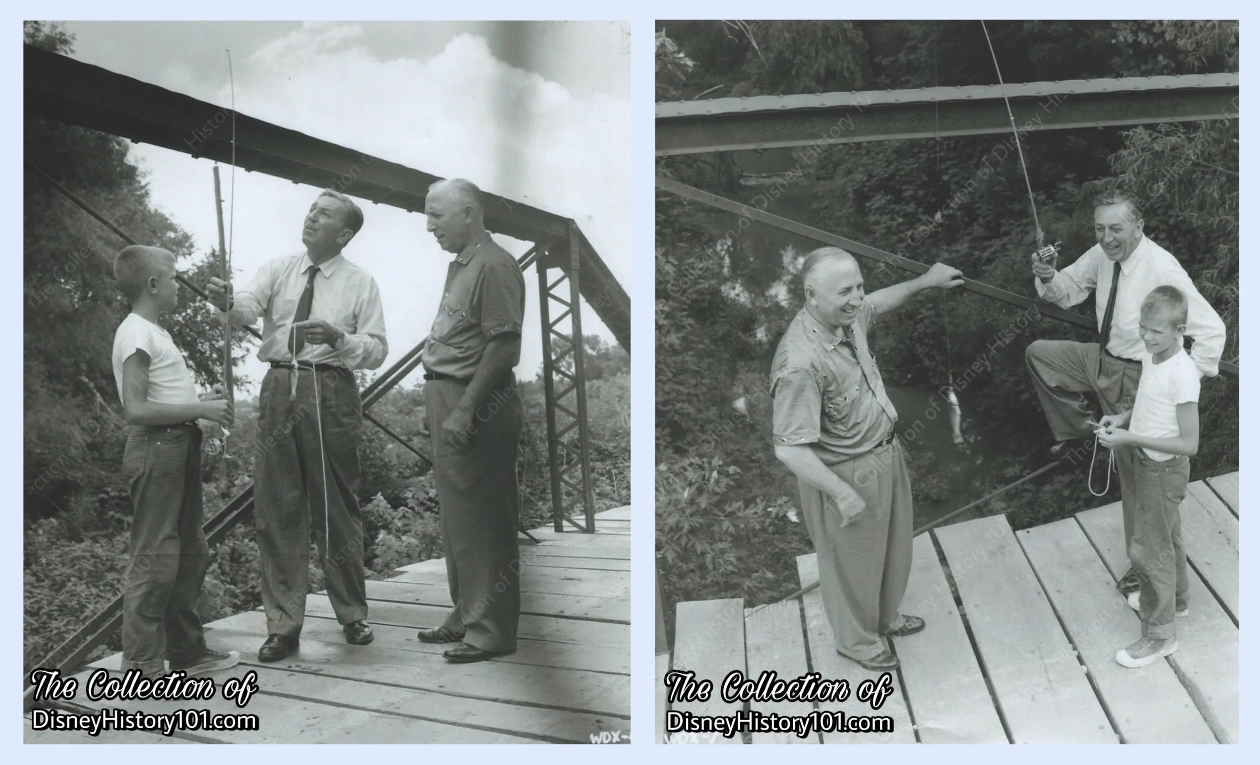
Walt & Roy visit an old "fishing' hole" called Yellow Creek in Marceline Missouri on July 4th, 1956, a month after the opening of Tom Sawyer Island.
It seems that there was more to the creation of the Fishing Pier & Catfish Cove than most perceive. A month after Tom Sawyer Island opened, Walt and Roy visited their boyhood home of Marceline, Missouri (to dedicate the dedication of a municipal swimming pool on July 4th). Two days later, the brothers took a detour to visit a little bridge over Yellow Creek (an old swimming and fishing hole where the two would picnic, fish, and swim as children), and met a young 12-year-old boy named Jim Payden and his 10-year-old sister Anne. They told them about how they would use sticks for fishing poles and safety pins for hooks.

Fishing Pier and Catfish Cove, (1956)
Fishing Pier and Catfish Cove, (1956)
Dean Narath recalled: “Walt had been fishing from the fish dock on Tom Sawyer island for some time and hadn't got a bite. He turned to me and my dad, and like all fishermen, said, 'There's NO FISH IN THE RIVER!' My dad replied, There's fish there all right, but the water's so muddy that the fish can't see the bait! Walt thought for a minute and then said, 'I fished in the Missouri River, and it was muddier than this river, and the fish SURE SAW THE BAIT!'"
Fishing Pier and Catfish Cove
From the Fishing Pier, guests could watch the river traffic (from keel boats to a fully-rigged vessel) pass by. Soon, Catfish Cove, and the Fishing Pier, would be featured in promotional media. For instance, a few young guests with catches in-hand at these locations (perhaps filmed on Saturday, October 5, 1957) were amazingly preserved on film in the “An Adventure in the Magic Kingdom” episode of Walt Disney’s Disneyland (airing in 1958)! As a sidelight, productions like these contributed to a good amount of income for Disneyland Inc. from television participation totaling $817,975 for the fiscal year ending September 29, 1957 and $195,450 for the fiscal year ending September 28, 1958.
Then, both David Oswald Nelson and Eric Hilliard Nelson were briefly featured (pole in hand) in a c.1959 Kodak Brownie commercial that starred their Ozzie and Harriet co-star Peggy Lou Snyder (Harriet Hillaird), and was partially shot near Catfish Cove and on the Fishing Pier. The commercial aired in conjunction with Disneyland ‘59 presented by Kodak.
Fishing Pier and Catfish Cove
"STEVE REMEMBERS HIS 'BIG CATCH' OF 1960"
“Tom Sawyer (real name Tom Nabbe, whom I didn't know his real name at that time) was supervising the fishing of me and two or three other boys and he advised us that we could keep any fish that we caught provided it was at least 6 inches long and that 6inches was roughly the distance between the tip of his thumb and the tip of his extended index finger. This was also the first time in my life that I had ever fished. I grabbed a bamboo Pole with a short maybe 10 foot line with a single barbed hook, pulled a worm from this gooey cylindrical apparatus that was placed in some kind of bucket, speared the poor little worm onto my hook and cast him into the Rivers of America!
It was hot that day and I wasn't catching anything. I befriended this other kid next to me and asked him to watch my pole and I walked back to the shore end of the dock to talk to Tom. I held up my open hands at chest height, fingers pointed away from me(like an old fisherman as if to say ‘I once caught a fish this big, no it was this big!, hands getting further apart, no it was this big!’, getting bigger), I was holding my hands about 6 inches apart and I asked Tom, "Is this about 6 inches?" And he replied, ‘Yes that's about 6 inches.’ I was thinking there was probably no fish in the water that long. With ever so slightly decreasing the distance between my two hands, I asked Tom again, ‘Is that about 6 inches?’ And Tom replied again, ‘Yes, that's about 6 inches.’ And finally a third time with ever-so-slightly decreasing the distance between my two hands, I asked Tom again, ‘Is this about 6 in?’ And Tom just chuckled and replied, ‘That six inches is getting smaller and smaller!’ So eventually a little while later I caught that perch and if my memory serves me correctly the other boy I befriended also caught one.
They were only about 4 inches long and Tom let us keep them... besides the fishing gear, Tom also provided large clear sturdy plastic bags that could hold about a quart of water. Also rubber bands to secure the top. I put it in a plastic bag filled with water and took it up to the Main Gate Souvenir Stand where my mother was clerking and put it under the counter into the cupboard.
When the park closed at midnight and my mom was off her shift, she… sat me down and reasoned with me and asked me what will I do with the fish when I got it home?... I thought to myself for a minute and we did not have a fish bowl or an aquarium at home and he was too small to cook and eat... I didn't even like the taste of fish at that age anyway... So I took compassion on him, I walked back with him to Adventureland and released him where the waters of the Jungle Cruise ride connected to the Rivers of America.”

George Mills recalled: “We had problems pumping the Adventureland River one time. bluegills were in all of the water systems. The strainers were all plugged with the little fish!”
Fishing Pier and Catfish Cove; March, 1965.
Catfish Cove and the Fishing Pier could be readily seen from the Mark Twain’s Dock. Only a year before this Vintage View was captured, audiences still fished “for real perch and bluegill (pole and tackle free of charge),” according to “Walt Disney Disneyland,” page 42, printed by Officine Grafiche Arnoldo Mondadori - Verona; first published 1964.
Fishing Pier and Catfish Cove, (1966)
Catfish Cove and the Fishing Pier look pretty busy during the summer of 1966! Apparently VIPs weren’t the only ones fishing, as fish carcasses began turning up hidden around Disneyland, and alas, the activity would soon end.
However, this attraction soon had a legacy of sorts in the Trout Fishing Stream at The Disneyland Hotel, where guests could “pay for what they catch.” Around 1970, the Disneyland Hotel featured a Fishing Pond near the Marina and Water Playground area.

Fishing Pier From Frontierland Dock, (1972)
Soon, the Mark Twain’s Frontierland Dock was a distant location to spy out Tom’s Landing and the Fishing Pier from across the river!
Fishing Pier and Catfish Cove
Fishing Pier and Catfish Cove
As late as 1980, the Fishing Pier Snack Stand offered “beverages and quick energy snacks” during the Summer and holiday periods. According to one Disneyland Food Menu (published for December of 1981), options included the Huck Finn Freeze, Ice Cream Bar, Ice Cream Sandwich, Frozen Banana, Potato Chips, Fritos, Doritos, Almonds, Raisins, Icees, and other snacks and ice cream novelties.
The neighboring Fort Wilderness Snack Bar on Tom Sawyer Island also offered refreshments.

Fishing Pier and Catfish Cove, (1968)

Catfish Cove and Fishing Pier, (2019)
Remnants of Catfish Cove and the Fishing Pier can still be readily seen from the Mark Twain’s Decks. The fishing poles and cans of worms are gone (and so are the Bluegill, Trout, and Perch). Still, the historic structures and Fishing Pier grant a scenic view to guests willing to venture to the end!
Soon, the Fishing Pier Snack Stand offered a selection of snacks.
Catfish Cove had a legacy (of sorts) when the “Vacation Kingdom” opened in 1971. Fort Wilderness Campground Resort offered the experience of fishing in a man-made fishin’ hole.

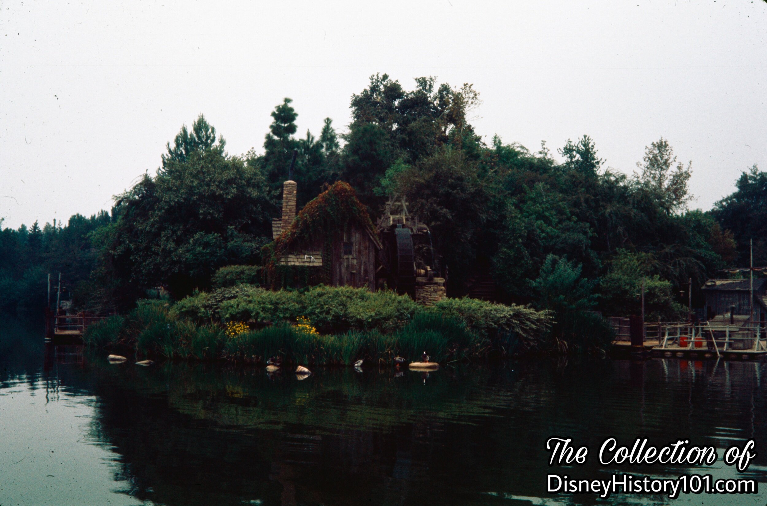
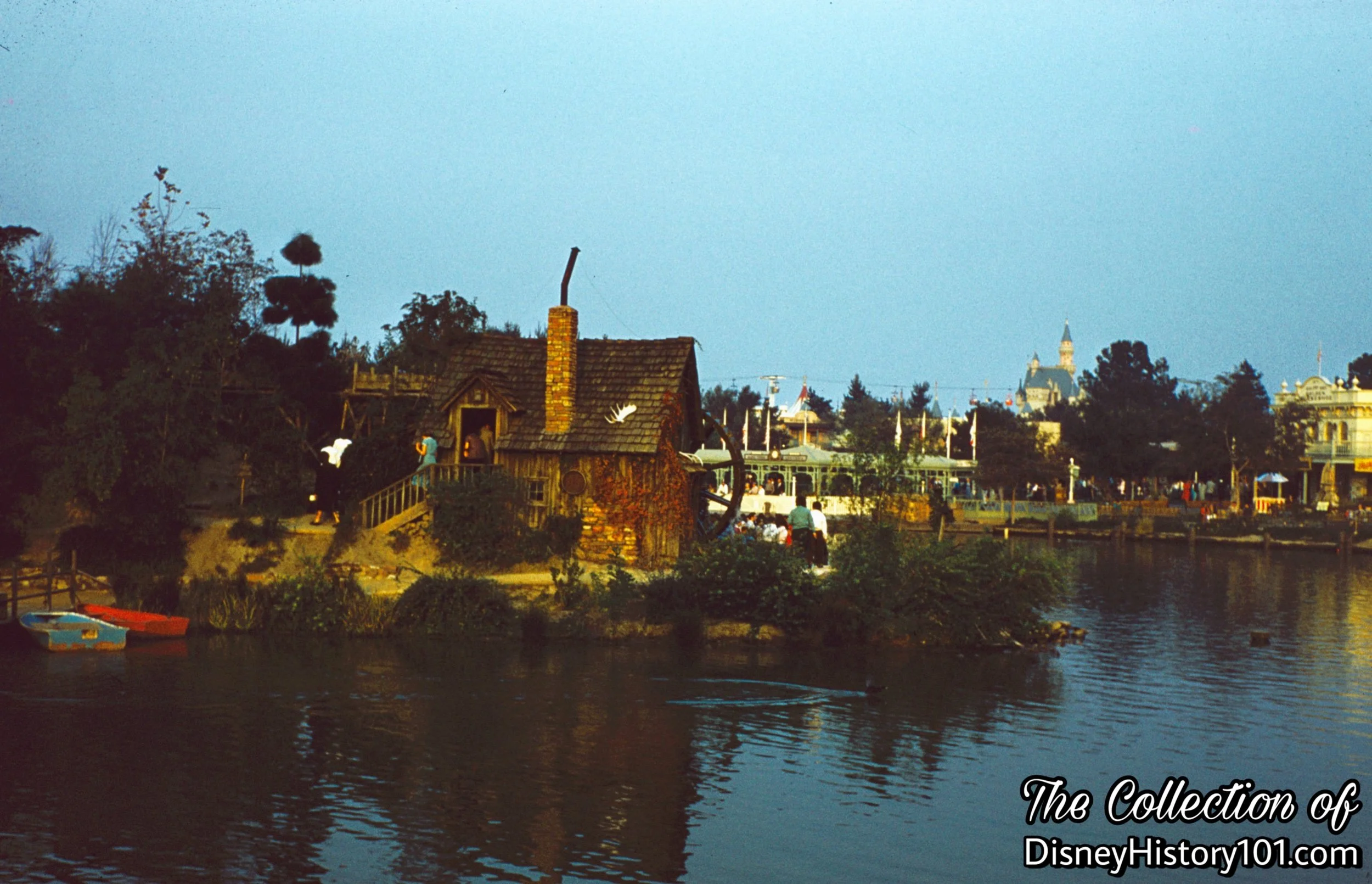
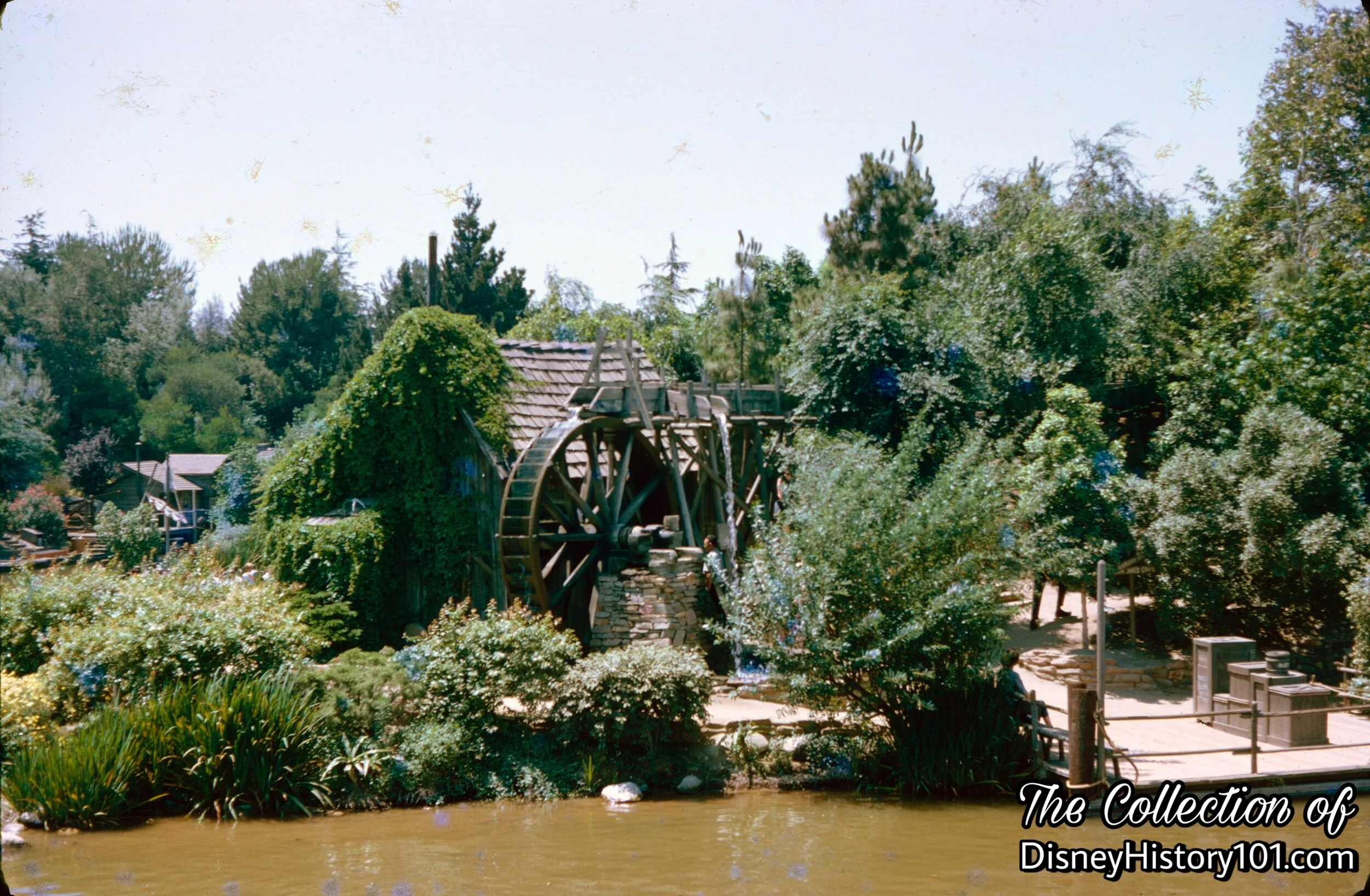
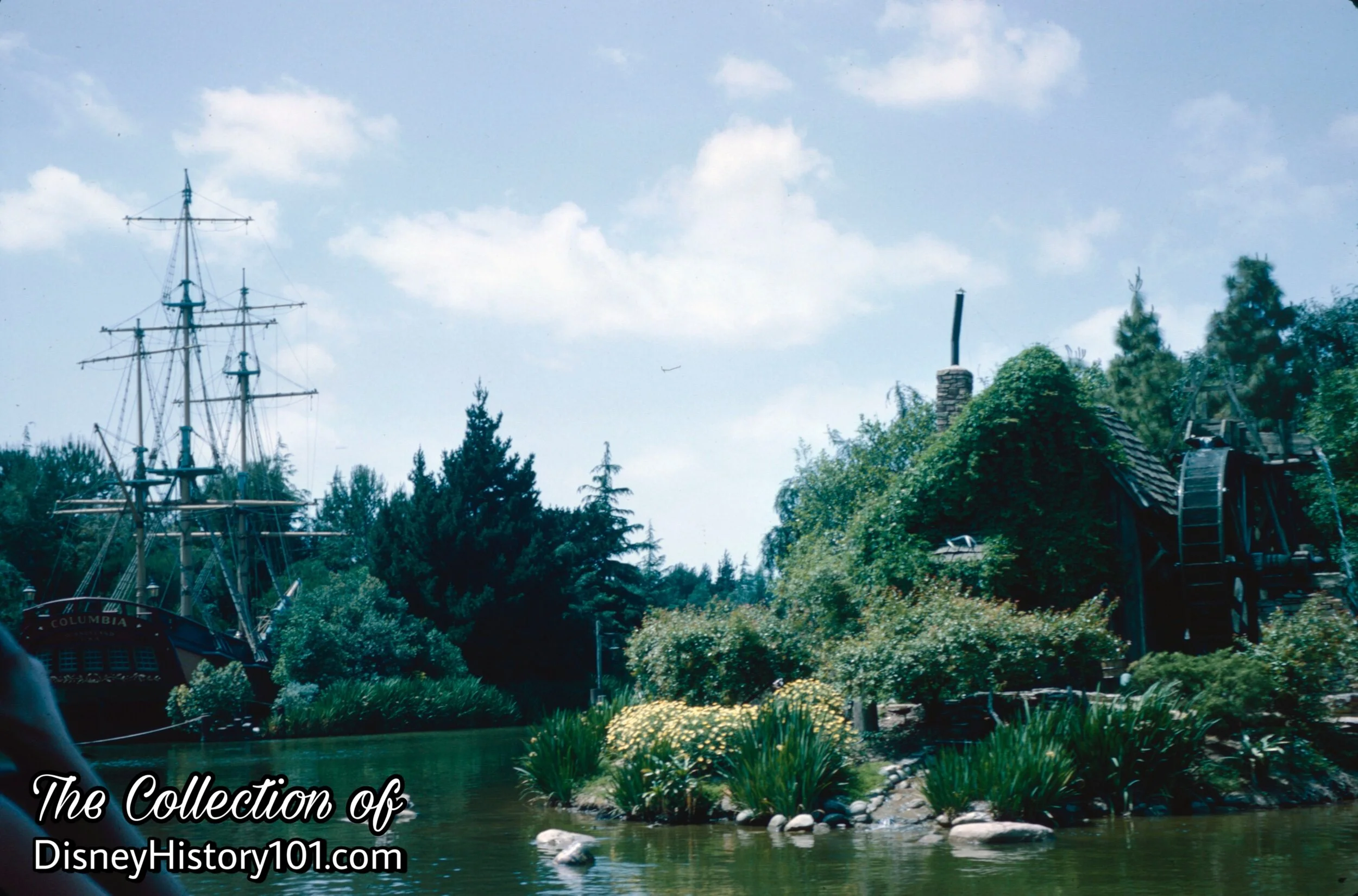
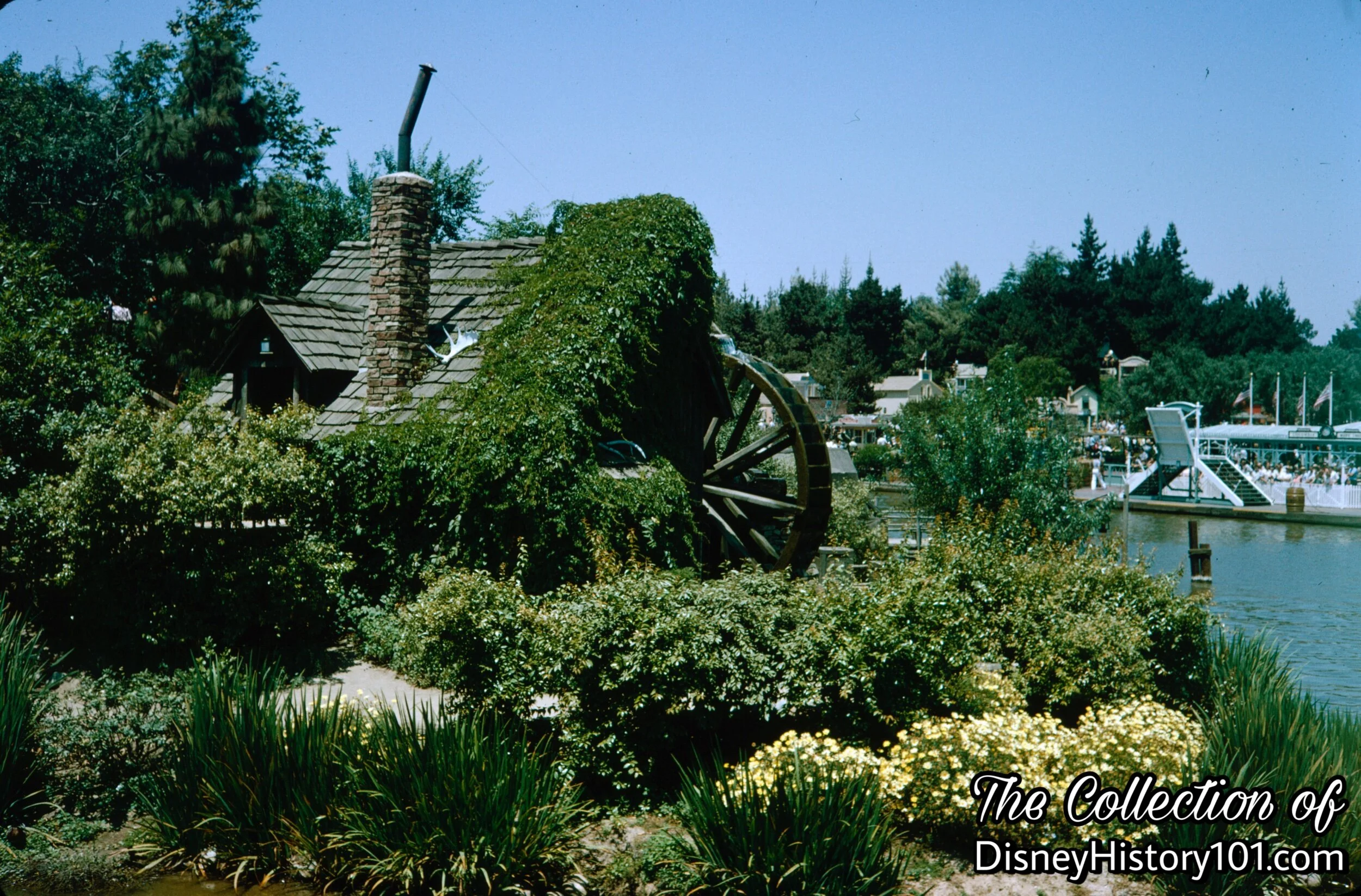
“This is an early American grist mill run by water power. Inside, you can see how great grandmother’s corn meal and flour were made,” according to the narrator of “An Adventure in the Magic Kingdom” episode of Walt Disney’s “Disneyland” television series (filmed in 1957, and airing in 1958). Tom Sawyer Island Explorer’s Map explains the purpose of these mills this way : “To the early settler, the mill was invaluable for grinding, sawing, and other uses. . . The massive overshot wheel of the old grist mill turned by a tumbling stream of water, channeled by a wooden flume typifies the ingenious use of water power.” By 1974, the Old Mill was one of four Disneyland locations featuring a waterwheel (this one in style of the ones once used for grinding and sawing in the grist mills of yesterday).
Occasionally, the Old Mill was utilized during Disneyland Holiday Festivals and parades during “Disneyland’s First Fabulous Decade,” as when balloon release boxes were temporarily stationed there during Fantasy on Parade of 1965.
Finally, by 1991, it was time to demolish the old grist mill. During the construction of the Imagination show, a new grist mill was constructed where the bait shack used to be. In the area behind the River of America Stage, a new “cider mill” was constructed, to house an electrical equipment room, the show equipment, and even an HVAC. The all-new Harper’s Mill would serve as the Fantasmic! staging area.
The Old Mill

The Old Mill, (December 30, 1956)
This memory was captured not even six months time from the moment excursions to Tom Sawyers Island began.

The Old Mill, (1957)
The Old Mill, (c. 1950s)
The Old Mill, (1956)
The Old Mill
(November 23, 1958)
The Old Mill, (March, 1960)
The Old Mill
Near Tom’s Landing was one of the first landmarks an explorer encountered - The Old Mill!
The Old Mill
The Old Mill, (1965)
Unlike today, the seemingly untamed foliage of Tom Sawyer Island’s southern shore would form a natural barrier.

The Old Mill
The Old Mill, (November 2, 1969)

The Old Mill
The Old Mill

The Old Mill, 1969

The Old Mill
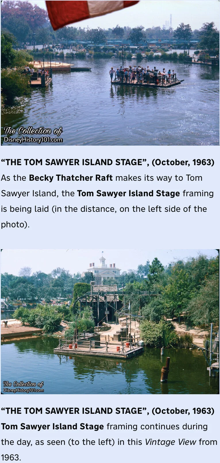
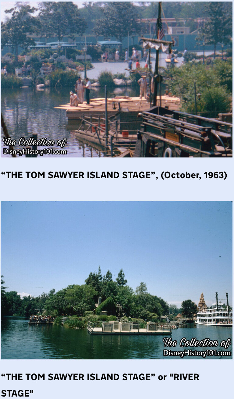
A giant dock was constructed to stage evening performances of popular bands. The River Stage was memorably used by special nighttime talent, and for events like Grad Nite!

Tom Sawyer Island Stage
Back on July 8th, 1964, one particular subject was announced and discussed at the Disneyland Customer Relations Division meeting - the “possible development of a pavement type stage for the Island.” This potential stage would showcase “special, revenue producing events, and other activities.” Soon after, it was divulged to Disneylanders that the cast of “Dixieland at Disneyland” would appear in “All That Jazz” staged on the Rivers of America in Frontierland, with a huge stage “being erected on the tip of Tom Sawyer Island for the production numbers staged and choreographed by Burch Mann.”[as reported by Small World Newsletter, September 23, 1964, page 2]

Disneyland Advertisement, (1976)
Louie Bellson (who had performed at Disneyland many times in the past), was joined by his wife Pearl Bailey and his brother Hank, to perform on this floating Rivers of America Stage on Friday and Saturday, November 26 - 27, 1976. January 17th, 1980, George Benson performed here during Disneyland’s 25th Anniversary! During 1981, Pete Fountain and His New Orleans Jazz Band performed on the River Stage and The Pointer Sisters starring in the “Rollin’ River Revue” performed on the River Stage. During March 26, 27 & 28, 1983, Kool & The Gang would perform twice nightly on the River Stage. The River Stage was the setting for a unique fireworks show in honor of Korea Festival Days at Disneyland, November 8 and 9, 1986.
This part of Tom Sawyer Island would eventually be home to a towering dragon.

The Rivers of America Stage.
Eventually, the Rivers of America Stage was home to a 45-foot tall fire-breathing dragon from Sleeping Beauty during Fantasmic! - “the ultimate battle of good versus evil,… filled with incredible special effects.” During the period of construction, the River of America Stage was first reduced entirely to dirt before a brand new Stage was built. Hydraulic lifts to raise both Mickey Mouse (to the stage level) and Maleficent (to 32 feet in the air) were installed.

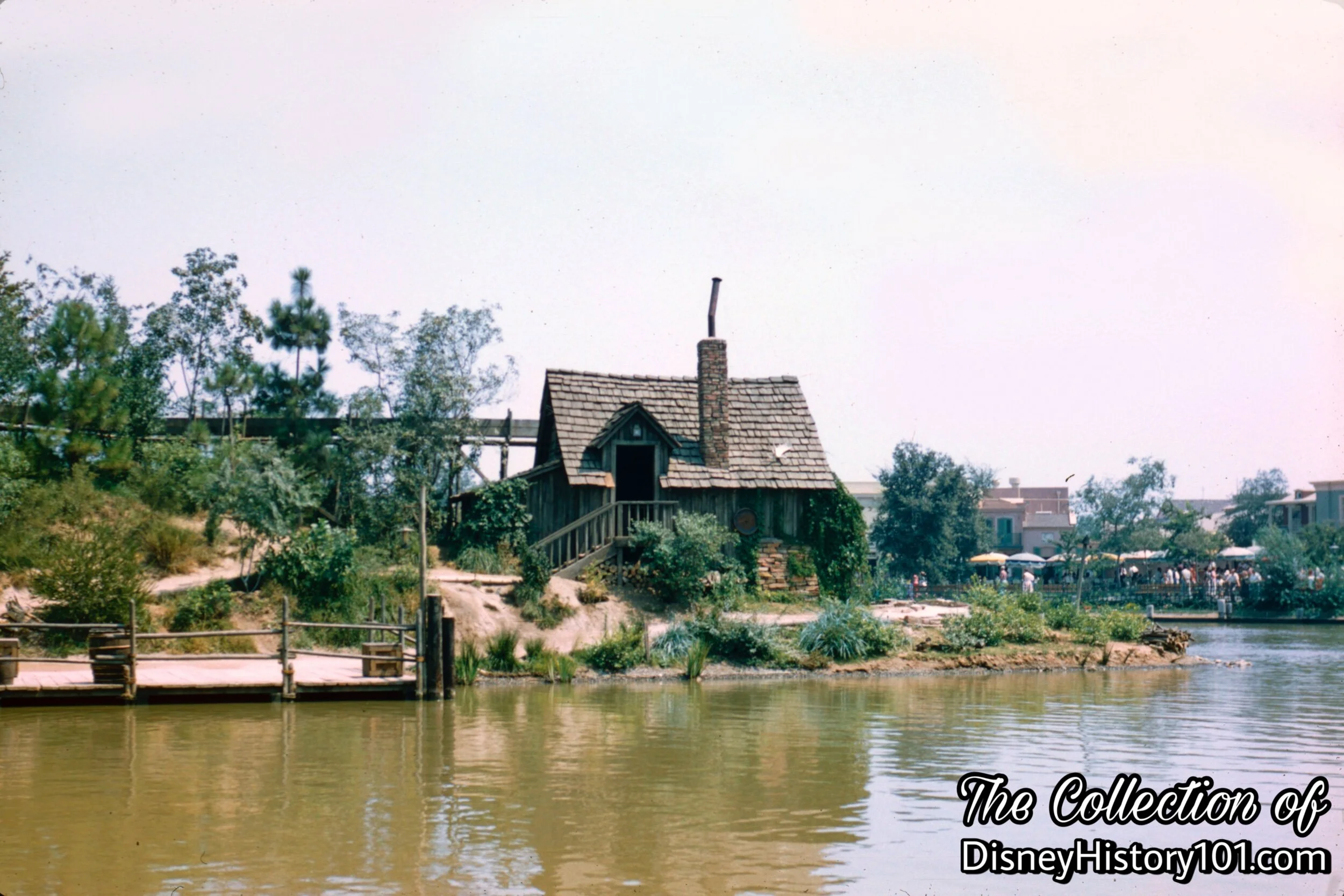
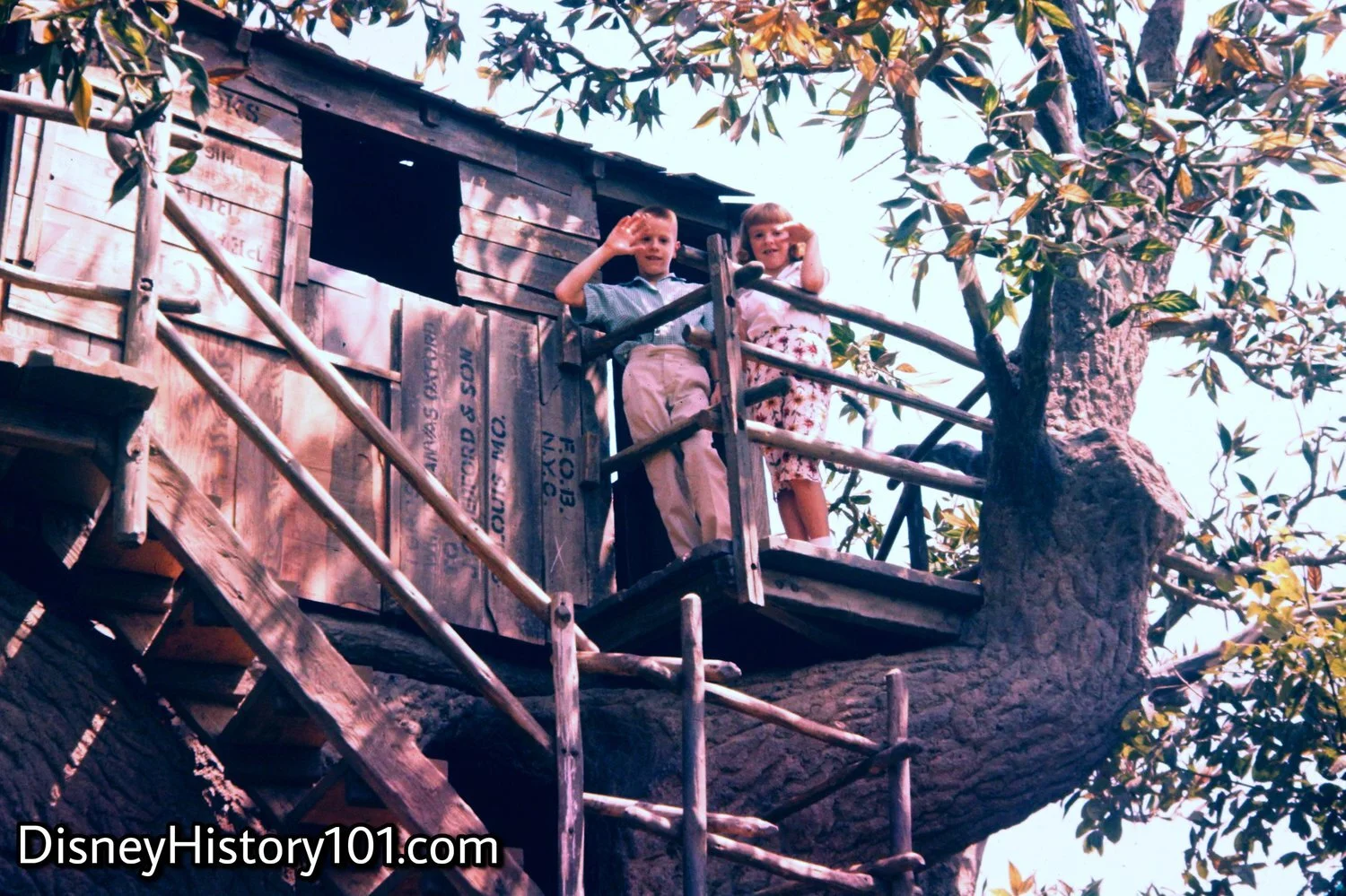
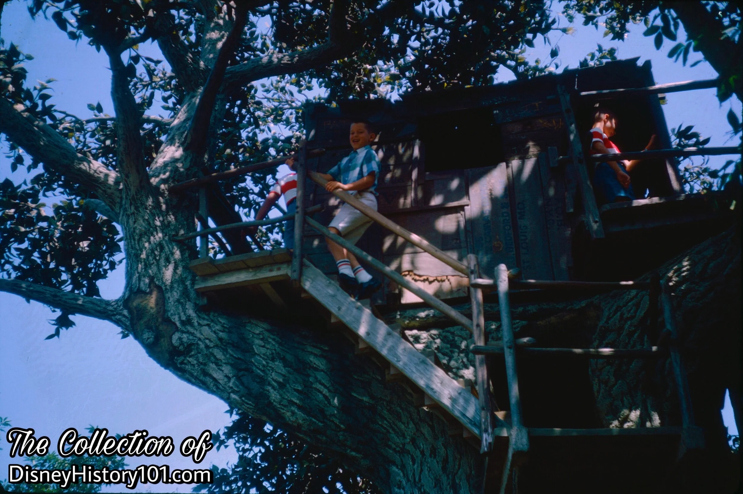
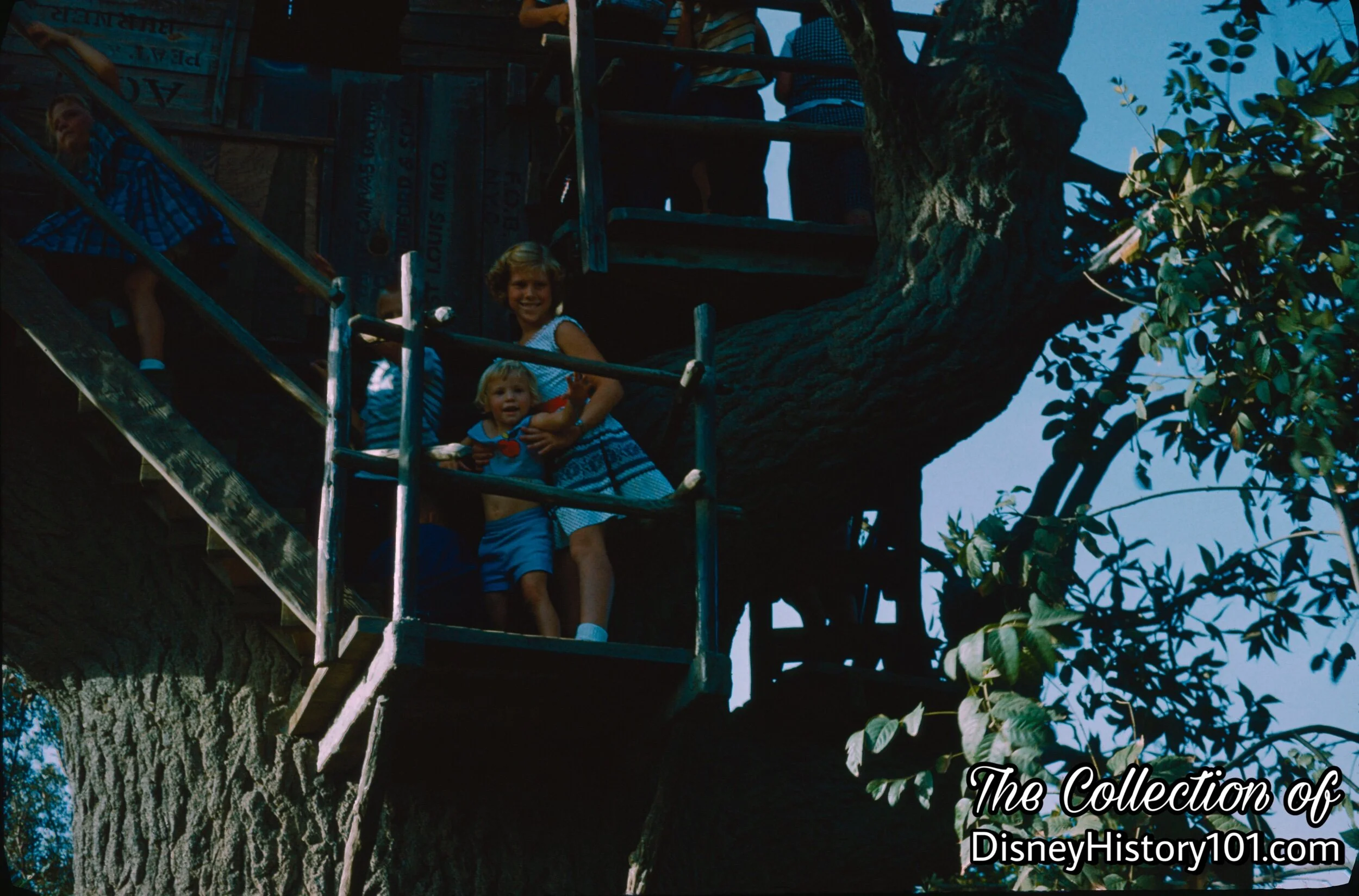
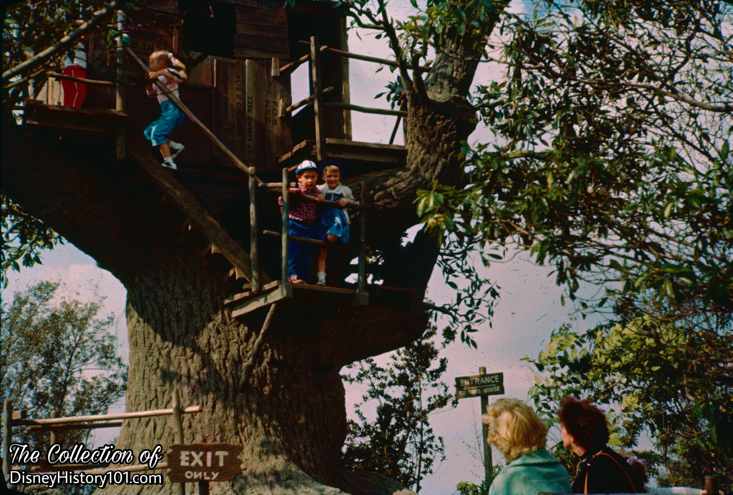
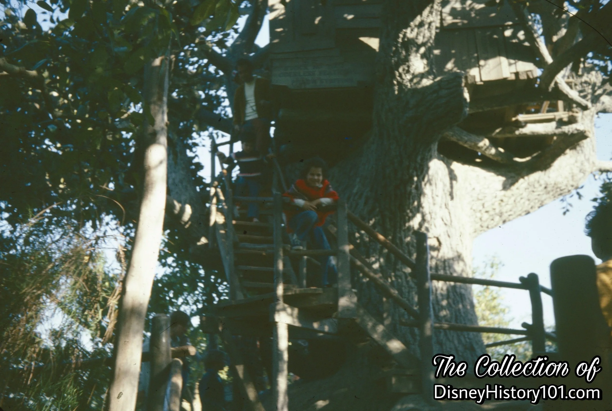
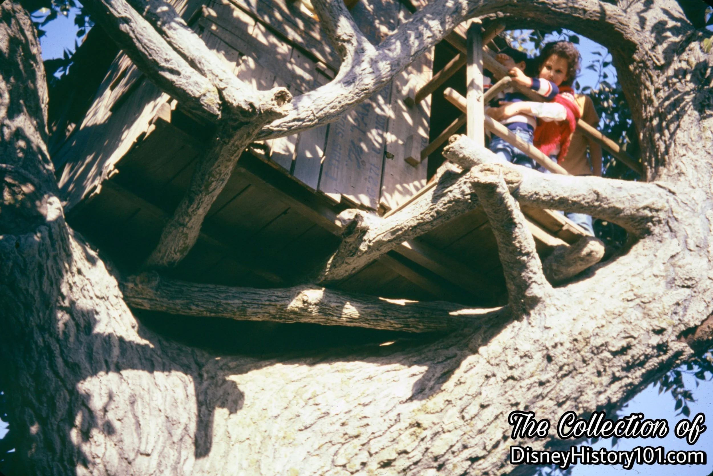
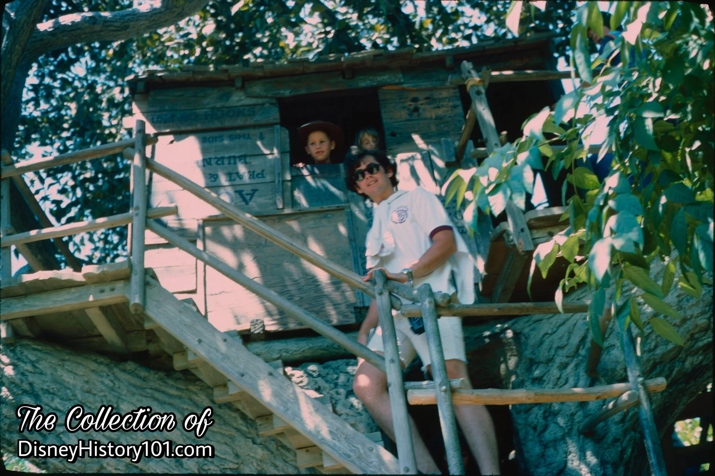
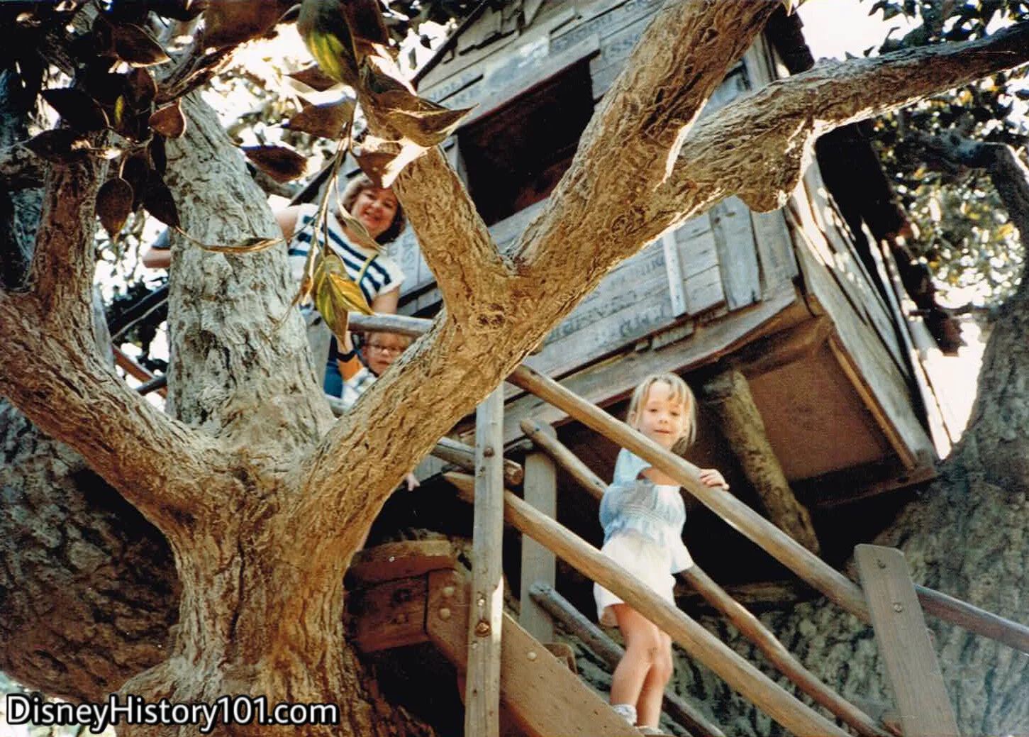
The “Disneyland Dictionary” (printed October 1959) calls the Tree House: “A Faithful reproduction of huge tree (made at Disneyland of plastics) with tree house near top, accessable by a staircase.”
After it’s debut, Disneyland Holiday magazine, described the adventure which was added during 1957: “From the lofty height of a tree house, entered by means of hollowed-out roots, young explorers can look through stove pipe telescopes.” According to Tom and Huck (and Tom Sawyer Island Explorer’s Maps, printed 1957) this is the “highest landpoint in Disneyland” - “Point Lookout” the top of Indian Hill! Perhaps it was so named because of the island’s fictitious previous inhabitants. Or, perhaps it was just a great vantage point of the Indian Village sitting on the other side of the Rivers of America. Still, beneath its roots lies Three Falls, the headwaters of the Rivers of America!
Anyway, from the height of a lofty treehouse, entered by means of hollowed-out roots, young explorers can (from a vantage which towers over the Old Mill below) look through stove pipe telescopes.
The famous Tom Sawyer Island landmark can be seen in an RCA commercial shot during 1963.
Tom & Huck's Tree House, (1961)

Tom & Huck's Tree House
Tom & Huck's Tree House, (August, 1966)
Tom & Huck's Tree House, (c. October, 1961)
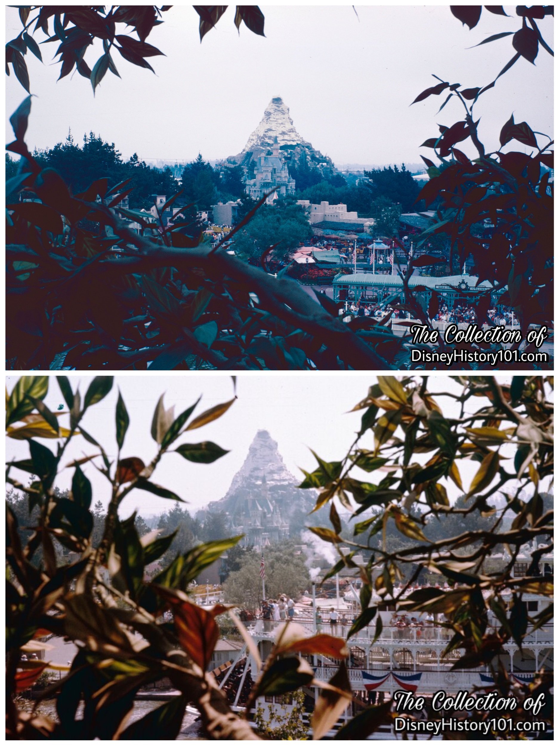
The Vintage Views from Tom & Huck's Tree House, (Upper, 1962; Lower 1961)
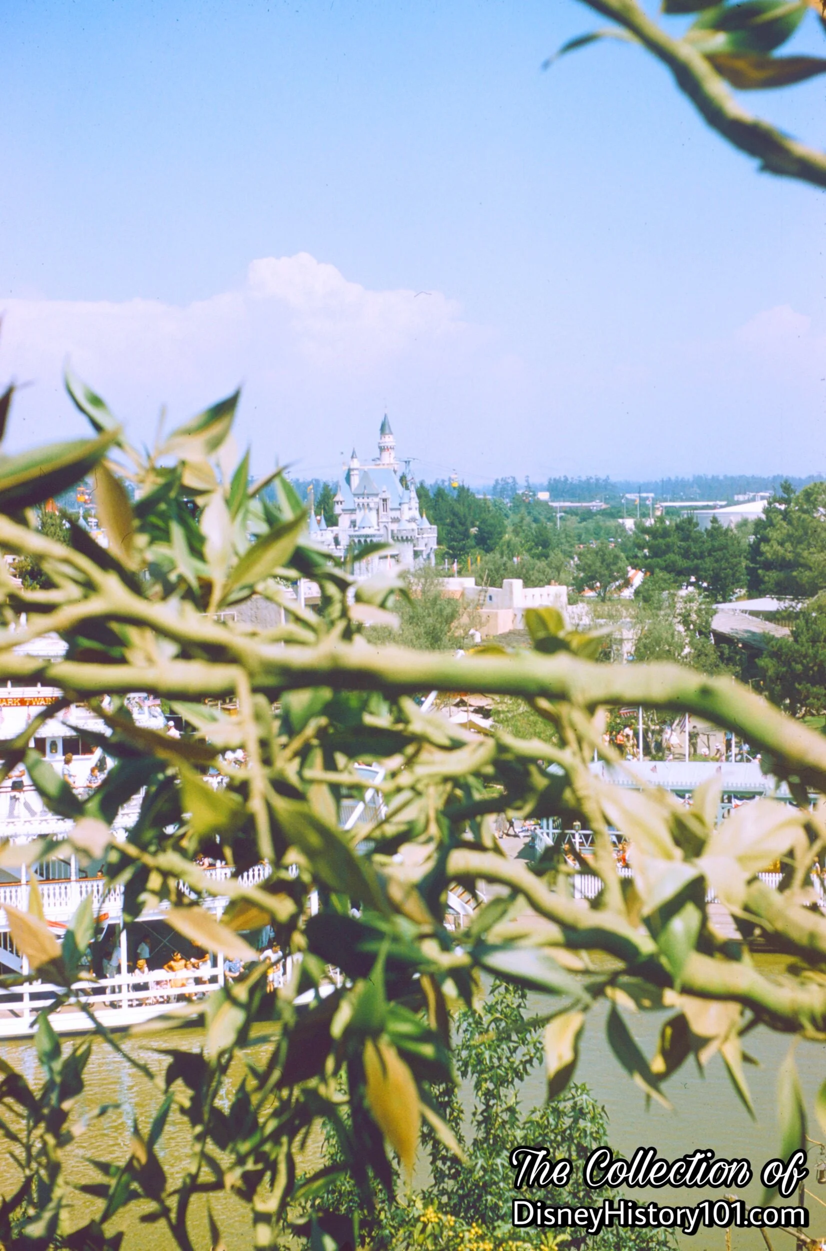
Without a spyglass, “the [one-time] highest point in Disneyland” gave guests a view of the Matterhorn and Sleeping Beauty Castle! While this sight may seem strange to some today, Walt initially thought differently. As Walt once said, “‘This is a magic place… The important thing is the castle. Make it tall enough to be seen from all around the Park. It’s got to keep people orientated,’” according to “Disneyland - Inside Story” by Randy Bright.
Tom & Huck's Tree House

Tom & Huck's Tree House
Throughout its duration, the view from Tom and Huck’s Treehouse continues to be enjoyed by explorers of all ages!

Tom & Huck's Tree House, (July 30, 1979)
At the top of the treehouse young guests Terry (left) and Brian (right) enjoy the view!

Tom & Huck's Tree House, (1969)
Tom & Huck's Tree House, (c. September, 1976)
Tom & Huck's Tree House


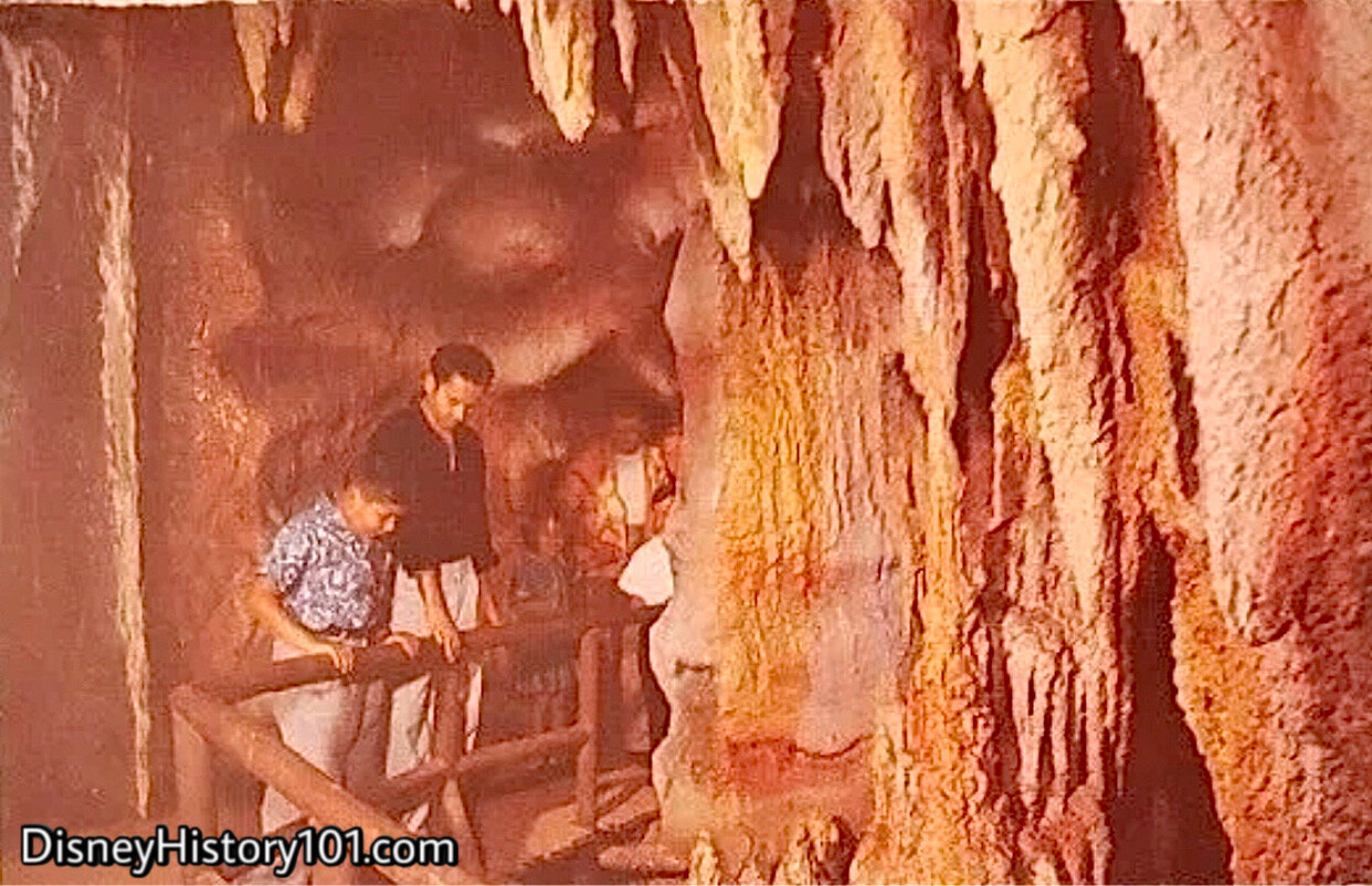
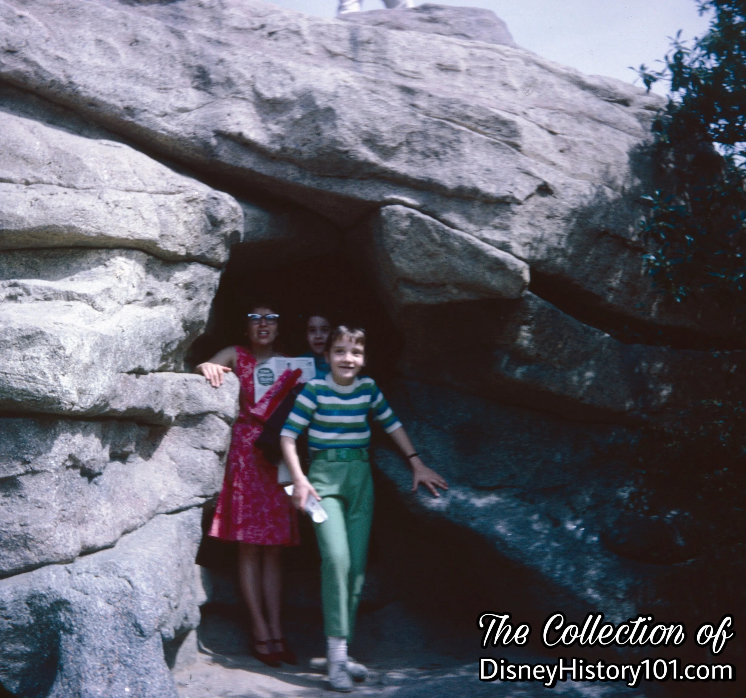
New adventures were added to Tom Sawyer Island during 1957. According to Disneyland Holiday magazine: “in new rock formations, several with interior caves, they can seek safe adventures in dark passageways and dungeon-like enclosures.” The “Disneyland Dictionary” (printed October 1959) briefly mentions “Injun Joe's Cave” calling it “a romantic interpretation of the cave in the Tom Sawyer story.”
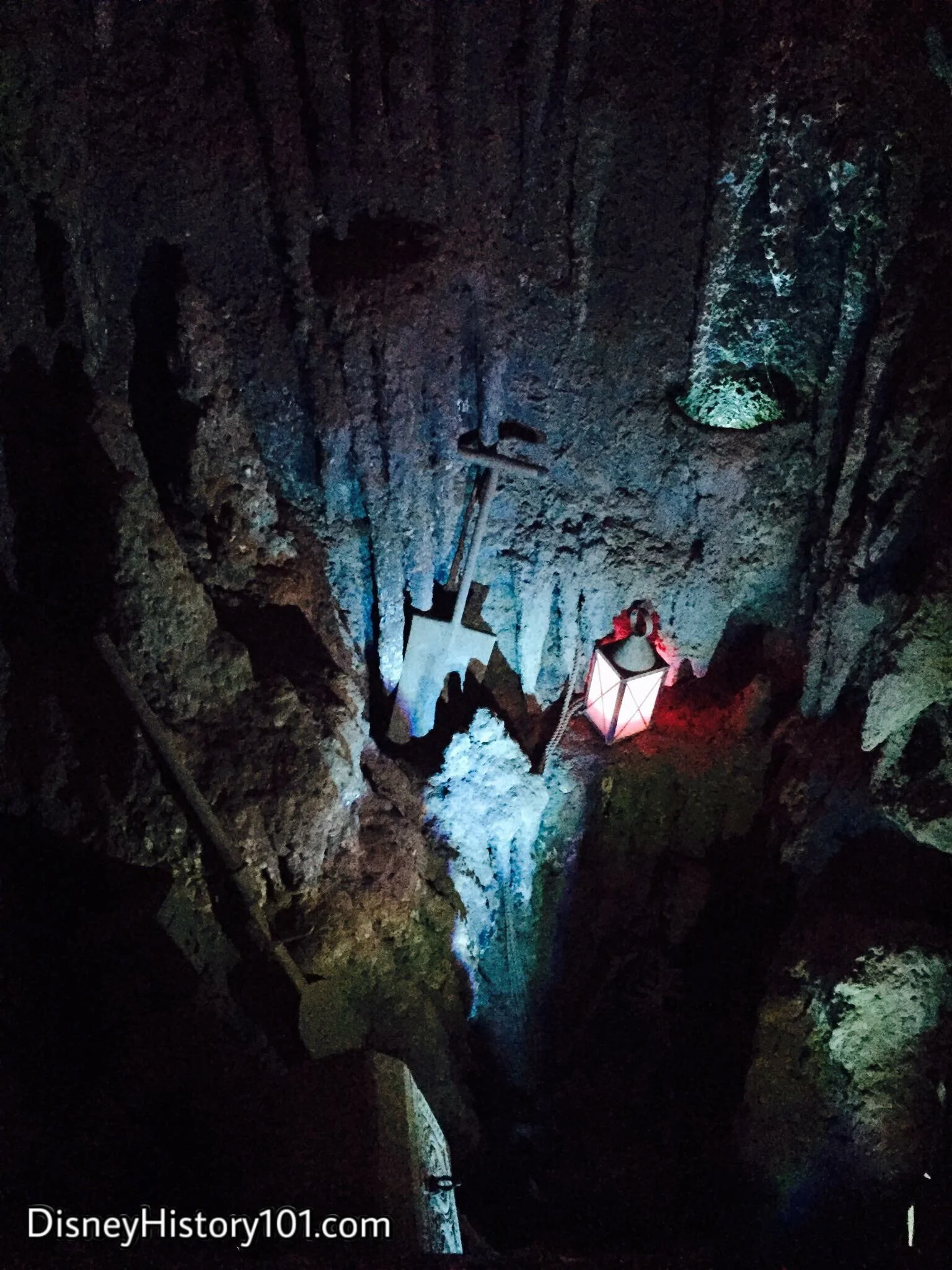
According to Walt Disney (in “Frontierland”, published in True West magazine, June, 1958) : “Nearby is Injun Joe’s Cave, which harks back to the caves I used to explore in Hannibal. This cave is the real thing, too.” Before entering, Tom Sawyer has left a painted message for explorers: “Welcum! If’n you like dark caves, mystery mines, bottomless pits, shakey bridges ‘n big rocks, you have come to the best place I know. If’n you don’t like creepy old scary places don’t worry… Huck Finn an myself wuz plenty scared too. Huck wuz more scared than me.” Behind the sign, guests entered through “Tom’s Secret Passage,” which was identified by the painted whitewash words on one rock face. Amidst the glistening (and “dripping”) stalactites, stalagmites, and (seahorse and fish) fossil-covered walls, you’ll explore the labyrinth of caverns where Tom Sawyer and Becky Thatcher wrote their name in smoke. Crawl through passages, and perhaps you’ll find the location where Injun Joe hid his treasure “under the cross”. If you listen real closely, some still claim to hear the mournful sound of old Injun crying out from the subterranean depths of the Bottomless Pit! Others believe that apparitions of pirates guard a hidden treasure of jewels in this former lair, while others believe its just the ever-present moaning of the wind. One way or another, you’ll still want to tread carefully wandering around Injun Joe’s Cave! Art Linkletter once said about Injun Joe’s Cavern : “you quake with…dread - but it is fear without danger”.
Entrance to Injun Joe's Cave, (1963)
This view impresses the fact that Tom’s Tree House was originally one of the highest points in Disneyland. Below, lays the entrance to the deepest depths of Disneyland - the mysterious cavern known as Injun Joe’s Cave!

Entrance to Injun Joe's Cave
Bottomless Pit Disneyland Postcard Image
This rare souvenir postcard image provides us with a colorful “Vintage View” of another feature (usually left off maps of Tom Sawyer Island) - Bottomless Pit inside Injun Joe’s Cavern!
“There are thousands of caves in America - many of them unexplored - even today. Here is a labyrinth of secret tunnels, colorful strata and curious fossils…a hiding place for buried treasure…where glistening stalactites and stalagmites form fantastic shapes…sounds sometimes echo thru the silent rooms.”
The character lighting of Injun Joe's Cavern.
Some say that pirates treasure was hidden somewhere below. But look out for Injun Joe! Can you feel the “cold air blowing from some unknown source?”
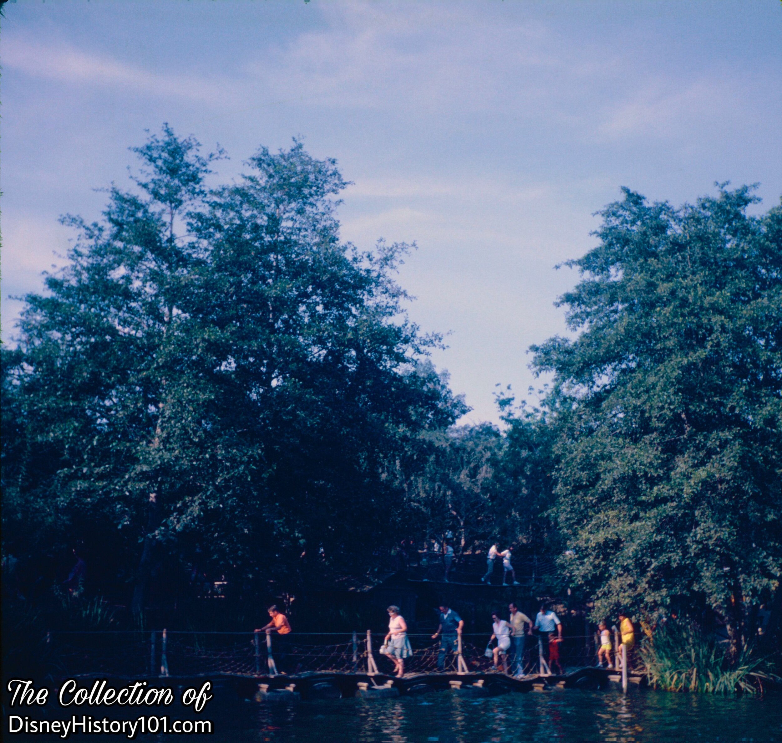
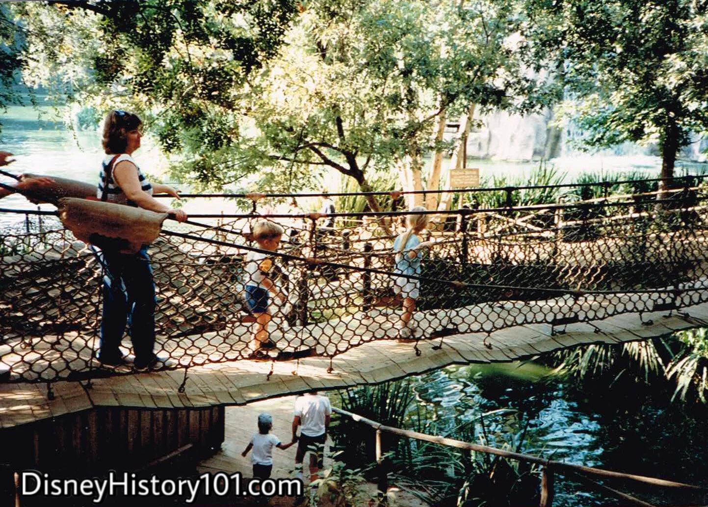
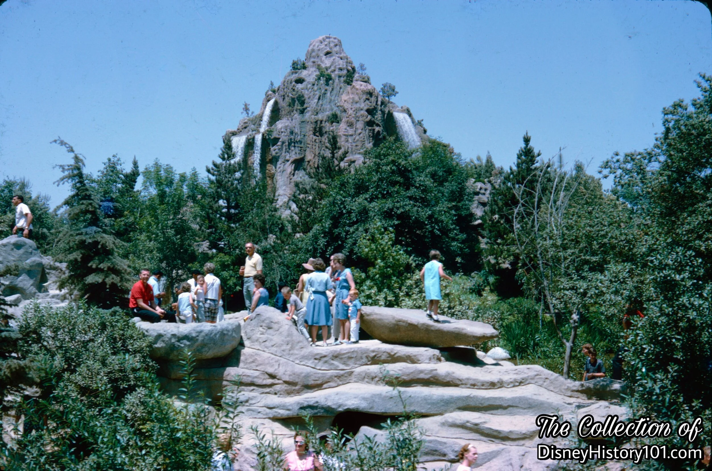
Below the headwaters emerging from an old oak (one of which empties into Smuggler’s Cove), the “Barrel Bridge” (like the Suspension Bridge, rock formations, and the caves) was an addition to Tom Sawyer Island during 1957. The “Disneyland Dictionary” (October 1959) made brief mention of the “floating bridge… made of barrels and planks.”
Today, the Pontoon Bridge carries explorers over mysterious waters where “plundered coin lies below in the hold of scuttled ships”.

Pontoon Bridge, (May, 1959)
“Once you’ve got the swing of it, you might try the Suspension Bridge above.”
Pontoon Bridge, (c. July, 1967)
John Yarber of Disneyland Maintenance “recounted a humorous incident from the early days on Tom Sawyer Island. ‘We had a pontoon bridge that kept breaking up, because we were just learning back then. Well, Charlie Nichols came over with his camera to get a picture of a bunch of kids on the bridge..so that we could see what was going wrong. Just while he was setting up, the bridge fell down and Charlie missed the picture. He was so mad, he picked up his gear and left!’”

Top : Pontoon Bridge, (October, 1968)
Pontoon Bridge
The Pontoon Bridge offered a quick route across Smuggler’s Cove. Just watch your footing, as watery currents cause the barrel pontoons to bob up and down!
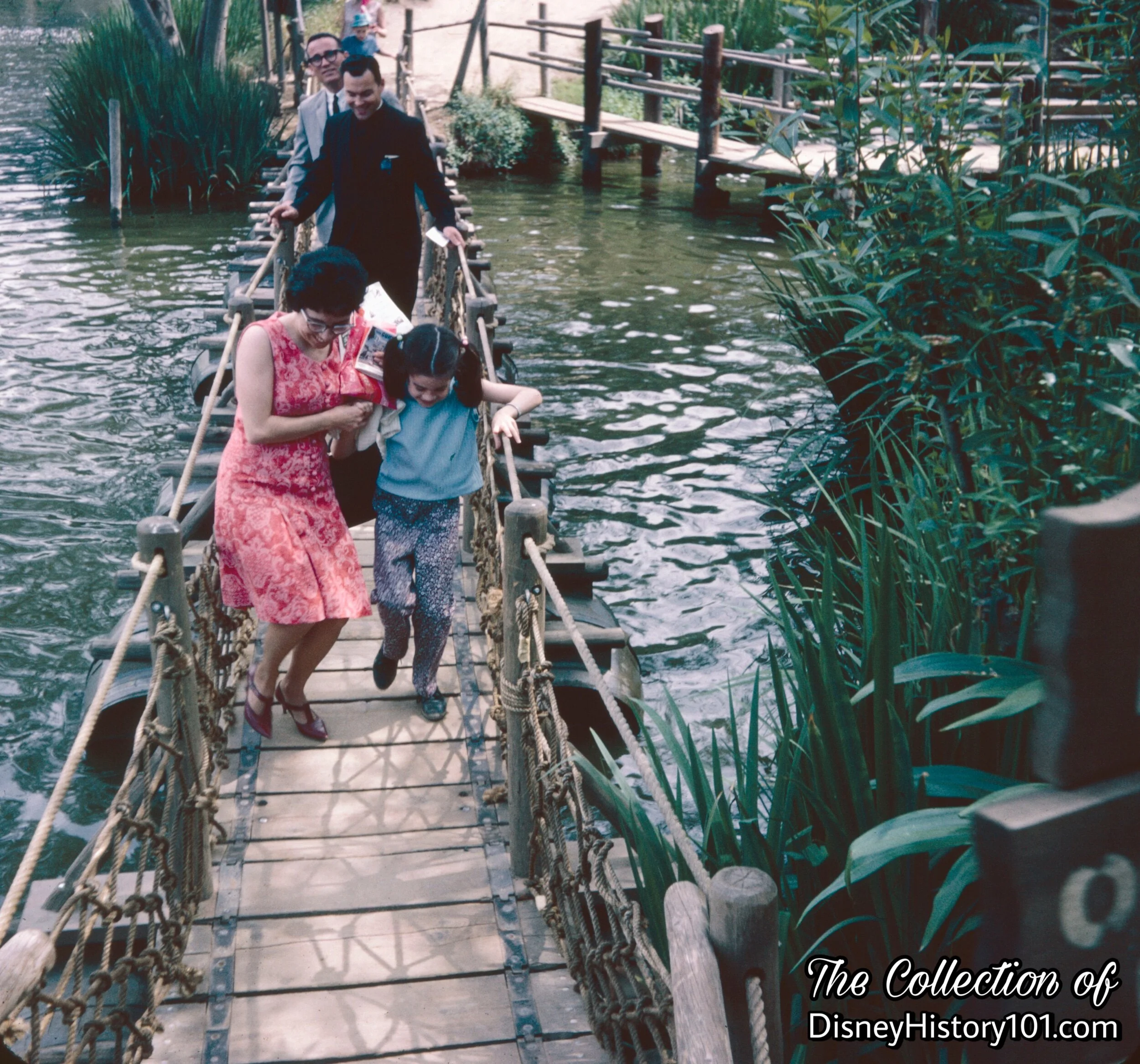
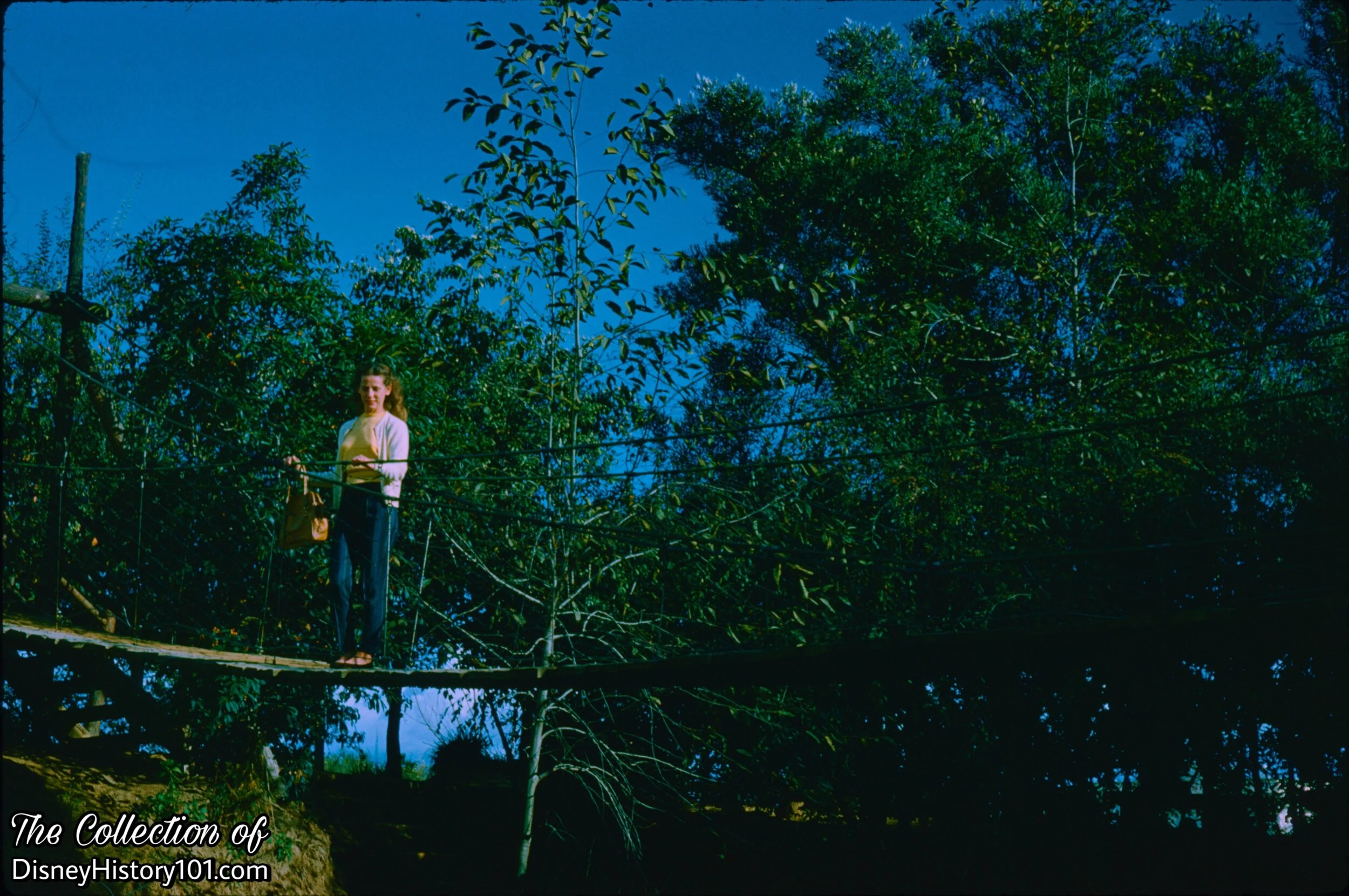
The Suspension Bridge (like the Barrel Bridge, rock formations, and the caves) was an addition to Tom Sawyer Island during 1957. The “Disneyland Dictionary” (October 1959) makes brief mention of the “Bridge of wood” which “hangs from steel cable and suspends over ‘Smugglers’ Cove.’” It’s only a bounce and a sway across, as the Suspension Bridge gives us a bird’s eye view of the Pontoon Bridge below. According to Walt Disney (in “Frontierland”, published in True West, June of 1958) : “There’s a Suspension Bridge over Smuggler’s Cove, which the kids love to rock to see if it will come down. It won’t.”
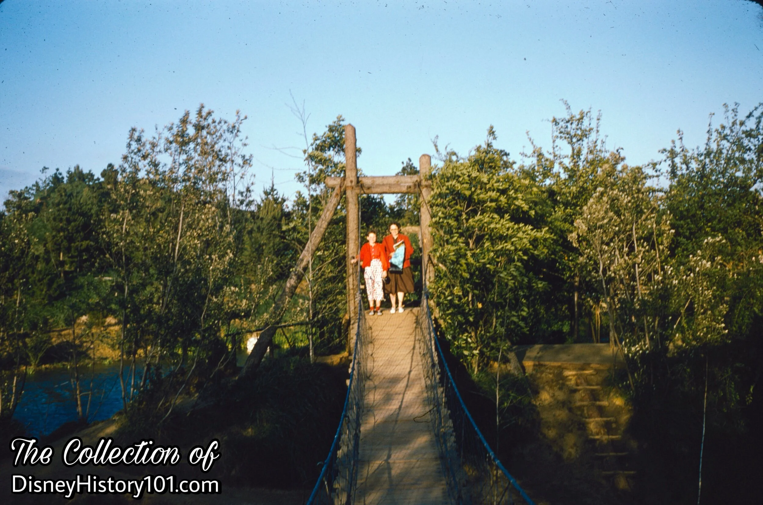
Suspension Bridge

Suspension Bridge, (May, 1957)
Suspension Bridge, (December 2, 1960)

Suspension Bridge, (November, 1960)

Suspension Bridge

Suspension Bridge


Suspension Bridge and Pontoon Bridge, (August, 1965)
The Suspension Bridge gives explorer’s a bird’s eye view of Smuggler’s Cove and Pontoon Bridge below.
Suspension Bridge

Suspension Bridge
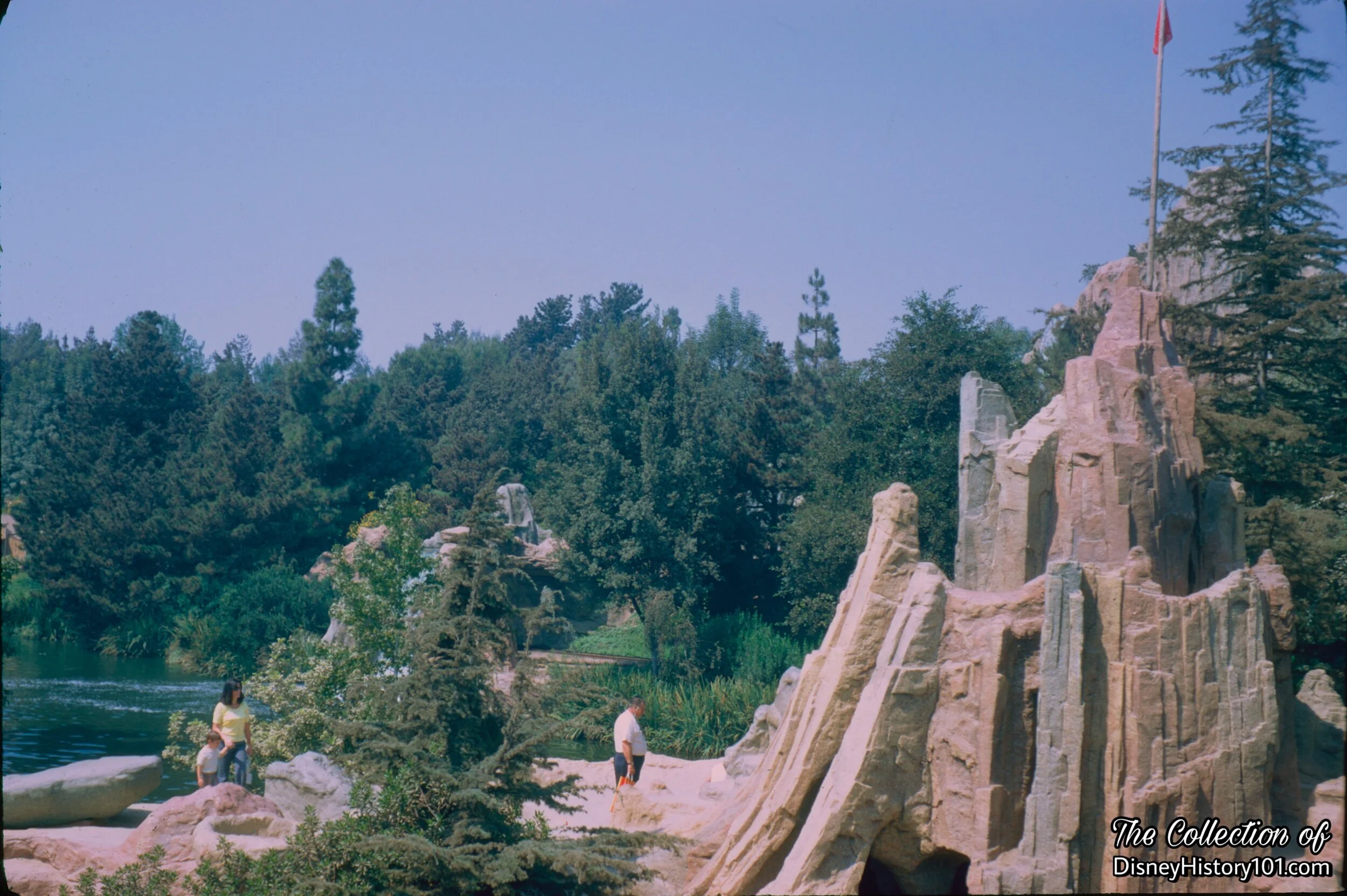
The “Disneyland Dictionary” (printed October 1959) briefly mentions the construction of the “group of rocks (made at Disneyland of plastics) for children to climb on and play in.” Guests could get the drop on pirates passing unsuspectingly below, while perfectly hidden high atop this perch!
Ambush Rock, (1967)
Ambush Rock jettisons out, allowing explorers to lie in Ambush as unsuspecting friends pass below.

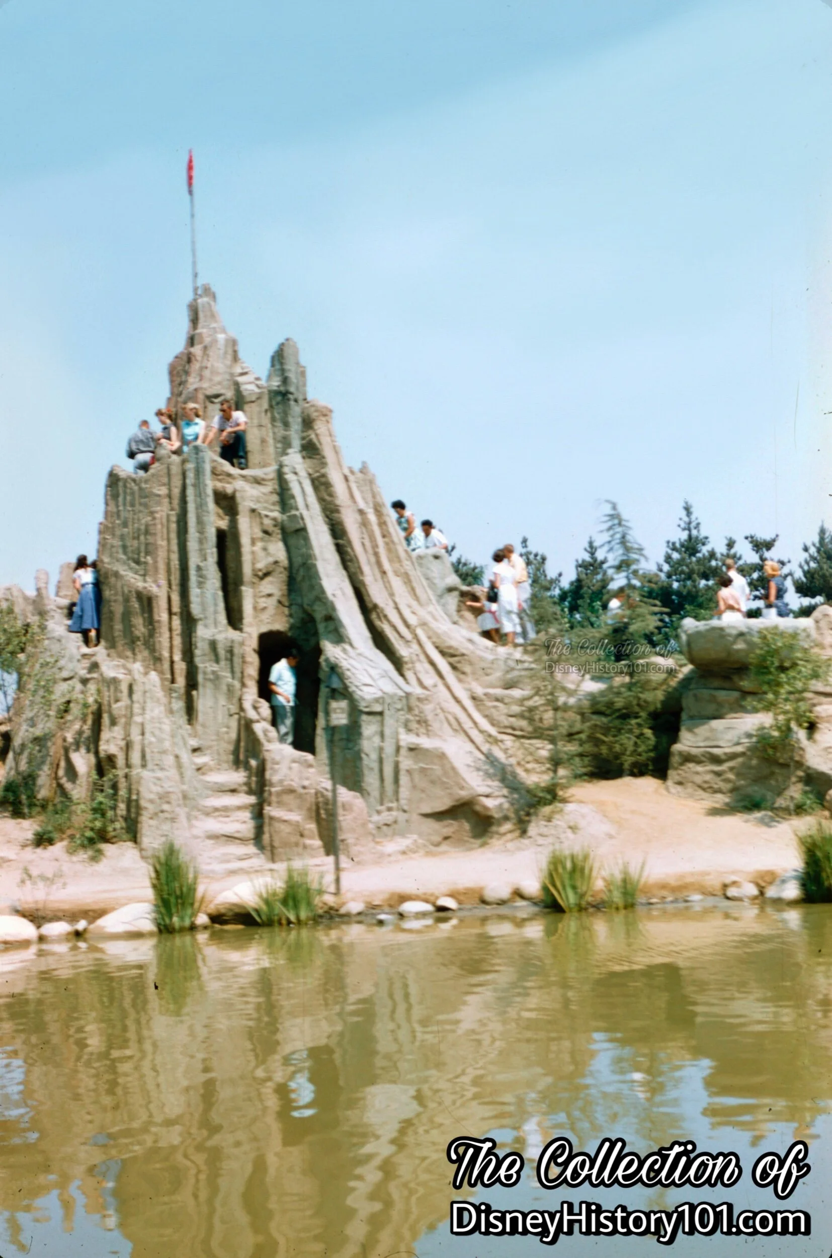
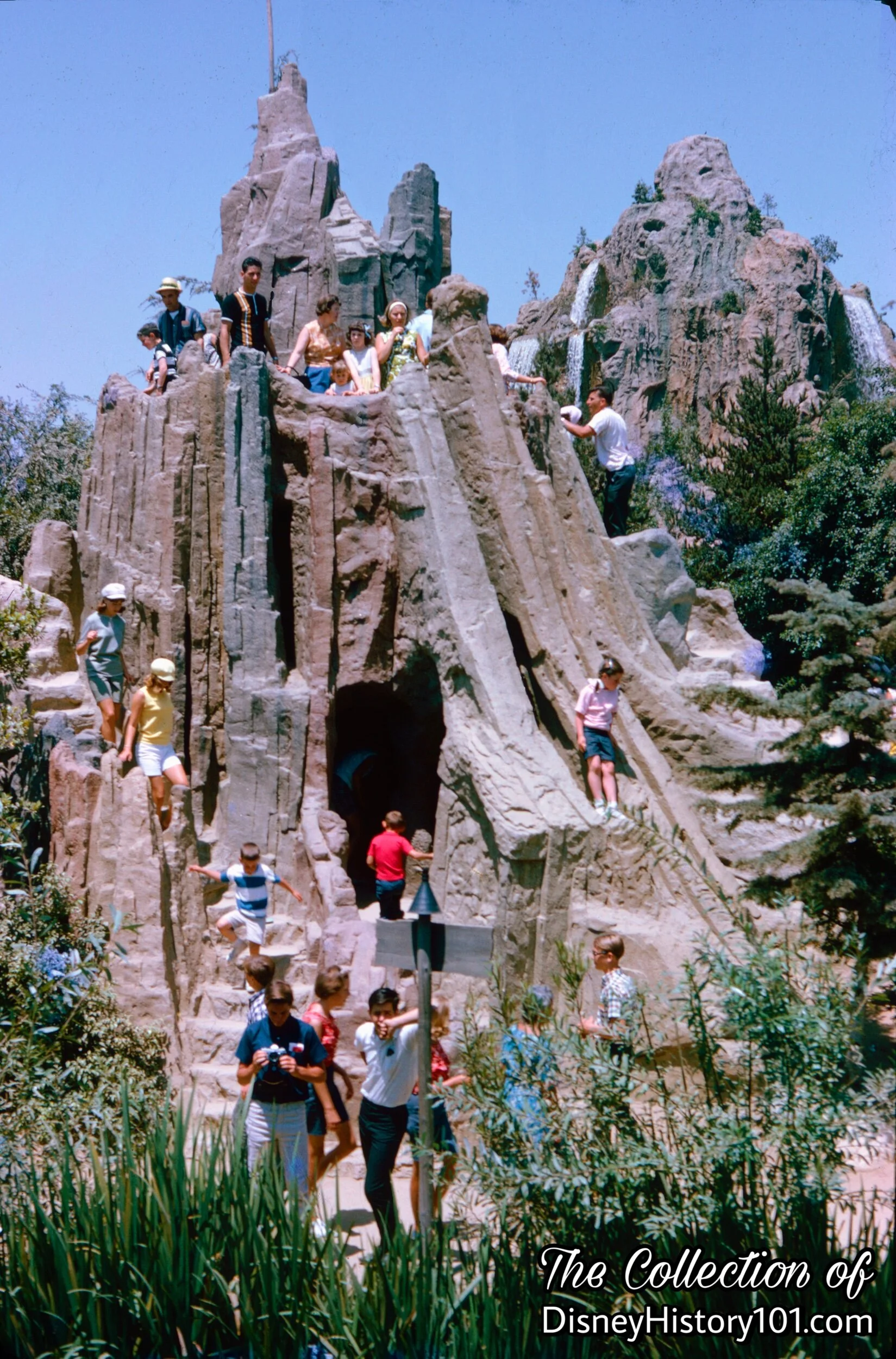
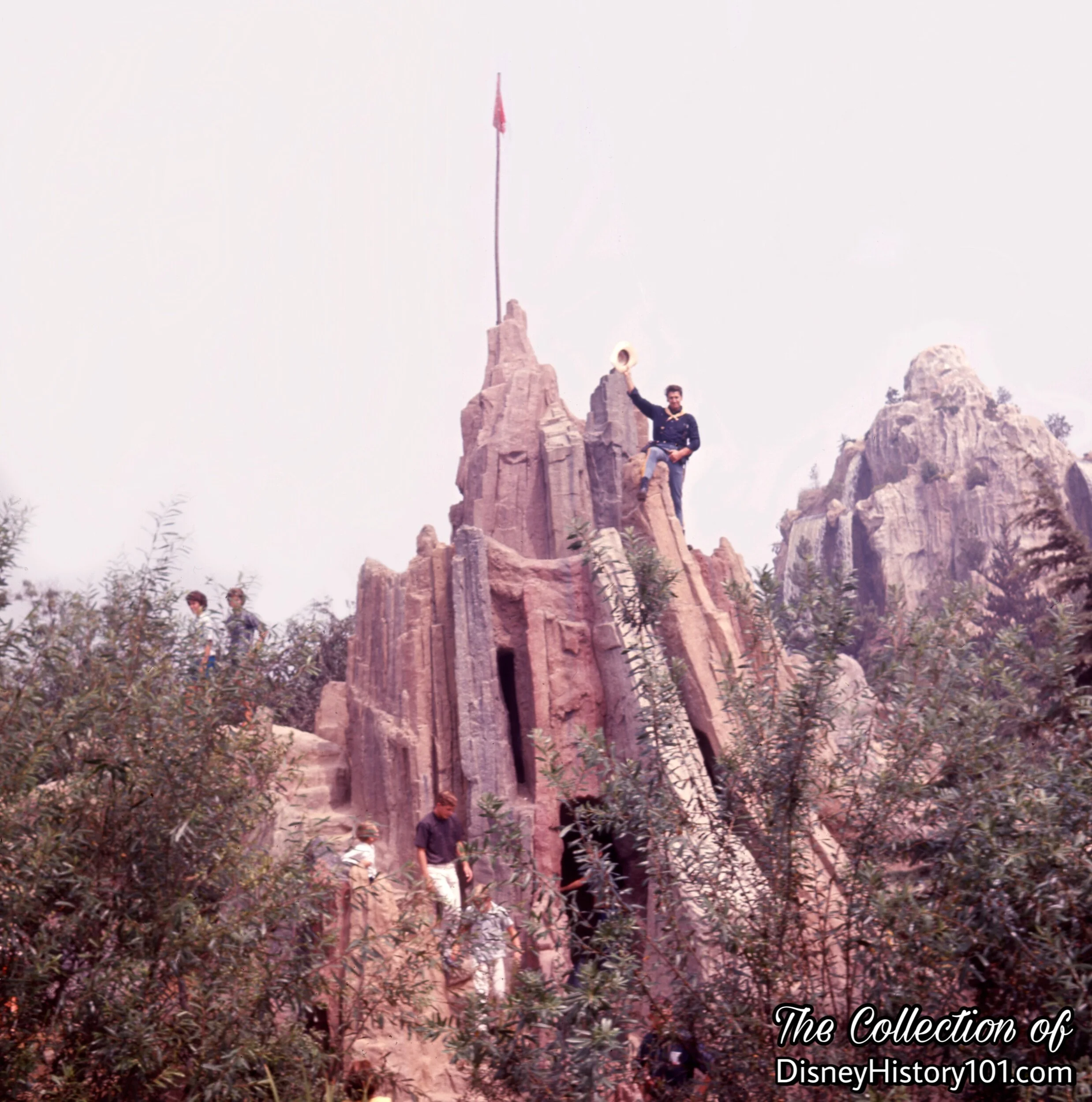
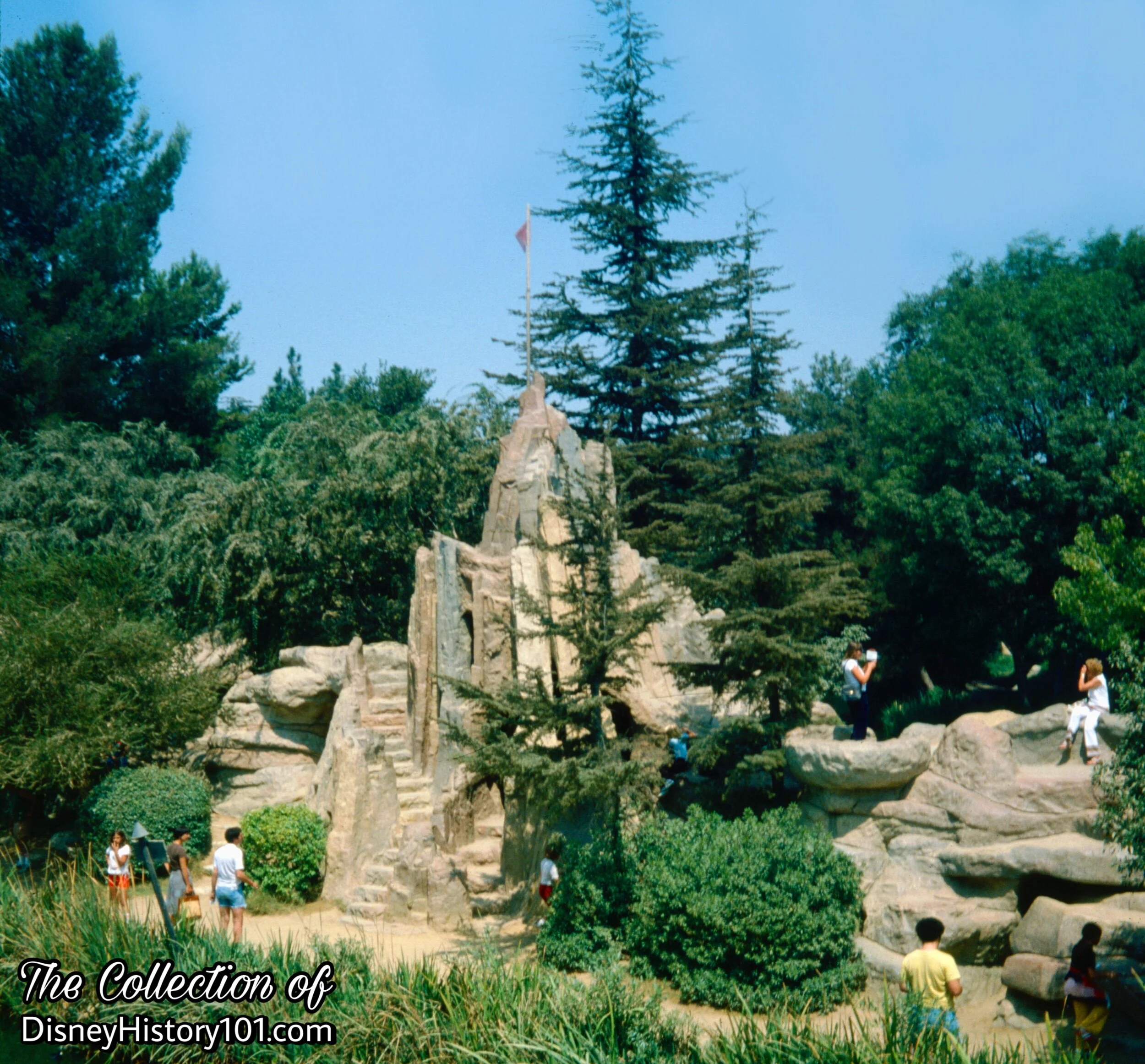
(1957 - 2002)
“Climb the stone steps to the ramparts of romantic Castle Rock high above the river… descend the spiral steps to the depths of the castle.”
-Disneyland map, 1957.
A “complete revision” of Tom Sawyer Island would be unveiled during 1957. One Associated Press article “Plan Trip Into Drop of Water, Liberty Square for Disneyland” (by Bob Thomas, published April 20, 1957) briefly divulged the big project. Upon being invited to Walt Disney Studio, Bob Thomas mentioned, “Walt gave me a preview of his ambitious plans at his Burbank studios. He showed models and sketches…plans call for… a rock mountain on Tom Sawyer Island where kids can climb through mazes, etc.”
Yes, once below, Guests of all ages explored a network of caves leading to various parts of the island! According to Walt Disney : “On the isthmus of the island is a weird formation of rocks which the kids of all ages seem to enjoy climbing on. There’s a merry-go-round rock, a teeter-totter rock and a Castle Rock Ridge with a maze leading to the Dungeon of No Escape”, [from the article “Frontierland”, published True West magazine, June of 1958].
The “Disneyland Dictionary” (printed October 1959) briefly mentions the construction of the “group of rocks (made at Disneyland of plastics) for children to climb on and play in.” Among these is listed “Castle Rock” and “Pirates Cave.”
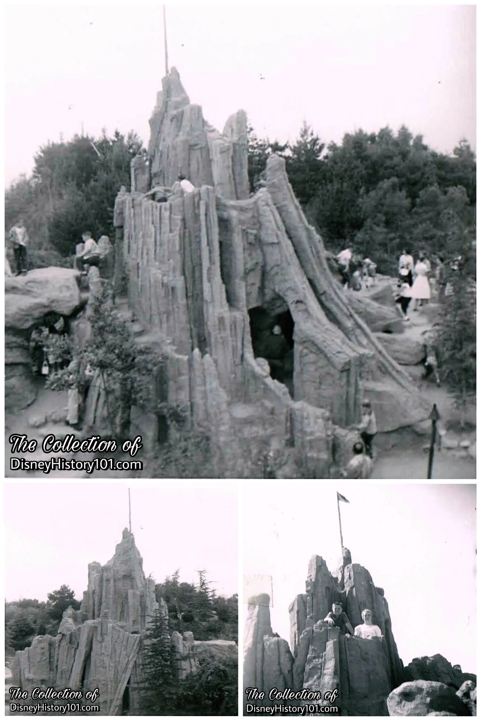
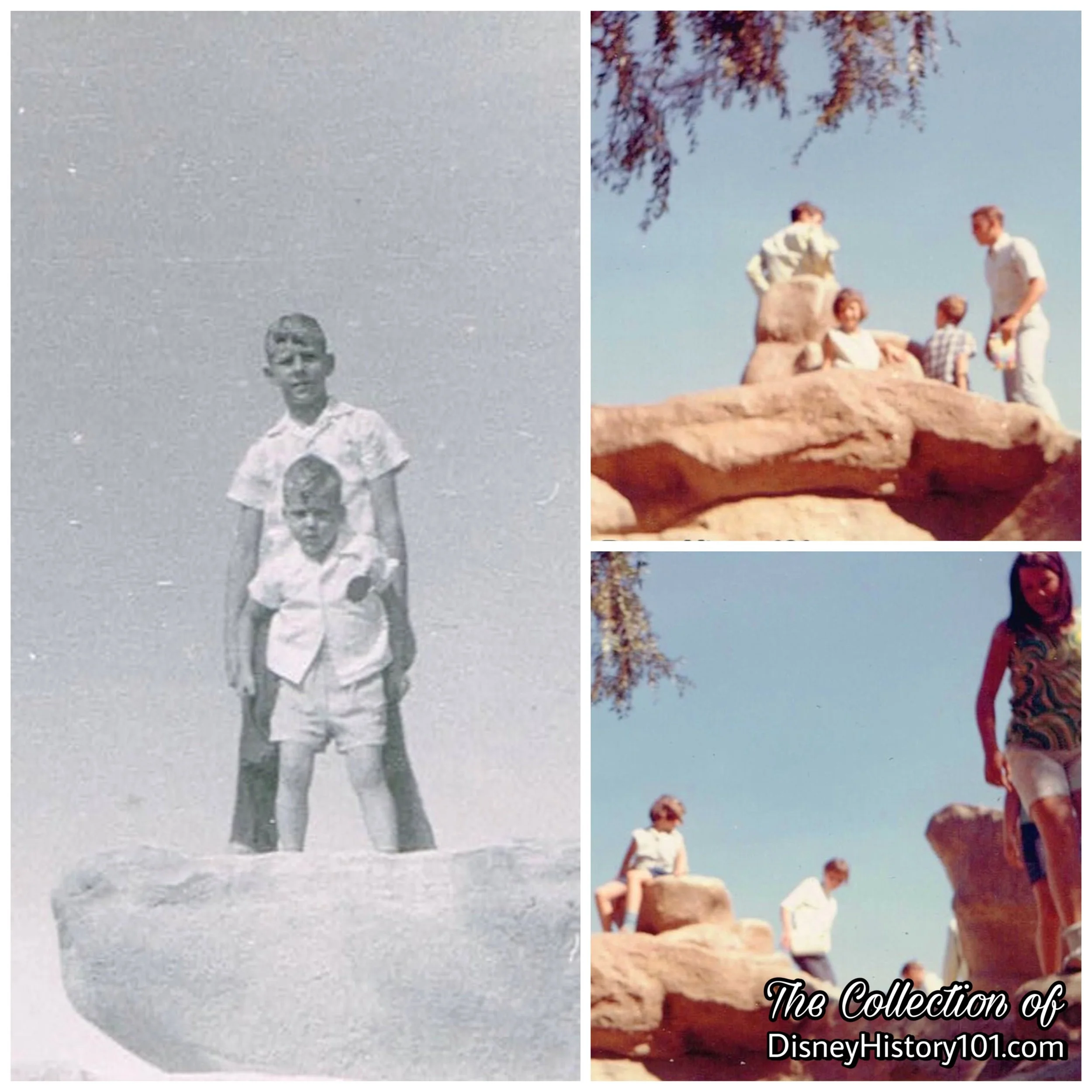
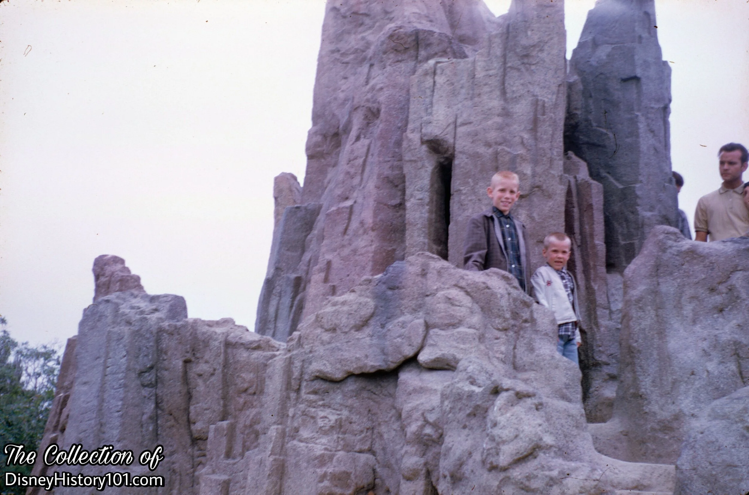
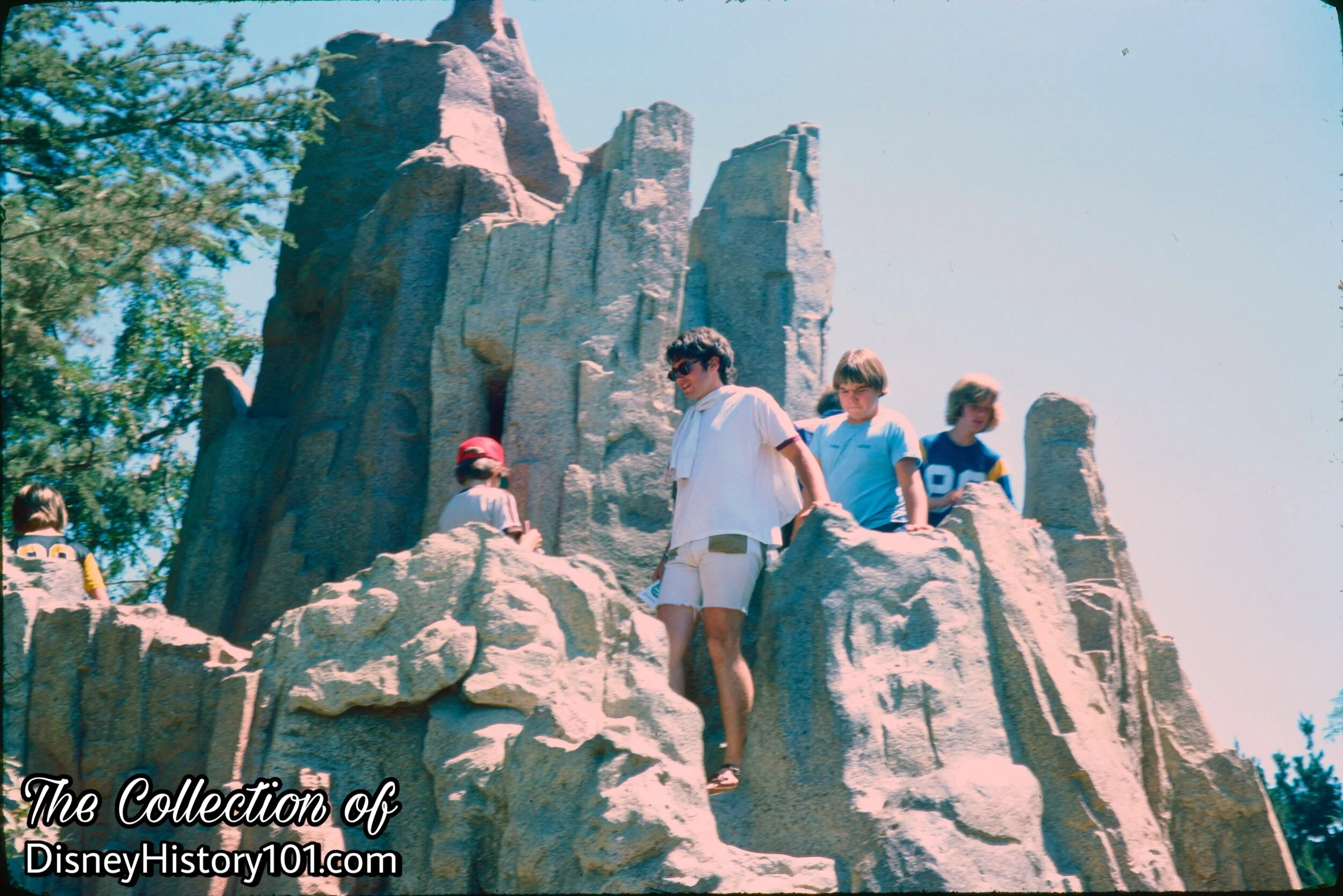
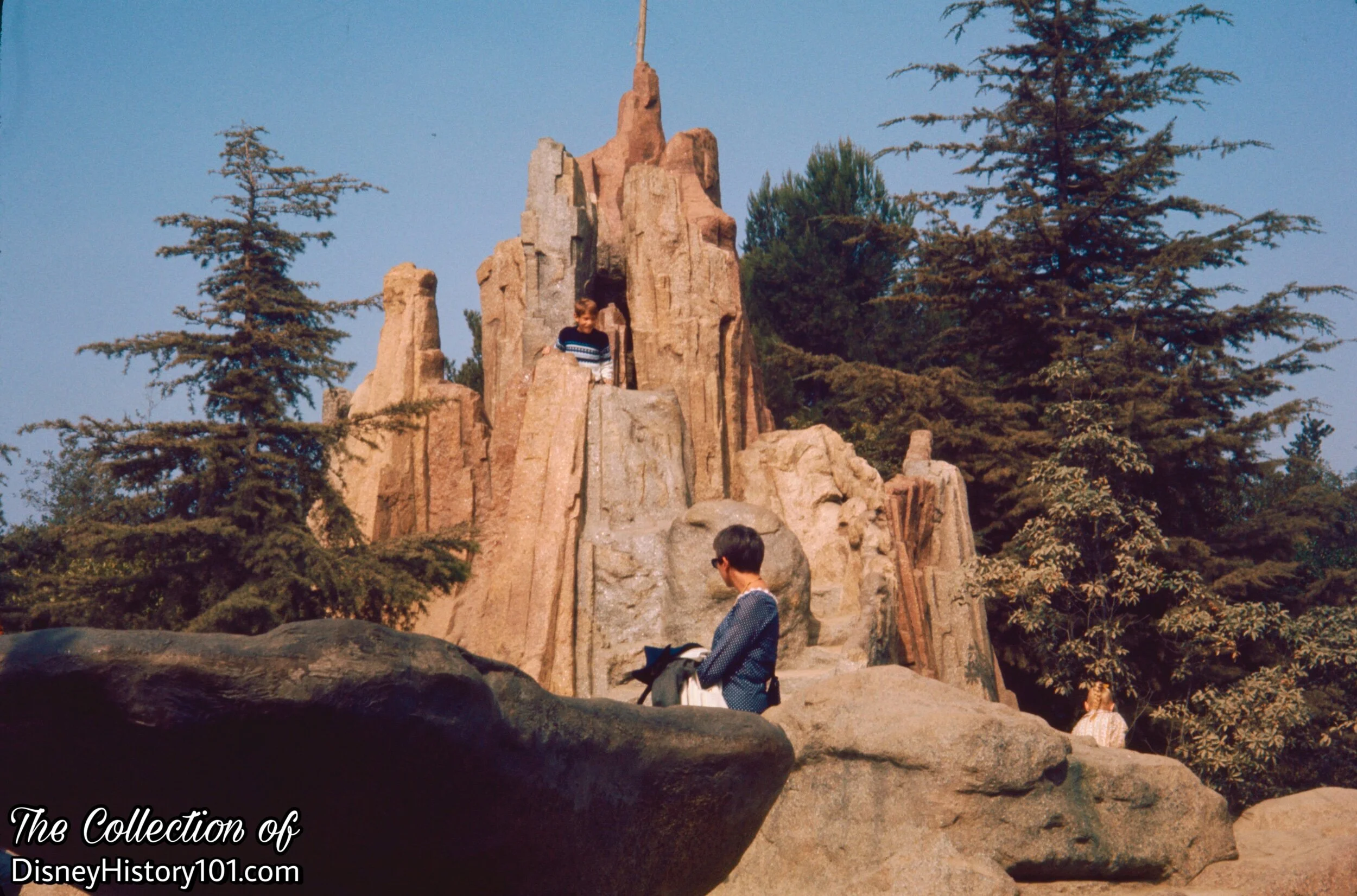
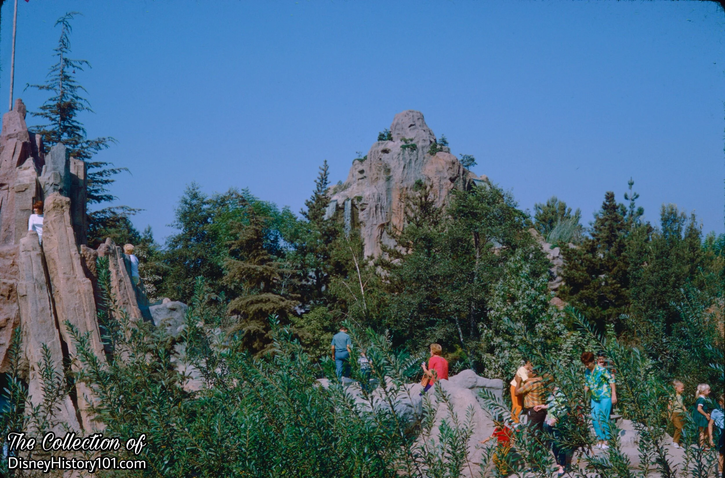
Castle Rock, (c. August, 1958-1959)
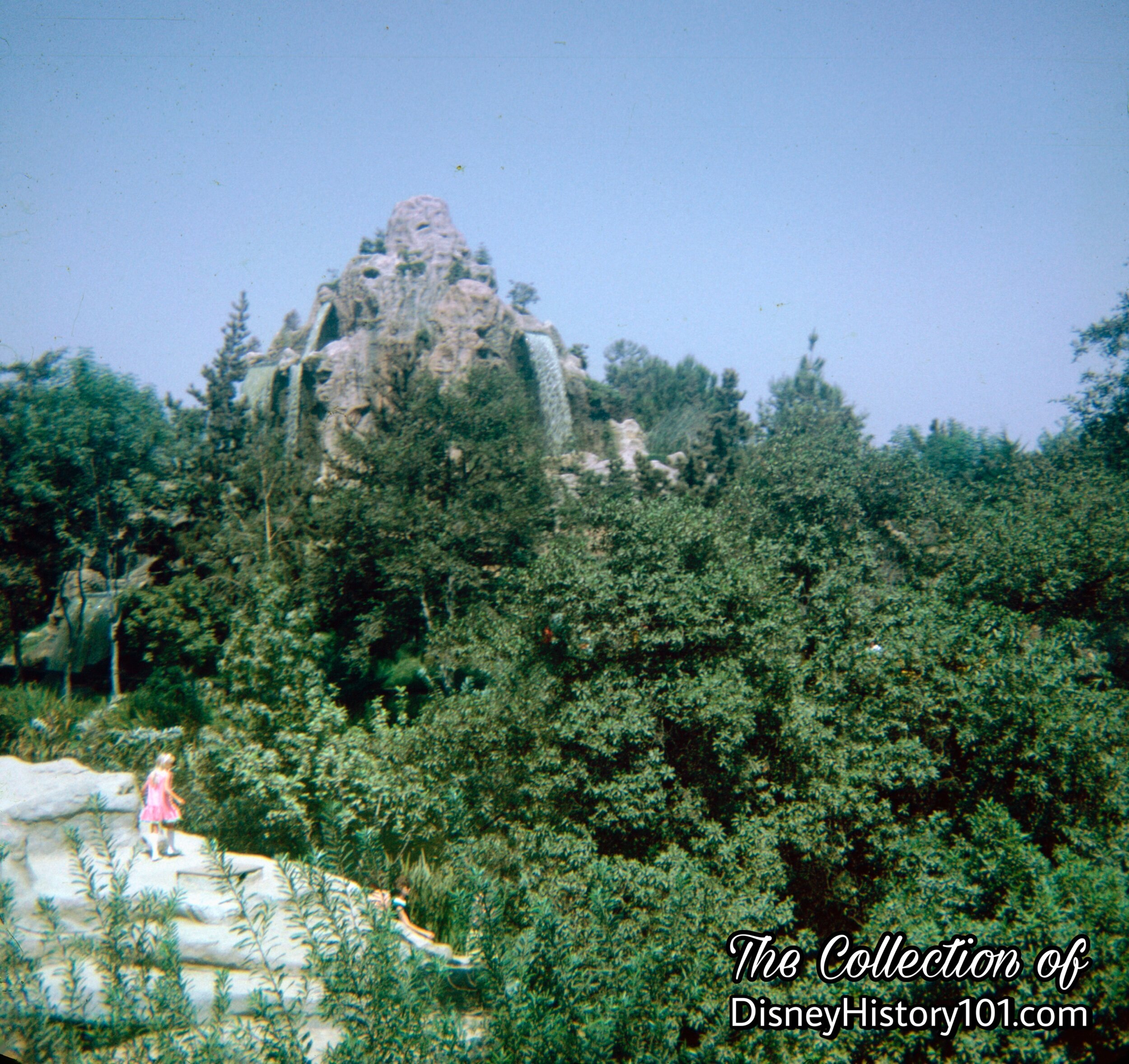
In the center of Tom Sawyer Island was a rocky citadel that gave one of the best vantage points from the island - Castle Rock! Castle Rock towered over the other rocks and trees on Tom Sawyer Island. Below Castle Rock is a labyrinth of interconnected caverns, which take guests on subterranean twists and turns.

Castle Rock
Castle Rock
Castle Rock, (June, 1962)
Castle Rock, (c. September, 1976)
Castle Rock, (October, 1968)

Castle Rock, (1969)
Both the young and “young at heart” continue to enjoy hiking to the top of Castle Rock!
Castle Rock, (October, 1959)
We imagine that the guest at the top of Castle Peak is attempting to get a better view of a chimpanzee climbing the Columbia’s rigging.

Castle Rock, (Winter, 1959)
Castle Rock, (c. March, 1974)
Castle Rock, (September, 1967)
From Castle Rock, you could clearly see one of the tallest mountains in Disneyland - Cascade Peak, on the other side of the Rivers of America!
Castle Rock, (September, 1970)


Castle Rock
Castle Rock

Once upon a time, Frontierland was home to a “natural wonder” - an entire canyon full of these “balancing rocks”! They would turn and spin, as mine train gondolas passed below. Guests could observe these “merry-go-round-rocks” up-close in just one location, on Tom Sawyer Island.
The “Disneyland Dictionary” (printed October 1959) briefly mentions the construction of the “group of rocks (made at Disneyland of plastics) for children to climb on and play in.” Among these is listed “Merry-go-round Rock.”

Merry-Go-Round Rock, (August, 1966)

Merry-go-round Rock and the Pirate's Den Below, (August, 1965)
Cave Exit beneath Merry-Go-Round Rock

There was also a time when an entire canyon full of these “balancing rocks” could be found amidst “nature’s wonderland”. Here, on Tom Sawyer Island, explorer’s will be able to examine at least one Teeter-Totter Rock (or, “Tettering Rock”) as it sits perfectly perched in the middle of the island!
(1965)

(c. August, 1962)
(1956 - c. 2007)
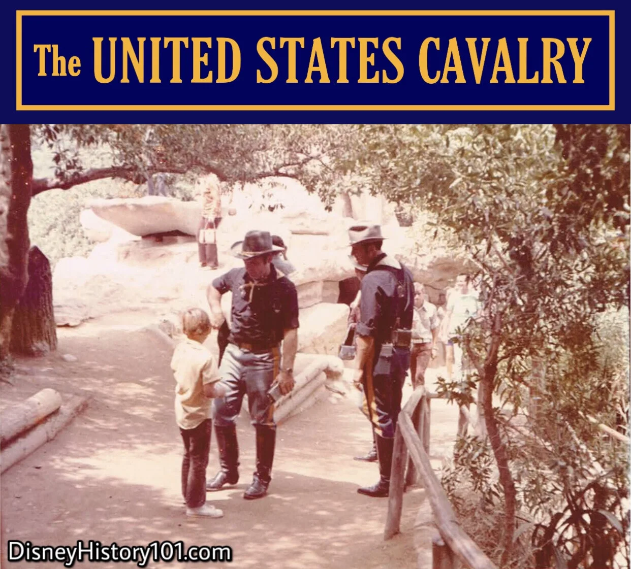
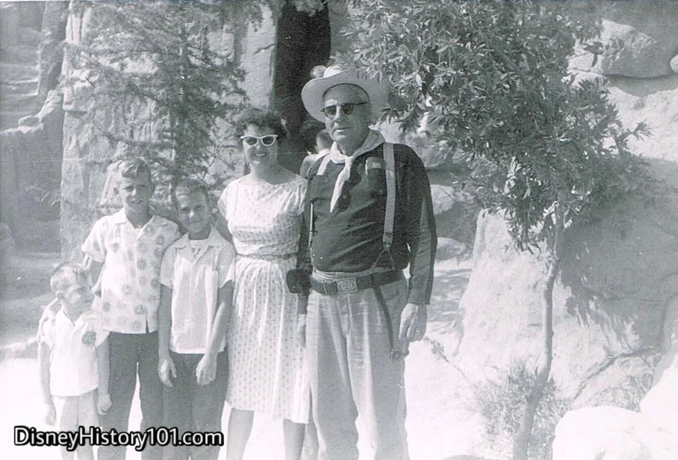
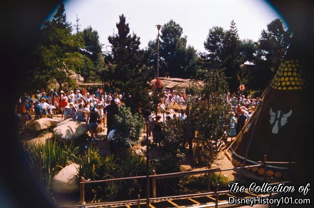
Near Teeter-Totter Rock we’ve run into a patrol of the United States Calvary. That means we must be nearing a settlement (or, Fort) of the United States Army. We’ll stop them, ask them for directions to the nearest fort, and perhaps see if we can take a photograph with them.
In actuality, these U.S. Cavalrymen were Disneyland Security Hosts, tasked with patrolling Tom Sawyer Island and keeping explorers safe! In addition, these Cast Members provided Atmosphere Entertainment complimenting the theme of the area and were staged to entertain Disneyland Guests on an immediate and personal level.
(Photo : 1972, September)

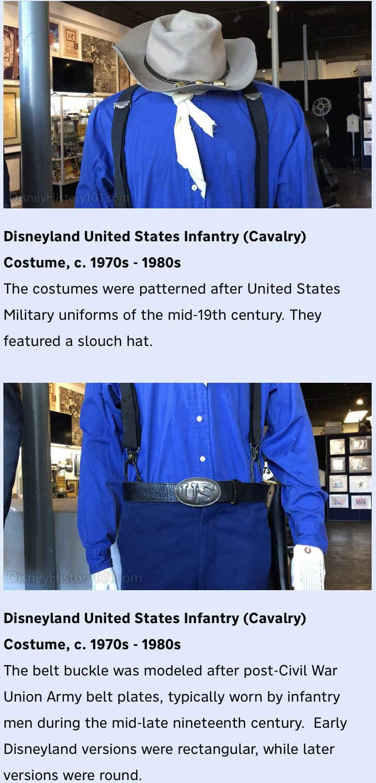
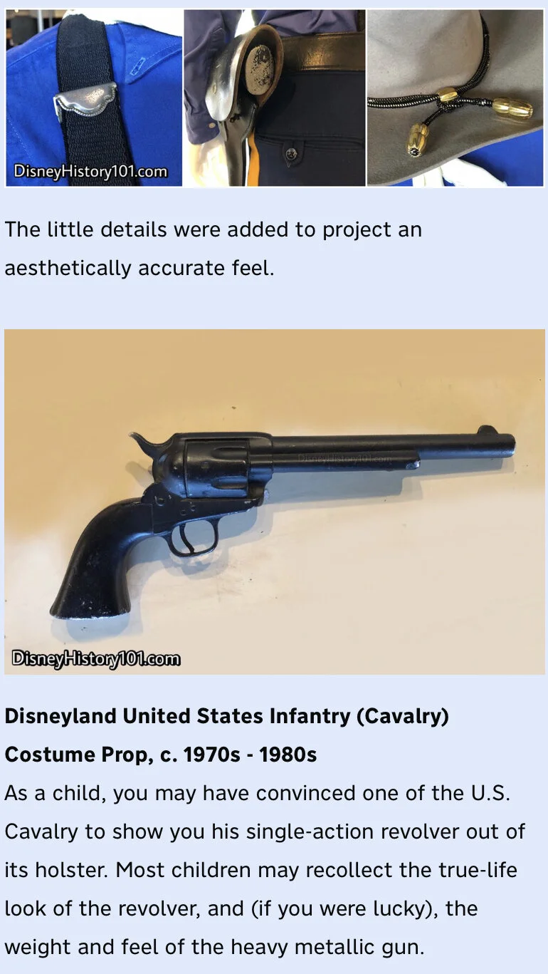
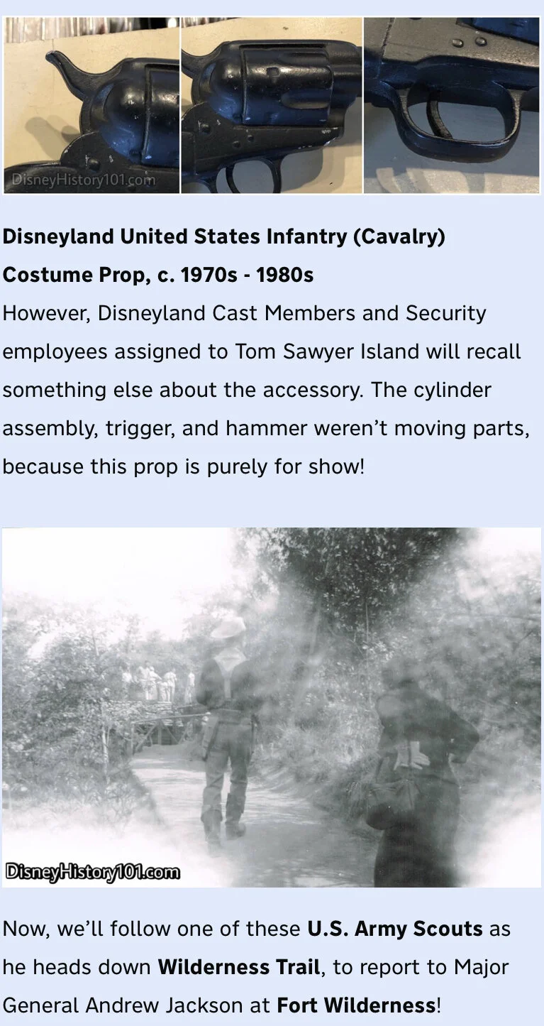
Disneyland United States Infantry (Cavalry) Costume, c. 1970s - 1980s
Our friends at Van Eaton Galleries offered us the rare opportunity to inspect one of those Entertainment Costuming Department Infantry Costumes up-close! It’s a rare treat to find one of these unique Disneyland Security uniforms complete, and together.

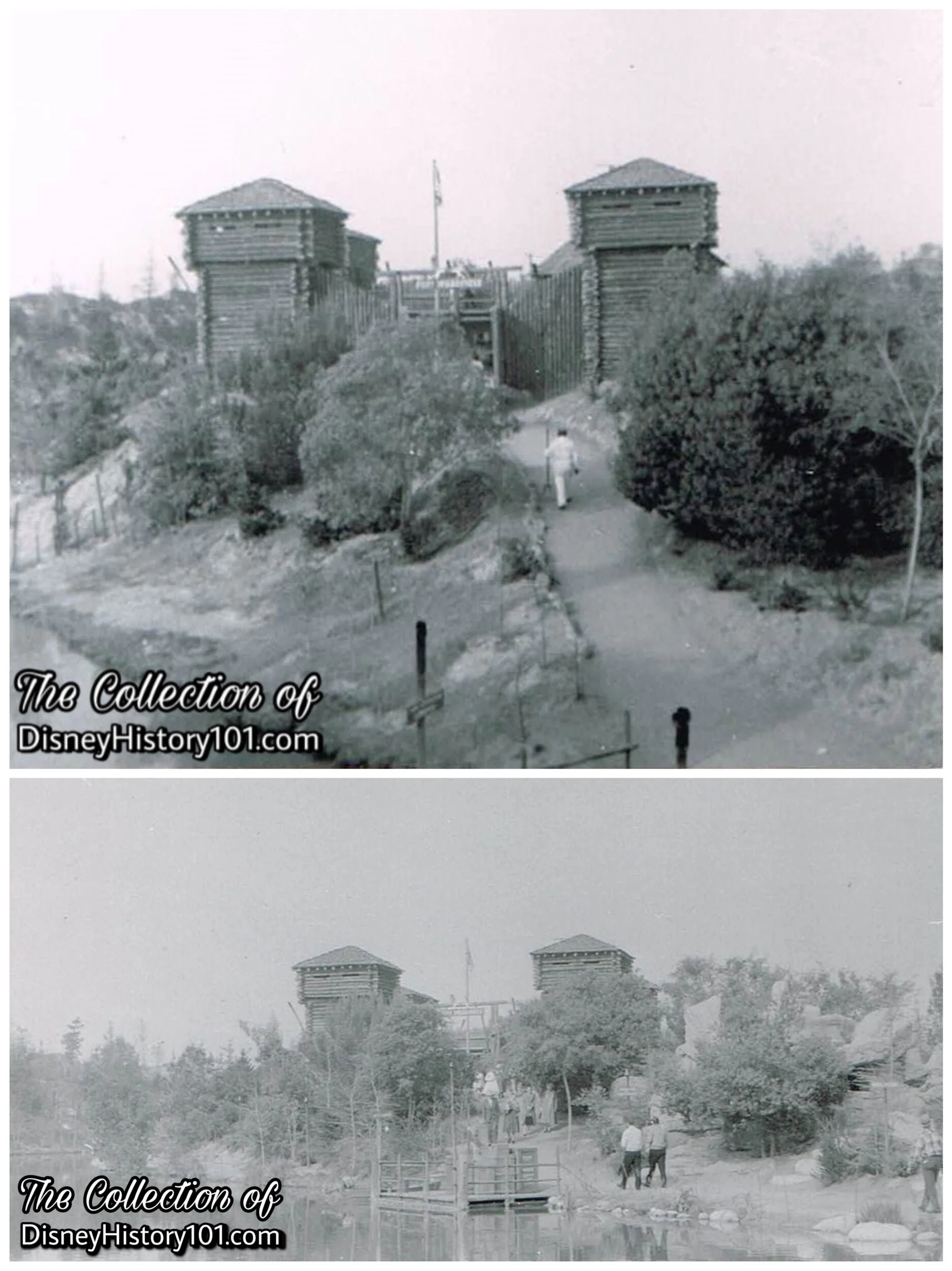
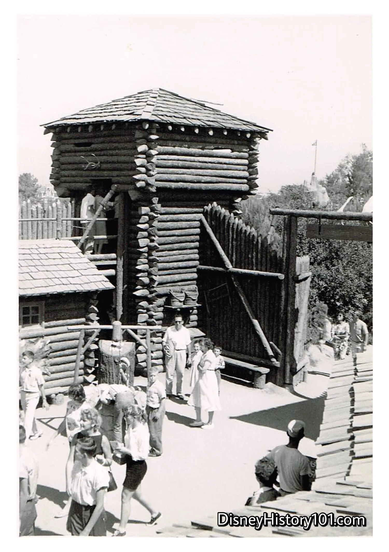
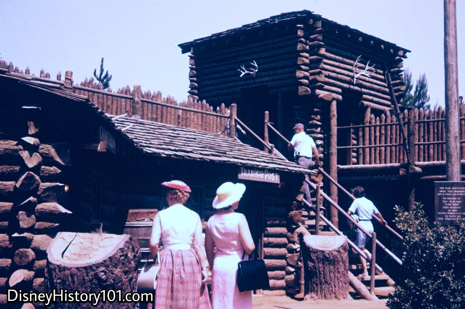
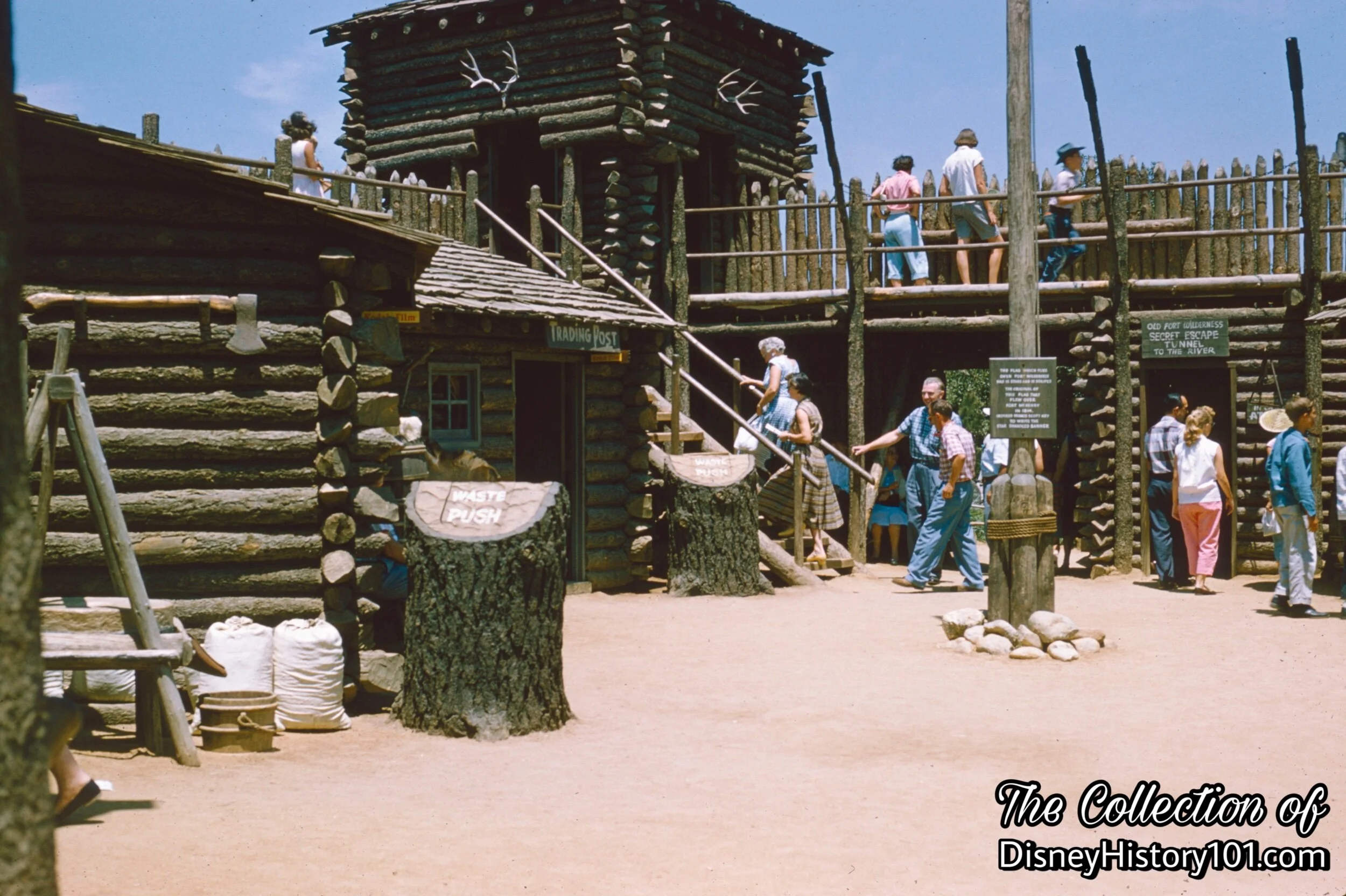
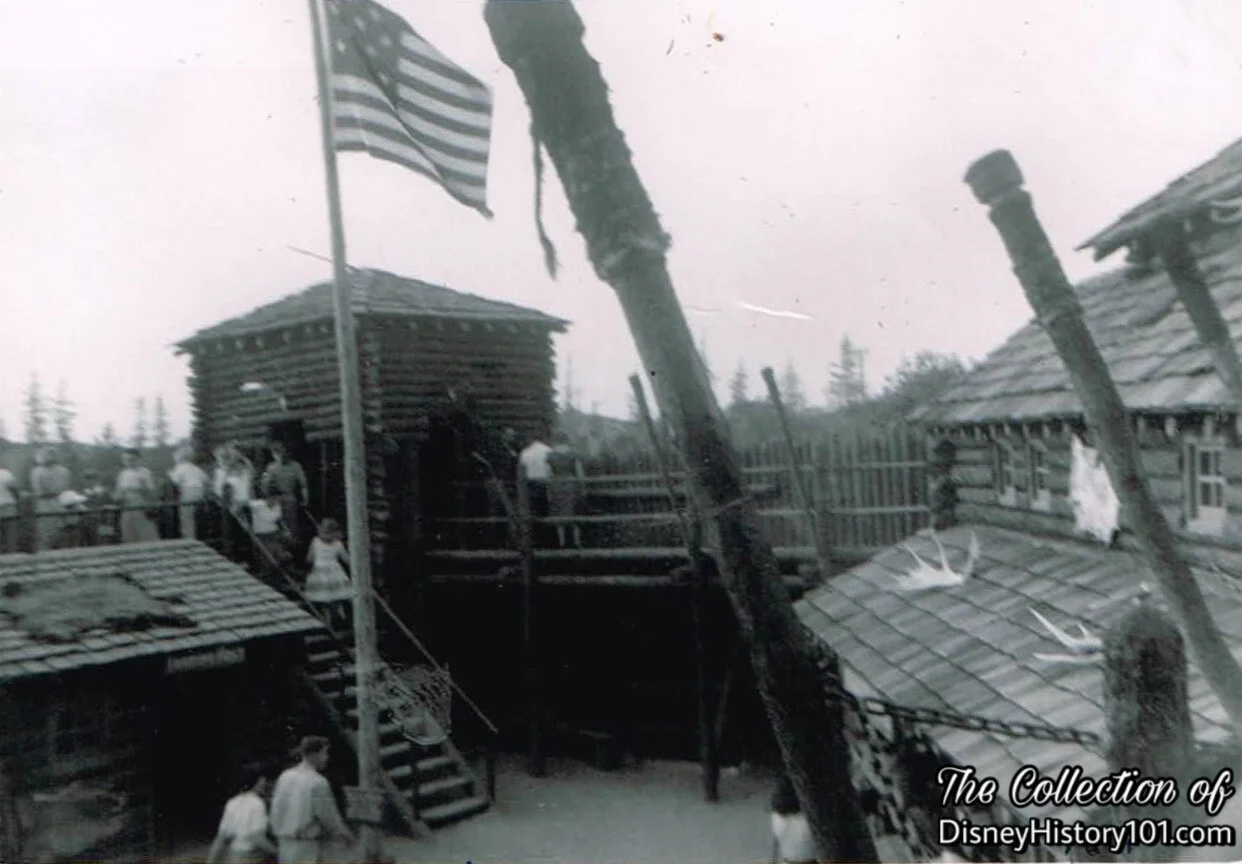
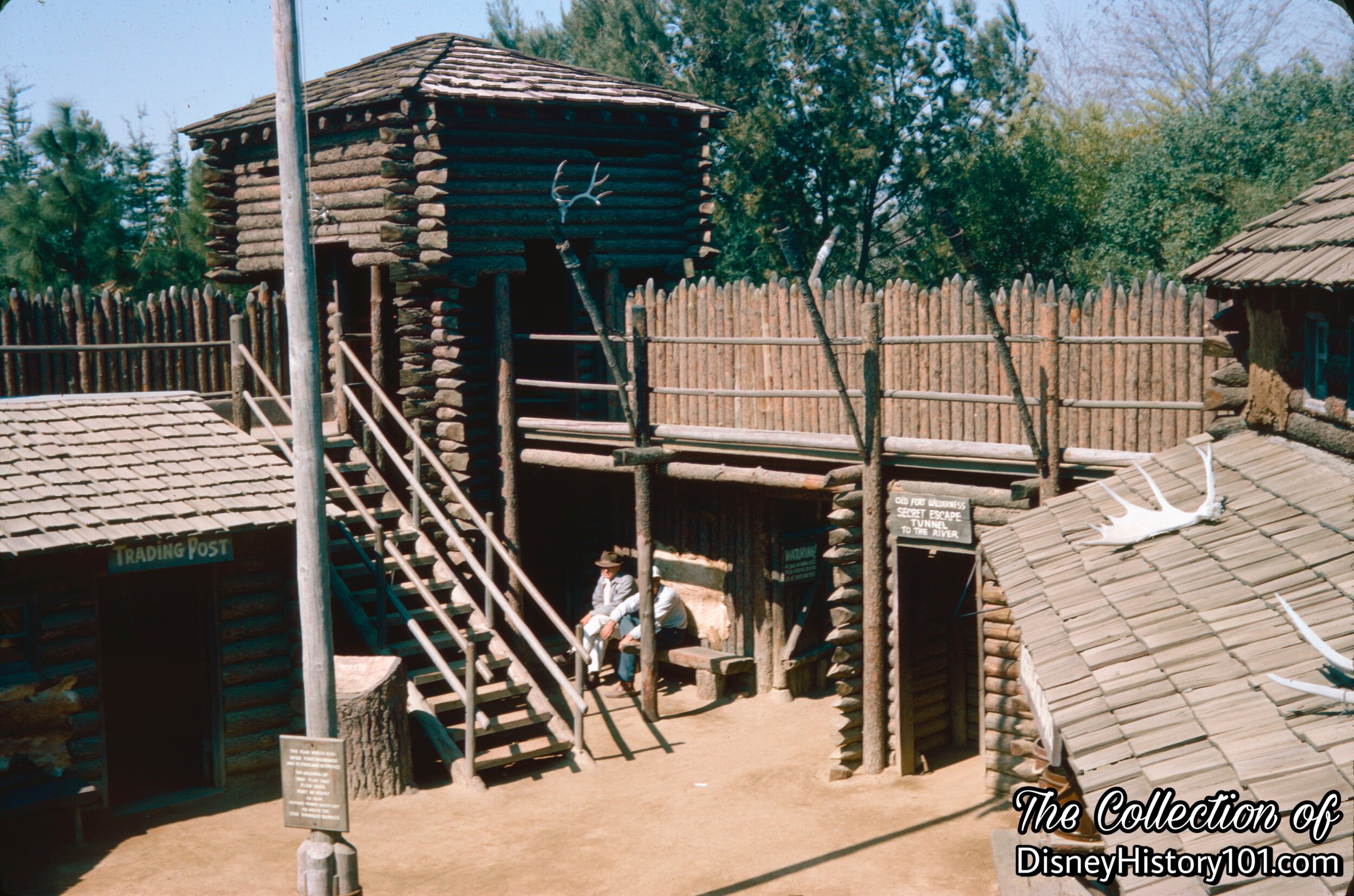
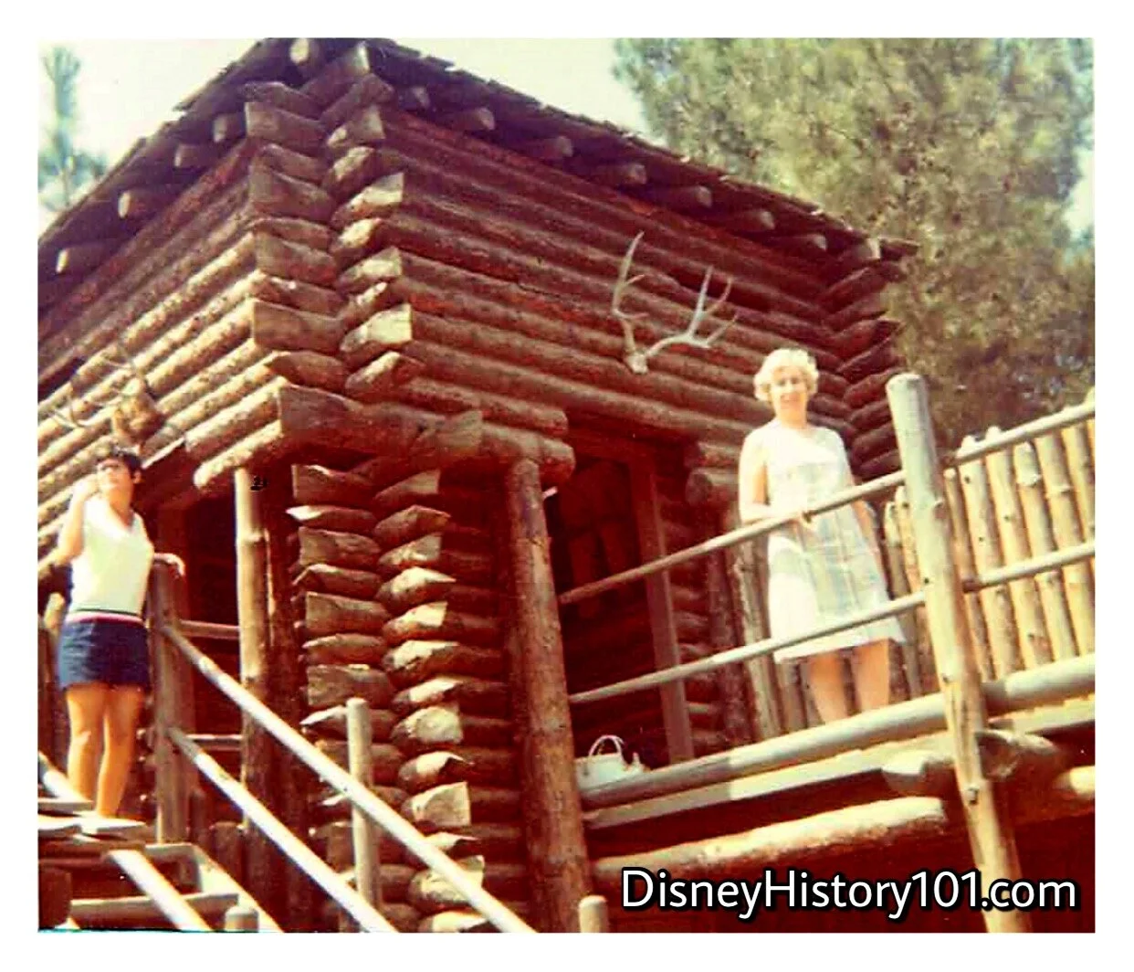
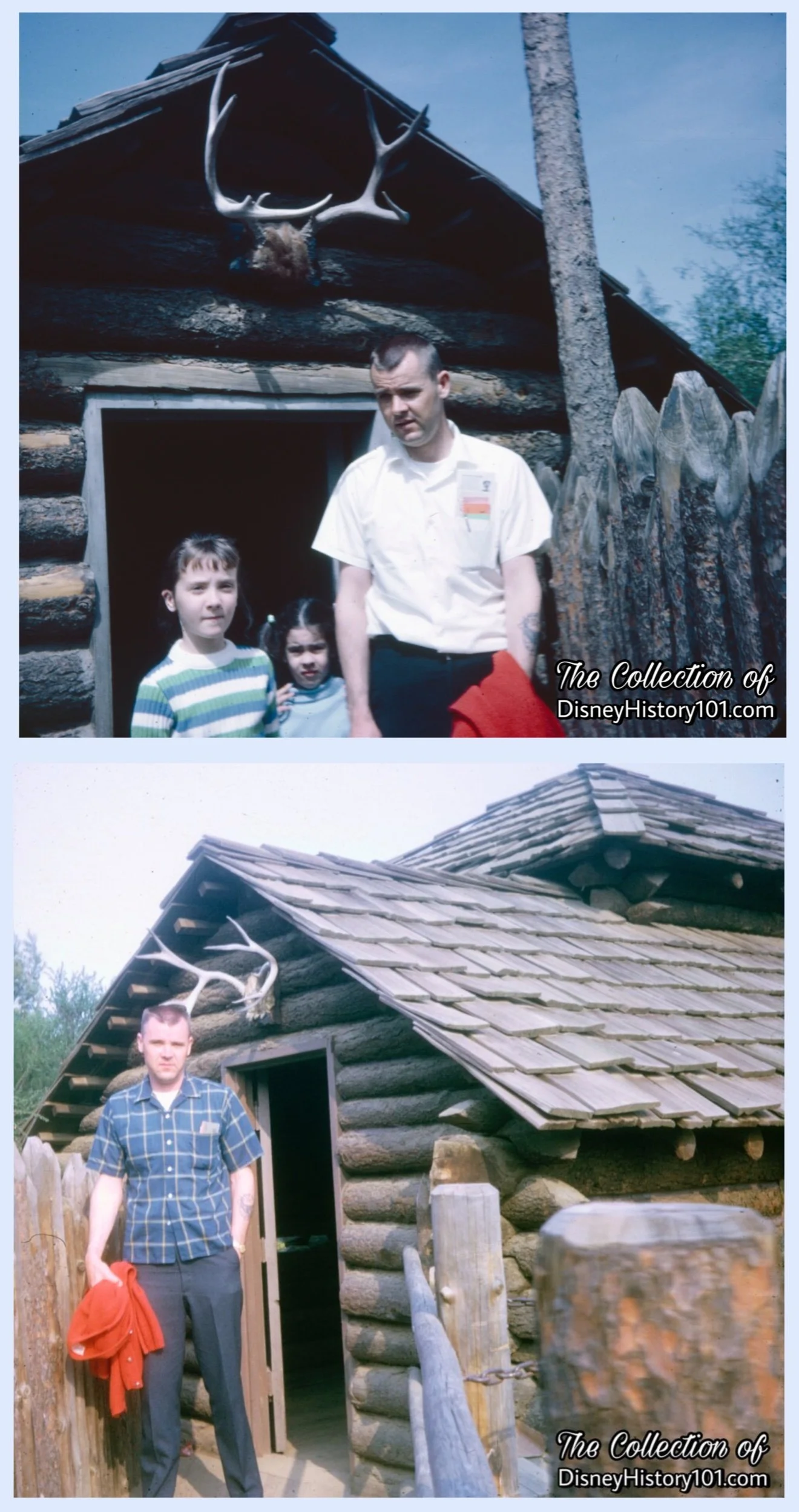
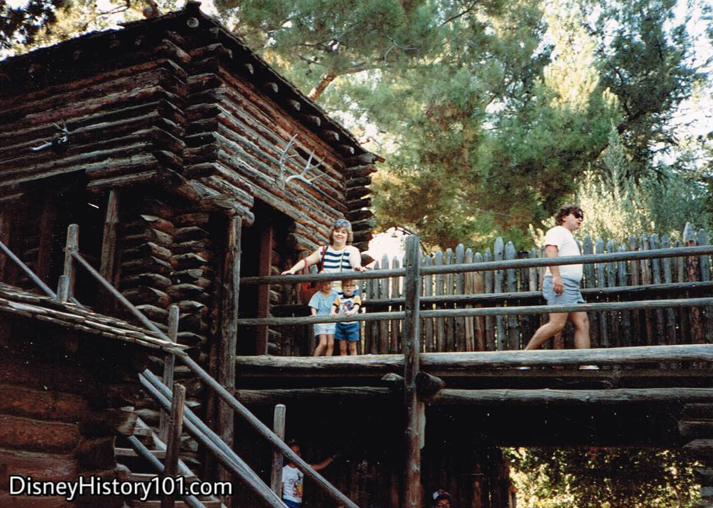
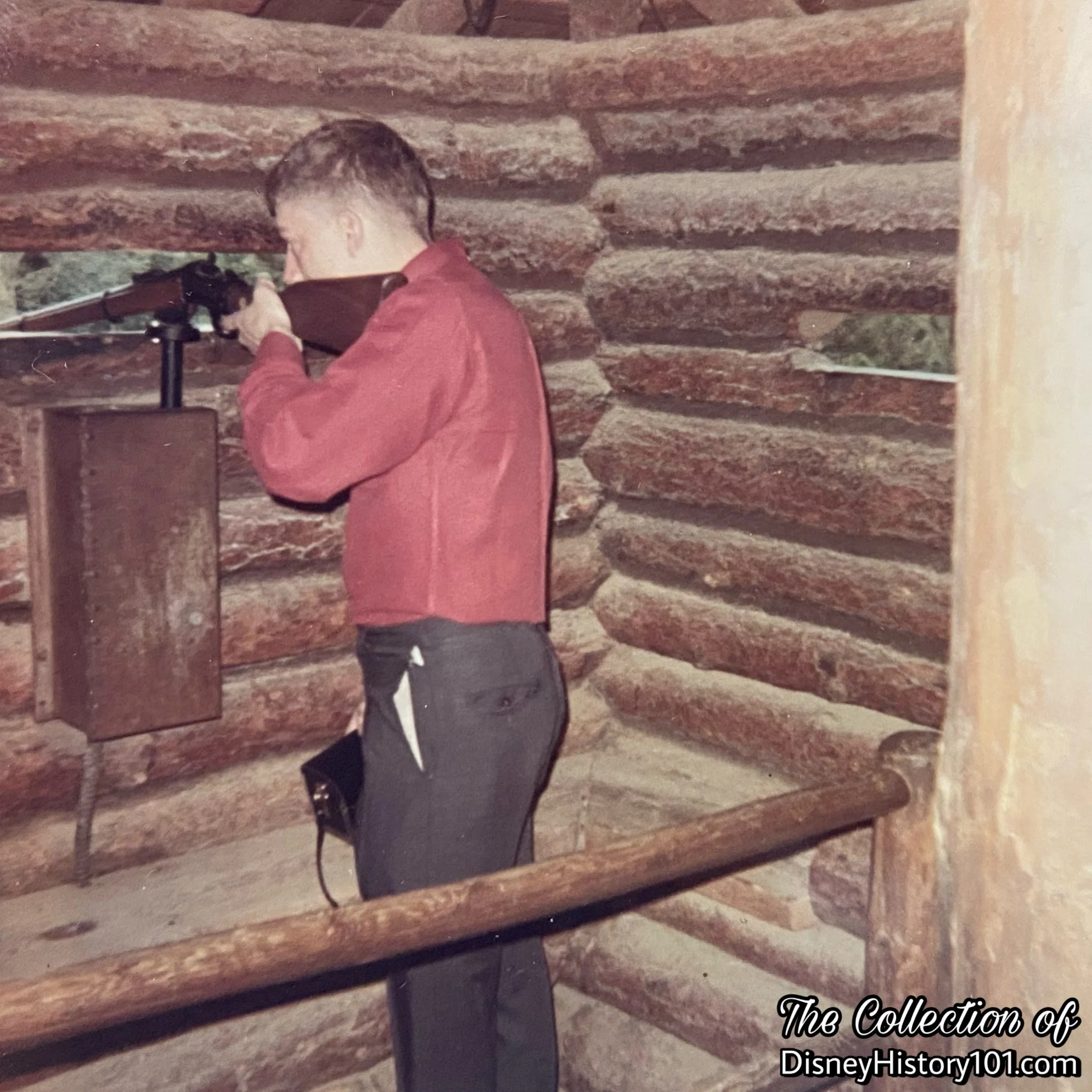
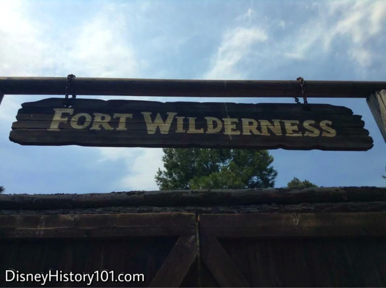
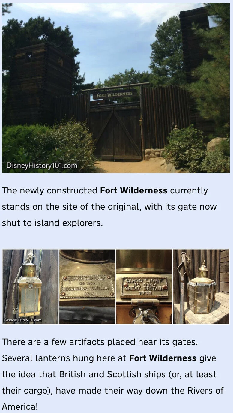
You’re welcome to set foot into frontier landmark - Fort Wilderness - the last stop before heading into the untamed and dangerous territory on the northern side of Tom Sawyer’s Island. Step inside the palisades of more than 700 hand-hewn, 12-foot-long, 300-pound logs. The fort (designed by Sam McKim), was based on the log forts built by fur traders and the Army of the 1800s. The Fort and stockade was of rough log construction with shake roof, rustic interior, wood plank floors, two restrooms of six fixtures. Years later, the “Disneyland Dictionary” (printed October 1959) described the attraction in the following way: “Contains small museum exhibit, cider bar, lookout parapets with rifles that may be operated, and an escape tunnel.” Just prior (c.1958) this entire structure and exhibit was appraised and valued at $27,000.
“Story”
The Island Fort would act as both a trading post and a garrison, designed to both “keep the peace and preserve the treaty with the Indians,” according to narration of “Disneyland U.S.A.” (released December 20, 1956, by Buena Vista Film Distribution). Feel free to get yourself familiar with the Regimental Headquarters, as well as all access points and escape routes. You just may see Davy Crockett conferring with Major Jackson. As a sidelight, this is interesting as Fess Parker had parted ways with Walt Disney Productions (on August 8th, 1958), but his likeness could still be found here at Fort Wilderness!
You can further survey your surroundings from the Blockhouse Towers, and lend a hand with a rifle should we face an “unfriendly” attack. The Disneyland News (Vol. 1, No. 12 ; June of 1956) mentioned that guests “will be able to fire trusty blunderbusses from the parapets of the log hewn ‘Fort Wilderness.’” Don’t forget to stock up on rations at the Fort Wilderness Snack Bar or use the restroom facilities before exploring the rest of the island!
Fort Wilderness’ towers (with hidden Blockhouse Rifles) guard approach to Fort Wilderness’ main entryway.

Bill Evans (in “Walt Disney World of Flowers”) spoke of the flora: “The wild flora of the island includes pines, southern red cedar and sweet gum, Carolina cherry, sycamores and live oak. Honeysuckle and blackberry ramble unrestricted. Wild flowers crop out among the boulders and tall grasses. Rushes and waterside lilies (Crinum Americana) grow by the river bank.”

(c. October, 1960)


(October, 1968)
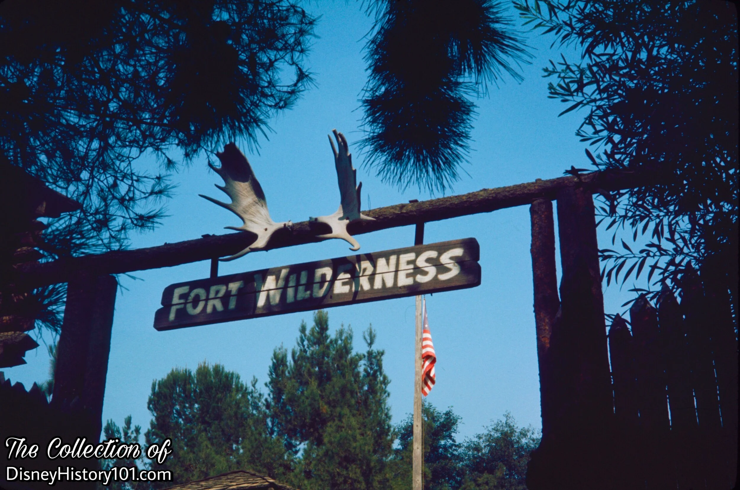
“They Use Antlers in All of Their Decorating”
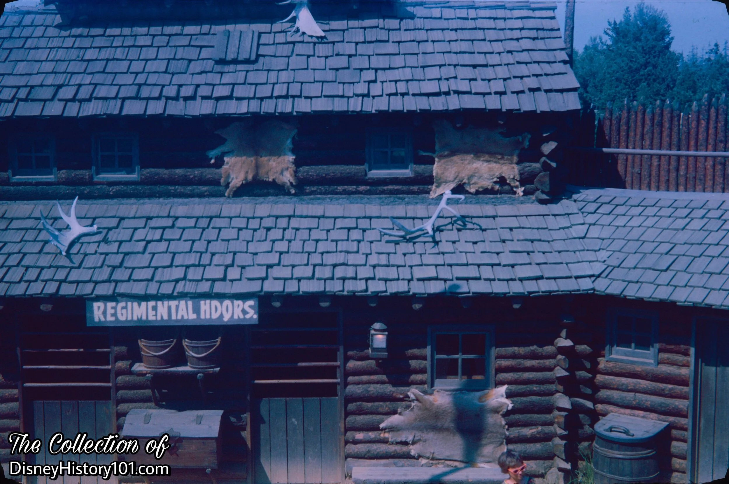
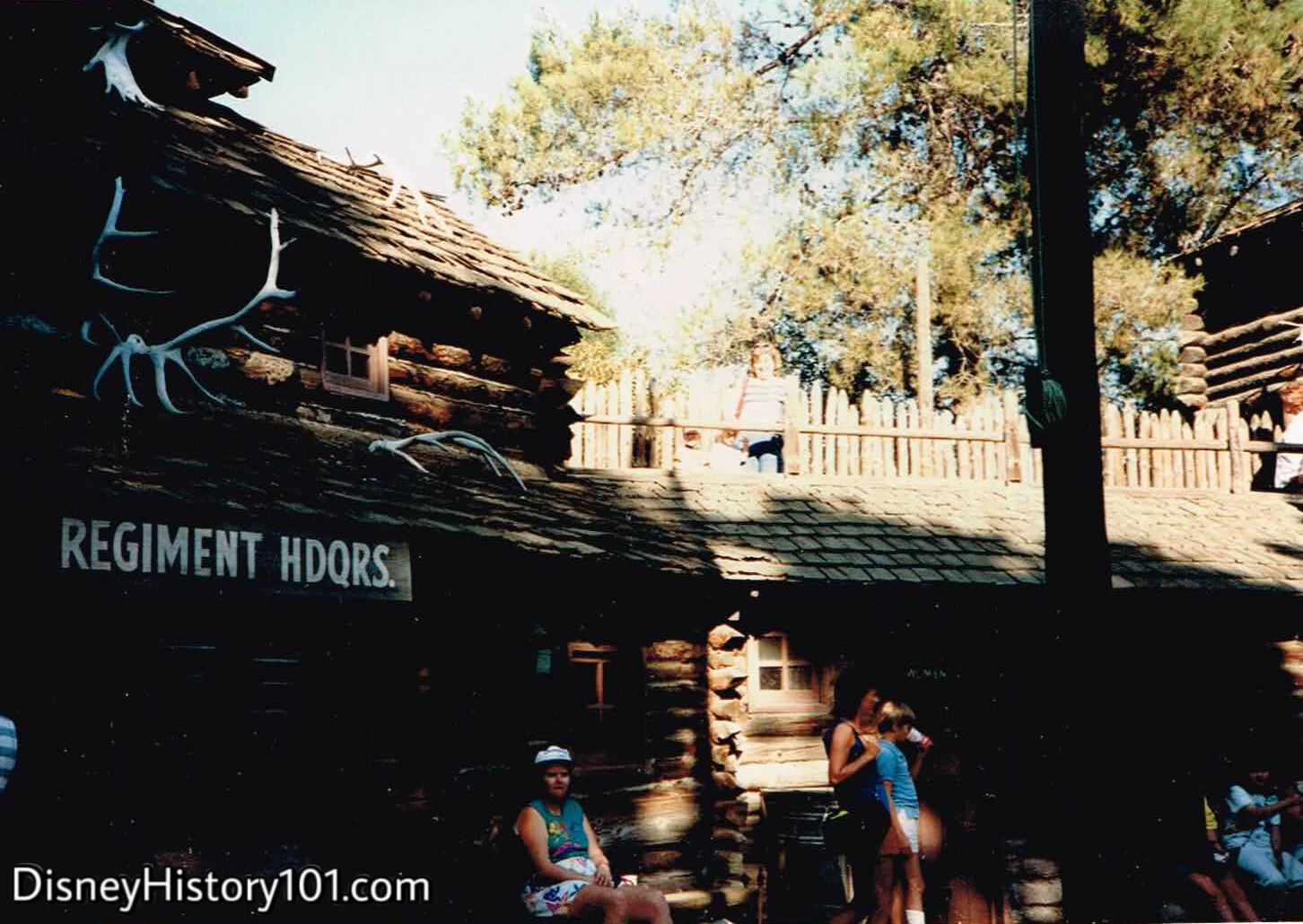
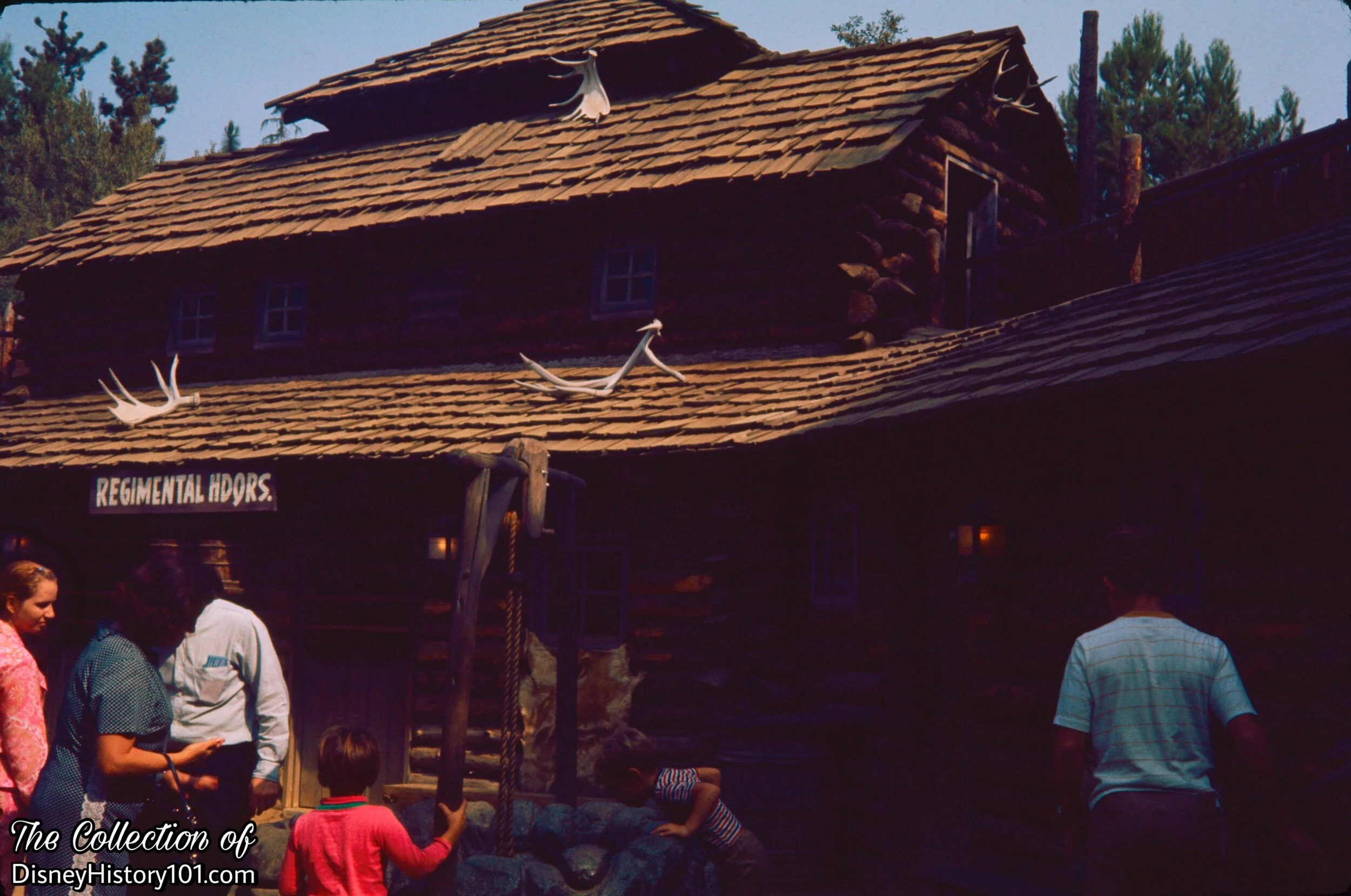
Rustic moose antlers hang over the entrance to Fort Wilderness, informing passerby of the good hunting on Tom Sawyer Island, and the healthy stock of goods at the Trading Post.
There was a lot to see inside this authentic recreation of an early 19th-century fort. Just through the entrance to Fort Wilderness, explorers would find the Regimental Headquarters of Major General Andrew Jackson & Davy Crockett.

1956, June

Here, you’ll find United States Army Scouts reporting to Major General Andrew Jackson.

Other old-west types (like the Frontierland Sheriff Lucky) have been known to pass through Fort Wilderness!
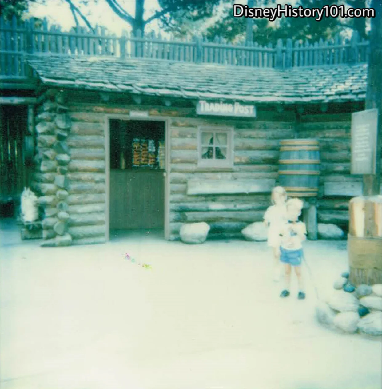
“THE TRADING POST,” (Tom Sawyer Island Refreshment Stand)
In the early days, the establishment was managed by Helen Case - “Disneylands First Harvey Girl” (who also managed the Milk Bar, the Main Street Station Concession Stand, and even Coke Corner). The Trading Post was also stocked with pelts, guns, knives, Indian craft, in addition to an assortment of food and drink to refresh explorers!
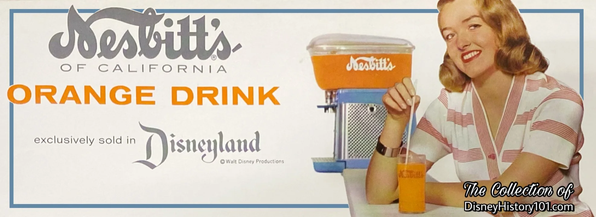
A Nesbitt’s of California advertisement; 1960.
You may remember eating dill pickles and drinking Nesbitt’s Orange soda when Nesbitt’s of California became a Disneyland participant and sponsor of the Trading Post! The synergistic relationship between the institutional lessee and Disneyland was beneficial. Nesbitt Fruit Products, Inc. yielded some revenue for Disneyland Inc. - $6,813 for the fiscal year ending September 29, 1957 and $6,600 for the fiscal year ending September 28, 1958.
The “Disneyland Dictionary” (published October 1958; for training purposes) described the “Cider Bar” located in Fort Wilderness on Tom Sawyer's Island, operated by UPT Concessions, with Nesbitt soft drinks as its primary scope of sales.
Later, there were also hot dogs, candy, cider and coffee available for purchase from the Canteen at Fort Wilderness.
By December of 1965 (after Helen Case), another female Cast Member Tommi Butler was “lookin’ after the place,” according to Walt Brickner of Backstage Disneyland magazine (Vol.4, No.4).
By 1981-84, Tom Sawyer’s Island Fort was reckoned among Bear Country territory. At the time, Fort Wilderness Snack Bar menu options and prices (including sakes tax) included: brownies (50¢), dill pickles (25¢), potato chips (40¢), Fritos (40¢), Doritos (40¢), almonds (40¢), raisins (40¢), Iced Tea (50/60¢), Coca Cola (50/60¢), Pepsi-Cola (50/60¢), Mountain Dew (50/60¢), Lemonade, Apple Cider (55/65¢), and Coffee (35¢).
1961
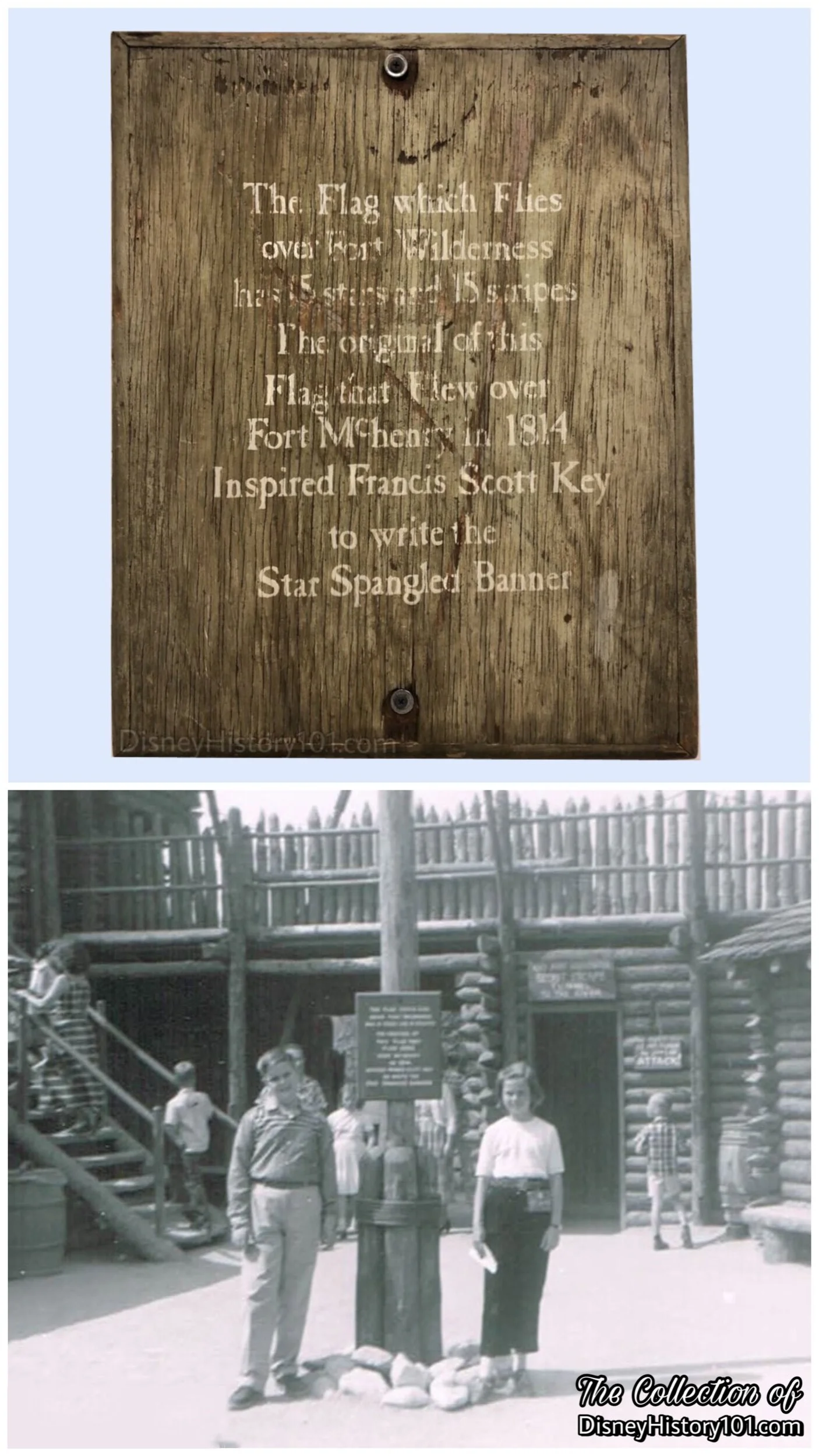
“FORT WILDERNESS FLAG POLE”
Disneyland is home to many historic United States flags, each one representing a different era! This is the only location in Disneyland where the original 1795 15-star 15-stripe “Star Spangled Banner” flew. Above, note a Fort Wilderness Flag Pole Plaque, of the Former Richard Kraft Collection.
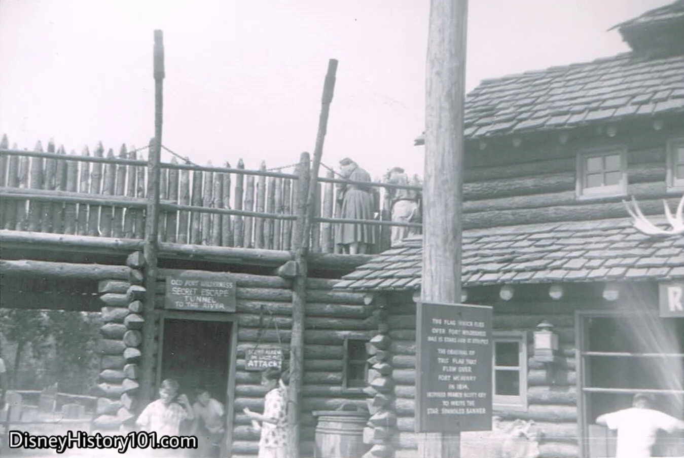
“OLD FORT WILDERNESS SECRET ESCAPE TUNNEL”
Look beyond the American flag pole, and you’ll notice a secret exit that lets guests escape Fort Wilderness via a hidden route!
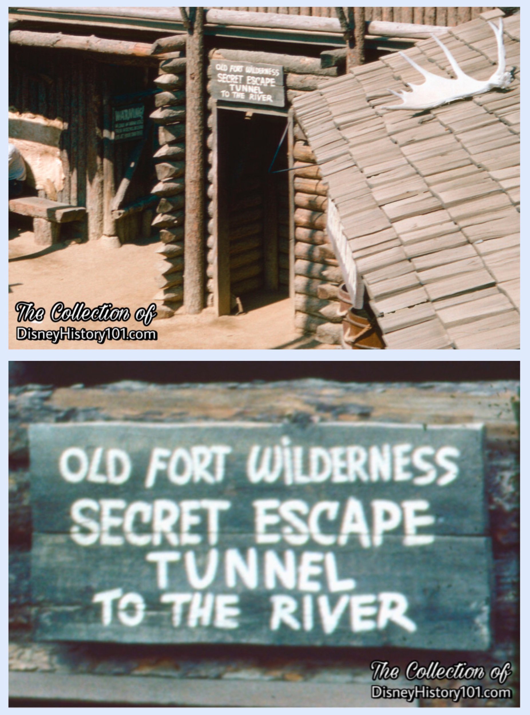
“OLD FORT WILDERNESS SECRET ESCAPE TUNNEL”
The other end let out in an area called Settler’s Landing (also called Wilderness Landing on Tom sawyer Island Maps, c. 1957).

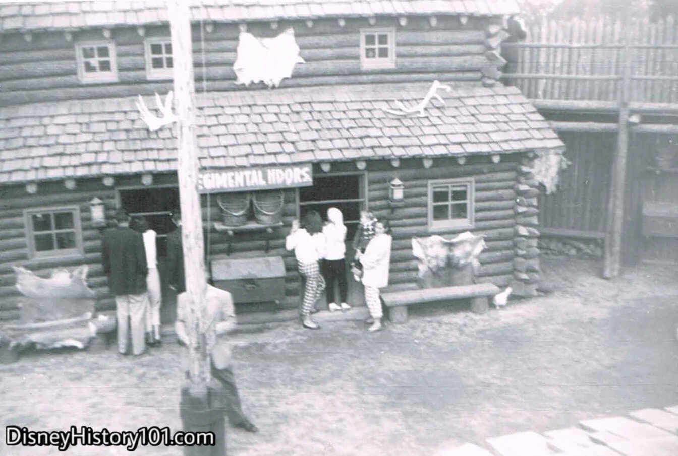
“REGIMENTAL HEADQUARTERS”
We’re looking at a recreation of Major General Andrew Jackson’s quarters during the Cherokee Indian Campaign of 1813. Incidentally, Major General Andrew Jackson also commanded the true-life United States Army during the Battle of New Orleans (in 1915).

(c. August, 1962)

Tom Roppa recalled: “One night a janitor at the Old Brown House on West Street saw his own shadow in a plate glass door and he lit out on the run for the Golden Horseshoe. When I caught up with him, he was shakin' and scared, stuttering, 'I saw a ghost! I saw a ghost!' So we sent him to Tom Sawyer Island and up at the fort he saw General Andrew Jackson lying in bed. Away the janitor went again, running like a giraffe (he was six feet, eight inches tall)… for the Horseshoe. This time he was quacking, ‘I saw a dead man in bed!’”
(October, 1968)

1969
This doorway leads to the Regimental Headquarters of Major General Andrew Jackson & Davy Crockett.
1969
The towers holding the Blockhouse rifles, gave explorers a view over the log walls.

Jerry and Susie Mathers survey Tom Sawyer Island from Fort Wilderness ; UPI Telephoto, (January 21, 1959)

(June, 1962)
(August, 1959)
Aside from the top of Castle Peak or one of Fort Wilderness’ towers, one of the best views of the Indian Village could be achieved by scaling Tom and Huck’s Treehouse on Tom Sawyer Island! This was the view from one of those stove pipe telescopes.

(May, 1961)
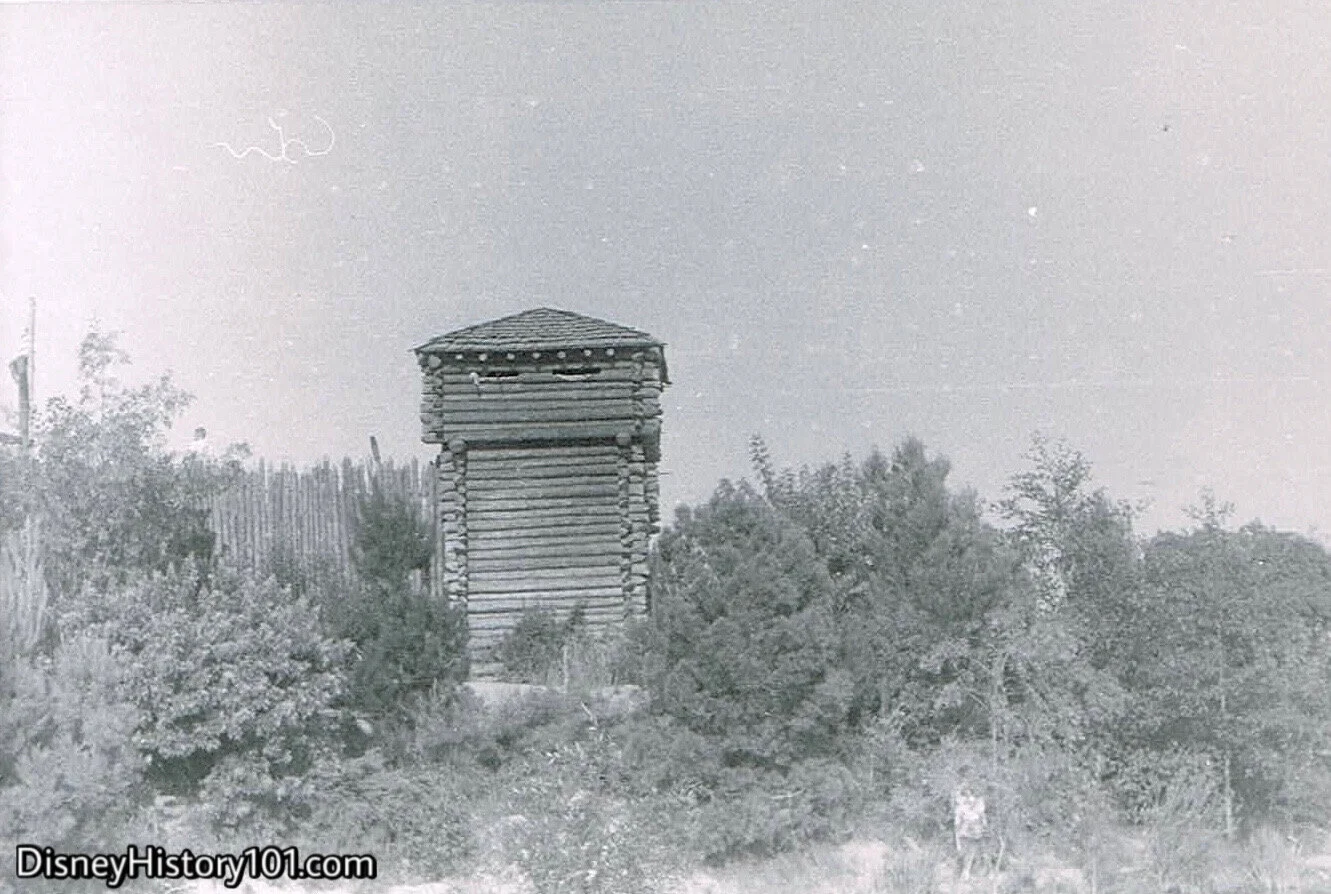
Located at the ‘Northern-most’ part of Tom Sawyer Island, Fort Wilderness’ was the last defense against a camp of unfriendly Indians on just the other side. Its four Stockade Guardhouses gave a clear vantage into the forested area beyond its walls.
From the Blockhouse, explorer’s could peer over the log walls of Fort Wilderness.

1959
From the upper level, you could see just over the Fort Palisades.
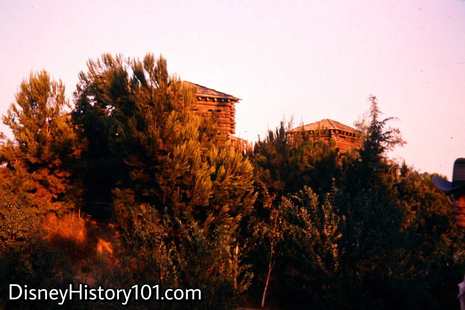
Fort Wilderness (the last stand between the unfriendly Indian camp and civilization), stands tall above the forest of Tom Sawyer’s Island. A peaceful view of Fort Wilderness at dusk, as the sun slowly sets over the Rivers of America!

Fort Wilderness Stockade or Blockhouse
Fort Wilderness on Tom Sawyer Island was part of the larger, Disneyland show which heightened the bar across the entire amusement park industry. Fort Wilderness was so popular that it even inspired attractions at non-Disney parks, like Freedomland which boasted “Fort Cavalry, a log-by-log replica of an army stockade of Indian-fighting days.”
Fort Wilderness stands as a testament of the “exciting days when the story of our country’s past was being lived”.
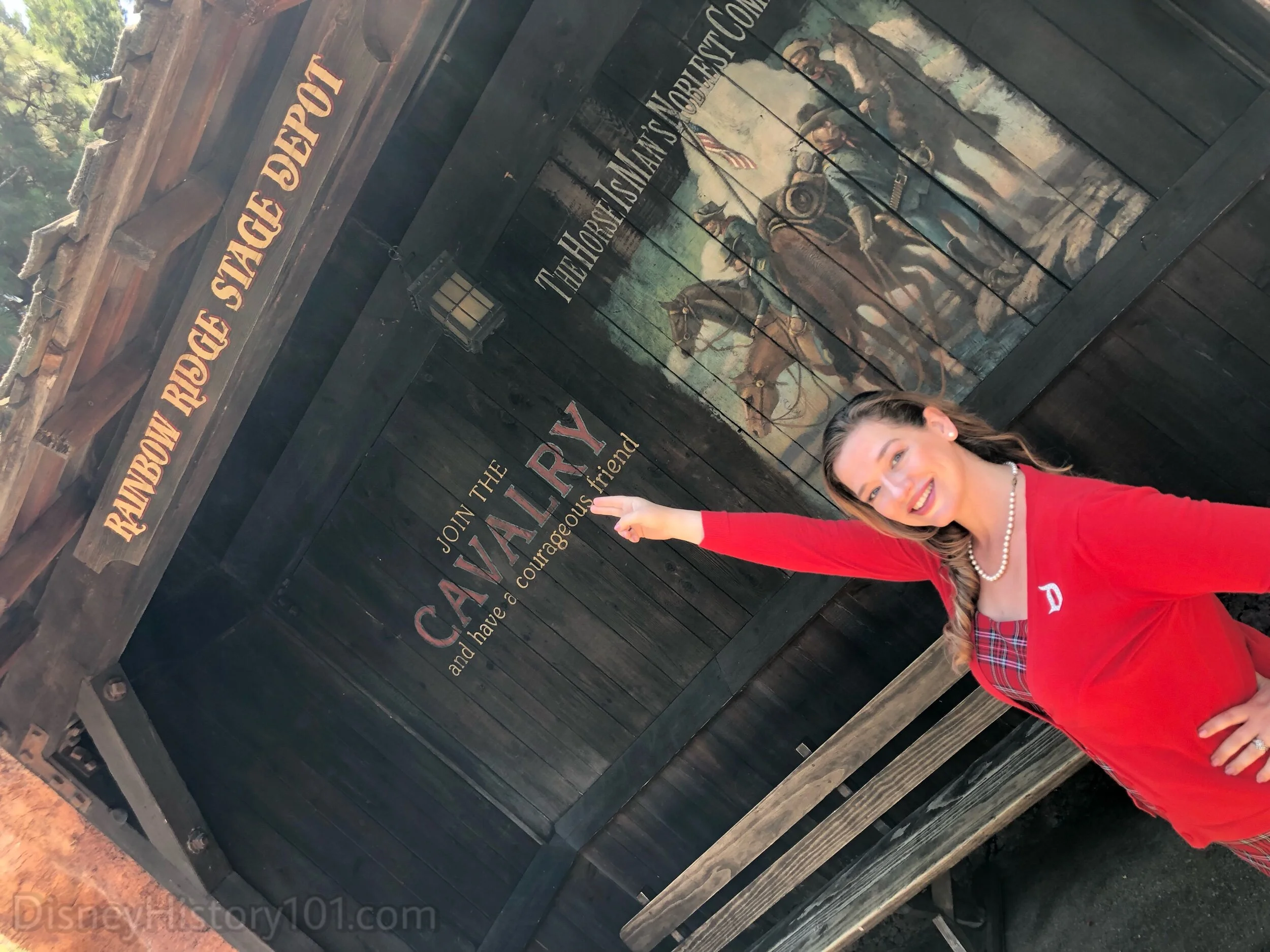
“A ‘Tip of the Hat’ to the Old ‘Cavalry’”, (Present)
The Cavalry hasn’t been seen on Tom Sawyer Island (or in all of Frontierland), in more than a decade. However, according to this mural (at the Rainbow Ridge Stage Depot on Big Thunder Trail), they’re currently enlisting!
Since 1956, Fort Wilderness Graveyard has been located behind Fort Wilderness (though there were a few headstones on the waterfront before the Fort Wilderness Gate). In the future, we hope to gain insight into those markers. For now, we will focus on the Fort Wilderness Graveyard. On schematics, it was simply labeled ‘Burial’. The graveyard featured headstones and markers for unfortunate folks who were laid to rest, and it may have offered a warning to those considering exploring the northern side of Tom Sawyer Island. Over the years, there have been three incarnations of the Fort Wilderness Graveyard.
During July of 1955, Walt Disney dedicated Disneyland ”to the ideals, the dreams, and the hard facts that have created America”. This dedication would partially be expressed through vignettes (like the Fort Wilderness Graveyard) found along the Rivers of America. It may be no coincidence that the Fort Wilderness Graveyard bordered the Indian Burial Ground (in “Unfriendly Indian Territory”) on the northern side of Tom Sawyer Island. There is no doubt that these two story scenes displayed some of those “hard facts” that Walt meant to be an “inspiration to all the world”.
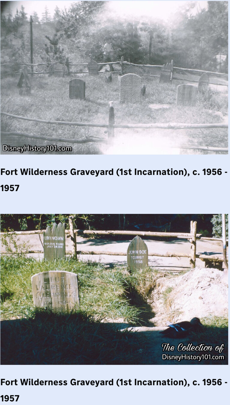
Some of the original headstones bore the names of Disneyland Staff. According to Dave Smith (Chief Archivist Emeritus of the Walt Disney Archives) : “Wally Feignoux was a Disney Legend who handled Disney film releases in Europe from 1936 until his death in 1981.” [Disney Facts Revealed by Dave Smith, 2016]

Fort Wilderness Graveyard (2nd Incarnation) known as Boot Hill Cemetary, c.1990s (top) and 2000s (bottom)
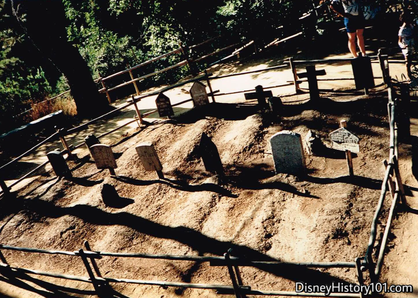
The old Fort Wilderness Graveyard (2nd Incarnation) known as Boot Hill Cemetary, 1990s

Boot Hill Cemetary.
The tradition of honoring craftspeople on Park props (starting with the Main Street Windows) continued with the Fort Wilderness headstones, and later with the Haunted Mansion tombstones.
“Now, we’re heading into the true backwoods. Watch for Indians and wild animals near the water’s edge. This is the American West as it was a century ago.
It is not possible to enter the north side of Tom Sawyer Island on foot. Disneyland schematics simply referred to this area of the island as ‘Wilderness’, and the Indian Burial Ground as ‘Burial.’ Early Explorer’s Maps of Tom sawyer Island (published 1957) explained the reason for this restriction : “Beyond the stockade are tepees . . . hostile Indians on the warpath.” Later maps clarified the real reason was due to the terms of an Indian treaty. This being the case, the northern part of the island remains uncharted. Most sights were safely viewed from the decks of large vessels, canoes, or keel boats. Those that trespassed paid the price.
Guests heading off trail (in hopes of entering into this restricted area) would be met by a hidden fence, preventing their entry on foot. Yet, passing the North Eastern shore aboard a vessel, it was possible to gain a short glimpse of what was called the Unfriendly Indian Camp. The “Disneyland Dictionary” (printed for training purposes; October 1959) described this area as a “faithful reproduction of war-like Indian Village.”
Years later (when the Indian Village was replaced by Bear Country) the Sacred Burial Grounds were moved across the river, near the “Unfriendly Indian Village) where it was shrouded in an oak and sycamore forest. Unlike the “Friendly Indian Village” on the other side of the river, there doesn’t seem to be any sign of movement coming from the six tipis of the “Unfriendly Indian Village.” However, if you were real quiet, you may be fortunate to see a family of deer!

We’re not far from the boundary of Indian Territory on the northern side of Tom Sawyer Island.
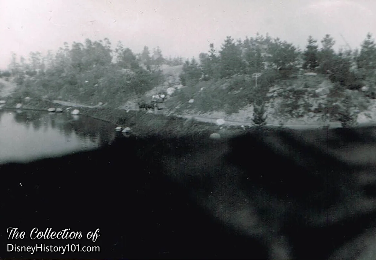
(Early 1957)
In the early days, the brush was low, and the Indian Territory’s forested area was sparse.
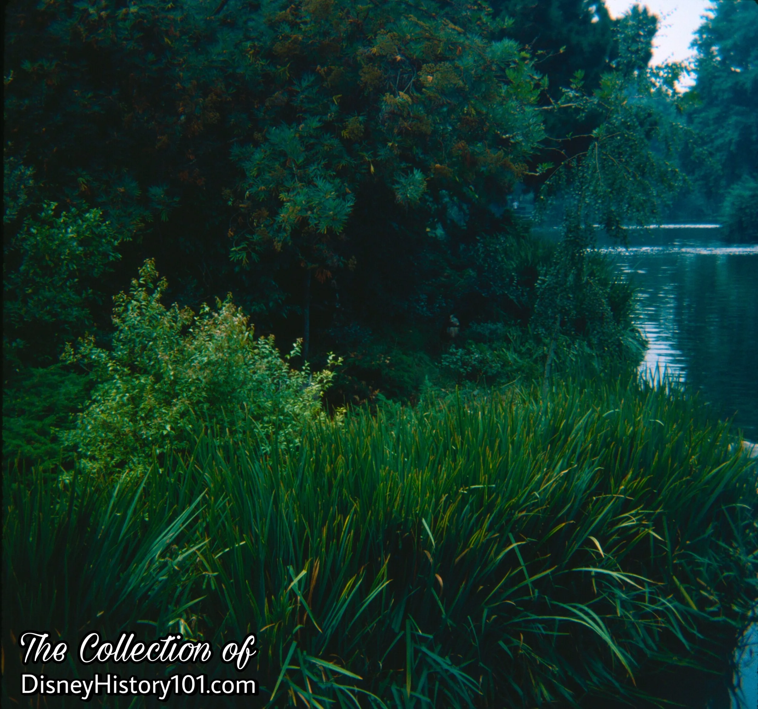
In time, the primitive forest grew thick and came to be home to deer, moose, bears, and other wildlife.
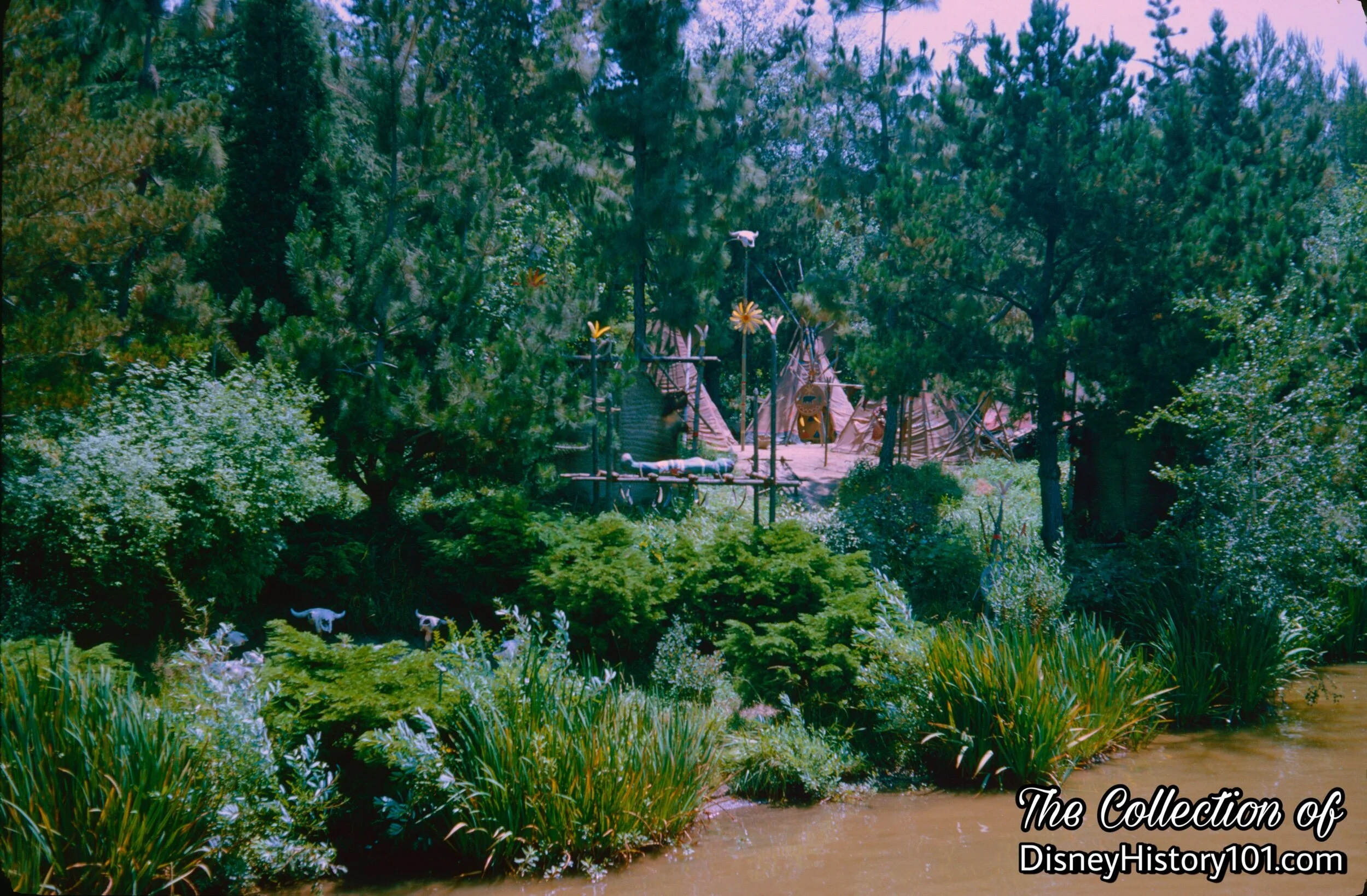
"UNFRIENDLY INDIAN CAMP" and SACRED BURIAL GROUND

"UNFRIENDLY INDIAN CAMP" and SACRED BURIAL GROUND, (c. Summer/Fall, 1970s)

"UNFRIENDLY INDIAN CAMP" and SACRED BURIAL GROUND, (1981)
“At an Indian burial site, a warrior who has died in battle lies atop the traditional bed of death”, according to Disney News (published Fall, 1968).
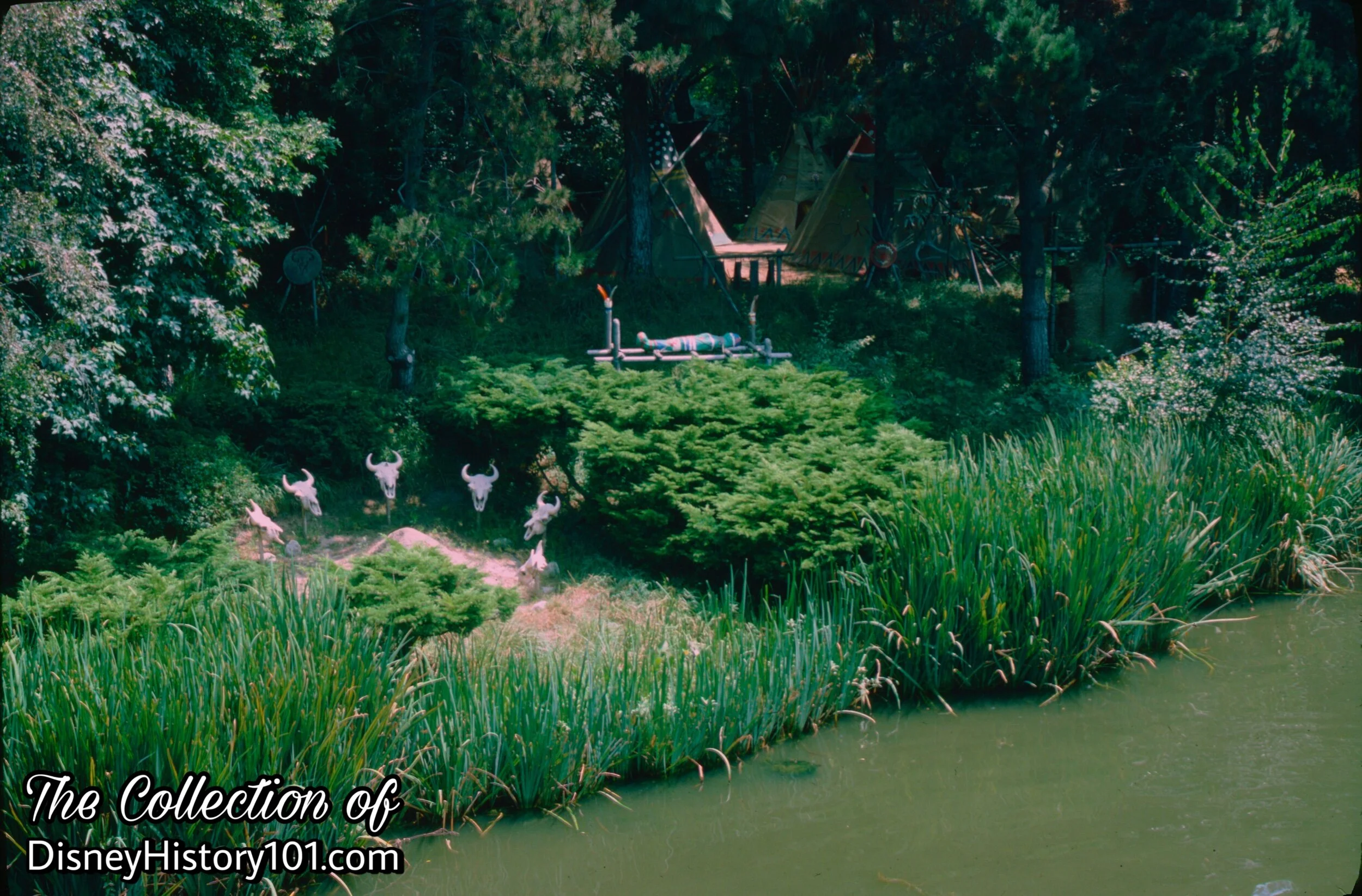
"UNFRIENDLY INDIAN CAMP" and SACRED BURIAL GROUND
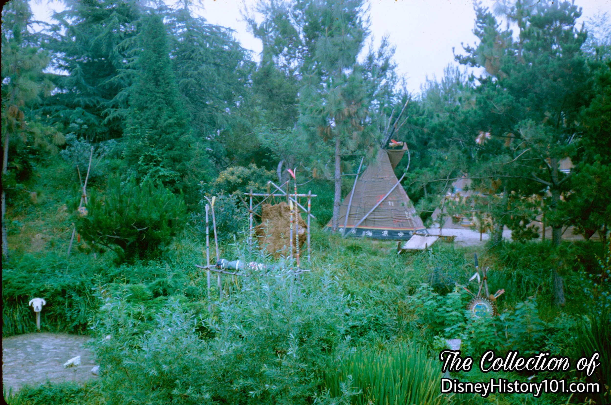
"UNFRIENDLY INDIAN CAMP" and SACRED BURIAL GROUND
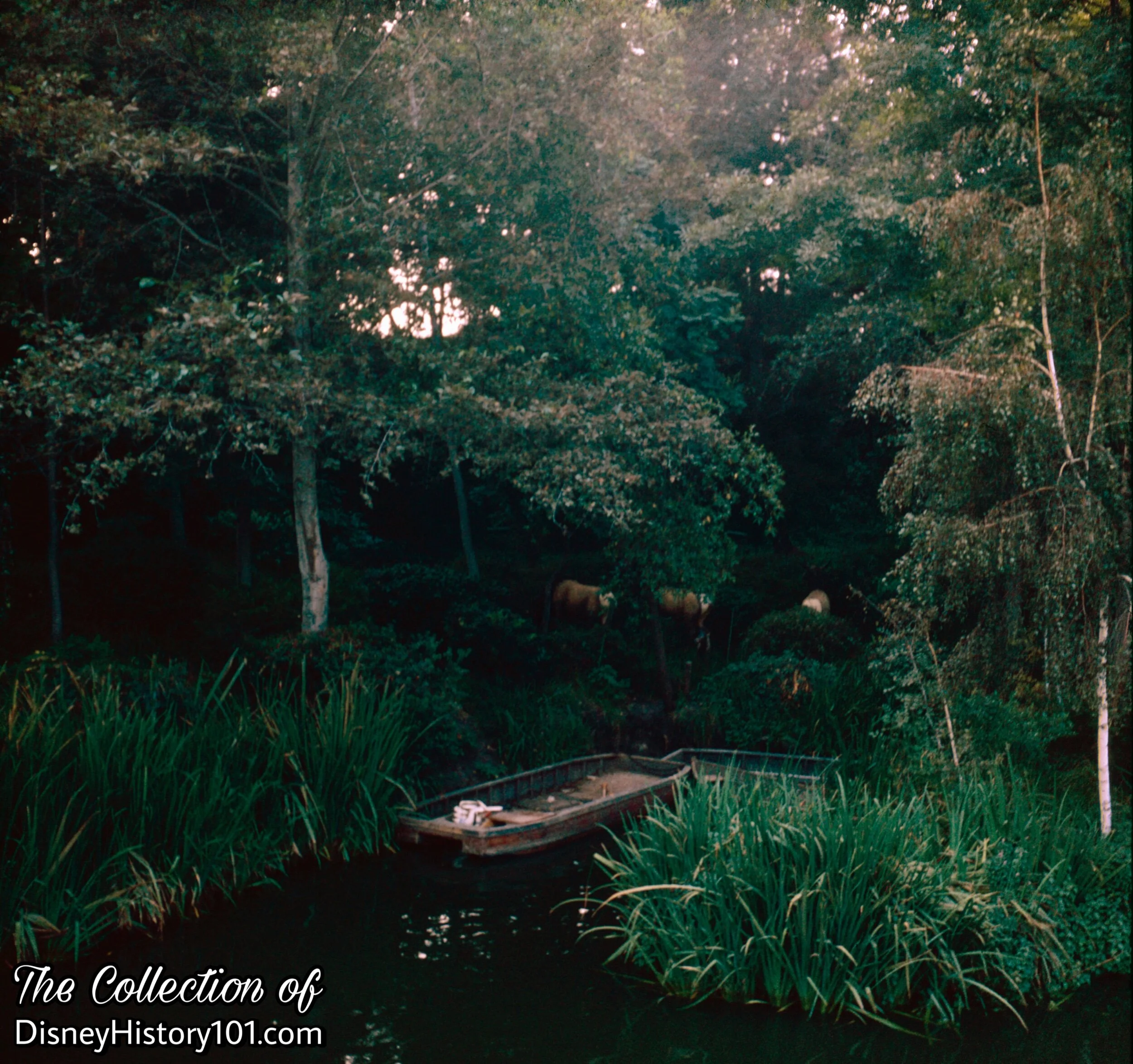
Indian Territory
A family of deer approach some Maintenance Skiffs, perhaps looking for food that one of the Maintenance or Landscaping Staff had left behind. During August of 1962, a skiff like this one was used by three Walt Disney Studio Staff (Lloyd Richardson, Larry Clemens, and Jack Leppert) to shoot scenery along the Rivers of America.
“55er” Leo Ara spent many of his his days at the Park looking after the condition of the Island, shoveling, raking and keeping the paths and slopes looking really top notch. John Yarber does all the carpentry and Rene was the gardener supreme. Leo recalled the challenging nature of these skiffs: “I saw Rene fall off a little skiff one time and he landed right in the river! I had jumped off from the bow, as we landed at the Island, and just then Rene stood up. He lost his balance, and over he went and there he was, up to his waist in mud! All the guests were looking and I was laughing hysterically.”
“55er” Cal McMurtrey recalled: “We were takin' off for the island and the skiff was overloaded with plants. Somebody shifted his weight too much, and the boat started to nose down...and then it SANK!”
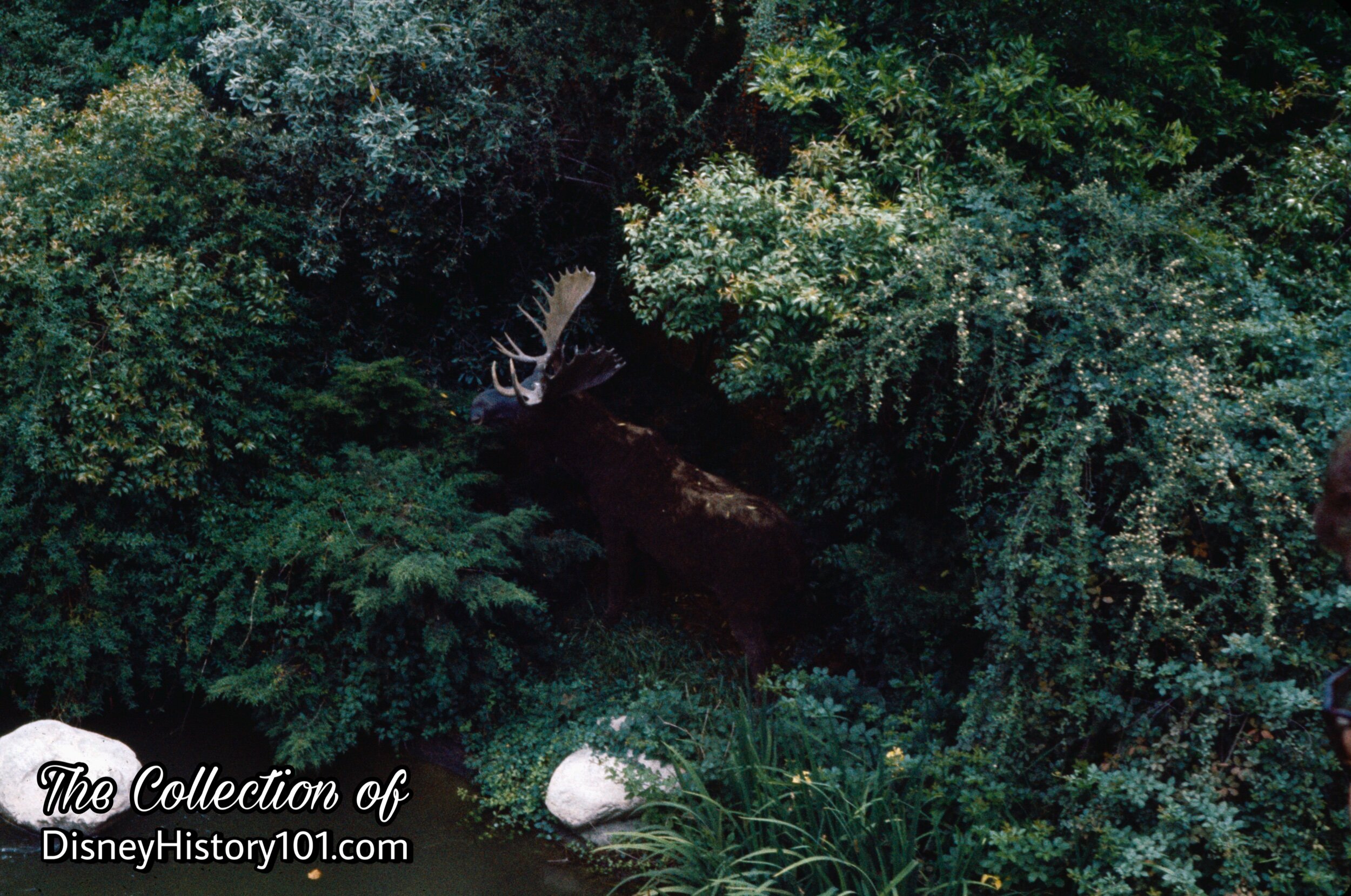
Moose in Indian Territory
As for animal life, grazing Moose, Deer, and Black Bear were once a common sight on Tom Sawyer Island.
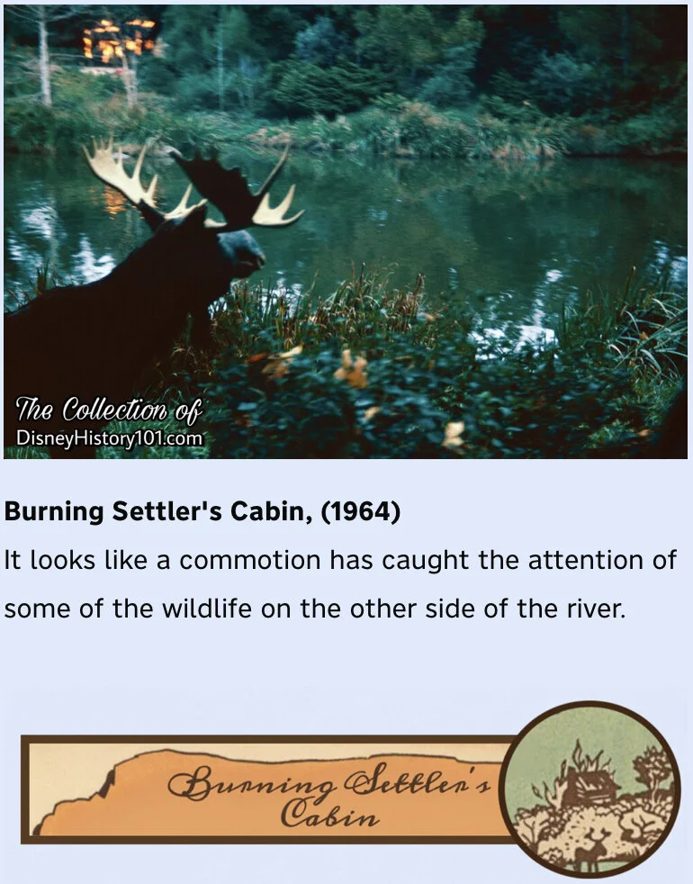
(1956-2016)
“The Light in the Forest”
Before we pass thru white water rapids (on to the final stretch of our journey), we pass the “Wilderness” territory of Tom Sawyer Island, and come upon another scene that was intended to depict the “hard facts that have created America.” “Our forefathers who tamed this great wilderness faced constant danger. And there, across the river, is proof—a settler’s cabin afire! The old pioneer lies nearby—the victim of an Indian arrow.” Early Tom Sawyer Island Maps (published 1957) elaborated, “A Settler’s Cabin burns furiously in the distance. . . mute evidence of a treacherous attack.”

Burning Settler's Cabin
But don’t feel so bad for this stubborn trespassing settler, because he knew just what he was doing. According to “The Disneyland News” (No. 2),“The ‘Burning Cabin’, [was] erected by a hardy settler who took the risk of going alone into unprotected Indian lands to make his homestead.” Early Tom Sawyer Island maps (posted on signs), elaborate that the “Settler” knowingly settled in “Indian Territory”, where “terms of treaty prohibit entry.” This was the way the story was told for some time.